Pulaski County, Kentucky
| Pulaski County, Kentucky | |
|---|---|
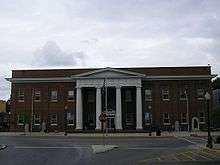 Pulaski County Courthouse | |
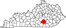 Location in the U.S. state of Kentucky | |
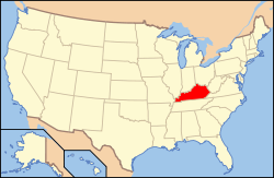 Kentucky's location in the U.S. | |
| Founded | 1798 |
| Named for | Kazimierz Pułaski |
| Seat | Somerset |
| Largest city | Somerset |
| Area | |
| • Total | 677 sq mi (1,753 km2) |
| • Land | 658 sq mi (1,704 km2) |
| • Water | 19 sq mi (49 km2), 2.8% |
| Population | |
| • (2010) | 63,063 |
| • Density | 96/sq mi (37/km²) |
| Congressional district | 5th |
| Time zone | Eastern: UTC-5/-4 |
| Website |
http://pcgovt.com/ www.somersetpulaskichamber.com |
Pulaski County is a county located in the U.S. Commonwealth of Kentucky. As of the 2010 census, the population was 63,063.[1] Its county seat is Somerset.[2] The county was founded in December 1798 from land given by Lincoln and Green Counties and named for Polish patriot Count Kazimierz Pułaski.[3][4][5]
Pulaski County comprises the Somerset, KY Micropolitan Statistical Area. Despite having a city population of just over 11,000, the statistic is misleading, as the Micropolitan Area for Somerset/Pulaski County is approaching 64,000, as Somerset is a lonely post being one of the few south-central Kentuckian cities with over 10,000 people.
In the early 2010s, after Lake Cumberland's water level raised to its normal level after its drastic fall (in which caused a drought in Pulaski County's economy) and Somerset and Burnside went "wet", Pulaski County's economy began to grow exponentially due to tourism, mainly from Ohio. Downtown Burnside had become a ghost town during Lake Cumberland's decline, and has not fully recovered to this day, although a few new businesses are popping up. Before the lake's decline, the Seven Gables Motel was a prominent motel in south central Kentucky.
Pulaski County is a "moist" county as defined by The Kentucky Department of Alcoholic Beverage Control. The County features two "Small Farm Wineries" that sell wine to the public. The City of Somerset voted on June 26, 2012 to go fully "wet" which means alcoholic beverages can be purchased by the package and restaurants and bars can serve alcoholic beverages by the drink. On October 15, 2013 the City of Burnside voted to go fully "wet" by a count of 123-39. All other areas of Pulaski County are "Dry".
Geography
According to the U.S. Census Bureau, the county has a total area of 677 square miles (1,750 km2), of which 658 square miles (1,700 km2) is land and 19 square miles (49 km2) (2.8%) is water.[6] It is the third-largest county by area in Kentucky.
Adjacent counties
- Lincoln County (north)
- Rockcastle County (northeast)
- Laurel County (east)
- McCreary County (southeast)
- Wayne County (southwest)
- Russell County (west)
- Casey County (northwest)
Demographics
| Historical population | |||
|---|---|---|---|
| Census | Pop. | %± | |
| 1800 | 3,161 | — | |
| 1810 | 6,897 | 118.2% | |
| 1820 | 7,597 | 10.1% | |
| 1830 | 9,500 | 25.0% | |
| 1840 | 9,620 | 1.3% | |
| 1850 | 14,195 | 47.6% | |
| 1860 | 17,201 | 21.2% | |
| 1870 | 17,670 | 2.7% | |
| 1880 | 21,318 | 20.6% | |
| 1890 | 25,731 | 20.7% | |
| 1900 | 31,293 | 21.6% | |
| 1910 | 35,986 | 15.0% | |
| 1920 | 34,010 | −5.5% | |
| 1930 | 35,640 | 4.8% | |
| 1940 | 39,863 | 11.8% | |
| 1950 | 38,452 | −3.5% | |
| 1960 | 34,403 | −10.5% | |
| 1970 | 35,234 | 2.4% | |
| 1980 | 45,803 | 30.0% | |
| 1990 | 49,489 | 8.0% | |
| 2000 | 56,217 | 13.6% | |
| 2010 | 63,063 | 12.2% | |
| Est. 2015 | 63,782 | [7] | 1.1% |
| U.S. Decennial Census[8] 1790-1960[9] 1900-1990[10] 1990-2000[11] 2010-2013[1] | |||
As of the census[12] of 2000, there were 56,217 people, 22,719 households, and 16,334 families residing in the county. The population density was 85 per square mile (33/km2). There were 27,181 housing units at an average density of 41 per square mile (16/km2). The racial makeup of the county was 97.48% White, 1.07% Black or African American, 0.22% Native American, 0.37% Asian, 0.02% Pacific Islander, 0.17% from other races, and 0.67% from two or more races. 0.81% of the population were Hispanic or Latino of any race.
There were 22,719 households out of which 31.20% had children under the age of 18 living with them, 58.50% were married couples living together, 10.10% had a female householder with no husband present, and 28.10% were non-families. 24.90% of all households were made up of individuals and 10.80% had someone living alone who was 65 years of age or older. The average household size was 2.42 and the average family size was 2.87.
In the county the population was spread out with 23.40% under the age of 18, 8.00% from 18 to 24, 28.60% from 25 to 44, 24.90% from 45 to 64, and 15.10% who were 65 years of age or older. The median age was 38 years. For every 100 females there were 95.60 males. For every 100 females age 18 and over, there were 91.90 males.
The median income for a household in the county was $27,370, and the median income for a family was $32,350. Males had a median income of $27,398 versus $19,236 for females. The per capita income for the county was $15,352. About 14.80% of families and 19.10% of the population were below the poverty line, including 26.90% of those under age 18 and 16.60% of those age 65 or over.
Politics
| Year | Republican | Democrat |
|---|---|---|
| 2016 | 81.67% 22,902 | 15.01% 4,208 |
| 2012 | 79.66% 20,714 | 19.14% 4,976 |
| 2008 | 77.09% 19,862 | 21.70% 5,590 |
| 2004 | 76.56% 19,535 | 22.84% 5,829 |
| 2000 | 73.56% 15,845 | 25.14% 5,415 |
Education
K-12
Three public school districts serve the county:
- Pulaski County School District
- The largest of the three districts, it serves the county outside of the city of Somerset with numerous elementary and middle schools feeding into Pulaski County High School and Southwestern Pulaski County High School.
- Somerset Independent School District
- Serves the city of Somerset with an elementary school (Hopkins Elementary), a middle school (Meece Middle) and a high school (Somerset High).
- Science Hill Independent School District
- Serves the city of Science Hill, with a single K-8 school. Students graduating from Science Hill can choose to attend either Pulaski County, Southwestern or Somerset High School.
There are also several private schools in the county, including Somerset Christian School.
Colleges and universities
Somerset Community College, is one of 16 two-year, open-admissions colleges of the Kentucky Community and Technical College System. The college offers academic, general education, and technical curricula leading to certificates, diplomas, and associate degrees. The college's Somerset Campus is located on Monticello Street in Somerset, across the street from the Center for Rural Development.
Transportation
Through Pulaski County run U.S. Highway South 27 from north to south and Highway East and West 80. Through the city limits of Somerset, Highway 27 stems into a three-lane road with u-turn and left turn options at each stoplight. Many food chains, local businesses and commerce centers are strewn along the highway, due to accessibility and consistent traffic throughout the area. Outside of the Somerset city limits, the highway becomes a two-lane road until it becomes a one-lane highway through downtown Burnside just south of Somerset.
Intersecting these highways are many junctions and bypasses that have been paved in order to allow quick and easy traffic flow through the county, revolving around the circumscribed Kentucky Route 914 around the outskirts of Somerset, in which transporters can enter through or exit from the city from any direction easily. These series of roads mimic the infrastructure of larger cities such as Interstate 465 in Indianapolis, Indiana and New Circle Road in Lexington, Kentucky. Many of these roads were paved in the 2000s. Despite the grand area of the county, the accessibility from one end to the other is smooth and expedited.
Lake Cumberland Regional Airport is located in Pulaski County, on the southern end of Somerset's US 27 business district. The airport is owned by the city of Somerset and Pulaski County. It also serves the area around Lake Cumberland. It is mostly used for general aviation, and from late 2008 until February 2010, was served by one commercial airline, Locair. Currently, the $3 million federally funded passenger terminal is not in use.
The airport was renamed in 2008; it was formerly known as Somerset-Pulaski County Airport or J.T. Wilson Field.[3]
Communities
Notable residents
- Harriette Simpson Arnow (1908–1986), author of Eastern Kentucky novels and histories. She and her husband Harold Arnow farmed near Burnside in the late 1930s and early 1940s.
- Silas Adams, (1839–1896), born in Pulaski County, lawyer and member of the United States House of Representatives[14]
- John Sherman Cooper, (1901–1991), born in Pulaski County. Lawyer, member Kentucky House of Representatives, Pulaski County Judge, United Nations delegate, member United States Senate, U.S. Ambassador to India and Nepal, first U.S. Ambassador to the German Democratic Republic (i.e. East Germany), member Warren Commission.
- Jack Daws, (1970–), born in Pulaski County. Conceptual artist.
- Vermont Garrison, career United States Air Force officer and "triple ace"
- Free Frank McWorter, (1777–1854), enslaved resident of Pulaski country, managed a saltpeter mine so effectively that he bought freedom for himself and his family.
- Rose Will Monroe, or Rosie the Riveter, (1920–1997) born in Pulaski County and moved to Michigan during World War II, where she helped build B-24s and B-29s for the war effort.
- Edwin P. Morrow, Kentucky Governor, 1919–1923.
- Venus Ramey, Miss America, 1944
- Hal Rogers, (born 1937), U.S. Congressman from Kentucky
- Brent Woods, (1855–1906), Sergeant, United States Army, Medal of Honor recipient.
See also
References
- 1 2 "State & County QuickFacts". United States Census Bureau. Retrieved March 6, 2014.
- ↑ "Find a County". National Association of Counties. Retrieved 2011-06-07.
- ↑ http://www.kyenc.org/entry/p/PULAS01.html
- ↑ The Register of the Kentucky State Historical Society, Volume 1. Kentucky State Historical Society. 1903. p. 36.
- ↑ Collins, Lewis (1882). Collins' Historical Sketches of Kentucky: History of Kentucky, Volume 2. Collins & Company. p. 26.
- ↑ "2010 Census Gazetteer Files". United States Census Bureau. August 22, 2012. Retrieved August 19, 2014.
- ↑ "County Totals Dataset: Population, Population Change and Estimated Components of Population Change: April 1, 2010 to July 1, 2015". Retrieved July 2, 2016.
- ↑ "U.S. Decennial Census". United States Census Bureau. Retrieved August 19, 2014.
- ↑ "Historical Census Browser". University of Virginia Library. Retrieved August 19, 2014.
- ↑ "Population of Counties by Decennial Census: 1900 to 1990". United States Census Bureau. Retrieved August 19, 2014.
- ↑ "Census 2000 PHC-T-4. Ranking Tables for Counties: 1990 and 2000" (PDF). United States Census Bureau. Retrieved August 19, 2014.
- ↑ "American FactFinder". United States Census Bureau. Retrieved 2008-01-31.
- ↑ "Dave Leip's Atlas of U.S. Presidential Elections". Retrieved 2016-05-17.
- ↑ Who Was Who in America, Historical Volume, 1607–1896. Chicago: Marquis Who's Who. 1963.
Municipalities and communities of Pulaski County, Kentucky, United States | ||
|---|---|---|
| Cities | | |
| Unincorporated communities | ||
| Ghost town | ||
| Footnotes | ‡This populated place also has portions in an adjacent county | |
