Martin County, Kentucky
| Martin County, Kentucky | |
|---|---|
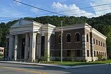 County government center | |
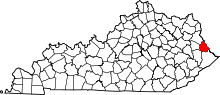 Location in the U.S. state of Kentucky | |
 Kentucky's location in the U.S. | |
| Founded | September 1, 1870 |
| Named for | John P. Martin |
| Seat | Inez |
| Largest city | Inez |
| Area | |
| • Total | 231 sq mi (598 km2) |
| • Land | 230 sq mi (596 km2) |
| • Water | 1.0 sq mi (3 km2), 0.4% |
| Population | |
| • (2010) | 12,929 |
| • Density | 56/sq mi (22/km²) |
| Congressional district | 5th |
| Time zone | Eastern: UTC-5/-4 |
| Website |
www |
Martin County is a county located in the U.S. state of Kentucky. As of the 2010 census, the population was 12,929.[1] Its county seat is Inez.[2] The county was founded in 1870 and is named for Congressman John Preston Martin.[3][4] It is a prohibition or dry county, which means that alcohol sales are prohibited in all areas of the county.
Geography
According to the U.S. Census Bureau, the county has a total area of 231 square miles (600 km2), of which 230 square miles (600 km2) is land and 1.0 square mile (2.6 km2) (0.4%) is water.[5] The county's eastern border is formed by the Tug Fork of the Big Sandy River.
Adjacent counties
- Lawrence County (northwest)
- Wayne County, West Virginia (northeast)
- Mingo County, West Virginia (southeast)
- Pike County (south)
- Floyd County (southwest)
- Johnson County (west)
Demographics
| Historical population | |||
|---|---|---|---|
| Census | Pop. | %± | |
| 1880 | 3,057 | — | |
| 1890 | 4,209 | 37.7% | |
| 1900 | 5,780 | 37.3% | |
| 1910 | 7,291 | 26.1% | |
| 1920 | 7,654 | 5.0% | |
| 1930 | 8,584 | 12.2% | |
| 1940 | 10,970 | 27.8% | |
| 1950 | 11,677 | 6.4% | |
| 1960 | 10,201 | −12.6% | |
| 1970 | 9,377 | −8.1% | |
| 1980 | 13,925 | 48.5% | |
| 1990 | 12,526 | −10.0% | |
| 2000 | 12,578 | 0.4% | |
| 2010 | 12,929 | 2.8% | |
| Est. 2015 | 12,307 | [6] | −4.8% |
| U.S. Decennial Census[7] 1790-1960[8] 1900-1990[9] 1990-2000[10] 2010-2013[1] | |||
As of the census[11] of 2000, there were 12,578 people, 4,776 households, and 3,620 families residing in the county. The population density was 54 per square mile (21/km2). There were 5,551 housing units at an average density of 24 per square mile (9.3/km2). The racial makeup of the county was 99.25% White, 0.03% Black or African American, 0.06% Native American, 0.07% Asian, 0.06% Pacific Islander, 0.01% from other races, and 0.52% from two or more races. 0.62% of the population were Hispanic or Latino of any race.
There were 4,776 households out of which 39.20% had children under the age of 18 living with them, 59.50% were married couples living together, 12.50% had a female householder with no husband present, and 24.20% were non-families. 21.80% of all households were made up of individuals and 8.30% had someone living alone who was 65 years of age or older. The average household size was 2.62 and the average family size was 3.05.
In the county the population was spread out with 28.10% under the age of 18, 9.50% from 18 to 24, 29.30% from 25 to 44, 23.30% from 45 to 64, and 9.70% who were 65 years of age or older. The median age was 34 years. For every 100 females there were 98.00 males. For every 100 females age 18 and over, there were 92.10 males.
The median income for a household in the county was $18,279, and the median income for a family was $21,574. Males had a median income of $31,994 versus $18,011 for females. The per capita income for the county was $10,650. About 33.30% of families and 37.00% of the population were below the poverty line, including 45.10% of those under age 18 and 26.90% of those age 65 or over.
Politics
| Year | Republican | Democrat |
|---|---|---|
| 2016 | 88.62% 3,503 | 9.18% 363 |
| 2012 | 83.16% 3,180 | 15.01% 574 |
| 2008 | 76.49% 2,824 | 21.89% 808 |
| 2004 | 66.01% 2,996 | 33.14% 1,504 |
| 2000 | 59.85% 2,667 | 38.46% 1,714 |
Economy
The Federal Bureau of Prisons U.S. Penitentiary, Big Sandy is located in unincorporated Martin County, near Inez.[13]
Coal companies in Martin County
- Alliance Resource Partners[14]
Education
The Martin County School System operates public schools.
- Sheldon Clark High School
- Inez Middle School
- Eden Elementary School
- Inez Elementary School
- Warfield Elementary School
- Warfield Middle school
Communities
See also
- Big Sandy Regional Airport
- Big Sandy Area Development District
- Dry counties
- Martin County Sludge Spill
- National Register of Historic Places listings in Martin County, Kentucky
- United States Penitentiary, Big Sandy
References
- 1 2 "State & County QuickFacts". United States Census Bureau. Retrieved March 6, 2014.
- ↑ "Find a County". National Association of Counties. Retrieved 2011-06-07.
- ↑ "Martin County". The Kentucky Encyclopedia. 2000. Retrieved August 23, 2014.
- ↑ The Register of the Kentucky State Historical Society, Volume 1. Kentucky State Historical Society. 1903. p. 36.
- ↑ "2010 Census Gazetteer Files". United States Census Bureau. August 22, 2012. Retrieved August 17, 2014.
- ↑ "County Totals Dataset: Population, Population Change and Estimated Components of Population Change: April 1, 2010 to July 1, 2015". Retrieved July 2, 2016.
- ↑ "U.S. Decennial Census". United States Census Bureau. Retrieved August 17, 2014.
- ↑ "Historical Census Browser". University of Virginia Library. Retrieved August 17, 2014.
- ↑ "Population of Counties by Decennial Census: 1900 to 1990". United States Census Bureau. Retrieved August 17, 2014.
- ↑ "Census 2000 PHC-T-4. Ranking Tables for Counties: 1990 and 2000" (PDF). United States Census Bureau. Retrieved August 17, 2014.
- ↑ "American FactFinder". United States Census Bureau. Retrieved 2008-01-31.
- ↑ "Dave Leip's Atlas of U.S. Presidential Elections". Retrieved 2016-04-13.
- ↑ "Institution Supplement." United States Penitentiary, Big Sandy. 2 (2/18). Retrieved on February 21, 2011. "USP Big Sandy is located at 1197 Airport Rd, Inez, Kentucky." and "Directions from Interstate 64: From the following areas: Ashland, KY, Huntington, WV, and the Ohio area, travel Interstate 64 to Kentucky Exit 191 to Route 23 South. Follow 23 South for approximately 38 miles until you reach Route 645. Turn left onto Route 645 South and travel approximately 11 miles until you reach Route 3. Turn right onto Route 3 and travel for approximately 10 miles until you reach Airport Road. Turn left onto Airport Road and follow signs to the institution."
- ↑ Alliance Resource Partners, L.P. » Central Appalachia
Further reading
- Cheves, John (November 16, 2013). "'A lot of people here have just given up'". Lexington Herald-Leader. Lexington: The McClatchy Company. Retrieved December 10, 2013.
- Egerton, John (October 18, 1981). "Boom or Bust in the Hollows of Appalachia". The New York Times Magazine. Retrieved November 21, 2013.
External links
- The Kentucky Highlands Project
- Martin County Slurry Spill
- Sandy Valley Transportation Services, Inc.
Municipalities and communities of Martin County, Kentucky, United States | ||
|---|---|---|
| Cities | | |
| Unincorporated communities | ||

Coordinates: 37°48′N 82°31′W / 37.80°N 82.52°W