Frenchburg, Kentucky
| Frenchburg, Kentucky | |
|---|---|
| City | |
|
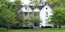
Walnut Street | |
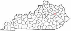 Location of Frenchburg, Kentucky | |
| Coordinates: 37°57′11″N 83°37′38″W / 37.95306°N 83.62722°WCoordinates: 37°57′11″N 83°37′38″W / 37.95306°N 83.62722°W | |
| Country | United States |
| State | Kentucky |
| County | Menifee |
| Area | |
| • Total | 1.0 sq mi (2.7 km2) |
| • Land | 1.0 sq mi (2.7 km2) |
| • Water | 0.0 sq mi (0.0 km2) |
| Elevation | 873 ft (266 m) |
| Population (2010) | |
| • Total | 486 |
| • Density | 486.0/sq mi (180.0/km2) |
| Time zone | Eastern (EST) (UTC-5) |
| • Summer (DST) | EDT (UTC-4) |
| ZIP code | 40322 |
| Area code(s) | 606 |
| FIPS code | 21-29260 |
| GNIS feature ID | 0512254 |

Frenchburg is a 6th-class city in Menifee County, Kentucky, in the United States. The population was 486 at the 2010 census. It is the seat and only incorporated city in its rural county.[1] It is located at the junction of U.S. Route 460 and Kentucky Route 36. Logging is the primary industry.[2]
Frenchburg is part of the Mount Sterling Micropolitan Statistical Area.
History
Frenchburg was laid out in 1869 to be the county seat of newly formed Menifee County and was named for Robert French, a local lawyer and judge.[3][4] It was formally incorporated by the state assembly in 1871.[5]
Frenchburg was nearly destroyed on June 27, 1882, when Beaver Creek flooded, sweeping away all but three buildings and killing six people.[2]
The Foothills Courier
The area was served by the Foothills Courier newspaper from June 1996 until January 2007. The newspaper was a private, non-affiliated publication, supported by local individuals and businesses. The business failed to financially sustain itself after the death of its editor on October 18, 2006. The Foothills Courier was bought out shortly thereafter by the Menifee County News, an affiliated publication from Carlisle, Kentucky.
Geography
Frenchburg is located at 37°57′11″N 83°37′38″W / 37.95306°N 83.62722°W (37.953176, -83.627210).[6]
According to the United States Census Bureau, the city has a total area of 1.0 square mile (2.6 km2), all land.
Climate
The climate in this area is characterized by relatively high temperatures and evenly distributed precipitation throughout the year. The Köppen Climate Classification subtype for this climate is "Cfa" (Humid Subtropical Climate).[7]
Law and government
Frenchburg is a six-class city governed by a mayor-commission form of government. The current mayor is Edward Bryant. The city commission is made up of four members: James D. Baker, Della Brown, Steve Peck, and Dwain Benson. Frenchburg is located in Kentucky's 5th Congressional District.[8]
Demographics
| Historical population | |||
|---|---|---|---|
| Census | Pop. | %± | |
| 1880 | 143 | — | |
| 1890 | 222 | 55.2% | |
| 1900 | 210 | −5.4% | |
| 1910 | 172 | −18.1% | |
| 1920 | 270 | 57.0% | |
| 1930 | 246 | −8.9% | |
| 1940 | 289 | 17.5% | |
| 1950 | 268 | −7.3% | |
| 1960 | 296 | 10.4% | |
| 1970 | 467 | 57.8% | |
| 1980 | 550 | 17.8% | |
| 1990 | 625 | 13.6% | |
| 2000 | 551 | −11.8% | |
| 2010 | 486 | −11.8% | |
| Est. 2015 | 531 | [9] | 9.3% |

As of the census[11] of 2000, there were 551 people, 245 households, and 174 families residing in the city. The population density was 528.4 people per square mile (204.6/km²). There were 279 housing units at an average density of 267.5 per square mile (103.6/km²). The racial makeup of the city was 99.64% White, and 0.36% from two or more races. Hispanic or Latino of any race were 1.09% of the population.
There were 245 households out of which 32.2% had children under the age of 18 living with them, 48.6% were married couples living together, 19.6% had a female householder with no husband present, and 28.6% were non-families. 26.9% of all households were made up of individuals and 13.5% had someone living alone who was 65 years of age or older. The average household size was 2.25 and the average family size was 2.66.
In the city the population was spread out with 24.5% under the age of 18, 13.2% from 18 to 24, 22.9% from 25 to 44, 24.9% from 45 to 64, and 14.5% who were 65 years of age or older. The median age was 36 years. For every 100 females there were 78.9 males. For every 100 females age 18 and over, there were 71.2 males.
The median income for a household in the city was $22,350, and the median income for a family was $28,333. Males had a median income of $25,221 versus $19,286 for females. The per capita income for the city was $12,288. About 22.0% of families and 27.5% of the population were below the poverty line, including 35.5% of those under age 18 and 24.2% of those age 65 or over.
References
- ↑ "Find a County". National Association of Counties. Retrieved 2011-06-07.
- 1 2 Bryant, Ron D. (1992). "Frenchburg". In Kleber, John. Encyclopedia of Kentucky. p. 358. Retrieved on 2010-06-29
- ↑ Rennick, Robert M. (1987). Kentucky Place Names. University Press of Kentucky. p. 110. Retrieved 28 Apr 2013.
- ↑ Gannett, Henry (1905). The Origin of Certain Place Names in the United States. Govt. Print. Off. p. 132.
- ↑ Commonwealth of Kentucky. Office of the Secretary of State. Land Office. "Frenchburg, Kentucky". Accessed 26 Jul 2013.
- ↑ "US Gazetteer files: 2010, 2000, and 1990". United States Census Bureau. 2011-02-12. Retrieved 2011-04-23.
- ↑ Climate Summary for Frenchburg, Kentucky
- ↑ Kentucky Secretary of State - Land Office Retrieved on 2010-06-29
- ↑ "Annual Estimates of the Resident Population for Incorporated Places: April 1, 2010 to July 1, 2015". Retrieved July 2, 2016.
- ↑ "Census of Population and Housing". Census.gov. Retrieved June 4, 2015.
- ↑ "American FactFinder". United States Census Bureau. Retrieved 2008-01-31.
Municipalities and communities of Menifee County, Kentucky, United States | ||
|---|---|---|
| City | 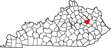 | |
| Unincorporated communities | ||
