Hanging Rock, Ohio
| Hanging Rock, Ohio | |
|---|---|
| Village | |
|
Stone arch bridge over Osborne Run | |
 Location of Hanging Rock, Ohio | |
 Location of Hanging Rock in Lawrence County | |
| Coordinates: 38°33′32″N 82°43′34″W / 38.55889°N 82.72611°WCoordinates: 38°33′32″N 82°43′34″W / 38.55889°N 82.72611°W | |
| Country | United States |
| State | Ohio |
| County | Lawrence |
| Area[1] | |
| • Total | 0.65 sq mi (1.68 km2) |
| • Land | 0.56 sq mi (1.45 km2) |
| • Water | 0.09 sq mi (0.23 km2) |
| Elevation[2] | 541 ft (165 m) |
| Population (2010)[3] | |
| • Total | 221 |
| • Estimate (2012[4]) | 221 |
| • Density | 394.6/sq mi (152.4/km2) |
| Time zone | Eastern (EST) (UTC-5) |
| • Summer (DST) | EDT (UTC-4) |
| ZIP code | 45638 |
| Area code(s) | 740 |
| FIPS code | 39-33194[5] |
| GNIS feature ID | 1075994[2] |

Hanging Rock is a village in Lawrence County, Ohio, United States, along the Ohio River. The population was 221 at the 2010 census. It is regularly labeled a speed trap as the state auditor reported $109,186 in mayor's court receipts in 2000 compared with $3,106 in property taxes.[6]
Hanging Rock is a part of the Huntington-Ashland, WV-KY-OH, Metropolitan Statistical Area (MSA); it had a population of 288,649 at the 2000 census.
Etymology
Hanging Rock had its start in 1820 when a blast furnace was built at the site.[7] The village takes its name from a nearby cliff.[8]
Geography
Hanging Rock is located at 38°33′32″N 82°43′34″W / 38.55889°N 82.72611°W (38.559021, -82.726070).[9]
According to the United States Census Bureau, the village has a total area of 0.65 square miles (1.68 km2), of which 0.56 square miles (1.45 km2) is land and 0.09 square miles (0.23 km2) is water.[1]
The Hanging Rock Recreational Area and the Hanging Rock Ponds are located near the village.
Demographics
| Historical population | |||
|---|---|---|---|
| Census | Pop. | %± | |
| 1880 | 624 | — | |
| 1890 | 846 | 35.6% | |
| 1900 | 665 | −21.4% | |
| 1910 | 662 | −0.5% | |
| 1920 | 591 | −10.7% | |
| 1930 | 550 | −6.9% | |
| 1940 | 481 | −12.5% | |
| 1950 | 465 | −3.3% | |
| 1960 | 352 | −24.3% | |
| 1970 | 278 | −21.0% | |
| 1980 | 353 | 27.0% | |
| 1990 | 306 | −13.3% | |
| 2000 | 279 | −8.8% | |
| 2010 | 221 | −20.8% | |
| Est. 2015 | 218 | [10] | −1.4% |
2010 census
As of the census[3] of 2010, there were 221 people, 95 households, and 68 families residing in the village. The population density was 394.6 inhabitants per square mile (152.4/km2). There were 102 housing units at an average density of 182.1 per square mile (70.3/km2). The racial makeup of the village was 98.6% White and 1.4% from two or more races. Hispanic or Latino of any race were 1.4% of the population.
There were 95 households of which 23.2% had children under the age of 18 living with them, 52.6% were married couples living together, 13.7% had a female householder with no husband present, 5.3% had a male householder with no wife present, and 28.4% were non-families. 20.0% of all households were made up of individuals and 11.6% had someone living alone who was 65 years of age or older. The average household size was 2.33 and the average family size was 2.60.
The median age in the village was 47.4 years. 14.9% of residents were under the age of 18; 4.1% were between the ages of 18 and 24; 28.5% were from 25 to 44; 32.6% were from 45 to 64; and 19.9% were 65 years of age or older. The gender makeup of the village was 47.5% male and 52.5% female.
2000 census
As of the census[5] of 2000, there were 279 people, 109 households, and 75 families residing in the village. The population density was 449.8 people per square mile (173.7/km²). There were 117 housing units at an average density of 188.6 per square mile (72.9/km²). The racial makeup of the village was 99.64% White, and 0.36% from two or more races.
There were 109 households out of which 31.2% had children under the age of 18 living with them, 58.7% were married couples living together, 9.2% had a female householder with no husband present, and 30.3% were non-families. 27.5% of all households were made up of individuals and 11.9% had someone living alone who was 65 years of age or older. The average household size was 2.56 and the average family size was 3.17.
In the village the population was spread out with 22.9% under the age of 18, 12.2% from 18 to 24, 28.7% from 25 to 44, 25.8% from 45 to 64, and 10.4% who were 65 years of age or older. The median age was 38 years. For every 100 females there were 96.5 males. For every 100 females age 18 and over, there were 93.7 males.
The median income for a household in the village was $30,417, and the median income for a family was $38,125. Males had a median income of $30,625 versus $35,625 for females. The per capita income for the village was $14,328. About 14.5% of families and 17.0% of the population were below the poverty line, including 23.6% of those under the age of eighteen and 20.8% of those sixty five or over.
Public services
The residents of Hanging Rock are served by the Rock Hill Local School District and the Briggs Lawrence County Public Library in Ironton, with branches in South Point, Chesapeake, Proctorville and Willow Wood.[12]
See also
References
- 1 2 "US Gazetteer files 2010". United States Census Bureau. Retrieved 2013-01-06.
- 1 2 "US Board on Geographic Names". United States Geological Survey. 2007-10-25. Retrieved 2008-01-31.
- 1 2 "American FactFinder". United States Census Bureau. Retrieved 2013-01-06.
- ↑ "Population Estimates". United States Census Bureau. Retrieved 2013-06-17.
- 1 2 "American FactFinder". United States Census Bureau. Retrieved 2008-01-31.
- ↑ Small municipalities turn highways into lucrative source of income, Toledo Blade, Sunday, July 20, 2003. Retrieved 2008-01-21.
- ↑ Overman, William Daniel (1958). Ohio Town Names. Akron, OH: Atlantic Press. p. 57.
- ↑ Gannett, Henry (1905). The Origin of Certain Place Names in the United States. Govt. Print. Off. p. 148.
- ↑ "US Gazetteer files: 2010, 2000, and 1990". United States Census Bureau. 2011-02-12. Retrieved 2011-04-23.
- ↑ "Annual Estimates of the Resident Population for Incorporated Places: April 1, 2010 to July 1, 2015". Retrieved July 2, 2016.
- ↑ "Census of Population and Housing". Census.gov. Retrieved June 4, 2015.
- ↑ "Briggs Lawrence County Public Library". Retrieved 2007-07-17.
Municipalities and communities of Lawrence County, Ohio, United States | ||
|---|---|---|
| City | 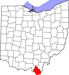 | |
| Villages | ||
| Townships | ||
| CDP | ||
| Unincorporated communities | ||
| Footnotes | ‡This populated place also has portions in an adjacent county or counties | |
| Principal cities | 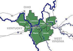 | |
|---|---|---|
| Municipalities with population over 5,000 | ||
| Municipalities with population 1,000–5,000 | ||
| Municipalities with population under 1,000 | ||
| West Virginia counties | ||
| Kentucky counties | ||
| Ohio counties | ||