Erlanger, Kentucky
| Erlanger, Kentucky | |
|---|---|
| City | |
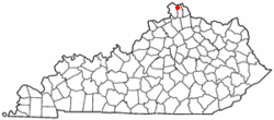 Location of Erlanger, Kentucky | |
| Coordinates: 39°0′49″N 84°35′39″W / 39.01361°N 84.59417°WCoordinates: 39°0′49″N 84°35′39″W / 39.01361°N 84.59417°W | |
| Country | United States |
| State | Kentucky |
| County | Kenton |
| Government | |
| • Type | Local or city government |
| • Mayor of Erlanger | Tyson Hermes |
| • City Administrator | Marc Fields |
| Area | |
| • Total | 8.4 sq mi (21.8 km2) |
| • Land | 8.3 sq mi (21.6 km2) |
| • Water | 0.1 sq mi (0.3 km2) |
| Elevation | 912 ft (278 m) |
| Population (2010) | |
| • Total | 18,368 |
| • Density | 2,213.0/sq mi (850.4/km2) |
| Time zone | Eastern (EST) (UTC-5) |
| • Summer (DST) | EDT (UTC-4) |
| ZIP codes | 41018 |
| Area code(s) | 859 |
| FIPS code | 21-25300 |
| GNIS feature ID | 0491808 |
| Website | www.ci.erlanger.ky.us |
Erlanger is a city in Kenton County, Kentucky, United States. It had a 2010 census population of 18,368. Erlanger is part of the Cincinnati-Middletown, OH-KY-IN Metropolitan Statistical Area.
Etymology
The city was named after the Parisian family bank of Emile d'Erlanger,[1] which helped finance the town's early development. In current usage, the name is pronounced in an anglicized way, with neither a French nor German accent. Erlanger is commonly referenced as the E-Town or The E. Nearby Elsmere was originally known as "South Erlanger".
Geography
Erlanger is located at 39°0′49″N 84°35′39″W / 39.01361°N 84.59417°W (39.013511, -84.594042).[2]
According to the United States Census Bureau, the city has a total area of 8.4 square miles (22 km2), of which 8.3 square miles (21 km2) is land and 0.1 square miles (0.26 km2) (1.19%) is water.
Demographics
As of the 2000 census,[3] there were 16,676 people, 6,597 households, and 4,406 families residing in the city. The population density was 2,002.4 people per square mile (772.9/km²). There were 6,865 housing units at an average density of 824.3 per square mile (318.2/km²). The racial makeup of the city was 60% White, 27% African American, 0.02% Native American, 0.04% Asian, 0.02% Pacific Islander, 0.42% from other races, and 1.87% from two or more races. Hispanic or Latino of any race were 10% of the population.
There were 6,597 households out of which 51.8% had children under the age of 18 living with them, 32.1% were married couples living together, 33.8% had a female householder with no husband present, and 11.1% were non-families. 28.0% of all households were made up of individuals and 9.3% had someone living alone who was 65 years of age or older. The average household size was 2.50 and the average family size was 4.09.
| Historical population | |||
|---|---|---|---|
| Census | Pop. | %± | |
| 1900 | 453 | — | |
| 1910 | 700 | 54.5% | |
| 1920 | 711 | 1.6% | |
| 1930 | 1,853 | 160.6% | |
| 1940 | 2,416 | 30.4% | |
| 1950 | 3,694 | 52.9% | |
| 1960 | 7,072 | 91.4% | |
| 1970 | 12,676 | 79.2% | |
| 1980 | 14,466 | 14.1% | |
| 1990 | 15,979 | 10.5% | |
| 2000 | 16,676 | 4.4% | |
| 2010 | 18,082 | 8.4% | |
| Est. 2015 | 18,797 | [4] | 4.0% |
In the city the population was spread out with 26.4% under the age of 18, 8.7% from 18 to 24, 33.0% from 25 to 44, 20.2% from 45 to 64, and 11.7% who were 65 years of age or older. The median age was 34 years. For every 100 females there were 92.8 males. For every 100 females age 18 and over, there were 87.8 males.
The median income for a household in the city was $29,835, and the median income for a family was $40,442. Males had a median income of $21,585 versus $19,296 for females. The per capita income for the city was $17,834. About 27.0% of families and 29.8% of the population were below the poverty line, including 42.0% of those under age 18 and 33.6% of those age 65 or over.
Erlanger has multiple neighborhoods within city limits such as, Cherry Hill (partially Boone County), Central Erlanger (the section marked between streets Sunset Ave. and Commonwealth Ave), An industrial area surrounding the Cincinnati Airport (includes Mineola Pike), Historic Erlanger (between Riggs Ave. and Crescent Ave.), Northeast Erlanger (Dixie Hwy. & Stevenson Rd. through Turkeyfoot Rd.), And North Central Erlanger (Erlanger Rd. and Riggs Ave. to Rosary Dr.) A large subdivision of mostly single-family dwellings, called "Cherry Hill" is in the city of Erlanger. The Kenton County and Boone County lines intersect within "Cherry Hill". This subdivision also is home to Cherry Hill Swim Club. Approximately one-half of the subdivision is within an unincorporated area of Boone County, which is adjacent the Greater Cincinnati International Airport.[6] A large sector of the city known as " North Central Erlanger" commonly referred to the area between Erlanger Rd. near Super Bowl, and Rosary Dr. near Eagle Ridge Apartments. This area includes low income apartment housing such as Greenfield, Town & Country, Willow Glen, and Eagle ridge, as well as stretch of Riggs Ave. between Erlanger Rd. And Rosary Dr. This is an impoverished area, far more than surrounding neighborhoods and cities. The North Central Erlanger area is known for increasing crime rates, and increasing poverty rates.
Economy
Toyota Boshoku America has a major manufacturing plant in Erlanger.
The United States Playing Card Company's corporate headquarters are also located here.[7]
Perfetti Van Melle, an Italian confectionery manufacturer, manufactures candy such as AirHeads here.
There is a global shipping centre here as well, often used to send international online purchases.
References
- ↑ Tenkotte, Paul A.; Claypool, James C. (5 February 2015). The Encyclopedia of Northern Kentucky. University Press of Kentucky. p. 308. ISBN 978-0-8131-5996-6.
- ↑ "US Gazetteer files: 2010, 2000, and 1990". United States Census Bureau. 2011-02-12. Retrieved 2011-04-23.
- ↑ "American FactFinder". United States Census Bureau. Retrieved 2008-01-31.
- ↑ "Annual Estimates of the Resident Population for Incorporated Places: April 1, 2010 to July 1, 2015". Retrieved July 2, 2016.
- ↑ "Census of Population and Housing". Census.gov. Retrieved June 4, 2015.
- ↑ Boone County Property Valuation Administration www.boonecountypva.org, Kenton County Property Valuation Administration www.kentonpva.org
- ↑ "Contact Us". The United States Playing Card Company. Retrieved 14 August 2015.
External links
Municipalities and communities of Kenton County, Kentucky, United States | ||
|---|---|---|
| Cities | 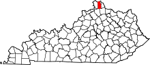 | |
| Unincorporated communities | ||
| Footnotes | ‡This populated place also has portions in an adjacent county or counties. | |
