Stanton, Kentucky
| Stanton, Kentucky | |
|---|---|
| City | |
|
Powell County Courthouse in Stanton | |
| Nickname(s): Nature's Bridge to the Mountains | |
| Motto: "All of nature is our bathroom!" | |
 Location of Stanton, Kentucky | |
| Coordinates: 37°50′51″N 83°51′33″W / 37.84750°N 83.85917°WCoordinates: 37°50′51″N 83°51′33″W / 37.84750°N 83.85917°W | |
| Country | United States |
| State | Kentucky |
| County | Powell |
| Incorporated | March 9, 1854 |
| Government | |
| • Type | Mayor-Council |
| • Mayor | Dale Allen |
| Area | |
| • Total | 2.0 sq mi (5.1 km2) |
| • Land | 2.0 sq mi (5.1 km2) |
| • Water | 0.0 sq mi (0.0 km2) |
| Elevation | 673 ft (205 m) |
| Population (2010) | |
| • Total | 2,733 |
| • Density | 1,366.5/sq mi (535.8/km2) |
| Time zone | Eastern (EST) (UTC-5) |
| • Summer (DST) | EDT (UTC-4) |
| ZIP code | 40380 |
| Area code(s) | 606 |
| FIPS code | 21-73164 |
| GNIS feature ID | 0515661 |

Stanton is a city in and the county seat of Powell County, Kentucky, United States.[1] The population was 2,733 at the 2010 census.
Stanton is the birthplace of Hall of Fame thoroughbred horse trainer Woody Stephens.
History
The first post office to be located in present-day Stanton was established on July 7, 1849 and was named Beaver Pond, because of the settlement's proximity to a small body of water resulting from a beaver dam.[2] In 1852, both the post office and the settlement were renamed Stanton for Richard H. Stanton, who served in Congress from 1849–1855 and later as a U.S. senator.[3]
In the late 1800s and early 1900s, Stanton (and nearby Clay City) were booming logging centers for Eastern Kentucky. The city was also connected to much of the country by a railroad that went through the city and county. Since then the railroad has been removed. The original train depot still exists and is home to the Powell County Tourism Association.
Geography
Stanton is located at 37°50′51″N 83°51′33″W / 37.84750°N 83.85917°W (37.847610, -83.859250).[4] Stanton lies in the floodplain of the Red River.
According to the United States Census Bureau, the city has a total area of 2.0 square miles (5.2 km2), all land.
Education
Stanton is served by the Powell County School District. The following schools are located within the city:
- Bowen Elementary School
- Stanton Elementary School
- Powell County Middle School
- Powell County High School
- Powell County Alternative School
Stanton Christian School was the only private school located within the city until, it closed in 2008/2009.
Overall the city has roughly 2,000-2,500 registered students in its public schools.
Government
Stanton is governed by a Mayor-council form of government. The current mayor is Dale Allen.
The representative body of the city of Stanton is the city council. The council members include: Dixie Lockard, Margarita Arnett, Pam McIntosh Tipton, Charlotte Estes, Linville Bellamy, and Tommy Mays.[5]
The Stanton Police Department (SPD) is a 24-hour department. The current Chief of Police is Arthur Lacy. SPD is a fully functioning police department that is involved in multiple facets of the community and other law enforcement agencies in the area including Clay City Police Department, Powell County Sheriffs Office, Kentucky State Police, surrounding county agencies, and federal agencies.
Events
During the first weekend in August, Stanton conducts the annual Corn Festival. The Corn Festival has been a tradition in Stanton for many years. The first ever festival was on August 5–6, 1989. The festival includes many events, such as corn eating contests, talent shows, beauty competitions, car shows, and corn hole tournaments. The festival also includes many booths exhibiting/selling local art, etc. The festival draws around 5,000 people annually.
Another event that happens in Stanton is the Powell County Fair. The fair is always conducted on the second week in September. It is held at the local Lion's Club Park (Powell County Fairgrounds). The fair includes many booths of people advertising their businesses, political positions, etc. It also includes few rides but many events. The events include truck/tractor pulls, greasy pig competition, baby pageants, etc.
Demographics
| Historical population | |||
|---|---|---|---|
| Census | Pop. | %± | |
| 1860 | 59 | — | |
| 1870 | 73 | 23.7% | |
| 1880 | 98 | 34.2% | |
| 1900 | 192 | — | |
| 1910 | 278 | 44.8% | |
| 1920 | 311 | 11.9% | |
| 1930 | 423 | 36.0% | |
| 1940 | 625 | 47.8% | |
| 1950 | 635 | 1.6% | |
| 1960 | 753 | 18.6% | |
| 1970 | 2,037 | 170.5% | |
| 1980 | 2,691 | 32.1% | |
| 1990 | 2,795 | 3.9% | |
| 2000 | 3,029 | 8.4% | |
| 2010 | 2,733 | −9.8% | |
| Est. 2015 | 2,666 | [6] | −2.5% |
As of the census[8] of 2010, there were 2,733 people, 1,048 households, and 667 families residing in the city. The population density was 1,365.5 people per square mile (535.8/km²). There were 1,048 housing units at an average density of 524 per square mile (262.6/km²). The racial makeup of the city was 92.5% White, 2.4% African American, 0.4% Native American, 0.6% Asian, 0.03% from other races, and 0.4% from two or more races. Hispanic or Latino of any race were 3.1% of the population.
There were 1,048 households out of which 27.0% had children under the age of 18 living with them, 32.0% were married couples living together, 13.4% had a female householder with no husband present, and 8.9% were non-families. 26.6% of all households were made up of individuals and 11.0% had someone living alone who was 65 years of age or older. The average household size was 2.60 and the average family size was 3.04.
In the city the population was spread out with 27.0% under the age of 18, 8.6% from 18 to 24, 23.3% from 25 to 44, 31.2% from 45 to 64, and 11.6% who were 65 years of age or older. The median age was 39 years. For every 100 females there were 91.1 males. For every 100 females age 18 and over, there were 86.0 males.
The median income for a household in the city was $25,750, and the median income for a family was $29,781. Males had a median income of $25,081 versus $20,432 for females. The per capita income for the city was $13,521. About 19.5% of families and 31.9% of the population were below the poverty line, including 29.2% of those under age 18 and 21.4% of those age 65 or over.
References
- ↑ "Find a County". National Association of Counties. Retrieved 2011-06-07.
- ↑ Federal Writers' Project (1996). The WPA Guide to Kentucky. University Press of Kentucky. p. 243. Retrieved 24 November 2013.
- ↑ Rennick, Robert M. (1988). "Place Names". Kentucky Place Names. Lexington, Kentucky: The University Press of Kentucky. ISBN 0-8131-0179-4. Retrieved on 2009-11-05
- ↑ "US Gazetteer files: 2010, 2000, and 1990". United States Census Bureau. 2011-02-12. Retrieved 2011-04-23.
- ↑ BARR DEFEATS CHANDLER, ROMNEY BEATS OBAMA IN POWELL AND THE STATE | Clay City Times 2012-11-09. Retrieved on 2013-02-11
- ↑ "Annual Estimates of the Resident Population for Incorporated Places: April 1, 2010 to July 1, 2015". Retrieved July 2, 2016.
- ↑ "Census of Population and Housing". Census.gov. Retrieved June 4, 2015.
- ↑ "American FactFinder". United States Census Bureau. Retrieved 2008-01-31.
Municipalities and communities of Powell County, Kentucky, United States | ||
|---|---|---|
| Cities | 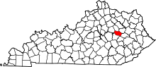 | |
| Unincorporated communities | ||
