Lavalette, West Virginia
| Lavalette | |
|---|---|
| Census-designated place (CDP) | |
 Lavalette Location within the state of West Virginia | |
| Coordinates: 38°19′22″N 82°26′49″W / 38.32278°N 82.44694°WCoordinates: 38°19′22″N 82°26′49″W / 38.32278°N 82.44694°W | |
| Country | United States |
| State | West Virginia |
| County | Wayne |
| Area[1] | |
| • Total | 2.607 sq mi (6.75 km2) |
| • Land | 2.607 sq mi (6.75 km2) |
| • Water | 0 sq mi (0 km2) |
| Population (2010)[2] | |
| • Total | 1,073 |
| • Density | 410/sq mi (160/km2) |
| Time zone | Eastern (EST) (UTC-5) |
| • Summer (DST) | EDT (UTC-4) |
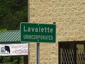
Lavalette is a census-designated place (CDP) in Wayne County, West Virginia, in the United States. As of the 2010 census, its population was 1,073.[2] Lavalette is located at the intersection of West Virginia Route 152 and West Virginia Route 75, eight miles south of Huntington. The town is near Beech Fork Lake, a popular location for boating and fishing, and Twelvepole Creek. Lavalette was named after Lavalette Miller, the daughter of a Norfolk & Western Railway official.
Lavalette is a part of the Huntington-Ashland, WV-KY-OH, Metropolitan Statistical Area. As of the 2010 census, the MSA had a population of 287,702.
Lavalette has two 18-hole public golf courses - Sugarwood Golf Club and Silo Golf Course. Silo Golf Course has a restaurant call the Wedge. It specializes in BBQ and rustic cuisine. Lavalette also has a paid EMS ambulance service with two emergency response squads and one transport unit. The 35 member volunteer fire department has four engine companies, a rescue boat, and a mobile disaster response trailer.
References
- ↑ "US Gazetteer files: 2010, 2000, and 1990". United States Census Bureau. 2011-02-12. Retrieved 2011-04-23.
- 1 2 "American FactFinder". United States Census Bureau. Retrieved 2011-05-14.
Municipalities and communities of Wayne County, West Virginia, United States | ||
|---|---|---|
| Cities | 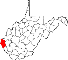 | |
| Towns | ||
| CDPs | ||
| Unincorporated communities |
| |
| Footnotes | ‡This populated place also has portions in an adjacent county or counties | |
| Principal cities | 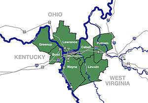 | |
|---|---|---|
| Municipalities with population over 5,000 | ||
| Municipalities with population 1,000–5,000 | ||
| Municipalities with population under 1,000 | ||
| West Virginia counties | ||
| Kentucky counties | ||
| Ohio counties | ||