Grayson, Kentucky
| Grayson, Kentucky | |
|---|---|
| City | |
|
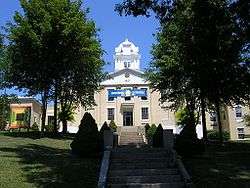
Carter County Courthouse in Grayson | |
| Motto: "Heart of the parks" | |
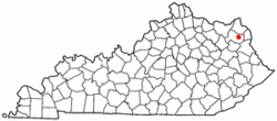 Location of Grayson, Kentucky | |
| Coordinates: 38°20′5″N 82°56′33″W / 38.33472°N 82.94250°WCoordinates: 38°20′5″N 82°56′33″W / 38.33472°N 82.94250°W | |
| Country | United States |
| State | Kentucky |
| County | Carter |
| Named for | landowner William Grayson |
| Government | |
| • Mayor | George Steel |
| Area | |
| • Total | 2.9 sq mi (7.5 km2) |
| • Land | 2.8 sq mi (7.3 km2) |
| • Water | 0.04 sq mi (0.1 km2) |
| Elevation | 633 ft (193 m) |
| Population (2010) | |
| • Total | 4,217 |
| • Density | 1,488/sq mi (574.7/km2) |
| Time zone | Eastern (EST) (UTC-5) |
| • Summer (DST) | EDT (UTC-4) |
| ZIP code | 41143 |
| Area code(s) | 606 |
| FIPS code | 21-32572 |
| GNIS feature ID | 0493221 |
| Website |
graysonky |
Grayson is a city in and the county seat of Carter County, Kentucky, United States,[1] in the state's northeastern region. The population was 4,217 at the 2010 census.[2] The city is part of the Huntington-Ashland WV-KY-OH Metropolitan Area. Interstate 64 and the AA Highway converge in Grayson making the city a gateway to the Huntington-Ashland urban area.
History
After the Revolutionary War, George Washington's aide-de-camp Col. William Grayson received a 70,000-acre (280 km2) tract of land for his service during the war from the state of Virginia.[3] By 1838, a small portion of this tract was set aside for the development of a town named for him. Although Grayson had only five streets and eighty lots, it was established by the General Assembly on February 6, 1844, and it was incorporated on February 22, 1860.[4][5]
Geography
Grayson is located in east-central Carter County at 38°20′5″N 82°56′33″W / 38.33472°N 82.94250°W (38.334738, -82.942368),[6] along the Little Sandy River, a tributary of the Ohio River.
U.S. Route 60 passes through the city as Main Street and is intersected in downtown by Kentucky Routes 1 and 7 (Carol Malone Boulevard). Interstate 64 runs through the northern end of the city, with access to KY 7 at Exit 172. Kentucky Route 9, the AA Highway, begins from KY 1-and-7 just north of the city limits and runs 111 miles (179 km) to the Cincinnati area. Huntington, West Virginia, is 29 miles (47 km) east of Grayson via I-64, and Lexington is 96 miles (154 km) to the west.
According to the United States Census Bureau, Grayson has a total area of 2.9 square miles (7.5 km2), of which 2.8 square miles (7.3 km2) is land and 0.039 square miles (0.1 km2), or 1.95%, is water.[2]
Climate
The climate in this area is characterized by hot, humid summers and generally mild to cool winters. According to the Köppen Climate Classification system, Grayson has a humid subtropical climate, abbreviated "Cfa" on climate maps.[7]
Education
Grayson is served by the Carter County School District. Schools located within the city includes:
- Heritage Elementary School
- Prichard Elementary School
- East Carter Middle School
- East Carter High School
The campus of Kentucky Christian University (formerly Kentucky Christian College) is located in Grayson.
Demographics
| Historical population | |||
|---|---|---|---|
| Census | Pop. | %± | |
| 1870 | 152 | — | |
| 1880 | 447 | 194.1% | |
| 1890 | 433 | −3.1% | |
| 1900 | 606 | 40.0% | |
| 1910 | 735 | 21.3% | |
| 1920 | 822 | 11.8% | |
| 1930 | 1,022 | 24.3% | |
| 1940 | 1,176 | 15.1% | |
| 1950 | 1,363 | 15.9% | |
| 1960 | 1,692 | 24.1% | |
| 1970 | 2,184 | 29.1% | |
| 1980 | 3,423 | 56.7% | |
| 1990 | 3,510 | 2.5% | |
| 2000 | 3,877 | 10.5% | |
| 2010 | 4,217 | 8.8% | |
| Est. 2015 | 4,058 | [8] | −3.8% |
As of the census[10] of 2000, there were 3,877 people, 1,415 households, and 938 families residing in the city. The population density was 1,549.1 people per square mile (598.8/km²). There were 1,538 housing units at an average density of 614.5 per square mile (237.5/km²). The racial makeup of the city was 98.32% White, 0.52% African American, 0.39% Native American, 0.28% Asian, 0.03% Pacific Islander, 0.18% from other races, and 0.28% from two or more races. Hispanic or Latino of any race were 0.77% of the population.
There were 1,415 households out of which 31.0% had children under the age of 18 living with them, 46.9% were married couples living together, 16.0% had a female householder with no husband present, and 33.7% were non-families. 31.0% of all households were made up of individuals and 13.1% had someone living alone who was 65 years of age or older. The average household size was 2.31 and the average family size was 2.86.
In the city the population was spread out with 21.9% under the age of 18, 19.0% from 18 to 24, 24.3% from 25 to 44, 18.5% from 45 to 64, and 16.3% who were 65 years of age or older. The median age was 32 years. For every 100 females there were 83.0 males. For every 100 females age 18 and over, there were 78.0 males.
The median income for a household in the city was $19,683, and the median income for a family was $26,280. Males had a median income of $32,022 versus $18,875 for females. The per capita income for the city was $11,879. About 27.7% of families and 31.4% of the population were below the poverty line, including 44.8% of those under age 18 and 22.3% of those age 65 or over.
Notable residents
- Robin L. Webb, Kentucky State Senator and former Kentucky State Representative
- Jill York, member of the Kentucky House of Representatives
- Charlie Borders, former Kentucky State Senator
References
- ↑ "Find a County". National Association of Counties. Retrieved 2011-06-07.
- 1 2 "Geographic Identifiers: 2010 Demographic Profile Data (G001): Grayson city, Kentucky". U.S. Census Bureau, American Factfinder. Retrieved August 7, 2014.
- ↑ Rennick, Robert M. (1988). "Place Names". Kentucky Place Names. Lexington, Kentucky: The University Press of Kentucky. ISBN 0-8131-0179-4. Retrieved on 9 Oct 2010.
- ↑ City of Grayson. Brochure. Retrieved on 2010-10-09
- ↑ Commonwealth of Kentucky. Office of the Secretary of State. Land Office. "Grayson, Kentucky". Accessed 29 Jul 2013.
- ↑ "US Gazetteer files: 2010, 2000, and 1990". United States Census Bureau. 2011-02-12. Retrieved 2011-04-23.
- ↑ Climate Summary for Grayson, Kentucky
- ↑ "Annual Estimates of the Resident Population for Incorporated Places: April 1, 2010 to July 1, 2015". Retrieved July 2, 2016.
- ↑ "Census of Population and Housing". Census.gov. Retrieved June 4, 2015.
- ↑ "American FactFinder". United States Census Bureau. Retrieved 2008-01-31.
External links
| Wikimedia Commons has media related to Grayson, Kentucky. |
Municipalities and communities of Carter County, Kentucky, United States | ||
|---|---|---|
| Cities | 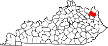 | |
| Unincorporated communities | ||
| Footnotes | ‡This populated place also has portions in an adjacent county or counties | |
| Principal cities |  | |
|---|---|---|
| Municipalities with population over 5,000 | ||
| Municipalities with population 1,000–5,000 | ||
| Municipalities with population under 1,000 | ||
| West Virginia counties | ||
| Kentucky counties | ||
| Ohio counties | ||
