Madison County, Kentucky
| Madison County, Kentucky | |
|---|---|
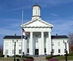 Madison County courthouse in Richmond | |
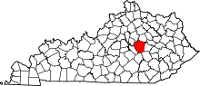 Location in the U.S. state of Kentucky | |
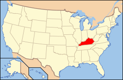 Kentucky's location in the U.S. | |
| Founded | December 15, 1785 |
| Named for | James Madison |
| Seat | Richmond |
| Largest city | Richmond |
| Area | |
| • Total | 443 sq mi (1,147 km2) |
| • Land | 437 sq mi (1,132 km2) |
| • Water | 6.0 sq mi (16 km2), 1.3% |
| Population | |
| • (2010) | 82,916 |
| • Density | 190/sq mi (73/km²) |
| Congressional district | 6th |
| Time zone | Eastern: UTC-5/-4 |
| Website |
www |
Madison County is a county located in the U.S. state of Kentucky. As of the 2010 census, the population was 82,916.[1] Its county seat is Richmond.[2] The county is named for Virginia statesman James Madison, who later became the fourth President of the United States.[3]
Madison County is part of the Richmond-Berea, KY Micropolitan Statistical Area, which is also included in the Lexington-Fayette-Richmond-Frankfort, KY Combined Statistical Area.
It is considered a moist county, meaning that although the county prohibits the sale of alcoholic beverages (and is thus a dry county), it contains a city where retail alcohol sales are allowed. Nevertheless, two of Richmond's 19 precincts are dry.[4] Alcohol can also be sold by the drink in Berea[5] and at Arlington and The Bull golf clubs.
Madison County is home to Eastern Kentucky University, Berea College, Boone Tavern, and Bybee Pottery,(closed February 2011) one of the oldest pottery operations in the United States.[6] This is also where famous pioneer Daniel Boone lived and built Fort Boonesborough, now a state historic site.
History
Indian trader John Findley, Daniel Boone, and four others first came into the area that is Madison County in 1769 on a hunting and exploring expedition. The Transylvania Company, led by Judge Richard Henderson of North Carolina, purchased 20,000,000 acres of land west of the Appalachians (including present-day Madison County) from the Cherokee in 1774. Daniel Boone was hired by the company to cut a trail through the Cumberland Gap and establish a settlement on the Kentucky River. The settlement at Fort Boonesborough began in April 1775.
In 1785, Madison County was established from land given by Lincoln County, Virginia.[7][8]
Geography
According to the U.S. Census Bureau, the county has a total area of 443 square miles (1,150 km2), of which 437 square miles (1,130 km2) is land and 6.0 square miles (16 km2) (1.3%) is water.[9]
Major highways
Adjacent counties
- Fayette County (north)
- Clark County (northeast)
- Estill County (east)
- Jackson County (southeast)
- Rockcastle County (south)
- Garrard County (southwest)
- Jessamine County (northwest)
Demographics
| Historical population | |||
|---|---|---|---|
| Census | Pop. | %± | |
| 1790 | 5,772 | — | |
| 1800 | 10,490 | 81.7% | |
| 1810 | 15,540 | 48.1% | |
| 1820 | 15,954 | 2.7% | |
| 1830 | 18,751 | 17.5% | |
| 1840 | 16,355 | −12.8% | |
| 1850 | 15,727 | −3.8% | |
| 1860 | 17,207 | 9.4% | |
| 1870 | 19,543 | 13.6% | |
| 1880 | 22,052 | 12.8% | |
| 1890 | 24,348 | 10.4% | |
| 1900 | 25,607 | 5.2% | |
| 1910 | 26,951 | 5.2% | |
| 1920 | 26,284 | −2.5% | |
| 1930 | 27,621 | 5.1% | |
| 1940 | 28,541 | 3.3% | |
| 1950 | 31,179 | 9.2% | |
| 1960 | 33,482 | 7.4% | |
| 1970 | 42,730 | 27.6% | |
| 1980 | 53,352 | 24.9% | |
| 1990 | 57,508 | 7.8% | |
| 2000 | 70,872 | 23.2% | |
| 2010 | 82,916 | 17.0% | |
| Est. 2015 | 87,824 | [10] | 5.9% |
| U.S. Decennial Census[11] 1790-1960[12] 1900-1990[13] 1990-2000[14] 2010-2013[1] | |||
As of the census[15] of 2000, there were 70,872 people, 27,152 households, and 18,218 families residing in the county. The population density was 161 per square mile (62/km2). There were 29,595 housing units at an average density of 67 per square mile (26/km2). The racial makeup of the county was 93.01% White, 4.44% Black or African American, 0.28% Native American, 0.72% Asian, 0.02% Pacific Islander, 0.34% from other races, and 1.19% from two or more races. 0.97% of the population were Hispanics or Latinos of any race.
There were 27,152 households out of which 31.50% had children under the age of 18 living with them, 53.10% were married couples living together, 10.70% had a female householder with no husband present, and 32.90% were non-families. 25.20% of all households were made up of individuals and 7.60% had someone living alone who was 65 years of age or older. The average household size was 2.42 and the average family size was 2.90.
By age, 21.90% were under 18, 18.80% from 18 to 24, 29.40% from 25 to 44, 20.10% from 45 to 64, and 9.80% 65 or older. The median age was 31 years. Both the relatively large 18-to-24 population and the relatively low median age can be explained by the presence of Eastern Kentucky University, and to a considerably lesser extent Berea College. For every 100 females there were 93.30 males. For every 100 females age 18 and over, there were 90.20 males.
The median income for a household in the county was $32,861, and the median income for a family was $41,383. Males had a median income of $31,974 versus $22,487 for females. The per capita income for the county was $16,790. About 12.00% of families and 16.80% of the population were below the poverty line, including 17.80% of those under age 18 and 17.10% of those age 65 or over.
Politics
| Year | Republican | Democrat |
|---|---|---|
| 2016 | 62.70% 23,431 | 31.56% 11,793 |
| 2012 | 63.41% 21,128 | 34.55% 11,512 |
| 2008 | 60.53% 19,694 | 38.09% 12,392 |
| 2004 | 61.62% 18,922 | 37.53% 11,525 |
| 2000 | 57.81% 13,682 | 39.33% 9,309 |
Education
Schools
Madison County is served by two school districts:
- Madison County Schools currently consisting of 10 elementary, 5 middle, and 2 high schools.
- Berea Independent Schools. currently consisting of 1 elementary, 1 middle, and 1 high school.
Colleges and universities
- Eastern Kentucky University, located in Richmond
- Berea College, located in Berea
- National College of Business & Technology, located in Richmond
Communities
- Boonesborough
- Berea
- Kirksville
- Richmond (county seat)
- Waco
Notable person
- Lonnie Napier (1940- ) - one of the current representatives for House District 36 in the Kentucky House of Representatives.
See also
References
- 1 2 "State & County QuickFacts". United States Census Bureau. Retrieved March 6, 2014.
- ↑ "Find a County". National Association of Counties. Archived from the original on 2011-05-31. Retrieved 2011-06-07.
- ↑ The Register of the Kentucky State Historical Society, Volume 1. Kentucky State Historical Society. 1903. p. 36.
- ↑ Lanier, Yvette (2007-08-01). "Berea votes down alcohol sales again". Lexington Herald-Leader. Retrieved 2007-08-01.
- ↑ "Berea prepares for future with alcohol sales". Richmond Register. Retrieved 2016-01-13.
- ↑ Foust, Michele. "200-year-old Kentucky pottery business a sight to see ", Atlanta Journal-Constitution, 2007-02-25. Retrieved on February 23, 2009.
- ↑ Collins, Lewis (1882). Collins' Historical Sketches of Kentucky: History of Kentucky, Volume 2. Collins & Company. p. 26.
- ↑ "Madison County". The Kentucky Encyclopedia. 2000. Retrieved August 23, 2014.
- ↑ "2010 Census Gazetteer Files". United States Census Bureau. August 22, 2012. Retrieved August 17, 2014.
- ↑ "County Totals Dataset: Population, Population Change and Estimated Components of Population Change: April 1, 2010 to July 1, 2015". Retrieved July 2, 2016.
- ↑ "U.S. Decennial Census". United States Census Bureau. Archived from the original on May 11, 2015. Retrieved August 17, 2014.
- ↑ "Historical Census Browser". University of Virginia Library. Retrieved August 17, 2014.
- ↑ "Population of Counties by Decennial Census: 1900 to 1990". United States Census Bureau. Retrieved August 17, 2014.
- ↑ "Census 2000 PHC-T-4. Ranking Tables for Counties: 1990 and 2000" (PDF). United States Census Bureau. Retrieved August 17, 2014.
- ↑ "American FactFinder". United States Census Bureau. Archived from the original on 2013-09-11. Retrieved 2008-01-31.
- ↑ "Dave Leip's Atlas of U.S. Presidential Elections". Retrieved 2016-07-31.
External links
| Wikimedia Commons has media related to Madison County, Kentucky. |
- Madison County government's website
- Madison County school district's website
- The Kentucky Highlands Project
- List of Madison County historic places on Placeography
Municipalities and communities of Madison County, Kentucky, United States | ||
|---|---|---|
| Cities | | |
| Unincorporated communities |
| |

Coordinates: 37°43′N 84°17′W / 37.72°N 84.28°W