Blaine, Kentucky
| Blaine, Kentucky | |
|---|---|
| City | |
 Location of Blaine, Kentucky | |
| Coordinates: 38°1′33″N 82°51′19″W / 38.02583°N 82.85528°WCoordinates: 38°1′33″N 82°51′19″W / 38.02583°N 82.85528°W | |
| Country | United States |
| State | Kentucky |
| County | Lawrence |
| Incorporated | March 10, 1886 |
| Government | |
| • Type | City Commission |
| • Mayor | Bradley Mattingly |
| • President of Council | Natalie Rice |
| Area | |
| • Total | 3.3 sq mi (8.5 km2) |
| • Land | 3.3 sq mi (8.5 km2) |
| • Water | 0.0 sq mi (0.0 km2) |
| Elevation | 659 ft (201 m) |
| Population (2000) | |
| • Total | 245 |
| • Density | 74.9/sq mi (28.9/km2) |
| Time zone | Eastern (EST) (UTC-5) |
| • Summer (DST) | EDT (UTC-4) |
| ZIP code | 41124 |
| Area code(s) | 606 |
| FIPS code | 21-07264 |
| GNIS feature ID | 0487427 |
Blaine is a 6th-class city in Lawrence County, Kentucky, United States. The population was 245 at the 2000 census.
History
Blaine was originally settled c. 1800 and established as a local trade center by 1882. The post office has been in operation since at least May 10, 1828 (Neri Swetnam, postmaster). Although the city was incorporated as "Blaine" on March 10, 1886, it was alternatively known as Blainetown or Mouth of Hood for the remainder of the 19th century.[1]
Geography
Blaine is located at 38°1′33″N 82°51′19″W / 38.02583°N 82.85528°W (38.025742, -82.855152).[2]
According to the United States Census Bureau, the city has a total area of 3.3 square miles (8.5 km2), all land.
Demographics
At the 2000 census,[3] there were 245 people, 95 households and 74 families residing in the city. The population density was 74.9 people per square mile (28.9/km²). There were 113 housing units at an average density of 34.6 per square mile (13.3/km²). The racial makeup of the city was 99.18% White, and 0.82% from two or more races.
There were 95 households of which 34.7% had children under the age of 18 living with them, 58.9% were married couples living together, 13.7% had a female householder with no husband present, and 21.1% were non-families. 20.0% of all households were made up of individuals and 10.5% had someone living alone who was 65 years of age or older. The average household size was 2.58 and the average family size was 2.89.
| Historical population | |||
|---|---|---|---|
| Census | Pop. | %± | |
| 1900 | 134 | — | |
| 1910 | 136 | 1.5% | |
| 1920 | 103 | −24.3% | |
| 1930 | 144 | 39.8% | |
| 1940 | 124 | −13.9% | |
| 1970 | 168 | — | |
| 1980 | 358 | 113.1% | |
| 1990 | 271 | −24.3% | |
| 2000 | 245 | −9.6% | |
| 2010 | 47 | −80.8% | |
| Est. 2015 | 47 | [4] | 0.0% |
Age distribution was 25.3% under the age of 18, 8.2% from 18 to 24, 26.9% from 25 to 44, 25.7% from 45 to 64, and 13.9% who were 65 years of age or older. The median age was 33 years. For every 100 females there were 105.9 males. For every 100 females age 18 and over, there were 96.8 males.
The median household income was $16,250, and the median family income was $24,000. Males had a median income of $26,250 versus $9,688 for females. The per capita income for the city was $9,740. About 29.4% of families and 39.0% of the population were below the poverty line, including 51.8% of those under the age of eighteen and 21.2% of those sixty five or over.
Economy
Dollar Store
Education
Students residing in the city of Blaine usually attend:
Government
Blaine is governed by a city commission form of government. Its current mayor is Brad Mattingly. The city commission consists of a panel of four members: Jared Howard, Jeremy Webb, Regina Jordan, and Steve Justice.[6]
Climate
The climate in this area is characterized by relatively high temperatures and evenly distributed precipitation throughout the year. According to the Köppen Climate Classification system, Blaine has a Humid subtropical climate, abbreviated "Cfa" on climate maps.[7]
| Climate data for Blaine, Kentucky | |||||||||||||
|---|---|---|---|---|---|---|---|---|---|---|---|---|---|
| Month | Jan | Feb | Mar | Apr | May | Jun | Jul | Aug | Sep | Oct | Nov | Dec | Year |
| Average high °C (°F) | 6 (42) |
8 (46) |
13 (56) |
21 (69) |
25 (77) |
28 (83) |
30 (86) |
30 (86) |
27 (80) |
21 (70) |
14 (57) |
8 (47) |
19 (67) |
| Average low °C (°F) | −8 (18) |
−7 (20) |
−2 (28) |
3 (37) |
8 (47) |
13 (56) |
16 (61) |
16 (60) |
12 (53) |
4 (39) |
−1 (30) |
−5 (23) |
4 (39) |
| Average precipitation mm (inches) | 86 (3.4) |
74 (2.9) |
100 (4) |
100 (4) |
107 (4.2) |
89 (3.5) |
135 (5.3) |
79 (3.1) |
89 (3.5) |
64 (2.5) |
79 (3.1) |
91 (3.6) |
1,090 (43) |
| Source: Weatherbase [8] | |||||||||||||
References
- ↑ Rennick, Robert M. (1988). "Place Names". Kentucky Place Names. Lexington, Kentucky: The University Press of Kentucky. ISBN 0-8131-0179-4. Retrieved on 2010-04-17
- ↑ "US Gazetteer files: 2010, 2000, and 1990". United States Census Bureau. 2011-02-12. Retrieved 2011-04-23.
- ↑ "American FactFinder". United States Census Bureau. Archived from the original on 2013-09-11. Retrieved 2008-01-31.
- ↑ "Annual Estimates of the Resident Population for Incorporated Places: April 1, 2010 to July 1, 2015". Retrieved July 2, 2016.
- ↑ "Census of Population and Housing". Census.gov. Archived from the original on May 11, 2015. Retrieved June 4, 2015.
- ↑ Kentucky Secretary of State-Land Office Archived June 6, 2011, at the Wayback Machine. Retrieved on 2010-04-17
- ↑ Climate Summary for Blaine, Kentucky
- ↑ "Weatherbase.com". Weatherbase. 2013. Retrieved on September 12, 2013.
Municipalities and communities of Lawrence County, Kentucky, United States | ||
|---|---|---|
| Cities | 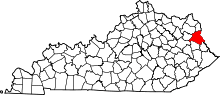 | |
| Unincorporated communities | ||
