Rebreuve-Ranchicourt
| Rebreuve-Ranchicourt | |
|---|---|
|
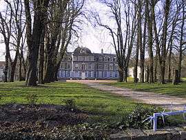
Chateau | |
 Rebreuve-Ranchicourt | |
|
Location within Hauts-de-France region  Rebreuve-Ranchicourt | |
| Coordinates: 50°26′15″N 2°33′22″E / 50.4375°N 2.5561°ECoordinates: 50°26′15″N 2°33′22″E / 50.4375°N 2.5561°E | |
| Country | France |
| Region | Hauts-de-France |
| Department | Pas-de-Calais |
| Arrondissement | Béthune |
| Canton | Houdain |
| Intercommunality | Artois |
| Government | |
| • Mayor (2008–2014) | Philippe Miloszyk |
| Area1 | 10.73 km2 (4.14 sq mi) |
| Population (2005)2 | 1,120 |
| • Density | 100/km2 (270/sq mi) |
| Time zone | CET (UTC+1) |
| • Summer (DST) | CEST (UTC+2) |
| INSEE/Postal code | 62693 / 62150 |
| Elevation |
58–185 m (190–607 ft) (avg. 65 m or 213 ft) |
|
1 French Land Register data, which excludes lakes, ponds, glaciers > 1 km² (0.386 sq mi or 247 acres) and river estuaries. 2 Population without double counting: residents of multiple communes (e.g., students and military personnel) only counted once. | |
Rebreuve-Ranchicourt is a commune in the Pas-de-Calais department in the Hauts-de-France region of France.
Geography
Rebreuve-Ranchicourt is situated about 8 miles (12.9 km) southwest of Béthune and 36 miles (57.9 km) southwest of Lille, at the junction of the D341 (an old Roman road, the Chaussee Brunehaut) and the D57 road. The commune was created in 1971 by the joining of the two villages.
Population
| 1962 | 1968 | 1975 | 1982 | 1990 | 1999 | 2006 |
|---|---|---|---|---|---|---|
| 822 | 933 | 951 | 892 | 1024 | 1061 | 1120 |
| Census count starting from 1962: Population without duplicates | ||||||
Places of interest
- The church of Notre-Dame, dating from the nineteenth century.
- An eighteenth-century manorhouse.
- The church of St.Pierre, dating from the fifteenth century.
- The nineteenth-century château de Ranchicourt with an older dovecote and other outbuildings.
See also
References
External links
| Wikimedia Commons has media related to Rebreuve-Ranchicourt. |
This article is issued from Wikipedia - version of the 11/8/2016. The text is available under the Creative Commons Attribution/Share Alike but additional terms may apply for the media files.