Bénifontaine
| Bénifontaine | ||
|---|---|---|
 | ||
| ||
 Bénifontaine | ||
|
Location within Hauts-de-France region  Bénifontaine | ||
| Coordinates: 50°29′16″N 2°49′52″E / 50.4878°N 2.8311°ECoordinates: 50°29′16″N 2°49′52″E / 50.4878°N 2.8311°E | ||
| Country | France | |
| Region | Hauts-de-France | |
| Department | Pas-de-Calais | |
| Arrondissement | Lens | |
| Canton | Wingles | |
| Intercommunality | Lens-Liévin | |
| Government | ||
| • Mayor (2008–2014) | Jacques Jakuboszczak | |
| Area1 | 4.84 km2 (1.87 sq mi) | |
| Population (2009)2 | 325 | |
| • Density | 67/km2 (170/sq mi) | |
| Time zone | CET (UTC+1) | |
| • Summer (DST) | CEST (UTC+2) | |
| INSEE/Postal code | 62107 / 62410 | |
| Elevation |
22–54 m (72–177 ft) (avg. 25 m or 82 ft) | |
|
1 French Land Register data, which excludes lakes, ponds, glaciers > 1 km² (0.386 sq mi or 247 acres) and river estuaries. 2 Population without double counting: residents of multiple communes (e.g., students and military personnel) only counted once. | ||

Bénifontaine is a commune in the Pas-de-Calais department in the Hauts-de-France region in northern France.
Geography
A farming village situated just 4 miles (6.4 km) north of Lens at the junction of the N47 and D39 roads.
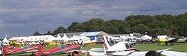
The airport of Lens-Bénifontaine (code LFQL) is located in the commune.
History
The commune owes its name to the quality of the local water, which is used for brewing the regional Ch'Ti beer. During World War I, the village, along with many others, was completely destroyed.
Population
| Historical population | ||
|---|---|---|
| Year | Pop. | ±% |
| 1962 | 258 | — |
| 1968 | 275 | +6.6% |
| 1975 | 289 | +5.1% |
| 1982 | 295 | +2.1% |
| 1990 | 303 | +2.7% |
| 1999 | 275 | −9.2% |
| 2005 | 278 | +1.1% |
| 2009 | 325 | +16.9% |
Sights
- The Castelain Ch’ti brewery.
- The aerodrome.
See also
References
External links
| Wikimedia Commons has media related to Bénifontaine. |
- Website of the Communaupole de Lens-Liévin (French)
- Aéroclub de Lens (French)
- Castelain Brewery website (French)
- Bénifontaine on the Quid website (French)
This article is issued from Wikipedia - version of the 11/6/2016. The text is available under the Creative Commons Attribution/Share Alike but additional terms may apply for the media files.