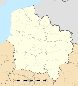
Gommecourt, Pas-de-Calais
| Gommecourt | ||
|---|---|---|
| ||
 Gommecourt | ||
|
Location within Hauts-de-France region  Gommecourt | ||
| Coordinates: 50°08′27″N 2°38′46″E / 50.1408°N 2.6461°ECoordinates: 50°08′27″N 2°38′46″E / 50.1408°N 2.6461°E | ||
| Country | France | |
| Region | Hauts-de-France | |
| Department | Pas-de-Calais | |
| Arrondissement | Arras | |
| Canton | Pas-en-Artois | |
| Intercommunality | Deux Sources | |
| Government | ||
| • Mayor (2008–2014) | Michel Lecrivent | |
| Area1 | 3.35 km2 (1.29 sq mi) | |
| Population (1999)2 | 126 | |
| • Density | 38/km2 (97/sq mi) | |
| Time zone | CET (UTC+1) | |
| • Summer (DST) | CEST (UTC+2) | |
| INSEE/Postal code | 62375 / 62111 | |
| Elevation |
124–155 m (407–509 ft) (avg. 148 m or 486 ft) | |
|
1 French Land Register data, which excludes lakes, ponds, glaciers > 1 km² (0.386 sq mi or 247 acres) and river estuaries. 2 Population without double counting: residents of multiple communes (e.g., students and military personnel) only counted once. | ||
Gommecourt is a commune in the Pas-de-Calais department in the Hauts-de-France region of France.
Geography
A small farming village situated 14 miles (22.5 km) south of Arras, on the D6 road.
History
Formerly within the ancient County of Artois, the village was redesignated within the new Department of the Pas de Calais after the French Revolution.
World War I
During most of the period of hostilities between 1914 and 1918 (World War I) Gommecourt was in the front line of the Western Front, occupied by the Imperial German Army, and was virtually destroyed as a result of the violence to which it was exposed.
The neighbouring villages of Hebuterne and Foncquevillers 800 yards or so to the west, being conversely in Allied forces occupation, were used as the bases for an assault upon it carried out by the British Army on 1 July 1916, as a part of the Battle of the Somme offensive, which resulted in a severe defeat for the attacking force.
The victorious German troops who defended the village during the battle were the 52nd Infantry Division from Baden together with 2nd Guards Reserve Division from Westphalia; the British troops taking part in the attack comprised the 56th (1/1st London) Division and the 46th (North Midland) Division.
The graves of the assaulting force's casualties are located in a number of local war cemeteries around the site, the graves of German casualties having been relocated further North after the war to the Neuville-St Vaast German war cemetery.
Population
| Year | 1962 | 1968 | 1975 | 1982 | 1990 | 1999 |
|---|---|---|---|---|---|---|
| Population | 150 | 169 | 132 | 132 | 116 | 126 |
Places of interest
- The church of St Martin, rebuilt, as was most of the village, after World War I.
- The Commonwealth War Graves Commission cemetery.
See also
References
External links
| Wikimedia Commons has media related to Gommecourt, Pas-de-Calais. |
