Thérouanne
| Thérouanne | ||
|---|---|---|
|
| ||
| ||
 Thérouanne | ||
|
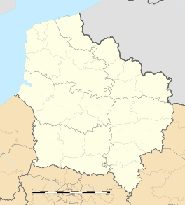
Location within Hauts-de-France region  Thérouanne | ||
| Coordinates: 50°38′15″N 2°15′35″E / 50.6375°N 02.2597°ECoordinates: 50°38′15″N 2°15′35″E / 50.6375°N 02.2597°E | ||
| Country | France | |
| Region | Hauts-de-France | |
| Department | Pas-de-Calais | |
| Arrondissement | Saint-Omer | |
| Canton | Aire-sur-la-Lys | |
| Intercommunality | La Morinie | |
| Government | ||
| • Mayor (2001–2008) | Alain Chevalier | |
| Area1 | 8.37 km2 (3.23 sq mi) | |
| Population (2006)2 | 1,082 | |
| • Density | 130/km2 (330/sq mi) | |
| Time zone | CET (UTC+1) | |
| • Summer (DST) | CEST (UTC+2) | |
| INSEE/Postal code | 62811 / 62129 | |
| Elevation |
31–116 m (102–381 ft) (avg. 38 m or 125 ft) | |
|
1 French Land Register data, which excludes lakes, ponds, glaciers > 1 km² (0.386 sq mi or 247 acres) and river estuaries. 2 Population without double counting: residents of multiple communes (e.g., students and military personnel) only counted once. | ||
Thérouanne (Dutch: Terwaan; French Flemish Terenburg) is a commune in the Pas-de-Calais department in the Hauts-de-France region of France. It is located 10 km (6.2 mi) west of Aire-sur-la-Lys and 13 km (8.1 mi) south of Saint-Omer, on the D 157 and D 341 road junction. Located on the river Leie (French: Lys).
Population
| Year | 1962 | 1968 | 1975 | 1982 | 1990 | 1999 | 2006 |
|---|---|---|---|---|---|---|---|
| Population | 868 | 877 | 886 | 943 | 971 | 1045 | 1082 |
| From the year 1962 on: No double counting—residents of multiple communes (e.g. students and military personnel) are counted only once. | |||||||
History
At the time of the Gauls, Tarwanna or Tervanna was the capital of the Belgian tribe of the Morini. After the Romans conquered Gaul, they too made the city the capital of the Civitas Morinorum district.
In the 7th century, probably around 639, Saint Audomar (Saint Omer) established the bishopric of Terwaan or Terenburg, the diocese of Thérouanne, which during the Middle Ages controlled a large part of the left bank of the river Scheldt. Territorially it was part of the county of Artois which belonged to the county of Flanders.
Thanks to that ecclesiastical control of some of the most prosperous cities north of the Alps, like Arras and Ypres, the bishopric was able to build a cathedral which was at the time the largest in France.
The town was captured by the Emperor Maximilian and Henry VIII from the French in 1513 after the battle of the Spurs. In 1553 Charles V besieged Thérouanne, then a French enclave in the Holy Roman Empire, in revenge for a defeat by the French at the siege of Metz. After he captured the city he ordered it to be razed, the roads to be broken up, and the area to be ploughed and salted.[1] Only a small commune which lay outside the city walls, then named Saint-Martin-Outre-Eaux, was left standing, and later (probably around 1800) took over the name Thérouanne. Part of the portal of the cathedral was acquired by Saint-Omer; a colossal statue of Christ is all that is left of it these days.
The disappearance of the former bishopric led to a reform of sees at the Council of Trent, and the bishopric of Thérouanne was split between those of Saint-Omer and Ypres.
Bishops
- Saint Audomar, founder, 637-c.670
- Hunfrid of Prüm (d. 871)
- A certain Adam, 1213–1229 List of religious leaders in 1220
- Antipope Clement VII, 1361–1368
- John, Cardinal of Lorraine (d. 1550)
Places of interest
- The church of Saint Martin, dating from the nineteenth century.
- The archaeological site, remains of the medieval city.
Twin towns
Thérouanne is twinned with Hamstreet in Kent (in southern England, across the English Channel).
Notable people
- The football manager Gérard Houllier was born in Thérouanne.
See also
References
- Jeff Rider and Benoît-Michel Tock (editors). 2010. Le Diocèse de Thérouanne au Moyen Âge. Arras: Commission départementale d’Histoire et d’Archéologie du Pas-de-Calais. ISBN 9782900643242.
- INSEE commune file
External links
| Wikimedia Commons has media related to Thérouanne. |
- Thérouanne on the Quid website (French)
