Affringues
| Affringues | ||
|---|---|---|
| ||
 Affringues | ||
|
Location within Hauts-de-France region  Affringues | ||
| Coordinates: 50°41′23″N 2°04′27″E / 50.6897°N 2.0742°E / 50.6897; 2.0742Coordinates: 50°41′23″N 2°04′27″E / 50.6897°N 2.0742°E / 50.6897; 2.0742 | ||
| Country | France | |
| Region | Hauts-de-France | |
| Department | Pas-de-Calais | |
| Arrondissement | Saint-Omer | |
| Canton | Lumbres | |
| Intercommunality | Pays de Lumbres | |
| Government | ||
| • Mayor | Françoise Huguet | |
| Area1 | 2.81 km2 (1.08 sq mi) | |
| Population (2009)2 | 222 | |
| • Density | 79/km2 (200/sq mi) | |
| Time zone | CET (UTC+1) | |
| • Summer (DST) | CEST (UTC+2) | |
| INSEE/Postal code | 62010 / 62380 | |
| Elevation |
52–158 m (171–518 ft) (avg. 73 m or 240 ft) | |
|
1 French Land Register data, which excludes lakes, ponds, glaciers > 1 km² (0.386 sq mi or 247 acres) and river estuaries. 2 Population without double counting: residents of multiple communes (e.g., students and military personnel) only counted once. | ||

Affringues is a commune in the Pas-de-Calais department in northern France. The placename derives from medieval Flemish: Hafferdingen.[1]
Geography
A village, located 9 miles (15 km) southwest of Saint-Omer, at the D205 and D202 crossroads.
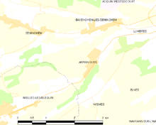
Map of the commune and adjacent places
History
First mentioned in the 12th century by the names Hafferdinges (+/- 1182) and Harfrenges (1186).
Population
| Historical population | ||
|---|---|---|
| Year | Pop. | ±% |
| 1962 | 117 | — |
| 1968 | 123 | +5.1% |
| 1975 | 145 | +17.9% |
| 1982 | 166 | +14.5% |
| 1990 | 219 | +31.9% |
| 1999 | 203 | −7.3% |
| 2009 | 222 | +9.4% |
Sights
- The church of St.Leger, dating from the sixteenth century, with a stone spire.
See also
Communes of the Pas-de-Calais department
References
- ↑ Placename Affringues/Hafferdingen: proussel.voila.net
External links
| Wikimedia Commons has media related to Affringues. |
- Affringues on the Quid website (French)
This article is issued from Wikipedia - version of the 10/5/2016. The text is available under the Creative Commons Attribution/Share Alike but additional terms may apply for the media files.