Vis-en-Artois
| Vis-en-Artois | |
|---|---|
 | |
 Vis-en-Artois | |
|
Location within Hauts-de-France region  Vis-en-Artois | |
| Coordinates: 50°14′52″N 2°56′27″E / 50.2478°N 2.9408°ECoordinates: 50°14′52″N 2°56′27″E / 50.2478°N 2.9408°E | |
| Country | France |
| Region | Hauts-de-France |
| Department | Pas-de-Calais |
| Arrondissement | Arras |
| Canton | Vitry-en-Artois |
| Intercommunality | Osartis |
| Government | |
| • Mayor (2008–2014) | Christian Thiévet |
| Area1 | 6.42 km2 (2.48 sq mi) |
| Population (2006)2 | 566 |
| • Density | 88/km2 (230/sq mi) |
| Time zone | CET (UTC+1) |
| • Summer (DST) | CEST (UTC+2) |
| INSEE/Postal code | 62864 / 62156 |
| Elevation |
46–88 m (151–289 ft) (avg. 68 m or 223 ft) |
|
1 French Land Register data, which excludes lakes, ponds, glaciers > 1 km² (0.386 sq mi or 247 acres) and river estuaries. 2 Population without double counting: residents of multiple communes (e.g., students and military personnel) only counted once. | |
Vis-en-Artois is a commune in the Pas-de-Calais department in the Hauts-de-France region of France.
Geography
Vis-en-Artois is situated 8 miles (12.9 km) southeast of Arras, at the junction of the D939 and the D9 roads.
History

A CWGC cemetery
World War I deeply affected the town, which was under the thumb of German troops from September 30, 1914 until its liberation by Canadian forces on 24 August 1918.
During the year 1918 the village was completely destroyed. The people who had not fled before the arrival of the invading troops were evacuated to Belgium.
On 24 September 1920, Vis-en-Artois received the Croix de Guerre.
Population
| Year | 1962 | 1968 | 1975 | 1982 | 1990 | 1999 | 2006 |
|---|---|---|---|---|---|---|---|
| Population | 585 | 608 | 617 | 603 | 539 | 536 | 566 |
| From the year 1962 on: No double counting—residents of multiple communes (e.g. students and military personnel) are counted only once. | |||||||
Places of interest
- The church of St.Martin, rebuilt, along with much of the village, after World War I.
- The war memorial, inaugurated on August 10, 1924.
- For the Vis-En-Artois British Cemetery, Haucourt see Haucourt.[1]
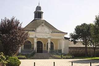
Town hall
See also
References
External links
| Wikimedia Commons has media related to Vis-en-Artois. |
- Vis-en-Artois official website (French)
- Vis-en-Artois on the Quid website (French)
This article is issued from Wikipedia - version of the 11/8/2016. The text is available under the Creative Commons Attribution/Share Alike but additional terms may apply for the media files.