Fressin
| Fressin | ||
|---|---|---|
|
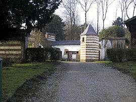
Pigeon house at the home of Bernanos | ||
| ||
 Fressin | ||
|
Location within Hauts-de-France region  Fressin | ||
| Coordinates: 50°26′50″N 2°03′20″E / 50.4472°N 2.0556°ECoordinates: 50°26′50″N 2°03′20″E / 50.4472°N 2.0556°E | ||
| Country | France | |
| Region | Hauts-de-France | |
| Department | Pas-de-Calais | |
| Arrondissement | Montreuil | |
| Canton | Fruges | |
| Intercommunality | Communauté de communes du Canton de Fruges et environs | |
| Government | ||
| • Mayor (2008–2014) | Christian Duflos | |
| Area1 | 17.17 km2 (6.63 sq mi) | |
| Population (2006)2 | 552 | |
| • Density | 32/km2 (83/sq mi) | |
| Time zone | CET (UTC+1) | |
| • Summer (DST) | CEST (UTC+2) | |
| INSEE/Postal code | 62359 / 62140 | |
| Elevation |
43–144 m (141–472 ft) (avg. 84 m or 276 ft) | |
|
1 French Land Register data, which excludes lakes, ponds, glaciers > 1 km² (0.386 sq mi or 247 acres) and river estuaries. 2 Population without double counting: residents of multiple communes (e.g., students and military personnel) only counted once. | ||

Fressin is a commune in the Pas-de-Calais department in the Hauts-de-France region of France.
Geography
A farming village situated 14 miles (22.5 km) east of Montreuil, at the junction of the D155 and the D154 roads. Fressin nestles in the valley of the Planquette, one of several small rivers that flow through the region known as the 'Seven Valleys'. Mixed arable and dairy farming is the predominant occupation of the inhabitants.
Population
| Year | 1962 | 1968 | 1975 | 1982 | 1990 | 1999 | 2006 |
|---|---|---|---|---|---|---|---|
| Population | 519 | 536 | 525 | 585 | 577 | 563 | 552 |
| From the year 1962 on: No double counting—residents of multiple communes (e.g. students and military personnel) are counted only once. | |||||||
Places of interest

Ruins of the castle, at Fressin
- Ruins of the fortress built in the early 15th century by Jean de Créquy, one of the first Knights of the Golden Fleece, counsellor and chamberlain to Philip the Good.
- The church of St. Martin, dating from the fifteenth century. Large and impressive for such a small village. Two information boards tell in English the history of the church and village.
- Another smaller chateau, dating from the eighteenth century.
Notable people
- Georges Bernanos, poet and writer, spent his youth here until 1924.
See also
References
External links
| Wikimedia Commons has media related to Fressin. |
- Fressin on the Quid website (French)
- Site of the Association du Château de Fressin (French)
- Fressin le Pays des 7 Vallées et son Foyer Rural (French)
- Annuaire-Mairie website (French)
This article is issued from Wikipedia - version of the 11/6/2016. The text is available under the Creative Commons Attribution/Share Alike but additional terms may apply for the media files.