Cedar Bluff, Virginia
| Town of Cedar Bluff, Virginia | ||
|---|---|---|
| Town | ||
| ||
| Motto: Step into a small bit of the past... Step into the Town of Cedar Bluff! | ||
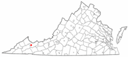 Location in the Commonwealth of Virginia | ||
| Coordinates: 37°5′17″N 81°45′53″W / 37.08806°N 81.76472°WCoordinates: 37°5′17″N 81°45′53″W / 37.08806°N 81.76472°W | ||
| Country | United States | |
| State | Virginia | |
| County | Tazewell | |
| Government | ||
| • Mayor | Johnnie Smith | |
| Area | ||
| • Total | 2.3 sq mi (5.9 km2) | |
| • Land | 2.3 sq mi (5.9 km2) | |
| • Water | 0.0 sq mi (0.0 km2) | |
| Elevation | 1,962 ft (598 m) | |
| Population (2010) | ||
| • Total | 1,139 | |
| • Density | 474/sq mi (182.9/km2) | |
| U.S. Census Bureau, 2000 Population Estimates | ||
| Time zone | EST (UTC-5) | |
| • Summer (DST) | EDT (UTC-4) | |
| ZIP code | 24609 | |
| Area code(s) | 276 | |
| FIPS code | 51-13784[1] | |
| GNIS feature ID | 1500063[2] | |

Cedar Bluff is a town in Tazewell County, Virginia, United States. The population was 1,139 at the 2010 census. It is part of the Bluefield, WV-VA micropolitan area, which has a population of 107,578.
History
The Clinch Valley Roller Mills and Old Kentucky Turnpike Historic District are listed on the National Register of Historic Places.[3]
Geography
Cedar Bluff is located at 37°5′17″N 81°45′53″W / 37.08806°N 81.76472°W (37.088073, -81.764803).[4]
According to the United States Census Bureau, the town has a total area of 2.3 square miles (5.9 km²), all land.
Demographics
| Historical population | |||
|---|---|---|---|
| Census | Pop. | %± | |
| 1920 | 533 | — | |
| 1930 | 590 | 10.7% | |
| 1940 | 823 | 39.5% | |
| 1950 | 1,083 | 31.6% | |
| 1960 | 995 | −8.1% | |
| 1970 | 1,050 | 5.5% | |
| 1980 | 1,550 | 47.6% | |
| 1990 | 1,290 | −16.8% | |
| 2000 | 1,085 | −15.9% | |
| 2010 | 1,137 | 4.8% | |
| Est. 2015 | 1,076 | [5] | −5.4% |
As of the census[1] of 2000, there were 1,085 people, 475 households, and 312 families residing in the town. The population density was 473.7 people per square mile (182.9/km²). There were 535 housing units at an average density of 233.6 per square mile (90.2/km²). The racial makeup of the town was 98.99% White, 0.18% Native American, 0.09% Asian, 0.37% from other races, and 0.37% from two or more races. Hispanic or Latino of any race were 0.55% of the population.
There were 475 households out of which 29.1% had children under the age of 18 living with them, 48.2% were married couples living together, 13.1% had a female householder with no husband present, and 34.3% were non-families. 32.0% of all households were made up of individuals and 13.9% had someone living alone who was 65 years of age or older. The average household size was 2.28 and the average family size was 2.84.
In the town the population was spread out with 22.8% under the age of 18, 7.3% from 18 to 24, 26.8% from 25 to 44, 27.6% from 45 to 64, and 15.5% who were 65 years of age or older. The median age was 40 years. For every 100 females there were 89.4 males. For every 100 females age 18 and over, there were 82.6 males.
The median income for a household in the town was $26,375, and the median income for a family was $30,357. Males had a median income of $30,982 versus $20,667 for females. The per capita income for the town was $16,664. About 11.9% of families and 14.3% of the population were below the poverty line, including 16.4% of those under age 18 and 23.7% of those age 65 or over.
Notable people
- George C. Peery-Former governor
References
- 1 2 "American FactFinder". United States Census Bureau. Archived from the original on 2013-09-11. Retrieved 2008-01-31.
- ↑ "US Board on Geographic Names". United States Geological Survey. 2007-10-25. Retrieved 2008-01-31.
- ↑ National Park Service (2010-07-09). "National Register Information System". National Register of Historic Places. National Park Service.
- ↑ "US Gazetteer files: 2010, 2000, and 1990". United States Census Bureau. 2011-02-12. Retrieved 2011-04-23.
- ↑ "Annual Estimates of the Resident Population for Incorporated Places: April 1, 2010 to July 1, 2015". Retrieved July 2, 2016.
- ↑ "Census of Population and Housing". Census.gov. Archived from the original on May 11, 2015. Retrieved June 4, 2015.
External links
Municipalities and communities of Tazewell County, Virginia, United States | ||
|---|---|---|
| Towns | 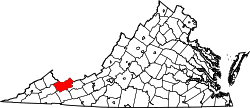 | |
| CDPs | ||
| Unincorporated communities | ||
| Footnotes | ‡This populated place also has portions in an adjacent county or counties | |