Rockingham County, Virginia
| Rockingham County, Virginia | ||
|---|---|---|
|
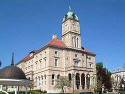
Rockingham County Courthouse in Court Square, Harrisonburg | ||
| ||
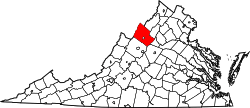 Location in the U.S. state of Virginia | ||
 Virginia's location in the U.S. | ||
| Founded | 1778 | |
| Named for | Charles Watson-Wentworth | |
| Seat | Harrisonburg | |
| Largest town | Bridgewater | |
| Area | ||
| • Total | 853 sq mi (2,209 km2) | |
| • Land | 849 sq mi (2,199 km2) | |
| • Water | 4.3 sq mi (11 km2), 0.5% | |
| Population (est.) | ||
| • (2015) | 78,593 | |
| • Density | 92/sq mi (36/km²) | |
| Congressional district | 6th | |
| Time zone | Eastern: UTC-5/-4 | |
| Website |
www | |

Rockingham County is a county located in the U.S. state of Virginia. As of the 2010 census, the population was 76,314.[1] Its county seat is Harrisonburg.[2]
Rockingham County is included in the Harrisonburg, VA, Metropolitan Statistical Area and is home of the Rockingham County Baseball League.
History
Settlement of the county began in 1727, when Adam Miller (Mueller) staked out a claim on the south fork of the Shenandoah River, near the line that now divides Rockingham County from Page County.[3][4][5][6] On a trip through eastern Virginia, the German-born Miller had heard reports about a lush valley to the west which had been discovered by Governor Alexander Spotswood's legendary Knights of the Golden Horseshoe Expedition, and then moved his family down from Lancaster County, Pennsylvania.[7][8][9] In 1741, Miller purchased 820 acres (3.3 km2), including a large lithia spring, near Elkton, Virginia, and lived on this property for the remainder of his life.[10][11]
Much-increased settlement of this portion of the Colony of Virginia by Europeans began in the 1740s and 1750s. Standing between the Tidewater and Piedmont regions to the east in Virginia and the Shenandoah Valley and the area beyond (known in old Virginia as the "Transmountaine") were the Blue Ridge Mountains. Rather than cross such a formidable physical barrier, most early settlers came southerly up the valley across the Potomac River from Maryland and Pennsylvania. Many followed the Great Wagon Trail, also known as the Valley Pike (U.S. Route 11 in modern times).
Rockingham County was established in 1778 from Augusta County. Harrisonburg was named as the county seat and incorporated as a town in 1780.[12] Harrisonburg was incorporated as a city in 1916 and separated from Rockingham County (all cities in Virginia are independent cities), but it remains the county seat.
The county is named for Charles Watson-Wentworth, 2nd Marquess of Rockingham, a British statesman (1730–1782). He was Prime Minister of Great Britain twice, and a keen supporter of constitutional rights for the colonists. During his first term, he repealed the Stamp Act of 1765, reducing the tax burden on the colonies. Appointed again in 1782, upon taking office, he backed the claim for the independence of the Thirteen Colonies, initiating an end to British involvement in the American Revolutionary War. However, he died after only 14 weeks in office.
By 1778, it was unusual to honor British officials in Virginia, fighting for its independence. The same year, immediately to the north of Rockingham County, Dunmore County, named for Virginia's last Royal Governor, John Murray, 4th Earl of Dunmore, an unpopular figure, was renamed. The new name, Shenandoah County, used a Native American name.
However, long their political supporter in the British Parliament, the Marquess of Rockingham was a popular figure with the citizens of the new United States. Also named in his honor were Rockingham County, New Hampshire, Rockingham County, North Carolina, and the City of Rockingham in Richmond County, North Carolina.
Rockingham County is the birthplace of Thomas Lincoln, Abraham Lincoln’s father.[13]
In 1979 when the Adolf Coors Brewing Company came to Rockingham County it caused an uproar where some citizens thought it would corrupt the morals of the area while others wanted the new jobs.[14]

Geography
According to the U.S. Census Bureau, the county has a total area of 853 square miles (2,210 km2), of which 849 square miles (2,200 km2) is land and 4.3 square miles (11 km2) (0.5%) is water.[15] It is the third-largest county in Virginia by land area. Large portions of the county fall within the Shenandoah National Park to the east and George Washington National Forest to the west, and therefore are subject to development restrictions. The county stretches west to east from the peaks of eastern-most Alleghany mountains to the peaks of the Blue Ridge mountains, encompassing the entire width of the Shenandoah Valley. Rockingham is bi-sected by another geographic formation, Massanutten Mountain stretching from just east of Harrisonburg, VA to a few miles southwest of Front Royal, VA in Warren County, VA. Massanutten Mountain splits the central Shenandoah Valley as the German River and the North Fork Shenandoah River flow on its western side and the South Fork flows on the eastern.
Adjacent counties
- Pendleton County, West Virginia - west
- Hardy County, West Virginia - north
- Shenandoah County, Virginia - northeast
- Page County, Virginia - east
- Greene County, Virginia - southeast
- Albemarle County, Virginia - southeast
- Augusta County, Virginia - southwest
- Harrisonburg, Virginia - center (enclave)
National protected areas
- George Washington National Forest (part)
- Shenandoah National Park (part)
Demographics
| Historical population | |||
|---|---|---|---|
| Census | Pop. | %± | |
| 1790 | 7,449 | — | |
| 1800 | 10,374 | 39.3% | |
| 1810 | 12,753 | 22.9% | |
| 1820 | 14,784 | 15.9% | |
| 1830 | 20,683 | 39.9% | |
| 1840 | 17,344 | −16.1% | |
| 1850 | 20,294 | 17.0% | |
| 1860 | 23,408 | 15.3% | |
| 1870 | 23,668 | 1.1% | |
| 1880 | 29,567 | 24.9% | |
| 1890 | 31,299 | 5.9% | |
| 1900 | 33,527 | 7.1% | |
| 1910 | 34,903 | 4.1% | |
| 1920 | 30,047 | −13.9% | |
| 1930 | 29,709 | −1.1% | |
| 1940 | 31,289 | 5.3% | |
| 1950 | 35,079 | 12.1% | |
| 1960 | 40,485 | 15.4% | |
| 1970 | 47,890 | 18.3% | |
| 1980 | 57,038 | 19.1% | |
| 1990 | 57,482 | 0.8% | |
| 2000 | 67,725 | 17.8% | |
| 2010 | 76,314 | 12.7% | |
| Est. 2015 | 78,593 | [16] | 3.0% |
| U.S. Decennial Census[17] 1790-1960[18] 1900-1990[19] 1990-2000[20] 2010-2012[1] | |||
As of the census[21] of 2000, 67,725 people, 25,355 households, and 18,889 families resided in the county. The population density was 80 people per square mile (31/km²). There were 27,328 housing units at an average density of 32 per square mile (12/km²). The racial makeup of the county was 96.58% White, 1.36% Black or African American, 0.13% Native American, 0.29% Asian, 0.01% Pacific Islander, 0.90% from other races, and 0.73% from two or more races. About 3.28% of the population were Hispanic or Latino of any race.
Of 25,355 households, 32.90% had children under the age of 18 living with them, 62.40% were married couples living together, 7.90% had a female householder with no husband present, and 25.50% were not families. About 21.20% of all households were made up of individuals and 9.10% had someone living alone who was 65 years of age or older. The average household size was 2.61 and the average family size was 3.02.
In the county, the population was distributed as 24.60% under the age of 18, 8.70% from 18 to 24, 28.90% from 25 to 44, 23.80% from 45 to 64, and 13.90% who were 65 years of age or older. The median age was 38 years. For every 100 females, there were 97.00 males. For every 100 females age 18 and over, there were 94.30 males.
The median income for a household in the county was $40,748, and for a family was $46,262. Males had a median income of $30,618 versus $21,896 for females. The per capita income for the county was $18,795. About 5.30% of families and 8.20% of the population were below the poverty line, including 9.10% of those under age 18 and 9.70% of those age 65 or over.
Education
Colleges and universities
- Bridgewater College Bridgewater, Virginia
- Eastern Mennonite University Harrisonburg, Virginia
- James Madison University Harrisonburg, Virginia
Transportation
Railroads
Rockingham County is principally served by Norfolk Southern Railway, a (major) Class 1 railroad and additionally, by the Shenandoah Valley Railroad, a short-line railroad.
Highways
Interstate 81 runs north-south and meets east-west Interstate 64 near Staunton to the south in adjacent Augusta County.
There are three major Primary State Highways in the county. (A primary road provides service which is relatively continuous and of relatively high traffic volume, long average trip length, high operating speed and high mobility importance).[22] Interstate highways and primary highways in Virginia are maintained by the Virginia Department of Transportation (VDOT).
These primary state highways are:
- U.S. Route 11 a north-south roadway which Interstate 81 parallels, U.S. Route 11 follows an old Native American trail, later known as the Valley Turnpike.
- U.S. Route 33 is an east-west road which extends from a mountain ridge border with West Virginia across the Shenandoah Valley through Harrisonburg and Elkton. East of there, it climbs the western slope of the Blue Ridge Mountains to reach Swift Run Gap, a wind gap located at an elevation of 2,365 feet (721 m). The bucolic Skyline Drive, which is part of Shenandoah National Park, has an entry point at Swift Run Gap and the Appalachian Trail also passes through nearby. The mountain ridge forms the border between Rockingham County and Greene County. (U.S. 33 continues east to Richmond).
- U.S. Route 340 in a north-south roadway which runs along the western slope of the Blue Ridge Mountains in the Valley.
Secondary roads: As provided by the Byrd Road Act of 1932, secondary roads in Rockingham County are also maintained by the Virginia Department of Transportation (VDOT).
Points of interest
The County is proud of its deep agricultural heritage. It leads Virginia in poultry production, and two turkey statues, one at either end of Route 11, indicate that the county is the "Turkey Capital" of Virginia. The annual Rockingham County Fair is one of the top fairs in the nation, and the county has a sizeable old-order-Mennonite farming presence, supporting numerous farmers' markets.
Rockingham County is home to a large section of the Shenandoah National Park and Skyline Drive, with an entrance point at Swift Run Gap. Boasting numerous hiking and walking trails, as well as scenic overlooks and waterfalls, the park is one of the focal points of Shenandoah Valley tourism. Numerous caves dot Rockingham county, including Grand Caverns in Grottoes, VA. The county also is home to a large section of the George Washington National Forest, offering camping and outdoor activity. Massanutten Resort offers two golf courses and an indoor water park, as well as seasonal skiing, mountain biking and river rafting.
Two Civil War battles took place in Rockingham County, one at Cross Keys, just southeast of Harrisonburg, and another at Port Republic, along the South Fork of the Shenandoah River just north of Grottoes. Among local museums, the Harrisonburg-Rockingham Historical Society in Dayton, VA is unique for its 20-foot multimedia wall-map narrating the troop-movements of Jackson's Valley Campaign.
Communities
Towns
Unincorporated communities
- Bergton
- Berrytown
- Briery Branch
- Clover Hill
- Cootes Store
- Criders
- Cross Keys
- Dale Enterprise
- Edom
- Fulks Run
- Hinton
- Inglewood
- Keezletown
- Lacey Spring
- Linville
- Lilly
- Massanutten
- Mauzy
- Mayland
- McGaheysville
- Montezuma
- Mount Clinton
- New Erection
- Penn Laird
- Pleasant Valley
- Port Republic
- Rawley Springs
- Singers Glen
- Sparkling Springs
- Spring Creek
- Stemphleytown
- Tenth Legion
- Third Hill-Genoa
- Turleytown
- Yankeetown
Independent city
Since it became an independent city, Harrisonburg is no longer politically located in Rockingham County, despite its status as the county seat.
See also
- National Register of Historic Places listings in Rockingham County, Virginia
- Rockingham County Sheriff’s Office
References
- 1 2 "State & County QuickFacts". United States Census Bureau. Retrieved January 5, 2014.
- ↑ "Find a County". National Association of Counties. Retrieved 2011-06-07.
- ↑ Wayland, John, “A History of Rockingham County, Virginia,” 1912: Ruebush-Elkins Co, Dayton, VA, pp 33-37
- ↑ “The Virginia Magazine of History and Biography” Vol X – No 1, July 1902, The Virginia Historical Society, Richmond, VA, pp 84-86
- ↑ Strickler, Harry, “A Short History of Page County Virginia” 1952: The Dietz Press, Richmond VA, pps 50-51
- ↑ Wayland, John, “The German Element in the Shenandoah Valley,” 1907: Michie Company Printers, Charlottesville, VA, p 38-39
- ↑ Wayland, John “A History of Rockingham County, Virginia,” p 37
- ↑ “ The Virginia Magazine of History and Biography," pp 84-86
- ↑ Wayland, “The German Element in the Shenandoah Valley,” (The Michie Company, Charlottesville, VA, 1907)p 38-39
- ↑ Wayland, John, “Virginia Valley Records,” 1996: Clearfield Co, Baltimore, MD, pp 311-312
- ↑ Wayland, “The German Element in the Shenandoah Valley,” p 42
- ↑ http://www.rootsweb.ancestry.com/~varockin/
- ↑ Thomas Lincoln
- ↑ Ringle, Ken (1979-03-25). "'Invasion' by Coors . . .". The Washington Post. ISSN 0190-8286. Retrieved 2015-09-02.
- ↑ "US Gazetteer files: 2010, 2000, and 1990". United States Census Bureau. 2011-02-12. Retrieved 2011-04-23.
- ↑ "County Totals Dataset: Population, Population Change and Estimated Components of Population Change: April 1, 2010 to July 1, 2015". Retrieved July 2, 2016.
- ↑ "U.S. Decennial Census". United States Census Bureau. Retrieved January 5, 2014.
- ↑ "Historical Census Browser". University of Virginia Library. Retrieved January 5, 2014.
- ↑ "Population of Counties by Decennial Census: 1900 to 1990". United States Census Bureau. Retrieved January 5, 2014.
- ↑ "Census 2000 PHC-T-4. Ranking Tables for Counties: 1990 and 2000" (PDF). United States Census Bureau. Retrieved January 5, 2014.
- ↑ "American FactFinder". United States Census Bureau. Retrieved 2011-05-14.
- ↑ http://www.highlandcova.org/Compplan/Tranverb.htm
External links
| Wikimedia Commons has media related to Rockingham County, Virginia. |
 |
Hardy County, West Virginia | Shenandoah County | | |
| Pendleton County, West Virginia | |
Page County | ||
| ||||
| | ||||
| Augusta County | Greene County and Albemarle County |
Municipalities and communities of Rockingham County, Virginia, United States | ||
|---|---|---|
| Towns | | |
| CDPs | ||
| Unincorporated communities |
| |
| Footnotes | ‡This populated place also has portions in an adjacent county or counties | |
Coordinates: 38°31′N 78°53′W / 38.52°N 78.88°W