Ashland, Virginia
| Ashland, Virginia | |
|---|---|
| Town | |
|
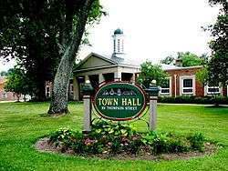
Ashland Town Hall | |
| Nickname(s): The Center of the Universe[1] | |
 Location in Hanover County and the state of Virginia. | |
| Coordinates: 37°45′34″N 77°28′38″W / 37.75944°N 77.47722°WCoordinates: 37°45′34″N 77°28′38″W / 37.75944°N 77.47722°W | |
| Country | United States |
| State | Virginia |
| County | Hanover |
| Founded | 1858 |
| Government | |
| • Type | Council-Manager |
| • Mayor | James R. Foley |
| • Town Manager | Charles W. Hartgrove |
| Area | |
| • Total | 7.2 sq mi (18.7 km2) |
| • Land | 7.16 sq mi (18.6 km2) |
| • Water | 0.04 sq mi (0.1 km2) |
| Elevation | 213 ft (65 m) |
| Population (2010) | |
| • Total | 7,503 |
| • Density | 1,042.083/sq mi (402.350/km2) |
| Time zone | Eastern (EST) (UTC-5) |
| • Summer (DST) | EDT (UTC-4) |
| ZIP code | 23005 |
| Area code(s) | 804 |
| FIPS code | 51-03368[2] |
| GNIS feature ID | 1492492[3] |
| Website | http://www.town.ashland.va.us |
Ashland is a town located 15 miles north of Richmond along Interstate-95 and historic Route 1 (and its bicycle version) in Hanover County, Virginia, United States. Ashland is named after the Lexington, Kentucky estate of Hanover County native and statesman Henry Clay. It is the only incorporated town in Hanover County chartered by the Commonwealth of Virginia. Although comprising only one square mile when originally incorporated in 1858, today Ashland has grown through several annexations to a size of 7.12 square miles, one of the Virginia's larger towns in terms of land area.
History
The Richmond, Fredericksburg and Potomac Railroad, initially developed the town in the 1840s as a mineral springs resort with a racetrack. The town was named “Ashland” after native son Henry Clay’s estate in Kentucky and officially incorporated on February 19, 1858. The area had been known as "The Slashes," sometimes translated as "swamp," but which also reflected the small ravines that formed in the sandy clay soil after hard rains.
Confederate troops trained on the former racetrack early in the American Civil War, but the war and its aftermath devastated Ashland. Randolph-Macon College (founded 1830) moved to Ashland in 1868, and began using buildings of the bankrupt hotel as well as building additional structures, so it became a small college town.
The railroad lines rebuilt and the town continued to expand. Even before the war, the railroad began offering monthly passes to Richmond to people buying lots and building houses in Ashland. When tycoon Jay Gould established a streetcar line between Ashland and Richmond in 1908, it became an early streetcar suburb of Richmond. Construction of U.S. Route 1 on the former Washington (or Richmond) Road, and later I-95, further shaped the town character and development.

One of Virginia's oldest churches is just outside Ashland: Slash Church, built as the Upper Church of St. Paul's Parish in 1729 remains a house of worship, though now used by the Disciples of Christ.[4][5] Ashland itself originally had a Free Church, shared by various Protestant denominations. Several denominations built churches shortly after the Civil War, but many were torn down in modern times. The town's current Episcopal Church is St. James the Less, on the other side of the railway line from Slash Church and whose congregation received monthly clergy visitations in the 1850s, and which in 1958 sold its 1866-consecrated and once-moved building as well as the old rectory (which still remains today, in private ownership) in order to build a larger one on the town's outskirts. The Disciples of Christ also had a historic church on Center Street (built 1900) that was replaced in 1985. Historic churches still within the town's (and historic district's) boundaries include: Ashland Baptist Church (1860, now the Hanover Arts and Activities Center); Shiloh Baptist Church (1866, originally Freedmens Baptist Church), Duncan Memorial Chapel (Methodist, 1879), St. Ann's Catholic Church (built 1892, remodeled 1925) and Ashland Presbyterian Church (1875-1881). Gwathmey Baptist Church (1892) is a mile nearer Richmond and (like the former St. James the Less Church), within 50 feet of the railroad tracks.[6] The town now also has an Eastern Orthodox congregation, St. Andrew's (2001), and a messianic Jewish congregation (Beth Shalom Ministries, 2004).
Major Payne was filmed at the Ashland train station, which now acts as a tourist information office and no longer sells rail tickets. Bloomberg Business in 2009 named Ashland "Best Place to Raise your Kids" in Virginia. www.movoto.com in 2014, named Ashland one of America's 10 best small towns. Ironically, the railroad that made the town may now be one of its biggest threats, as many residents oppose construction of a high-speed rail line on the narrow right of way through the elongated historic town.
On October 19, 2002, Ashland made national news as the site of one of the Beltway sniper attacks. 37-year-old Jeffrey Hopper was shot at 8:00 pm in the parking lot of a Ponderosa Steakhouse as he and his wife left the restaurant.
Geography
Ashland is located at 37°45′34″N 77°28′38″W / 37.75944°N 77.47722°W (37.759361, -77.477226).[7]
According to the United States Census Bureau, the town has a total area of 7.2 square miles (18.7 km²), of which 7.2 square miles (18.6 km²) is land and 0.04 square mile (0.1 km²) (0.55%) is water.
Demographics
| Historical population | |||
|---|---|---|---|
| Census | Pop. | %± | |
| 1860 | 148 | — | |
| 1870 | 491 | 231.8% | |
| 1880 | 764 | 55.6% | |
| 1890 | 948 | 24.1% | |
| 1900 | 1,147 | 21.0% | |
| 1910 | 1,324 | 15.4% | |
| 1920 | 1,290 | −2.6% | |
| 1930 | 1,297 | 0.5% | |
| 1940 | 1,718 | 32.5% | |
| 1950 | 2,610 | 51.9% | |
| 1960 | 2,773 | 6.2% | |
| 1970 | 2,934 | 5.8% | |
| 1980 | 4,640 | 58.1% | |
| 1990 | 5,864 | 26.4% | |
| 2000 | 6,619 | 12.9% | |
| 2010 | 7,225 | 9.2% | |
| Est. 2015 | 7,503 | [8] | 3.8% |
As of the census[2] of 2010, there were 7225 people with 2,863 households in the town. The racial makeup of the town was 71.1% White, 22.2% African American, 0.4% Native American, 1.2% Asian, 0.68% from other races, and 2.6% from two or more races. Hispanic or Latino of any race were 4.7% of the population.
The median income for a household in the town was $46,474. The per capita income for the town was $23,569. About 5.9% of the population were below the poverty line.
Public services
The town is now run by a manager. Hanover County handles Stormwater Pollutant Removal and Filtration [10] The town's library is now part of the multi-county Pamunkey Regional Library System, although additional libraries are at the courthouse and Randolph Macon College.[11]
The Ashland Volunteer Fire Company, formed in 1890, is located on 501 Archie Canon Drive.[12]
The Ashland Police Department has 25 sworn full-time officers and is Law Enforcement Accredited by the Commission on Accreditation for Law Enforcement Agencies, Inc. (C.A.L.E.A.)
Local festivals
For nearly 35 years, Ashland's main festival has been the Strawberry Faire in June.[13] Vendors from all around the state sell a variety of different items (with a strawberry theme). Festivities include a Strawberry Faire Pageant for Little Miss and Mister Strawberry, as well as live performances by local artists. Ten Hanover County Schools students each year receive Strawberry Faire scholarships.
Climate
The climate in this area is characterized by hot, humid summers and generally mild to cool winters. According to the Köppen Climate Classification system, Ashland has a humid subtropical climate, abbreviated "Cfa" on climate maps.[14] Air pollution levels see.[15]
References
- ↑ "History of Ashland". Town of Ashland. Retrieved 13 November 2015.
- 1 2 "American FactFinder". United States Census Bureau. Archived from the original on 2013-09-11. Retrieved 2008-01-31.
- ↑ "US Board on Geographic Names". United States Geological Survey. 2007-10-25. Retrieved 2008-01-31.
- ↑ Don W. and Sue Massey, Colonial Churches of Virginia (Charlottesville, Howell Press, 2003) at pp. 54-55
- ↑ "Slash Christian Church (Disciples of Christ)". Retrieved 13 November 2015.
- ↑ http://scholarship.richmond.edu/cgi/viewcontent.cgi?article=1283&context=honors-theses
- ↑ "US Gazetteer files: 2010, 2000, and 1990". United States Census Bureau. 2011-02-12. Retrieved 2011-04-23.
- ↑ "Annual Estimates of the Resident Population for Incorporated Places: April 1, 2010 to July 1, 2015". Retrieved July 2, 2016.
- ↑ "Census of Population and Housing". Census.gov. Archived from the original on May 11, 2015. Retrieved June 4, 2015.
- ↑ http://www.filterra.com/index.php/contact
- ↑ http://www.pamunkeylibrary.org/
- ↑ "History". Ashland Volunteer Fire Company. Retrieved 20 December 2015.
- ↑ "Ashland Strawberry Faire". Ashland Strawberry Faire. Retrieved 13 November 2015.
- ↑ "Ashland, Virginia Köppen Climate Classification(Weatherbase)". Weatherbase. Retrieved 13 November 2015.
- ↑ Ashland Weather and Air Quality/Pollution
External links
| Wikivoyage has a travel guide for Ashland (Virginia). |
- Ashland Volunteer Fire Company
- TownHound
- Herald-Progress area newspaper
- Hanover County Economic Development
- Ashland Tourist Attractions
- City of Ashland Tourism Department
Municipalities and communities of Hanover County, Virginia, United States | ||
|---|---|---|
| Town | 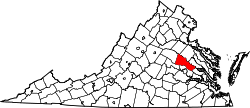 | |
| CDPs | ||
| Unincorporated communities | ||