Claypool Hill, Virginia
| Claypool Hill, Virginia | |
|---|---|
| Census-designated place (CDP) | |
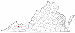 Location of Claypool Hill, Virginia | |
| Coordinates: 37°3′46″N 81°45′23″W / 37.06278°N 81.75639°WCoordinates: 37°3′46″N 81°45′23″W / 37.06278°N 81.75639°W | |
| Country | United States |
| State | Virginia |
| County | Tazewell |
| Area | |
| • Total | 3.9 sq mi (10.1 km2) |
| • Land | 3.9 sq mi (10.1 km2) |
| • Water | 0.0 sq mi (0.0 km2) |
| Elevation | 2,349 ft (716 m) |
| Population (2010) | |
| • Total | 1,776 |
| • Density | 460/sq mi (180/km2) |
| Time zone | Eastern (EST) (UTC-5) |
| • Summer (DST) | EDT (UTC-4) |
| FIPS code | 51-17120[1] |
| GNIS feature ID | 1464963[2] |
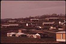
Claypool Hill is a census-designated place (CDP) in Tazewell County, Virginia, United States. The population was 1,776 at the 2010 census, which was up from the 1,719 reported in 2000. Claypool is part of the Bluefield WV-VA micropolitan area which has a population of 107,578.
Geography
Claypool Hill is located at 37°3′46″N 81°45′23″W / 37.06278°N 81.75639°W (37.062842, -81.756355).[3]
According to the United States Census Bureau, the CDP has a total area of 3.9 square miles (10.1 km²), all land.
Demographics
As of the census[1] of 2000, there were 1,719 people, 710 households, and 565 families residing in the CDP. The population density was 442.3 people per square mile (170.6/km²). There were 760 housing units at an average density of 195.5/sq mi (75.4/km²). The racial makeup of the CDP was 98.95% White, 0.06% African American, 0.17% Native American, 0.52% Asian, 0.12% from other races, and 0.17% from two or more races. Hispanic or Latino of any race were 1.11% of the population.
There were 710 households out of which 29.3% had children under the age of 18 living with them, 68.0% were married couples living together, 8.7% had a female householder with no husband present, and 20.4% were non-families. 18.9% of all households were made up of individuals and 7.0% had someone living alone who was 65 years of age or older. The average household size was 2.42 and the average family size was 2.74.
In the CDP the population was spread out with 20.0% under the age of 18, 6.6% from 18 to 24, 27.1% from 25 to 44, 33.7% from 45 to 64, and 12.6% who were 65 years of age or older. The median age was 42 years. For every 100 females there were 89.7 males. For every 100 females age 18 and over, there were 89.3 males.
The median income for a household in the CDP was $36,382, and the median income for a family was $42,321. Males had a median income of $30,878 versus $21,493 for females. The per capita income for the CDP was $19,588. About 9.5% of families and 13.1% of the population were below the poverty line, including 21.5% of those under age 18 and 7.0% of those age 65 or over.
References
- 1 2 "American FactFinder". United States Census Bureau. Archived from the original on 2013-09-11. Retrieved 2008-01-31.
- ↑ "US Board on Geographic Names". United States Geological Survey. 2007-10-25. Retrieved 2008-01-31.
- ↑ "US Gazetteer files: 2010, 2000, and 1990". United States Census Bureau. 2011-02-12. Retrieved 2011-04-23.
Municipalities and communities of Tazewell County, Virginia, United States | ||
|---|---|---|
| Towns | 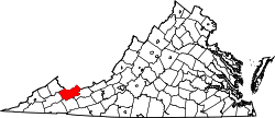 | |
| CDPs | ||
| Unincorporated communities | ||
| Footnotes | ‡This populated place also has portions in an adjacent county or counties | |