Onancock, Virginia
| Onancock, Virginia | |
|---|---|
| Town | |
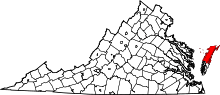
 Location in Accomack County and the state of Virginia. | |
| Coordinates: 37°42′38″N 75°44′47″W / 37.71056°N 75.74639°WCoordinates: 37°42′38″N 75°44′47″W / 37.71056°N 75.74639°W | |
| Country | United States |
| State | Virginia |
| County | Accomack |
| Area | |
| • Total | 1.1 sq mi (2.7 km2) |
| • Land | 1.1 sq mi (2.7 km2) |
| • Water | 0.0 sq mi (0.0 km2) |
| Elevation | 13 ft (4 m) |
| Population (2010) | |
| • Total | 1,263 |
| • Density | 1,100/sq mi (470/km2) |
| Time zone | Eastern (EST) (UTC-5) |
| • Summer (DST) | EDT (UTC-4) |
| ZIP code | 23417 |
| Area code(s) | 757 |
| FIPS code | 51-59336[1] |
| GNIS feature ID | 1493376[2] |
Onancock is a town in Accomack County, Virginia, United States. The population was 1,263 at the 2010 census.[3]
History
The Onancock Historic District, Cokesbury Church, Hopkins and Brother Store, and Kerr Place are listed on the National Register of Historic Places.[4]
In the mid-19th century, it was a point along the stagecoach route between Wilmington, Delaware and Eastville, Virginia.[5]
Geography
Onancock is located at 37°42′38″N 75°44′47″W / 37.71056°N 75.74639°W (37.710578, -75.746307).[6]
According to the United States Census Bureau, the town has a total area of 1.0 square miles (2.7 km²), all of it land.
Demographics
| Historical population | |||
|---|---|---|---|
| Census | Pop. | %± | |
| 1900 | 938 | — | |
| 1910 | 1,001 | 6.7% | |
| 1920 | 1,074 | 7.3% | |
| 1930 | 1,245 | 15.9% | |
| 1940 | 1,283 | 3.1% | |
| 1950 | 1,353 | 5.5% | |
| 1960 | 1,759 | 30.0% | |
| 1970 | 1,614 | −8.2% | |
| 1980 | 1,461 | −9.5% | |
| 1990 | 1,434 | −1.8% | |
| 2000 | 1,525 | 6.3% | |
| 2010 | 1,263 | −17.2% | |
| Est. 2015 | 1,261 | [7] | −0.2% |

As of the census[1] of 2000, there were 1,525 people, 656 households, and 392 families residing in the town. The population density was 1,452.3 people per square mile (560.8/km²). There were 733 housing units at an average density of 698.0 per square mile (269.5/km²). The racial makeup of the town was 66.43% White, 31.41% African American, 0.46% Native American, 0.07% Asian, 0.66% from other races, and 0.98% from two or more races. Hispanic or Latino of any race were 2.89% of the population.
There were 656 households out of which 23.6% had children under the age of 18 living with them, 41.3% were married couples living together, 16.3% had a female householder with no husband present, and 40.1% were non-families. 38.0% of all households were made up of individuals and 24.7% had someone living alone who was 65 years of age or older. The average household size was 2.19 and the average family size was 2.82.
In the town the population was spread out with 21.2% under the age of 18, 6.8% from 18 to 24, 21.6% from 25 to 44, 24.1% from 45 to 64, and 26.3% who were 65 years of age or older. The median age was 45 years. For every 100 females there were 80.3 males. For every 100 females age 18 and over, there were 73.1 males.
The median income for a household in the town was $28,214, and the median income for a family was $37,039. Males had a median income of $25,956 versus $19,250 for females. The per capita income for the town was $18,393. About 8.4% of families and 15.3% of the population were below the poverty line, including 20.4% of those under age 18 and 15.6% of those age 65 or over.
Notable people
- Josh Nolz - professional soccer player.
- Ralph Northam - Lt. Governor of Virginia, former state senator.
- Nick Boddie Williams - editor of the Los Angeles Times from 1958 to 1971.
- George D. Wise - U.S. Representative from Virginia.
References
- 1 2 "American FactFinder". United States Census Bureau. Retrieved 2008-01-31.
- ↑ "US Board on Geographic Names". United States Geological Survey. 2007-10-25. Retrieved 2008-01-31.
- ↑ "Profile of General Population and Housing Characteristics: 2010 Demographic Profile Data (DP-1): Onancock town, Virginia". U.S. Census Bureau, American Factfinder. Retrieved April 5, 2012.
- ↑ National Park Service (2010-07-09). "National Register Information System". National Register of Historic Places. National Park Service.
- ↑ Smith, John Calvin (1847). The Illustrated Hand-book, a New Guide for travelers through the United States of America. New York City: Sherman & Smith. pp. 127–128.
- ↑ "US Gazetteer files: 2010, 2000, and 1990". United States Census Bureau. 2011-02-12. Retrieved 2011-04-23.
- ↑ "Annual Estimates of the Resident Population for Incorporated Places: April 1, 2010 to July 1, 2015". Retrieved July 2, 2016.
- ↑ "Census of Population and Housing". Census.gov. Retrieved June 4, 2015.