Russell County, Virginia
| Russell County, Virginia | |
|---|---|
|
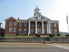
Russell County Courthouse in Lebanon | |
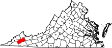 Location in the U.S. state of Virginia | |
 Virginia's location in the U.S. | |
| Founded | January 2, 1786 |
| Named for | William Russell |
| Seat | Lebanon |
| Largest town | Lebanon |
| Area | |
| • Total | 477 sq mi (1,235 km2) |
| • Land | 474 sq mi (1,228 km2) |
| • Water | 2.9 sq mi (8 km2), 0.6% |
| Population (est.) | |
| • (2015) | 27,891 |
| • Density | 58/sq mi (22/km²) |
| Congressional district | 9th |
| Time zone | Eastern: UTC-5/-4 |
| Website |
www |
Russell County is a county located in the Commonwealth of Virginia. As of the 2010 census, the population was 28,897.[1] Its county seat is Lebanon.[2]
History
On January 2, 1786, Russell County was established from a section of Washington County. L.P. Summers, a Washington County historian later wrote, "Washington County lost a great extent of country and many valuable citizens when Russell County was formed." The county was named for Culpeper County native Colonel William Russell.[3] The first court met in May 1786 in the Castle's Woods settlement (present-day Castlewood) in the house of William Robinson. Later, a new place was built to house the County Seat. The structure used as a courthouse still stands, and is referred to as "The Old Courthouse." The present Courthouse, located in Lebanon, has been in use since 1874.
The County has been home for many well known persons such as Daniel Boone, Governor H.C. Stuart, State Representative Boyd C. Fugate and State Senator M.M. Long. Russell County was also the birthplace of other counties. The counties of Wise, Lee, Tazewell, and Scott were formed from parts of Russell County.
The largest cattle farm East of the Mississippi River, and one of the oldest corporations in the country, Stuart Land & Cattle, is headquartered at Rosedale in Russell County.
Geography
According to the U.S. Census Bureau, the county has a total area of 477 square miles (1,240 km2), of which 474 square miles (1,230 km2) is land and 2.9 square miles (7.5 km2) (0.6%) is water.[4]
The 4th highest peak in VA is located on the eastern part of the county, Beartown Mountain.
Adjacent Counties
- Dickenson County – northwest
- Buchanan County – north
- Tazewell County – east
- Smyth County – southeast
- Washington County – south
- Scott County – southwest
- Wise County – west
Major highways
Demographics
| Historical population | |||
|---|---|---|---|
| Census | Pop. | %± | |
| 1790 | 3,338 | — | |
| 1800 | 4,808 | 44.0% | |
| 1810 | 6,319 | 31.4% | |
| 1820 | 5,536 | −12.4% | |
| 1830 | 6,714 | 21.3% | |
| 1840 | 7,878 | 17.3% | |
| 1850 | 11,919 | 51.3% | |
| 1860 | 10,280 | −13.8% | |
| 1870 | 11,103 | 8.0% | |
| 1880 | 13,906 | 25.2% | |
| 1890 | 16,126 | 16.0% | |
| 1900 | 18,031 | 11.8% | |
| 1910 | 23,474 | 30.2% | |
| 1920 | 26,786 | 14.1% | |
| 1930 | 25,957 | −3.1% | |
| 1940 | 26,627 | 2.6% | |
| 1950 | 26,818 | 0.7% | |
| 1960 | 26,290 | −2.0% | |
| 1970 | 24,533 | −6.7% | |
| 1980 | 31,761 | 29.5% | |
| 1990 | 28,667 | −9.7% | |
| 2000 | 30,308 | 5.7% | |
| 2010 | 28,897 | −4.7% | |
| Est. 2015 | 27,891 | [5] | −3.5% |
| U.S. Decennial Census[6] 1790–1960[7] 1900–1990[8] 1990–2000[9] 2010–2015[1] | |||
As of the census[10] of 2000, there were 30,308 people, 11,789 households, and 8,818 families residing in the county. The population density was 64 people per square mile (25/km²). There were 13,191 housing units at an average density of 28 per square mile (11/km²). The racial makeup of the county was 96.07% White, 3.08% Black or African American, 0.11% Native American, 0.05% Asian, 0.28% from other races, and 0.40% from two or more races. 0.78% of the population were Hispanic or Latino of any race.
There were 11,789 households out of which 31.00% had children under the age of 18 living with them, 60.90% were married couples living together, 10.10% had a female householder with no husband present, and 25.20% were non-families. 23.10% of all households were made up of individuals and 10.00% had someone living alone who was 65 years of age or older. The average household size was 2.44 and the average family size was 2.87.
In the county, the population was spread out with 21.20% under the age of 18, 8.60% from 18 to 24, 30.90% from 25 to 44, 26.00% from 45 to 64, and 13.30% who were 65 years of age or older. The median age was 39 years. For every 100 females there were 102.70 males. For every 100 females age 18 and over, there were 103.30 males.
The median income for a household in the county was $26,834, and the median income for a family was $31,491. Males had a median income of $26,950 versus $20,108 for females. The per capita income for the county was $14,863. About 13.00% of families and 16.30% of the population were below the poverty line, including 21.30% of those under age 18 and 16.90% of those age 65 or over.
Education
Public high schools
Fire and rescue services
- Castlewood Fire and Rescue
- Lebanon Lifesaving Crew
- New Garden Rescue
- Lebanon Fire
- Honaker Fire
- Dante Rescue
- Dante Fire
- Copper Creek Fire
- Belfast Fire
- Saint Paul Fire
- Cleveland Volunteer Fire Department
- Cleveland Lifesaving Crew
Communities
Towns
Unincorporated communities
- Castlewood
- Dante
- Rosedale
- Willis
- Belfast
- Swords Creek
See also
References
- 1 2 "State & County QuickFacts". United States Census Bureau. Retrieved January 5, 2014.
- ↑ "Find a County". National Association of Counties. Retrieved 2011-06-07.
- ↑ Des Cognets, Anna Russell (1884). William Russell and His Descendants. Lexington, Kentucky: Samuel F. Wilson. Retrieved 2011-04-18.
- ↑ "US Gazetteer files: 2010, 2000, and 1990". United States Census Bureau. 2011-02-12. Retrieved 2011-04-23.
- ↑ "County Totals Dataset: Population, Population Change and Estimated Components of Population Change: April 1, 2010 to July 1, 2015". Retrieved July 2, 2016.
- ↑ "U.S. Decennial Census". United States Census Bureau. Retrieved January 5, 2014.
- ↑ "Historical Census Browser". University of Virginia Library. Retrieved January 5, 2014.
- ↑ "Population of Counties by Decennial Census: 1900 to 1990". United States Census Bureau. Retrieved January 5, 2014.
- ↑ "Census 2000 PHC-T-4. Ranking Tables for Counties: 1990 and 2000" (PDF). United States Census Bureau. Retrieved January 5, 2014.
- ↑ "American FactFinder". United States Census Bureau. Retrieved 2011-05-14.
External links
 |
Dickenson County | Buchanan County | | |
| Wise County | |
Tazewell County | ||
| ||||
| | ||||
| Scott County | Washington County | Smyth County |
Municipalities and communities of Russell County, Virginia, United States | ||
|---|---|---|
| Towns | | |
| CDPs | ||
| Unincorporated community | ||
| Footnotes | ‡This populated place also has portions in an adjacent county or counties | |
Coordinates: 36°56′N 82°06′W / 36.94°N 82.10°W