Duffield, Virginia
| Duffield, Virginia | |
|---|---|
| Town | |
 Location of Duffield, Virginia | |
| Coordinates: 36°43′11″N 82°47′51″W / 36.71972°N 82.79750°WCoordinates: 36°43′11″N 82°47′51″W / 36.71972°N 82.79750°W | |
| Country | United States |
| State | Virginia |
| County | Scott |
| Area | |
| • Total | 0.6 sq mi (1.5 km2) |
| • Land | 0.6 sq mi (1.5 km2) |
| • Water | 0.0 sq mi (0.0 km2) |
| Elevation | 1,437 ft (438 m) |
| Population (2010) | |
| • Total | 91 |
| • Density | 150/sq mi (61/km2) |
| Time zone | Eastern (EST) (UTC-5) |
| • Summer (DST) | EDT (UTC-4) |
| ZIP code | 24244 |
| Area code(s) | 276 |
| FIPS code | 51-23680[1] |
| GNIS feature ID | 1483156[2] |
Duffield is a town in Scott County, Virginia, United States. The population was 91 at the 2010 census. It is part of the Kingsport–Bristol (TN)–Bristol (VA) Metropolitan Statistical Area, which is a component of the Johnson City–Kingsport–Bristol, TN-VA Combined Statistical Area – commonly known as the "Tri-Cities" region.
Geography
Duffield is located at 36°43′11″N 82°47′51″W / 36.71972°N 82.79750°W (36.719642, -82.797393).[3]
According to the United States Census Bureau, the town has a total area of 0.6 square miles (1.6 km2), all land.
Demographics
| Historical population | |||
|---|---|---|---|
| Census | Pop. | %± | |
| 1900 | 98 | — | |
| 1910 | 122 | 24.5% | |
| 1920 | 120 | −1.6% | |
| 1930 | 170 | 41.7% | |
| 1940 | 83 | −51.2% | |
| 1950 | 176 | 112.0% | |
| 1960 | 97 | −44.9% | |
| 1970 | 63 | −35.1% | |
| 1980 | 148 | 134.9% | |
| 1990 | 54 | −63.5% | |
| 2000 | 62 | 14.8% | |
| 2010 | 91 | 46.8% | |
| Est. 2015 | 86 | [4] | −5.5% |
As of the census[1] of 2000, there were 62 people, 25 households, and 20 families residing in the town. The population density was 107.6 people per square mile (41.3/km²). There were 30 housing units at an average density of 52.1 per square mile (20.0/km²). The racial makeup of the town was 100.00% White.
There were 25 households out of which 24.0% had children under the age of 18 living with them, 68.0% were married couples living together, 12.0% had a female householder with no husband present, and 20.0% were non-families. 20.0% of all households were made up of individuals and 8.0% had someone living alone who was 65 years of age or older. The average household size was 2.48 and the average family size was 2.85.
In the town the population was spread out with 21.0% under the age of 18, 4.8% from 18 to 24, 25.8% from 25 to 44, 35.5% from 45 to 64, and 12.9% who were 65 years of age or older. The median age was 44 years. For every 100 females there were 82.4 males. For every 100 females age 18 and over, there were 88.5 males.
The median income for a household in the town was $27,500, and the median income for a family was $29,375. Males had a median income of $29,000 versus $15,938 for females. The per capita income for the town was $12,046. There were no families and 6.3% of the population living below the poverty line, including no under eighteens and 33.3% of those over 64.
Points of interest
Located between Duffield and Pattonsville, on U.S. Route 421, is the gravesite of Ross Carter, a paratrooper from World War II, who wrote Those Devils in Baggy Pants, a story about the 82nd Airborne during World War II. There are many Civil War-era homes in the Duffield area.
The town is situated at the southern edge of the Jefferson National Forest and approximately two miles west of Natural Tunnel State Park. Natural Tunnel, called the "Eighth Wonder of the World" by William Jennings Bryan, has been attracting sightseers for more than 100 years.[6]
References
- 1 2 "American FactFinder". United States Census Bureau. Retrieved 2008-01-31.
- ↑ "US Board on Geographic Names". United States Geological Survey. 2007-10-25. Retrieved 2008-01-31.
- ↑ "US Gazetteer files: 2010, 2000, and 1990". United States Census Bureau. 2011-02-12. Retrieved 2011-04-23.
- ↑ "Annual Estimates of the Resident Population for Incorporated Places: April 1, 2010 to July 1, 2015". Retrieved July 2, 2016.
- ↑ "Census of Population and Housing". Census.gov. Retrieved June 4, 2015.
- ↑ "Natural Tunnel State Park". Dcr.virginia.gov. 2011-01-24. Retrieved 2011-02-14.
Municipalities and communities of Scott County, Virginia, United States | ||
|---|---|---|
| Towns | 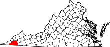 | |
| Unincorporated communities | ||