Wythe County, Virginia
| Wythe County, Virginia | ||
|---|---|---|
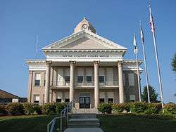
 Wythe County Courthouse in Wytheville | ||
| ||
 Location in the U.S. state of Virginia | ||
 Virginia's location in the U.S. | ||
| Founded | 1790 | |
| Named for | George Wythe | |
| Seat | Wytheville | |
| Largest town | Wytheville | |
| Area | ||
| • Total | 465 sq mi (1,204 km2) | |
| • Land | 462 sq mi (1,197 km2) | |
| • Water | 2.8 sq mi (7 km2), 0.6% | |
| Population (est.) | ||
| • (2015) | 29,119 | |
| • Density | 63/sq mi (24/km²) | |
| Congressional district | 9th | |
| Time zone | Eastern: UTC-5/-4 | |
| Website |
www | |

Wythe County is a county located in the U.S. state of Virginia. As of the 2010 census, the population was 29,235.[1] Its county seat is Wytheville.[2]
History
Wythe County was formed from Montgomery County in 1790. It was named after George Wythe, the first Virginian signer of the Declaration of Independence. During the Civil War the Battle of Cove Mountain was fought in the county.
Prior to Wythe County's creation, what is now the Wythe County community of Austinville served as the county seat for Fincastle County, an extinct Virginia county whose borders stretched from Roanoke, Virginia, to the Mississippi River – a county roughly the size of half the State of Texas.[3]
Wythe County's Austinville community, which was founded by Stephen and his brother Moses Austin, father of the famous Stephen F. Austin. In the 1790s the Austins took over the mines that produced lead and zinc; the town was named for the Austin surname, and not for any one particular Austin of the brothers who bore that surname. Lead was mined and shipped throughout the fledgling country; lead shot was also produced. Located near Fosters Falls, Jackson Ferry Shot Tower still stands as a testament to the citizens of Wythe County. Lead was hoisted to the top of the tower using block and tackle and oxen. The lead was melted in a retort and then poured through a sieve at the top of the tower. The droplets of molten lead would become round during the 150-foot descent. The shot would collect in a kettle of water and slave laborers[4] would enter through a 110-foot access tunnel located near the bank of the New River to retrieve the shot from the kettle.
The lead mines closed in 1982 due to new United States Environmental Protection Agency standards and the lack of a market for lead. The mines have since filled with water; the main shaft extended in excess of 1100 feet straight down.
Another notable area within the county is the unincorporated community of Fort Chiswell - named for a French and Indian War era fort. The fort and its surrounding buildings served as the county seat until the incorporated town of Wytheville was established approximately 10 miles to the west. The fort fell into disrepair and its ruins were covered over when the intersection of I-77 and I-81 was constructed in the 1970s. A pyramid marker now stands in the approximate location of the former fort. The community was named for Colonel John Chiswell who helped establish the lead mines (1757) prior to the Austin's purchase.
Wythe County's location, at the confluence of I-81 and I-77 which is, incidentally, a wrong-way concurrency, has led to its growth for industry and tourism. Recently Gatorade and Pepsi manufacturing facilities have located here, primarily due to the ease of access and central location along the Eastern seabord. There are a variety of travel-related businesses including several hundred hotel rooms, several truck stops, and restaurants located in the county. Tourism takes a variety of different forms in Wythe County. There are numerous opportunities for those that enjoy outdoor activities including a variety of trails, campgrounds, and parks in the area. Its first winery opened in 2006 and a second opened in 2007. A dinner theatre is located in the county seat, Wytheville.
Geography
According to the U.S. Census Bureau, the county has a total area of 465 square miles (1,200 km2), of which, 462 square miles (1,200 km2) of it is land and 2.8 square miles (7.3 km2) (0.6%) is water.[5] The county is intersected by the New River. The land is mostly an elevated plateau, lying between Iron Mountain on the south and Walker's Mountain on the northwest. The soil is generally fertile. Iron ore, lead, bituminous coal, limestone, and gypsum are very abundant, and there are traces of silver found in the lead mines.[6]
Adjacent counties
- Bland County - north
- Smyth County - west
- Grayson County - south
- Carroll County - southeast
- Pulaski County - east
National protected areas
Major highways
Demographics
| Historical population | |||
|---|---|---|---|
| Census | Pop. | %± | |
| 1800 | 6,380 | — | |
| 1810 | 8,356 | 31.0% | |
| 1820 | 9,692 | 16.0% | |
| 1830 | 12,163 | 25.5% | |
| 1840 | 9,375 | −22.9% | |
| 1850 | 12,024 | 28.3% | |
| 1860 | 12,305 | 2.3% | |
| 1870 | 11,611 | −5.6% | |
| 1880 | 14,318 | 23.3% | |
| 1890 | 18,019 | 25.8% | |
| 1900 | 20,437 | 13.4% | |
| 1910 | 20,372 | −0.3% | |
| 1920 | 20,217 | −0.8% | |
| 1930 | 20,704 | 2.4% | |
| 1940 | 22,721 | 9.7% | |
| 1950 | 23,327 | 2.7% | |
| 1960 | 21,975 | −5.8% | |
| 1970 | 22,139 | 0.7% | |
| 1980 | 25,522 | 15.3% | |
| 1990 | 25,466 | −0.2% | |
| 2000 | 27,599 | 8.4% | |
| 2010 | 29,235 | 5.9% | |
| Est. 2015 | 29,119 | [7] | −0.4% |
| U.S. Decennial Census[8] 1790-1960[9] 1900-1990[10] 1990-2000[11] 2010-2013[1] | |||
As of the census[12] of 2000, there were 27,599 people, 11,511 households, and 8,103 families residing in the county. The population density was 60 people per square mile (23/km²). There were 12,744 housing units at an average density of 28 per square mile (11/km²). The racial makeup of the county was 95.76% White, 2.87% Black or African American, 0.16% Native American, 0.38% Asian, 0.01% Pacific Islander, 0.24% from other races, and 0.58% from two or more races. 0.57% of the population were Hispanic or Latino of any race.
There were 11,511 households out of which 28.90% had children under the age of 18 living with them, 56.20% were married couples living together, 10.50% had a female householder with no husband present, and 29.60% were non-families. 26.30% of all households were made up of individuals and 11.70% had someone living alone who was 65 years of age or older. The average household size was 2.36 and the average family size was 2.83.
In the county, the population was spread out with 21.80% under the age of 18, 7.60% from 18 to 24, 28.90% from 25 to 44, 25.90% from 45 to 64, and 15.80% who were 65 years of age or older. The median age was 39 years. For every 100 females there were 91.40 males. For every 100 females age 18 and over, there were 88.30 males.
The median income for a household in the county was $32,235, and the median income for a family was $40,188. Males had a median income of $29,053 versus $20,550 for females. The per capita income for the county was $17,639. About 8.50% of families and 11.00% of the population were below the poverty line, including 12.50% of those under age 18 and 13.40% of those age 65 or over.
Education
Colleges
- Breckbill Bible College, Grahams Forge
- Blueridge College of Evangelism, Wytheville
- Wytheville Community College, Wytheville
Public high schools
- Fort Chiswell High School, Fort Chiswell
- George Wythe High School, Wytheville
- Rural Retreat High School, Rural Retreat
Private schools
- The Baptist Academy of Rural Retreat, Rural Retreat
- Granite Christian Academy, Wytheville
- Appalachian Christian Academy, Rural Retreat
Government
Board of Supervisors
- District 1 (Blacklick District): Gary M. Houseman, Ed.D. (I)
- District 2 (West Wytheville District): Charlie Lester(R)
- District 3 (East Wytheville District): Steven T. Willis (R)
- District 4 (Fort Chiswell District): Joe F. Hale, Vice Chairman (D)
- District 5 (Lead Mines District): Coy L. McRoberts (D)
- District 6 (Speedwell District): B.G. "Gene" Horney, Jr., (D)
- District 7 (Supervisor At-Large): Tim A. Reeves, Chairman (R)
County Administration
- County Administrator: R. Cellell Dalton
- Asst. County Administrator: Stephen Bear
Constitutional Officers
- Clerk of the Circuit Court: Hayden Horney (D)
- Commissioner of the Revenue: Faye Barker (R)
- Commonwealth's Attorney: Jerry Mabe (R)
- Sheriff: Keith Dunagan (R)
- Treasurer: Lori Guynn (D)
Communities
Towns
Unincorporated communities
See also
- National Register of Historic Places listings in Wythe County, Virginia
- Wythe County Sheriff's Office
References
- 1 2 "State & County QuickFacts". United States Census Bureau. Retrieved January 5, 2014.
- ↑ "Find a County". National Association of Counties. Archived from the original on May 31, 2011. Retrieved 2011-06-07.
- ↑ Appalachian Magazine Wythe County Turns 225 Years Old in 2015.
- ↑ Slavery in the American Mountain South, Wilma A. Dunaway; Cambridge University Press, 2003, ISBN 978-0-521-01215-7
- ↑ "US Gazetteer files: 2010, 2000, and 1990". United States Census Bureau. 2011-02-12. Retrieved 2011-04-23.
- ↑
 Ripley, George; Dana, Charles A., eds. (1879). "Wythe". The American Cyclopædia.
- ↑ "County Totals Dataset: Population, Population Change and Estimated Components of Population Change: April 1, 2010 to July 1, 2015". Retrieved July 2, 2016.
- ↑ "U.S. Decennial Census". United States Census Bureau. Archived from the original on May 11, 2015. Retrieved January 5, 2014.
- ↑ "Historical Census Browser". University of Virginia Library. Retrieved January 5, 2014.
- ↑ "Population of Counties by Decennial Census: 1900 to 1990". United States Census Bureau. Retrieved January 5, 2014.
- ↑ "Census 2000 PHC-T-4. Ranking Tables for Counties: 1990 and 2000" (PDF). United States Census Bureau. Retrieved January 5, 2014.
- ↑ "American FactFinder". United States Census Bureau. Archived from the original on September 11, 2013. Retrieved 2011-05-14.
 |
Bland County | | ||
| Smyth County | |
Pulaski County | ||
| ||||
| | ||||
| Grayson County | Carroll County |
Municipalities and communities of Wythe County, Virginia, United States | ||
|---|---|---|
| Towns | | |
| CDPs | ||
| Unincorporated communities | ||
Coordinates: 36°55′N 81°05′W / 36.92°N 81.09°W