Haymarket, Virginia
| Haymarket, Virginia | |
|---|---|
| Town | |
| Town of Haymarket | |
|
Spire of the Haymarket Museum | |
| Nickname(s): "The Crossroads" | |
 Location in Prince William County and the state of Virginia. | |
| Coordinates: 38°48′46″N 77°38′6″W / 38.81278°N 77.63500°WCoordinates: 38°48′46″N 77°38′6″W / 38.81278°N 77.63500°W | |
| Country |
|
| State |
|
| County |
|
| Government | |
| • Type | Mayor-council |
| • Mayor | David Leake |
| • Vice Mayor | Jay Tobias |
| Area | |
| • Total | 0.5 sq mi (1.3 km2) |
| • Land | 0.5 sq mi (1.3 km2) |
| • Water | 0.0 sq mi (0.0 km2) |
| Elevation | 367 ft (112 m) |
| Population (2010) | |
| • Total | 1,782 |
| • Density | 3,170.8/sq mi (1,224.3/km2) |
| Time zone | Eastern (EST) (UTC-5) |
| • Summer (DST) | EDT (UTC-4) |
| ZIP codes | 20168-20169 |
| Area code(s) | 571, 703 |
| FIPS code | 51-35976[1] |
| GNIS feature ID | 1499541[2] |
| Website |
townofhaymarket |

Haymarket is a town in Prince William County, Virginia. The population was 1,782 at the 2010 United States Census, although a 2012 population estimate places the town's population at 1,909.[3]
History

.
Haymarket owes its location to the Iroquois as the center of the town was their hunting path. It was used until 1722, when a treaty forced the Iroquois into the Blue Ridge Mountain region. Due to the use of the area as hunting paths, the location, and later the town, was given the nickname The Crossroads.
The town of Haymarket was formally founded in 1799 on the land of William Skinker. The Virginia General Assembly gave Skinker the rights to layout the town, which he drew to consist of 13 streets and 140 lots. Shortly after, a clerk's office and jail were constructed sometime in 1801, as the town had been selected to be the home for a now District Court. Today St. Paul's Church stands in its location. The town owes its early thrive in business to the court.
Six years later in 1807, the Virginia General Assembly abolished the District Court in favor of the Circuit Court system that was to be located at each county seat. Until 1830 the Court House remained the focal point of the town while serving multiple purposes. In 1830, the Court House was converted into and deeded an Episcopal Church; three years later in 1833 being consecrated St Paul's.
During the Civil War, on November 4, 1862, Union troops invaded Haymarket, setting the entire town ablaze. Only four buildings survived: three small houses and St. Paul’s Church. For the remainder of the war, Haymarket remained mostly unpopulated. There were only two more incidents, a skirmish on October 19, 1863 involving the Second Brigade, Second Division, Fifth Army Corp and June 1863.[4] They both involved the Confederate cavalry.
Following General Robert E. Lee's surrender, Haymarket began to recover and slowly regained its former prosperity and size.
Haymarket was incorporated in 1882, the second town in Prince William County to do so. The first Mayor elected was Mr. Garrett Hulfish and the first Councilmen elected were Mr. T.A. Smith, Mr. Charles Jordan, and Mr. William W. Meade. In May 1882 during the Council's second meeting, the rudimentary ordinances were drafted and adopted.[5]
From 1882 to today, much of central Haymarket has remained the same. The town borders U.S Route 15. While no schools are located with the town, the area is now home to 5 schools – all part of the Prince William County School System.[6] In the 1970s during the construction of the Interstate System, Haymarket became Exit 40 of Interstate 66, giving way to the town's movement away from a rural town, as well as its population boom. In the early 1990s The Walt Disney Company drafted plans to build a theme park near Haymarket, named Disney's America. Due to opposition from various groups and other factors, the project was cancelled.[7]
In addition to St. Paul's Church, Evergreen, Locust Bottom, Mt. Atlas, and Old Town Hall and School are listed on the National Register of Historic Places.[8][9]
Geography
Haymarket is located at 38°48′46″N 77°38′6″W / 38.81278°N 77.63500°W (38.812670, −77.635084).[10]
According to the United States Census Bureau, the town has a total area of 0.5 square miles (1.3 km2), all of it land.
The greater town of Haymarket (ZIP code 20169) has a total area of 32.2 square miles (83.4 km2), with 0.2 square miles (0.5 km2) of water.[11]
Demographics
| Historical population | |||
|---|---|---|---|
| Census | Pop. | %± | |
| 1880 | 107 | — | |
| 1910 | 162 | — | |
| 1920 | 133 | −17.9% | |
| 1930 | 167 | 25.6% | |
| 1940 | 156 | −6.6% | |
| 1950 | 213 | 36.5% | |
| 1960 | 257 | 20.7% | |
| 1970 | 288 | 12.1% | |
| 1980 | 230 | −20.1% | |
| 1990 | 483 | 110.0% | |
| 2000 | 879 | 82.0% | |
| 2010 | 1,782 | 102.7% | |
| Est. 2015 | 1,980 | [12] | 11.1% |
As of the 2010 United States Census, there were 1,782 people, 585 households, and 460 families residing within the town. The population density was 3,170.8 people per square mile (1224.3/km2). There are 621 housing units, with an average density of 1,105 per square mile (426.6/km2). Haymarket town's racial makeup was 73.3% White, 8.1% African American, 10.1% Asian, and 9.7% Hispanic or Latino of any race. Two or more races made up 4.7% of the population and 3.7% were from other races.
Out of the 585 households, 49.1% had children under the age of 18 residing, and 64.3% were married couples living together. 4.6% had a male householder with no female present and 9.7% had a female householder with no male present. 15.2% of all households had individuals living alone, with 1.7% over the age of 65. The average family size was 3.39, and the average household size was 3.05.
The population of the town was spread out with 32.8% under the age of 18, 2.6% from 18 to 21, 59.2% from 21 to 62, 2% from 61 to 65, and 4.4% over the age of 65. The median age of Haymarket is 32.2 years. For every 100 females there are 97.3 males, and for every 100 males there are 102.7 females.
The median income for a household in Haymarket was $120,174 and the family median income was $117,708. Females had a median income of $52,102 while males' median income was $79,861. The town's per capita income was $39,887. 2.4% of families were under the poverty line, while 3.8% of the town's population were below the poverty line.
For the greater Haymarket area, the population was 19,801 people with 6,502 households and 5,520 families. 78.1% are White, 9.5% are Asian, 7.4% are African American, and 6.4% are Hispanic or Latino of any race. The majority of the population was age 35 to 39. The median income for all householders was $120,174, with a family median income of $117,708.[14]
The estimated population in July 2012 was 1,909.
Education
- Battlefield High School
- Haymarket Elementary School opened September 2, 2014 after an August 19, 2014 ribbon cutting ceremony.[15]
Police Department
The town of Haymarket is patrolled by the Haymarket Police Department along with the Prince William County Police department and Virginia State Police.
Holland in Haymarket
The largest Pick Your Own Spring flower Festival in the United States is located just two miles from downtown Haymarket. Late March/Early April marks the start of the 3-week festival at Burnside Farms. Close to 500,000 bulbs are planted for one of the most spectacular picking fields in the Country.
See also
References
- ↑ "American FactFinder". United States Census Bureau. Retrieved January 31, 2008.
- ↑ "US Board on Geographic Names". United States Geological Survey. October 25, 2007. Retrieved January 31, 2008.
- ↑ "American FactFinder - Results". factfinder2.census.gov. Retrieved February 11, 2016.
- ↑ Scharf, John Thomas (2003). History of Western Maryland: Being a History of Frederick, Montgomery, Carroll, Washington, Allegany, and Garrett Counties from the Earliest Period to the Present Day, Including Biographical Sketches of Their Representative Men. Genealogical Publishing Com. ISBN 978-0-8063-4565-9.:312
- ↑ Historical Information retrieved October 30, 2013.
- ↑ Prince William County Schools retrieved October 30, 2013.
- ↑ The Disney Drawing Board – Disney’s America retrieved October 30, 2013.
- ↑ National Park Service (2010-07-09). "National Register Information System". National Register of Historic Places. National Park Service.
- ↑ "National Register of Historic Places Listings". Weekly List of Actions Taken on Properties: 2/28/11 through 3/04/11. National Park Service. March 11, 2011.
- ↑ "US Gazetteer files: 2010, 2000, and 1990". United States Census Bureau. February 12, 2011. Retrieved April 23, 2011.
- ↑ US Census Bureau, retrieved October 30, 2013.
- ↑ "Annual Estimates of the Resident Population for Incorporated Places: April 1, 2010 to July 1, 2015". Retrieved July 2, 2016.
- ↑ "Census of Population and Housing". Census.gov. Retrieved June 4, 2015.
- ↑ American FactFinder – Community Facts, retrieved October 30, 2013.
- ↑ "Haymarket Elementary School - Start Page". haymarketes.schools.pwcs.edu. Retrieved February 11, 2016.
External links
| Administration |
|  | |||||
|---|---|---|---|---|---|---|---|
| Organizations | |||||||
| Landmarks | |||||||
| Transportation | |||||||
| Culture |
| ||||||
| Education | |||||||
Municipalities and communities of Prince William County, Virginia, United States | ||
|---|---|---|
| Towns | 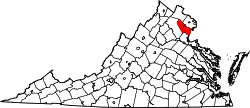 | |
| CDPs | ||
| Unincorporated communities | ||
| Footnotes | ‡This populated place also has portions in an adjacent county or counties | |