Poquoson, Virginia
| Poquoson, Virginia | ||
|---|---|---|
| Independent city | ||
|
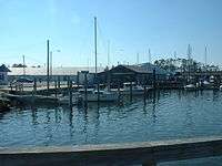
Boats parked at the Poquoson Marina. Boating has been an important part of Poquoson's economy since its inception. | ||
| ||
| Nickname(s): Bull Island | ||
 Location in the Commonwealth of Virginia | ||
| Coordinates: 37°7′59″N 76°22′25″W / 37.13306°N 76.37361°W | ||
| Country |
| |
| State |
| |
| County | None (Independent city) | |
| Founded | 1631 | |
| Government | ||
| • Mayor | W. Eugene "Gene" Hunt Jr. | |
| Area | ||
| • Independent city | 200 km2 (79 sq mi) | |
| • Land | 40 km2 (15 sq mi) | |
| • Water | 160 km2 (63 sq mi) | |
| Elevation | 3 m (10 ft) | |
| Population (2010) | ||
| • Independent city | 12,150 | |
| • Density | 59/km2 (150/sq mi) | |
| • Metro | 1,645,015 | |
| Time zone | EST (UTC-5) | |
| • Summer (DST) | EDT (UTC-4) | |
| ZIP code | 23662 | |
| Area code(s) | 757 | |
| FIPS code | 51-63768[1] | |
| GNIS feature ID | 1479363[2] | |
| Website | http://www.poquoson-va.gov | |

Poquoson /pəˈkoʊsən/ is an independent city located in the U.S. state of Virginia. As of the 2010 census, the population was 12,150.[3] The Bureau of Economic Analysis combines the city of Poquoson with surrounding York County for statistical purposes.
Poquoson is located on the Virginia Peninsula, in the Hampton Roads metropolitan area.
Poquoson, which was formerly part of York County, became an incorporated town in 1952 and an independent city in 1975. (In Virginia, municipalities incorporated as independent cities are not part of any county.) However, the ties remain close. Over 30 years after Poquoson became a politically independent entity, some constitutional services such as the courts, sheriff and jail continue to be shared with neighboring York County.
Poquoson is one of the oldest continuously named cities in Virginia. It is also one of the few to retain a name which derived from the Native Americans who inhabited the area before colonization by the English began in the 17th century.
History
The name of the city is a Native American word which roughly translates to "great marsh." The term pocosin, with its varied spellings, was a term used by the area's inhabitants to describe a low, marshy, woody place covered by water in the winter, but dry in the summer. These Native Americans were Algonquians, a tribal group affiliated through the Powhatan Confederacy, and were hostile to the early settlers. A petition to have the name of the parish and river changed was an attempt to rid the language of all vestiges of Indian terms. However, "poquoson" has survived through the centuries and has become a proper noun used to designate the present city.
The current city is a remnant of a larger area known from the first days of its settlement in the early 17th century by English colonists as the New Poquoson Parish of the Church of England. In the colonial times before separation of church and state and freedom of religion were established in Virginia and the United States, the church parish boundaries and governmental ones were often the same. In addition to the current city of Poquoson, New Poquoson Parish originally included the areas in York County known today as Poquoson, Tabb, Grafton, Dare and Seaford. This land was opened for settlement in the year 1628 and was occupied by people from the English settlement of the Virginia Colony established at Kecoughtan in 1610 by Sir Thomas Gates which eventually became part of the current City of Hampton. The first reference to Poquoson is believed to be in Colonial records of a land grant of 500 acres (200 ha) in New Poquoson to Christopher Calthorpe in 1631 by a court in what became the former Elizabeth City County.[4]
In 1634, the eight original shires of Virginia were created. Poquoson was located in Charles River Shire. The name was changed to York County in 1642-43. The York River was known earlier as the Charles River, and its name was also changed about the same time.
Poquoson grew as a close-knit rural community of York County for the next 300 years. During the American Revolutionary War, independence was won at nearby Yorktown, a major tourist attraction of the Historic Triangle of Colonial Virginia.
Poquoson became an incorporated town in 1952, as the citizens of the community wanted to keep their own high school open instead of having their children to be bussed to the new York High School due to distance. When the town was incorporated, Poquoson's small predominately African American community known as Cary's Chapel was given the choice to become a part of Poquoson or remain with York County. The Cary's Chapel community chose to remain just outside the town limits in York County. The town became an independent city in 1975 in order to maintain this status. The change from incorporated town to independent city status also effectively protected Poquoson from potential annexation suits by the adjacent City of Hampton.
The changes to incorporated town and independent city were part of a wave of municipal changes in southeastern Virginia in the third quarter of the 20th century. Although Poquoson is one of the smaller of 10 independent cities extant in the Hampton Roads region in the 21st century, it is not unique in the area as a city having large areas of undeveloped and protected wetlands.
Government and law
The Poquoson City Council is composed of seven members who are elected by the voters and serve four-year terms. Elections are held in even numbered years on the first Tuesday in November. Any Poquoson resident who is at least 18 years of age, is a United States citizen and a resident of Virginia is eligible to be a candidate for election.
The City is divided into three precincts with each precinct having two council representatives. Voters cast their ballot for one candidate from each precinct. One representative is elected at large and serves as City Mayor. Persons elected to City Council take office on the first day of January following the election.
The City Council is the policy making body of the City. Its responsibilities include: adoption of the City budget; approval of all tax levies; adoption of ordinances; approval of amendments, supplements or repeals to ordinances and the City Code; and appointment of the City Manager, City Clerk, City Attorney and various local boards, commissions and committees.
City Council meetings are held on the second and fourth Monday of each month at 7:00 p.m. in the Council Chambers located at 500 City Hall Avenue and are open to the public. The meetings are televised live on Cable Channel 5, and are rebroadcast on Wednesday, 10 a.m. and Thursday, 7 p.m., following the meeting.
Agenda items for City Council meetings are determined by the City Council, City Manager, City Clerk, and other staff members. Individuals wanting information about the agenda should contact the office of the City Clerk (757-868-3000).
Any individuals may address Council during the "Audience for Visitors" portion of the Council meeting. Comments are not limited at this time. [5] The City's school board is appointed by the City Council.
Over 30 years after Poquoson became an independent city from York County, some constitutional services such as the courts, sheriff and jail continue to be shared with neighboring York County.[6]
Politics
Historically, Poquoson voters have trended strongly towards Republican and conservative candidates at the national, state, and local levels. Poquoson used to be part of Virginia's 1st congressional district but was redistricted into the 2nd district in 2016. As such, its representative in Congress switched from Rob Wittman to Scott Rigell, both Republicans. With Rigell retiring at the end of his present term, the seat will be up for grabs during the 2016 Virginia elections.
At the state level, Poquoson is represented by Tommy Norment, a Republican and current Majority Leader of the Virginia State Senate, as members of District 3 of the Virginia Senate and Gordon Helsel, a Republican and the city's former mayor, as part of the 91st District of the Virginia House of Delegates.[7] The mayor and city council members are elected in nonpartisan elections; the current mayor, W. Eugene "Gene" Hunt, Jr., became mayor in 2011 after Gordon Helsel was elected to the House of Delegates.
| Year | DEM | GOP | Others |
|---|---|---|---|
| 2012 | 23.62% 1,679 | 74.75% 5,312 | 1.60% 115 |
| 2008 | 24.74% 1,748 | 74.01% 5,229 | 1.23% 88 |
| 2004 | 21.98% 1,424 | 77.22% 5,004 | 0.80% 42 |
| 2000 | 24.71% 1,448 | 72.87% 4,271 | 2.7% 142 |
| 1996 | 26.70% 1,409 | 64.86% 3,422 | 8.43% 445 |
| 1992 | 19.97% 1,086 | 61.69% 3,354 | 17.66% 997 |
| 1988 | 18.46% 877 | 80.83% 3,840 | 0.71% 34 |
| 1984 | 14.95% 647 | 84.73% 3,667 | 0.32% 14 |
| 1980 | 25.80% 877 | 68.78% 2,338 | 5.42% 184 |
Media
Poquoson's daily newspaper is the Daily Press. Other papers include the New Journal and Guide, The Virginian-Pilot, and Inside Business.
Poquoson has a weekly paper, The Yorktown Crier / The Poquoson Post.[10] The Hampton Roads Magazine serves as a bi-monthly regional magazine for Poquoson and the Hampton Roads area.[11] The Hampton Roads Times serves as an online magazine for all the Hampton Roads cities and counties.[12]
Poquoson is served by a variety of radio stations on the AM and FM dials, with towers located around the Hampton Roads area.[13]
Poquoson is also served by several television stations. The Norfolk-Portsmouth-Newport News designated market area (DMA), of which Poquoson is included, is the 44th largest in the U.S. with 709,730 homes (0.62% of the total U.S.).[14] The major network television affiliates are WTKR-TV 3 (CBS), WAVY 10 (NBC), WVEC-TV 13 (ABC), WGNT 27 (CW), WTVZ 33 (MyNetworkTV), WVBT 43 (Fox), and WPXV 49 (ION Television). The Public Broadcasting Service station is WHRO-TV 15. Newport News residents also can receive independent stations, such as WSKY broadcasting on channel 4 from the Outer Banks of North Carolina and WGBS-LD broadcasting on channel 11 from Hampton. Poquoson is served by Cox Cable which provides LNC 5, a local 24-hour cable news television network. DirecTV, Verizon FiOS,and Dish Network are also popular as an alternative to cable television in Poquoson.
Geography
Poquoson is located at 37°7′59″N 76°22′25″W / 37.13306°N 76.37361°W (37.133153, -76.373881).
According to the United States Census Bureau, the city has a total area of 78 square miles (200 km2), of which 15 square miles (39 km2) is land and 63 square miles (160 km2) (80.4%) is water.[15]
The city is a peninsula containing twenty square miles and is located between the Poquoson River on the north, Back River and Wythe Creek (the Old Poquoson River) on the south, the Chesapeake Bay on the east, and York County on the west. The city also shares a border with the City of Hampton and a water boundary across Chesapeake Bay with Northampton County.
Climate
Poquoson's mild four season climate means outdoor activities can be enjoyed year round. The weather in Poquoson is temperate and seasonal. Summers are hot and humid with cool evenings. The mean annual temperature is 60 °F (16 °C), with an average annual snowfall of 6 inches (15 cm) and an average annual rainfall of 47 inches (1,200 mm). No measurable snow fell in 1999. The wettest seasons are the spring and summer, although rainfall is fairly constant all year round. The highest recorded temperature was 105 °F (41 °C) in 1980. The lowest recorded temperature was −3 °F (−19 °C) on January 21, 1985.[16]
Additionally, the geographic location of the city, with respect to the principal storm tracks, is generally favorable, as it is south of the usual path of storms originating in the higher latitudes, and north of the usual tracks of hurricanes and other major tropical storms.[17] However, when in the path of a storm the City of Poquoson is subject to severe flooding due to its very low elevation above sea level. Poquoson was significantly impacted by the most destructive storm of 2003, Hurricane Isabel, which caused the worst flooding the Hampton Roads area had seen in over 70 years. During Hurricane Isabel most of the city was under several feet of water due to the storm surge. Six years later the November 2009 Mid-Atlantic nor'easter again flooded much of the city. A mandatory evacuation order was issued during Hurricane Irene in 2011 which also caused significant flooding in Poquoson. As a result of these floods many homes in Poquoson have been elevated on raised foundations.
| Climate data for Norfolk International Airport, Virginia (1981–2010 normals,[lower-alpha 1] extremes 1874–present[lower-alpha 2]) | |||||||||||||
|---|---|---|---|---|---|---|---|---|---|---|---|---|---|
| Month | Jan | Feb | Mar | Apr | May | Jun | Jul | Aug | Sep | Oct | Nov | Dec | Year |
| Record high °F (°C) | 84 (29) |
82 (28) |
92 (33) |
97 (36) |
100 (38) |
102 (39) |
105 (41) |
105 (41) |
100 (38) |
95 (35) |
86 (30) |
82 (28) |
105 (41) |
| Mean maximum °F (°C) | 71.1 (21.7) |
73.2 (22.9) |
80.2 (26.8) |
86.4 (30.2) |
91.4 (33) |
95.5 (35.3) |
97.8 (36.6) |
95.8 (35.4) |
92.1 (33.4) |
85.6 (29.8) |
78.7 (25.9) |
72.5 (22.5) |
98.8 (37.1) |
| Average high °F (°C) | 48.1 (8.9) |
50.9 (10.5) |
58.2 (14.6) |
67.6 (19.8) |
75.4 (24.1) |
83.5 (28.6) |
87.4 (30.8) |
85.1 (29.5) |
79.3 (26.3) |
70.1 (21.2) |
61.1 (16.2) |
52.1 (11.2) |
68.3 (20.2) |
| Average low °F (°C) | 32.7 (0.4) |
34.4 (1.3) |
40.5 (4.7) |
48.9 (9.4) |
57.9 (14.4) |
67.1 (19.5) |
71.9 (22.2) |
70.7 (21.5) |
65.3 (18.5) |
54.0 (12.2) |
44.6 (7) |
36.1 (2.3) |
52.1 (11.2) |
| Mean minimum °F (°C) | 17.6 (−8) |
21.2 (−6) |
27.2 (−2.7) |
35.7 (2.1) |
45.7 (7.6) |
55.5 (13.1) |
63.1 (17.3) |
61.6 (16.4) |
53.7 (12.1) |
39.7 (4.3) |
30.5 (−0.8) |
21.7 (−5.7) |
15.2 (−9.3) |
| Record low °F (°C) | −3 (−19) |
2 (−17) |
14 (−10) |
23 (−5) |
36 (2) |
45 (7) |
54 (12) |
49 (9) |
40 (4) |
27 (−3) |
17 (−8) |
5 (−15) |
−3 (−19) |
| Average precipitation inches (mm) | 3.40 (86.4) |
3.12 (79.2) |
3.68 (93.5) |
3.41 (86.6) |
3.41 (86.6) |
4.26 (108.2) |
5.14 (130.6) |
5.52 (140.2) |
4.76 (120.9) |
3.42 (86.9) |
3.15 (80) |
3.26 (82.8) |
46.53 (1,181.9) |
| Average snowfall inches (cm) | 2.4 (6.1) |
2.0 (5.1) |
0.2 (0.5) |
trace | 0 (0) |
0 (0) |
0 (0) |
0 (0) |
0 (0) |
0 (0) |
trace | 1.2 (3) |
5.8 (14.7) |
| Average precipitation days (≥ 0.01 in) | 10.4 | 9.5 | 10.6 | 10.1 | 10.6 | 9.9 | 11.1 | 10.1 | 8.8 | 7.6 | 8.5 | 9.8 | 117.0 |
| Average snowy days (≥ 0.1 in) | 1.6 | 1.3 | 0.4 | 0.1 | 0 | 0 | 0 | 0 | 0 | 0 | 0 | 0.6 | 4.0 |
| Average relative humidity (%) | 66.3 | 65.6 | 64.6 | 62.8 | 68.8 | 70.6 | 73.3 | 75.2 | 74.4 | 72.1 | 68.5 | 67.0 | 69.1 |
| Mean monthly sunshine hours | 171.5 | 175.2 | 229.3 | 252.8 | 271.7 | 280.1 | 278.3 | 260.4 | 231.4 | 208.3 | 175.7 | 160.4 | 2,695.1 |
| Percent possible sunshine | 56 | 58 | 62 | 64 | 62 | 64 | 62 | 62 | 62 | 60 | 57 | 53 | 61 |
| Source: NOAA (relative humidity and sun 1961–1990)[16][18][19] | |||||||||||||
National protected area
Infrastructure
Poquoson is served by two airports. Newport News/Williamsburg International Airport, located in Newport News, and Norfolk International Airport, in Norfolk, both cater to passengers from Hampton Roads. The primary airport for the Virginia Peninsula is the Newport News/Williamsburg International Airport. The Airport is experiencing a 4th year of record, double-digit growth, making it one of the fastest growing airports in the country. In January 2006, the airport reported having served 1,058,839 passengers.[20] Norfolk International Airport (IATA: ORF, ICAO: KORF, FAA LID: ORF), serves the region. The airport is located near Chesapeake Bay, along the city limits of Norfolk and Virginia Beach.[21] Seven airlines provide nonstop services to twenty five destinations. ORF had 3,703,664 passengers take off or land at its facility and 68,778,934 pounds of cargo were processed through its facilities.[22] The Williamsburg-Jamestown Airport provides general aviation services and is located in Williamsburg.[23]
Amtrak serves nearby Newport News, Virginia and Williamsburg, Virginia with three trains a day. The line runs west along the Virginia Peninsula to Richmond and points beyond. Connecting buses are available to Norfolk and Virginia Beach. A high-speed rail connection at Richmond to both the Northeast Corridor and the Southeast High Speed Rail Corridor are also under study.[24] Poquoson is served by two state highways:
- Route 171, also known as Victory Boulevard entering Poquoson before becoming Little Florida Road, then Poquoson Avenue, and finally Messick Road.[25][26]
- Route 172, also known as Wythe Creek Road before terminating at Yorktown Road and Hunt's Neck Road.[26][27]
The Newport News Waterworks was begun as a project of Collis P. Huntington as part of the development of the lower peninsula with the Chesapeake and Ohio Railway, the coal piers on the harbor of Hampton Roads, and massive shipyard which were the major sources of industrial growth which helped found Newport News as a new independent city in 1896. It includes reservoirs at Skiffe's Creek and another near Walker's Dam on the Chickahominy River. A regional water provider, in modern times it is owned and operated by the City of Newport News, and serves over 400,000 people in the cities of Hampton, Newport News, Poquoson, and portions of York County and James City County.[28]
The City provides wastewater services for residents and transports wastewater to the regional Hampton Roads Sanitation District treatment plants.[29]
Poquoson has access to four area hospitals, served by Riverside Medical Center and Bon Secours Mary Immaculate Hospital in Newport News and the Sentara Careplex and the V.A. Medical Center in Hampton.[30]
Demographics
| Historical population | |||
|---|---|---|---|
| Census | Pop. | %± | |
| 1960 | 4,278 | — | |
| 1970 | 5,441 | 27.2% | |
| 1980 | 8,726 | 60.4% | |
| 1990 | 11,005 | 26.1% | |
| 2000 | 11,566 | 5.1% | |
| 2010 | 12,150 | 5.0% | |
| Est. 2015 | 12,059 | [31] | −0.7% |
| U.S. Decennial Census[32] 1790-1960[33] 1900-1990[34] 1990-2000[35] 2010-2013[3] | |||
As of the census[36] of 2010, there were 12,150 people, 4,166 households, and 3,370 families residing in the city. The population density was 745.4 people per square mile (287.7/km²). There were 4,300 housing units at an average density of 277.1 per square mile (107.0/km²). The racial makeup of the city was 95.1% White, 0.6% African American, 0.3% Native American, 2.1% Asian, 0.0% Pacific Islander, 0.3% from other races, and 1.4% from two or more races. Hispanic or Latino of any race were 1.8% of the population.
There were 4,166 households out of which 39.1% had children under the age of 18 living with them, 69.4% were married couples living together, 8.4% had a female householder with no husband present, and 19.1% were non-families. 15.9% of all households were made up of individuals and 7.1% had someone living alone who was 65 years of age or older. The average household size was 2.75 and the average family size was 3.08.
In the city the population was spread out with 26.8% under the age of 18, 6.4% from 18 to 24, 26.7% from 25 to 44, 28.7% from 45 to 64, and 11.4% who were 65 years of age or older. The median age was 40 years. For every 100 females there were 100.2 males. For every 100 females age 18 and over, there were 94.4 males.
The median income for a household in the city was $86,611, and the median income for a family was $96,419. Males had a median income of $71,025 versus $43,864 for females. The per capita income for the city was $37,988. About 2.9% of families and 4.3% of the population were below the poverty line, including 6.5% of those under age 18 and 6.5% of those age 65 or over.
Culture

Prior to the World War II and Cold War era expansions of nearby military bases and defense industries that rapidly turned the area into a bedroom community, Poquoson was a sleepy rural area with many small family farms, commercial wharves, seafood packing houses, and boat yards that built and repaired log canoes, oyster buy-boats, and Chesapeake Bay deadrise work boats used by the local waterman. The annual Poquoson Seafood Festival[37] which celebrates Poquoson's heritage is the biggest event in Poquoson. Events at the Friday - Sunday festival include work boat races, singers/bands, vendors, food, crafts, children's entertainment, carnival rides, and sometimes even fireworks.
The Poquoson Museum,[38] founded in 2003, is located on a 16-acre parcel that contains a circa 1900 farm house, agricultural out buildings, frontage along the marshes of Topping Creek and a country store known as ‘Miss Becky’s Store’ that served local residents for many years. In April 2013 the museum completed work on a marsh walk that incorporates 750 feet of raised platforms with signs highlighting different native wildlife and plant life.[39]
Education
The city is served by Poquoson City Public Schools. There are 4 public schools in Poquoson. There is the Poquoson Primary School for Kindergarten, and 1st and 2nd grades. Poquoson Elementary School serves the 3rd, 4th, and 5th grades. Poquoson Middle School offers 6th, 7th, and 8th grade classes. Poquoson High School has grades 9-12. Poquoson's mascot is the bull.[40]
There are no private schools or colleges in Poquoson and York County. However, there are institutions of each type close by on the Virginia Peninsula. Some of the private schools include Hampton Roads Academy, Our Lady of Mt. Carmel Catholic School, Peninsula Catholic High School, and Denbigh Baptist Christian School, all in Newport News.
Higher education is available at Thomas Nelson Community College, with campuses in Hampton and James City County, Old Dominion University and Norfolk State University in Norfolk, Christopher Newport University in Newport News, Hampton University in Hampton, and the College of William and Mary in Williamsburg.[41][42][43][44][45][46]
Sister cities and schools
Poquoson's sister city is:
Poquoson has two current partner schools.
Notable people
- Kyle Crockett, Cleveland Indians baseball player[50]
- Chad Pinder, Oakland Athletics baseball player
- Thomas Guglielmo, musician
- Lew Worsham, professional golfer, 1947 U.S. Open champion
Gallery
 View from the old Whitehouse Cove public boat ramp
 Poquoson Marina near Owen's Marina and Whitehouse Cove leading out towards the Chesapeake Bay
 Wythe Creek Road approaching the city from Hampton across Brick Kiln Creek
 Boats docked during the winter at Messick Point
 Looking towards the city from Messick Point
 View of the Poquoson River facing towards York County from the end of Hunts Neck Road
Notes
- ↑ Mean monthly maxima and minima (i.e. the expected highest and lowest temperature readings at any point during the year or given month) calculated based on data at said location from 1981 to 2010.
- ↑ Official records for Norfolk kept January 1874 to December 1945 at the Weather Bureau Office in downtown, and at Norfolk Int'l since January 1946. For more information, see Threadex
References
- ↑ "American FactFinder". United States Census Bureau. Retrieved 2008-01-31.
- ↑ "US Board on Geographic Names". United States Geological Survey. 2007-10-25. Retrieved 2008-01-31.
- 1 2 "State & County QuickFacts". United States Census Bureau. Retrieved January 6, 2014.
- ↑ "History". City of Poquoson. Retrieved 2011-10-14.
- ↑ "Government Information". City of Poquoson. Retrieved 2011-10-14.
- ↑ "Shared Services". City of Poquoson. Retrieved 2011-10-14.
- ↑ "Senate Districts". Virginia State Senate. Retrieved 2013-08-26.
- ↑ "Election Results". Virginia State Board of Elections. Retrieved 2013-08-26.
- ↑ Miller, Alan William (1995). The Atlas of Virginia Statewide General Elections, 1980-1994. Richmond, Virginia: Klipsan Press. ISBN 0964531801.
- ↑ "The Yorktown Crier / The Poquoson Post". The Yorktown Crier. Retrieved 2013-05-21.
- ↑ "Hampton Roads Magazine". Hampton Roads Magazine. Retrieved 2013-05-21.
- ↑ "Hampton Roads Times". Hampton Roads Times. Retrieved 2013-05-21.
- ↑ "Hampton Roads Radio Links". ontheradio.net. Retrieved 2013-05-21.
- ↑ "http://tvbythenumbers.zap2it.com/2012/08/31/nielsen-local-television-market-universe-estimates-for-2012-13/146976/ Nielsen Local Television Market Universe Estimates For 2012-13]." Nielsen Media Research. August 31, 2012. Retrieved on May 21, 2013.
- ↑ "US Gazetteer files: 2010, 2000, and 1990". United States Census Bureau. 2011-02-12. Retrieved 2011-04-23.
- 1 2 "NowData - NOAA Online Weather Data". National Oceanic and Atmospheric Administration. Retrieved 2016-09-07.
- ↑ Information from NOAA.
- ↑ "Station Name: VA NORFOLK INTL AP". National Oceanic and Atmospheric Administration. Retrieved 2016-09-07.
- ↑ "WMO Climate Normals for NORFOLK/INTL, VA 1961–1990". National Oceanic and Atmospheric Administration. Retrieved 2014-03-10.
- ↑ "Newport News/Williamsburg International Airport". Newport News/Williamsburg International Airport. Retrieved 2008-02-25.
- ↑ "Norfolk International Airport Mission and History". Norfolk International Airport. Retrieved 2007-10-02.
- ↑ "Norfolk International Airport Statistics" (PDF). Norfolk International Airport. Retrieved 2007-10-02.
- ↑ "Williamsburg-Jamestown Airport". Retrieved 2008-01-12.
- ↑ "Southeast High Speed Rail". Southeast High Speed Rail. Retrieved 2007-10-15.
- ↑ 2005 Virginia Department of Transportation Jurisdiction Report - Daily Traffic Volume Estimates - Warwick Maintenance Area
- 1 2 2005 Virginia Department of Transportation Jurisdiction Report - Daily Traffic Volume Estimates - York County
- ↑ 2005 Virginia Department of Transportation Jurisdiction Report - Daily Traffic Volume Estimates - Elizabeth City Maintenance Area
- ↑ Waterworks — City of Newport News Waterworks
- ↑ "Hampton Roads Sanitation District". Hampton Roads Sanitation District. Retrieved 2008-03-08.
- ↑ "Virginia Hospitals and Medical Centers". The Agape Center. Retrieved 2007-08-06.
- ↑ "Annual Estimates of the Resident Population for Incorporated Places: April 1, 2010 to July 1, 2015". Retrieved July 2, 2016.
- ↑ "U.S. Decennial Census". United States Census Bureau. Retrieved January 6, 2014.
- ↑ "Historical Census Browser". University of Virginia Library. Retrieved January 6, 2014.
- ↑ "Population of Counties by Decennial Census: 1900 to 1990". United States Census Bureau. Retrieved January 6, 2014.
- ↑ "Census 2000 PHC-T-4. Ranking Tables for Counties: 1990 and 2000" (PDF). United States Census Bureau. Retrieved January 6, 2014.
- ↑ "American FactFinder". United States Census Bureau. Retrieved 2011-05-14.
- ↑ "Poquoson Seafood Festival". City of Poquoson. Retrieved 2013-05-21.
- ↑ "Poquoson Museum". City of Poquoson. Retrieved 2013-05-21.
- ↑ "Poquoson Museum to debut new marsh walk, book." Daily Press. April 11, 2013. Retrieved on May 21, 2013.
- ↑ "Poquoson City Schools". City of Poquoson School Board. Retrieved 2007-07-08.
- ↑ Christopher Newport University
- ↑ College of William and Mary
- ↑ Old Dominion University
- ↑ Norfolk State University
- ↑ Hampton University
- ↑ Thomas Nelson Community College
- ↑ "Le Bar Sur Loup" (in French). Association du Clue Des Jeunes du Bar Sur Loup. Retrieved 2007-07-08.
- ↑ "AAIE Spring Newsletter 2007" (PDF). Association for the Advancement of International Education. Archived from the original (PDF) on 2007-08-09. Retrieved 2007-07-08.
- ↑ "Uruguayan American School". City of Poquoson School Board. Archived from the original on 2007-08-02. Retrieved 2007-07-08.
- ↑ "Kyle Crockett and Chad Pinder led Poquoson to a second consecutive baseball state title - Daily Press". Articles.dailypress.com. June 19, 2010. Retrieved November 14, 2013.
External links
| Wikimedia Commons has media related to Poquoson, Virginia. |
- City of Poquoson
- Poquoson City Public Schools
- Poquoson.com
- Poquoson, Virginia at DMOZ
- Hampton Roads Economic Development Alliance - serving Poquoson
Coordinates: 37°07′59″N 76°22′26″W / 37.133153°N 76.373881°W
 |
Grafton, York County | Poquoson River | Chesapeake Bay | |
| Tabb, York County | |
Plum Tree Wildlife Refuge | ||
| ||||
| | ||||
| City of Newport News | Back River NASA Langley • Langley AFB |
City of Hampton |