Stanley, Virginia
| Stanley, Virginia | |
|---|---|
| Town | |
|
Looking West from Fisher's Gap Overlook on Skyline Drive toward Stanley, VA (photographed by Mark Levisay) | |
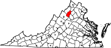
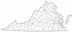 Location of Stanley, Virginia | |
| Coordinates: 38°34′40″N 78°30′32″W / 38.57778°N 78.50889°WCoordinates: 38°34′40″N 78°30′32″W / 38.57778°N 78.50889°W | |
| Country | United States |
| State | Virginia |
| County | Page |
| Area | |
| • Total | 1.1 sq mi (2.9 km2) |
| • Land | 1.1 sq mi (2.9 km2) |
| • Water | 0.0 sq mi (0.0 km2) |
| Elevation | 1,093 ft (333 m) |
| Population (2010) | |
| • Total | 1,689 |
| Time zone | Eastern (EST) (UTC-5) |
| • Summer (DST) | EDT (UTC-4) |
| ZIP code | 22851 |
| Area code(s) | 540 |
| FIPS code | 51-75024[1] |
| GNIS feature ID | 1487517[2] |

Stanley is a town in Page County, Virginia, United States. The population was 1,689 at the 2010 census.
History
Fort Philip Long and Graves Chapel and Cemetery are listed on the National Register of Historic Places.[3]
Geography
Stanley is located at 38°34′40″N 78°30′32″W / 38.57778°N 78.50889°W (38.577649, -78.508980).[4]
According to the United States Census Bureau, the town has a total area of 1.1 square miles (2.8 km²), all of it land.
Demographics
| Historical population | |||
|---|---|---|---|
| Census | Pop. | %± | |
| 1910 | 218 | — | |
| 1920 | 449 | 106.0% | |
| 1930 | 259 | −42.3% | |
| 1940 | 317 | 22.4% | |
| 1950 | 399 | 25.9% | |
| 1960 | 1,039 | 160.4% | |
| 1970 | 1,208 | 16.3% | |
| 1980 | 1,204 | −0.3% | |
| 1990 | 1,186 | −1.5% | |
| 2000 | 1,326 | 11.8% | |
| 2010 | 1,689 | 27.4% | |
| Est. 2015 | 1,654 | [5] | −2.1% |
As of the census[1] of 2000, there were 1,326 people, 562 households, and 363 families residing in the town. The population density was 1,203.8 people per square mile (465.4/km²). There were 598 housing units at an average density of 542.9 per square mile (209.9/km²). The racial makeup of the town was 97.89% White, 1.28% from other races, and 0.83% from two or more races. Hispanic or Latino of any race were 2.49% of the population.
There were 562 households out of which 28.1% had children under the age of 18 living with them, 46.1% were married couples living together, 14.6% had a female householder with no husband present, and 35.4% were non-families. 31.3% of all households were made up of individuals and 15.8% had someone living alone who was 65 years of age or older. The average household size was 2.36 and the average family size was 2.95.
In the town the population was spread out with 23.9% under the age of 18, 9.8% from 18 to 24, 28.0% from 25 to 44, 22.4% from 45 to 64, and 15.9% who were 65 years of age or older. The median age was 37 years. For every 100 females there were 87.6 males. For every 100 females age 18 and over, there were 82.5 males.
The median income for a household in the town was $25,917, and the median income for a family was $33,188. Males had a median income of $24,706 versus $18,850 for females. The per capita income for the town was $13,082. About 12.1% of families and 16.6% of the population were below the poverty line, including 22.8% of those under age 18 and 25.2% of those age 65 or over.
References
- 1 2 "American FactFinder". United States Census Bureau. Retrieved 2008-01-31.
- ↑ "US Board on Geographic Names". United States Geological Survey. 2007-10-25. Retrieved 2008-01-31.
- ↑ National Park Service (2010-07-09). "National Register Information System". National Register of Historic Places. National Park Service.
- ↑ "US Gazetteer files: 2010, 2000, and 1990". United States Census Bureau. 2011-02-12. Retrieved 2011-04-23.
- ↑ "Annual Estimates of the Resident Population for Incorporated Places: April 1, 2010 to July 1, 2015". Retrieved July 2, 2016.
- ↑ "Census of Population and Housing". Census.gov. Retrieved June 4, 2015.