Gate City, Virginia
| Gate City, | |
|---|---|
 | |
 Location of Gate City, Virginia | |
| Coordinates: 36°38′18″N 82°34′50″W / 36.63833°N 82.58056°WCoordinates: 36°38′18″N 82°34′50″W / 36.63833°N 82.58056°W | |
| Country | United States |
| State | Virginia |
| County | Scott |
| Area | |
| • Total | 2.1 sq mi (5.3 km2) |
| • Land | 2.0 sq mi (5.3 km2) |
| • Water | 0.0 sq mi (0.0 km2) |
| Elevation | 1,339 ft (408 m) |
| Population (2010) | |
| • Total | 2,034 |
| • Density | 970/sq mi (380/km2) |
| Time zone | Eastern (EST) (UTC-5) |
| • Summer (DST) | EDT (UTC-4) |
| ZIP code | 24251 |
| Area code(s) | 276 |
| FIPS code | 51-30496[1] |
| GNIS feature ID | 1498481[2] |
| Website | Official website |
Gate City is a town in Scott County, Virginia, United States. The population was 2,034 at the 2010 census. It is the county seat of Scott County.[3]
Gate City is part of the Kingsport–Bristol (TN)–Bristol (VA) Metropolitan Statistical Area, which is a component of the Johnson City–Kingsport–Bristol, TN-VA Combined Statistical Area – commonly known as the "Tri-Cities" region.
Some scenes from The River were shot here.
History
The Gate City Historic District was listed on the National Register of Historic Places in 2010.[4]
Geography
Gate City is located at 36°38′18″N 82°34′50″W / 36.63833°N 82.58056°W (36.638325, -82.580659).[5]
According to the United States Census Bureau, the town has a total area of 2.1 square miles (5.4 km2), of which 2.0 square miles (5.2 km2) is land and 0.04 square miles (0.10 km2), or 0.97%, is water. The town has expanded its boundaries since the 2000 census via a boundary adjustment agreement with the county.
Bordered by a mountain, Gate City is a small city relative to its neighbors and located on U.S. Routes 23 and 421 near the Tennessee state line. The Virginia Department of Transportation (VDOT) plans for a large portion of the mountain at Moccasin Gap to be shorn away.[6]
Demographics
| Historical population | |||
|---|---|---|---|
| Census | Pop. | %± | |
| 1900 | 521 | — | |
| 1910 | 599 | 15.0% | |
| 1920 | 684 | 14.2% | |
| 1930 | 1,216 | 77.8% | |
| 1940 | 1,565 | 28.7% | |
| 1950 | 2,126 | 35.8% | |
| 1960 | 2,142 | 0.8% | |
| 1970 | 1,914 | −10.6% | |
| 1980 | 2,494 | 30.3% | |
| 1990 | 2,214 | −11.2% | |
| 2000 | 2,159 | −2.5% | |
| 2010 | 2,034 | −5.8% | |
| Est. 2015 | 1,955 | [7] | −3.9% |
As of the census[1] of 2000, there were 2,159 people, 984 households, and 604 families residing in the town. The population density was 1,058.8 people per square mile (408.6/km²). There were 1,119 housing units at an average density of 548.8 per square mile (211.8/km²). The racial makeup of the town was 95.69% White, 3.80% African American, 0.09% Native American, and 0.42% from two or more races. Hispanic or Latino of any race were 0.42% of the population.
There were 984 households out of which 23.7% had children under the age of 18 living with them, 47.9% were married couples living together, 11.0% had a female householder with no husband present, and 38.6% were non-families. 36.2% of all households were made up of individuals and 19.7% had someone living alone who was 65 years of age or older. The average household size was 2.16 and the average family size was 2.81.
In the town the population was spread out with 20.0% under the age of 18, 7.3% from 18 to 24, 25.7% from 25 to 44, 24.8% from 45 to 64, and 22.2% who were 65 years of age or older. The median age was 43 years. For every 100 females there were 87.7 males. For every 100 females age 18 and over, there were 81.0 males.
The median income for a household in the town was $31,875, and the median income for a family was $48,068. Males had a median income of $35,875 versus $22,292 for females. The per capita income for the town was $19,268. About 4.1% of families and 13.5% of the population were below the poverty line, including 15.9% of those under age 18 and 22.9% of those age 65 or over.
Notable people
- Fayette McMullen, second appointed Governor of Washington Territory[9]
Gallery


References
- 1 2 "American FactFinder". United States Census Bureau. Retrieved 2008-01-31.
- ↑ "US Board on Geographic Names". United States Geological Survey. 2007-10-25. Retrieved 2008-01-31.
- ↑ "Find a County". National Association of Counties. Retrieved 2011-06-07.
- ↑ "National Register of Historic Places Listings". Weekly List of Actions Taken on Properties: 9/07/10 through 9/10/10. National Park Service. 2010-09-17.
- ↑ "US Gazetteer files: 2010, 2000, and 1990". United States Census Bureau. 2011-02-12. Retrieved 2011-04-23.
- ↑ "VDOT Moccasin Gap Bypass". Retrieved 16 March 2012.
- ↑ "Annual Estimates of the Resident Population for Incorporated Places: April 1, 2010 to July 1, 2015". Retrieved July 2, 2016.
- ↑ "Census of Population and Housing". Census.gov. Retrieved June 4, 2015.
- ↑ "McMULLEN, Fayette, (1805 - 1880)". Biographical Directory of the United States Congress. Retrieved October 9, 2012.
External links
Municipalities and communities of Scott County, Virginia, United States | ||
|---|---|---|
| Towns | 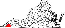 | |
| Unincorporated communities | ||