Chase City, Virginia
| Chase City, Virginia | ||
|---|---|---|
| Town | ||
|
Downtown Chase City | ||
| ||
 Location of Chase City, Virginia | ||
| Coordinates: 36°47′58″N 78°27′40″W / 36.79944°N 78.46111°WCoordinates: 36°47′58″N 78°27′40″W / 36.79944°N 78.46111°W | ||
| Country | United States | |
| State | Virginia | |
| County | Mecklenburg | |
| Government | ||
| • Mayor | John Eddie Bratton | |
| • Vice Mayor | Lisa A. Gillispie | |
| • Town Council |
James Bohannon Winthy Hatcher, Jr. Dominique Sturdifen Munsey A. Moore Charles Willis | |
| • Town Manager | Angela Lawrence | |
| • Police Chief | J. A. Jordon | |
| Area | ||
| • Total | 2.2 sq mi (5.7 km2) | |
| • Land | 2.2 sq mi (5.7 km2) | |
| • Water | 0.0 sq mi (0.0 km2) | |
| Elevation | 571 ft (174 m) | |
| Population (2000) | ||
| • Total | 2,457 | |
| • Density | 1,121.2/sq mi (432.9/km2) | |
| Time zone | Eastern (EST) (UTC-5) | |
| • Summer (DST) | EDT (UTC-4) | |
| ZIP code | 23924 | |
| Area code(s) | 434 | |
| FIPS code | 51-14984[1] | |
| GNIS feature ID | 1464752[2] | |
| Website | Official website | |
.jpg)

Chase City is a town in Mecklenburg County, Virginia, United States. Chase City was incorporated in 1873 and named for Salmon P. Chase, United States Chief Justice and Lincoln's Secretary of the Treasury. The population was 2,457 at the 2000 census. Tobacco and other crops are grown nearby.
History
The Chase City High School, MacCallum More and Hudgins House Historic District, and Shadow Lawn are listed on the National Register of Historic Places.[3][4]
Geography
Chase City is located at 36°47′58″N 78°27′40″W / 36.79944°N 78.46111°W (36.799312, -78.461019).[5]
According to the United States Census Bureau, the town has a total area of 2.2 square miles (5.7 km²), all of it land.
Demographics
| Historical population | |||
|---|---|---|---|
| Census | Pop. | %± | |
| 1880 | 251 | — | |
| 1890 | 618 | 146.2% | |
| 1900 | 542 | −12.3% | |
| 1910 | 1,662 | 206.6% | |
| 1920 | 1,646 | −1.0% | |
| 1930 | 1,590 | −3.4% | |
| 1940 | 1,896 | 19.2% | |
| 1950 | 2,519 | 32.9% | |
| 1960 | 3,207 | 27.3% | |
| 1970 | 2,909 | −9.3% | |
| 1980 | 2,749 | −5.5% | |
| 1990 | 2,442 | −11.2% | |
| 2000 | 2,457 | 0.6% | |
| 2010 | 2,351 | −4.3% | |
| Est. 2015 | 2,296 | [6] | −2.3% |
As of the census[1] of 2000, there were 2,457 people, 1,099 households, and 658 families residing in the town. The population density was 1,121.2 people per square mile (433.2/km²). There were 1,249 housing units at an average density of 570.0 per square mile (220.2/km²). The racial makeup of the town was 53.52% White, 44.65% African American, 0.20% Native American, 0.12% Asian,0.04% Pacific Islander, 0.49% from other races, and 0.98% from two or more races. Hispanic or Latino of any race were 1.34% of the population.
There were 1,099 households out of which 26.1% had children under the age of 18 living with them, 36.6% were married couples living together, 18.7% had a female householder with no husband present, and 40.1% were non-families. 36.7% of all households were made up of individuals and 21.7% had someone living alone who was 65 years of age or older. The average household size was 2.24 and the average family size was 2.93.
In the town the population was spread out with 25.4% under the age of 18, 6.8% from 18 to 24, 23.5% from 25 to 44, 22.5% from 45 to 64, and 21.8% who were 65 years of age or older. The median age was 40 years. For every 100 females there were 80.1 males. For every 100 females age 18 and over, there were 74.5 males.
The median income for a household in the town was $22,193, and the median income for a family was $32,700. Males had a median income of $26,712 versus $18,750 for females. The per capita income for the town was $13,559. About 15.9% of families and 22.7% of the population were below the poverty line, including 27.4% of those under age 18 and 20.3% of those age 65 or over.
Notable people
- Rufus Meadows, pitcher for the MLB's Cincinnati Reds.
- Martin Mull, actor and recording artist. He moved away when he was two.
References
- 1 2 "American FactFinder". United States Census Bureau. Archived from the original on 2013-09-11. Retrieved 2008-01-31.
- ↑ "US Board on Geographic Names". United States Geological Survey. 2007-10-25. Retrieved 2008-01-31.
- ↑ National Park Service (2010-07-09). "National Register Information System". National Register of Historic Places. National Park Service.
- ↑ "National Register of Historic Places Listings". Weekly List of Actions Taken on Properties: 9/07/10 through 9/10/10. National Park Service. 2010-09-17.
- ↑ "US Gazetteer files: 2010, 2000, and 1990". United States Census Bureau. 2011-02-12. Retrieved 2011-04-23.
- ↑ "Annual Estimates of the Resident Population for Incorporated Places: April 1, 2010 to July 1, 2015". Retrieved July 2, 2016.
- ↑ "Census of Population and Housing". Census.gov. Archived from the original on May 11, 2015. Retrieved June 4, 2015.
Municipalities and communities of Mecklenburg County, Virginia, United States | ||
|---|---|---|
| Towns | 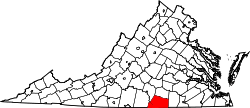 | |
| CDPs | ||
| Unincorporated communities | ||
| Footnotes | ‡This populated place also has portions in an adjacent county or counties | |