Bath County, Virginia
| Bath County, Virginia | |
|---|---|
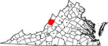 Location in the U.S. state of Virginia | |
 Virginia's location in the U.S. | |
| Founded | 1790 |
| Named for | Bath, England |
| Seat | Warm Springs |
| Largest community | Hot Springs |
| Area | |
| • Total | 535 sq mi (1,386 km2) |
| • Land | 529 sq mi (1,370 km2) |
| • Water | 5 sq mi (13 km2), 1.0% |
| Population (est.) | |
| • (2015) | 4,470 |
| • Density | 8.3/sq mi (3/km²) |
| Congressional district | 6th |
| Time zone | Eastern: UTC-5/-4 |
| Website |
www |
Bath County is a United States county located in the Shenandoah Valley and on the central western border of the Commonwealth of Virginia. As of the 2010 census, the population was 4,731;[1] in 2015, the population was estimated at 4,470,[2] it the second-least populous county in Virginia. Bath's county seat is Warm Springs.[3]
Bath County was created in 1790 from parts of Augusta, Botetourt, and Greenbrier counties, and it was named for the English city of Bath. Like its namesake, Bath County's economy is focused on tourism and recreation, due to its many natural mineral springs found in the area. The county's major employer is The Homestead, a resort and historical hotel located in Hot Springs, Virginia.
The county is represented in the Virginia General Assembly by Senator Creigh Deeds and Delegate Ben Cline.
History
Bath County was established on December 14, 1790 from sections of Augusta, Botetourt, and Greenbrier counties. Due to the many mineral springs found in the area, the county was named for the English spa and resort city of Bath.[4] The area's economy has focused on tourism and travel since the 1700s, particularly when The Homestead Resort was built in 1766.[5]
Located along the western central border with West Virginia, Bath County comprises a number of villages, including Hot Springs, Warm Springs, Millboro and Mountain Grove. Hot Springs and Warm Springs are the most well known of the villages, given their natural mineral springs. Bath County is one of the few counties in Virginia without a traffic signal. (Charlotte County, Mathews County, and Rappahannock County are the others.)
Geography
According to the U.S. Census Bureau, the county has a total area of 535 square miles (1,390 km2), of which 529 square miles (1,370 km2) is land and 5 square miles (13 km2) (1.0%) is water.[6] 89% of Bath County is forest, with 51% national forest and 6% state park. The Nature Conservancy owns more than 9,000 acres (36 km2) of forest habitat.[5]
Adjacent Counties
- Highland County – north
- Augusta County – northeast
- Rockbridge County – east
- Alleghany County – south
- Greenbrier County, West Virginia – southwest
- Pocahontas County, West Virginia – west
National protected areas
Major highways
Demographics
| Historical population | |||
|---|---|---|---|
| Census | Pop. | %± | |
| 1800 | 5,508 | — | |
| 1810 | 4,837 | −12.2% | |
| 1820 | 5,237 | 8.3% | |
| 1830 | 4,002 | −23.6% | |
| 1840 | 4,300 | 7.4% | |
| 1850 | 3,486 | −18.9% | |
| 1860 | 3,676 | 5.5% | |
| 1870 | 3,795 | 3.2% | |
| 1880 | 4,482 | 18.1% | |
| 1890 | 4,587 | 2.3% | |
| 1900 | 5,595 | 22.0% | |
| 1910 | 6,538 | 16.9% | |
| 1920 | 6,389 | −2.3% | |
| 1930 | 8,137 | 27.4% | |
| 1940 | 7,191 | −11.6% | |
| 1950 | 6,296 | −12.4% | |
| 1960 | 5,335 | −15.3% | |
| 1970 | 5,192 | −2.7% | |
| 1980 | 5,860 | 12.9% | |
| 1990 | 4,799 | −18.1% | |
| 2000 | 5,048 | 5.2% | |
| 2010 | 4,731 | −6.3% | |
| Est. 2015 | 4,470 | [2] | −5.5% |
| U.S. Decennial Census[7] 1790-1960[8] 1900-1990[9] 1990-2000[10] 2010-2013[1] | |||
As of the census[11] of 2000, there were 5,048 people, 2,053 households, and 1,451 families residing in the county. The population density was 10 people per square mile (4/km²). There were 2,896 housing units at an average density of 5 per square mile (2/km²). The racial makeup of the county was 92.29% White, 6.28% Black or African American, 0.22% Native American, 0.38% Asian, 0.06% Pacific Islander, 0.10% from other races, and 0.67% from two or more races. 0.36% of the population were Hispanic or Latino of any race.
There were 2,053 households out of which 28.00% had children under the age of 18 living with them, 58.60% were married couples living together, 7.80% had a female householder with no husband present, and 29.30% were non-families. 26.30% of all households were made up of individuals and 12.10% had someone living alone who was 65 years of age or older. The average household size was 2.34 and the average family size was 2.80.
In the county, the population was spread out with 21.00% under the age of 18, 5.50% from 18 to 24, 28.20% from 25 to 44, 28.50% from 45 to 64, and 16.70% who were 65 years of age or older. The median age was 42 years. For every 100 females there were 100.60 males. For every 100 females age 18 and over, there were 99.20 males.
The median income for a household in the county was $35,013, and the median income for a family was $41,276. Males had a median income of $30,238 versus $21,974 for females. The per capita income for the county was $23,092. 7.80% of the population and 5.80% of families were below the poverty line. Out of the total people living in poverty, 5.40% are under the age of 18 and 12.90% are 65 or older.
Government
Board of Supervisors
Cedar Creek district: Claire A. Collins (I)
Millboro district: Eddy T. Hicklin (I)
Valley Springs district: Richard B. Byrd (I)
Warm Springs district: Matthew S. Ratcliffe (I)
Williamsville district: Stuart L. Hall (I)
Constitutional Officers
Clerk of the Circuit Court: Annette T. Loan (I)
Commissioner of the Revenue: Angel M. Grimm (I)
Commonwealth's Attorney: John C. Singleton (I)
Sheriff: Robert W. Plecker (I)
Treasurer: Pam Webb (I)
Bath County is represented by Democrat R. Creigh Deeds in the Virginia Senate, Republican Ben L. Cline in the Virginia House of Delegates, and Republican Robert W. "Bob" Goodlatte in the U.S. House of Representatives.
Politics
| Year | Democrat | Republican |
|---|---|---|
| 2012 | 40.2% 894 | 57.3% 1,274 |
| 2008 | 42.9% 1,043 | 55.5% 1,349 |
| 2004 | 36.3% 828 | 62.8% 1,432 |
| 2000 | 37.2% 822 | 59.3% 1,311 |
| 1996 | 45.0% 922 | 41.3% 847 |
| 1992 | 36.7% 855 | 46.1% 1,075 |
| 1988 | 40.7% 881 | 58.7% 1,273 |
| 1984 | 33.4% 727 | 65.9% 1,434 |
| 1980 | 49.8% 999 | 45.9% 921 |
| 1976 | 53.3% 1,029 | 46.0% 888 |
| 1972 | 28.2% 462 | 68.9% 1,127 |
| 1968 | 26.0% 494 | 46.0% 872 |
| 1964 | 59.9% 770 | 40.1% 516 |
| 1960 | 49.3% 629 | 50.6% 646 |
Economy
Tourism and recreation has been the focus of the economy from the time the county was established.[5] The Homestead, a luxury mountain resort in Hot Springs, is the county's major employer.[12] The resort grew around the area's natural hot mineral springs, such as the Jefferson Pools.
Bath County is also home to the Bath County Pumped Storage Station, a pumped storage hydroelectric power plant.
Education
The county has two elementary schools (Pre-Kindergarten to 7th grade) and one high school (8th grade to 12th grade). The school system has about 600 students in total and like many Virginia counties is declining in number due to the falling (and aging) population.[13] [14]
Communities
Unincorporated communities
Notable residents
- The American educator C. E. Byrd was born in Bath County in 1859.
See also
References
- 1 2 "State & County QuickFacts". United States Census Bureau. Retrieved January 1, 2015.
- 1 2 "County Totals Dataset: Population, Population Change and Estimated Components of Population Change: April 1, 2010 to July 1, 2015". Retrieved July 2, 2016.
- ↑ "Find a County". National Association of Counties. Archived from the original on 2012-07-12. Retrieved 2011-06-07.
- ↑ Salmon, edited by Emily J.; Jr, Edward D.C. Campbell, (1994). The Hornbook of Virginia History : a ready-reference guide to the Old Dominion's people, places, and past (4th ed.). Richmond: Library of Virginia. p. 161. ISBN 0884901777.
- 1 2 3 "About Bath County". County of Bath, Virginia. Retrieved 1 August 2014.
- ↑ "US Gazetteer files: 2010, 2000, and 1990". United States Census Bureau. 2011-02-12. Retrieved 2011-04-23.
- ↑ "U.S. Decennial Census". United States Census Bureau. Archived from the original on May 11, 2015. Retrieved January 1, 2014.
- ↑ "Historical Census Browser". University of Virginia Library. Retrieved January 1, 2014.
- ↑ "Population of Counties by Decennial Census: 1900 to 1990". United States Census Bureau. Retrieved January 1, 2014.
- ↑ "Census 2000 PHC-T-4. Ranking Tables for Counties: 1990 and 2000" (PDF). United States Census Bureau. Retrieved January 1, 2014.
- ↑ "American FactFinder". United States Census Bureau. Archived from the original on 2013-09-11. Retrieved 2011-05-14.
- ↑ Mitchell, Lynn R. (23 April 2012). "Three years later … where is the Homestead Resort murderer?". Bearing Drift. Retrieved 10 July 2012.
- ↑ Virginia Department of Education. "Enrollment Data". Retrieved 10 July 2015.
- ↑ University of Virginia. "Enrollment Trends". Retrieved 10 July 2015.
External links
 |
Highland County | Augusta County | | |
| Pocahontas County, West Virginia | |
Rockbridge County | ||
| ||||
| | ||||
| Greenbrier County, West Virginia | Alleghany County |
Municipalities and communities of Bath County, Virginia, United States | ||
|---|---|---|
| CDPs | | |
| Unincorporated communities |
| |
| Footnotes | ‡This populated place also has portions in an adjacent county or counties | |
Coordinates: 38°04′N 79°44′W / 38.06°N 79.74°W