Amelia County, Virginia
| Amelia County, Virginia | ||
|---|---|---|
|
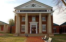
Amelia County Courthouse | ||
| ||
 Location in the U.S. state of Virginia | ||
 Virginia's location in the U.S. | ||
| Founded | 1735 | |
| Named for | Princess Amelia | |
| Seat | Amelia | |
| Area | ||
| • Total | 359 sq mi (930 km2) | |
| • Land | 355 sq mi (919 km2) | |
| • Water | 3.3 sq mi (9 km2), 0.9% | |
| Population (est.) | ||
| • (2015) | 12,903 | |
| • Density | 35/sq mi (13.7/km²) | |
| Congressional district | 4th | |
| Time zone | Eastern: UTC-5/-4 | |
| Website |
www | |

Amelia County is a United States county located just west of Richmond in the Commonwealth of Virginia. The county is included in the Greater Richmond Region, and its county seat is Amelia Courthouse.[1]
Amelia County was created in 1735 from parts of Prince George and Brunswick counties, and it was named in honor of Princess Amelia of Great Britain. Parts of the county were later carved out to create Prince Edward and Nottoway counties.
As of the 2010 census, the county population was 12,690, which is an increase of over 44 percent from the 1990 census.[2] The largest individual ancestry group in Amelia is African Americans at 28% of the total population.
History
_by_Jean%3DBaptiste_van_Loo.jpg)
Amelia County was created by a legislative act in 1734 and 1735[3] from parts of Prince George and Brunswick counties. The County is named for Princess Amelia of Great Britain, daughter of King George II. Twice Amelia County was reduced in size to form newer counties; in 1754, Prince Edward County was formed from parts of Amelia County, and in 1789, Nottoway County was formed.
During the Civil War General Robert E. Lee and his Army spent April 4 and 5, 1865 at Amelia Courthouse before his surrender to General Ulysses S. Grant at Appomattox. The last major battle of the war was fought at Sayler’s Creek on April 6.
Amelia is known for its minerals, including the nation's best supply of Amazonite found at the Morefield mine. In addition, the Amelia County Fair was home to the world's largest potato pancake (with apple sauce) which was built to raise money for the German American National Scholarship Fund in 1986. It weighed over two and one quarter tons and used four truck loads of potatoes.
Geography
According to the U.S. Census Bureau, the county has a total area of 359 square miles (930 km2), of which 355 square miles (920 km2) is land and 3.3 square miles (8.5 km2) (0.9%) is water.[4]
Adjacent counties
- Powhatan County - north
- Chesterfield County - northeast
- Dinwiddie County - southeast
- Nottoway County - south
- Prince Edward County - southwest
- Cumberland County - west
Major highways
Demographics
| Historical population | |||
|---|---|---|---|
| Census | Pop. | %± | |
| 1790 | 18,097 | — | |
| 1800 | 9,432 | −47.9% | |
| 1810 | 10,594 | 12.3% | |
| 1820 | 11,104 | 4.8% | |
| 1830 | 11,036 | −0.6% | |
| 1840 | 10,320 | −6.5% | |
| 1850 | 9,770 | −5.3% | |
| 1860 | 10,741 | 9.9% | |
| 1870 | 9,878 | −8.0% | |
| 1880 | 10,377 | 5.1% | |
| 1890 | 9,068 | −12.6% | |
| 1900 | 9,037 | −0.3% | |
| 1910 | 8,720 | −3.5% | |
| 1920 | 9,800 | 12.4% | |
| 1930 | 8,799 | −10.2% | |
| 1940 | 8,495 | −3.5% | |
| 1950 | 7,908 | −6.9% | |
| 1960 | 7,815 | −1.2% | |
| 1970 | 7,592 | −2.9% | |
| 1980 | 8,405 | 10.7% | |
| 1990 | 8,787 | 4.5% | |
| 2000 | 11,400 | 29.7% | |
| 2010 | 12,690 | 11.3% | |
| Est. 2015 | 12,903 | [5] | 1.7% |
| U.S. Decennial Census[6] 1790-1960[7] 1900-1990[8] 1990-2000[9] 2010-2013[2] | |||
As of the census[10] of 2000, there were 11,400 people, 4,240 households, and 3,175 families residing in the county. The population density was 32 people per square mile (12/km²). There were 4,609 housing units at an average density of 13 per square mile (5/km²). The racial makeup of the county was 70.57% White, 28.05% Black or African American, 0.28% Native American, 0.17% Asian, 0.02% Pacific Islander, 0.25% from other races, and 0.67% from two or more races. 0.80% of the population were Hispanic or Latino of any race.
The two largest ancestry groups in Amelia County are African American (28%) and English American (11%).[11]
There were 4,240 households out of which 32.80% had children under the age of 18 living with them, 59.10% were married couples living together, 11.40% had a female householder with no husband present, and 25.10% were non-families. 20.70% of all households were made up of individuals and 8.10% had someone living alone who was 65 years of age or older. The average household size was 2.66 and the average family size was 3.07.
In the county, the population was spread out with 25.30% under the age of 18, 6.70% from 18 to 24, 29.20% from 25 to 44, 25.40% from 45 to 64, and 13.30% who were 65 years of age or older. The median age was 38 years. For every 100 females there were 97.30 males. For every 100 females age 18 and over, there were 94.20 males.
The median income for a household in the county was $40,252, and the median income for a family was $47,157. Males had a median income of $32,315 versus $23,102 for females. The per capita income for the county was $18,858. 8.40% of the population and 6.70% of families were below the poverty line. Out of the total people living in poverty, 7.10% are under the age of 18 and 11.70% are 65 or older.
Government
Board of Supervisors
- District 1: Ellsworth J. Bennett, Vice Chairman (I)
- District 2: Judy Jones (I)
- District 3: Ralph A. Whitaker, Jr. (R)
- District 4: Carroll E. Barnard (R)
- District 5: Franklin D. Harris, Chairman (D)
Constitutional Officers
- Clerk of the Circuit Court: Marilyn L. Wilson (D)
- Commissioner of the Revenue: Laura Walsh (I)
- Commonwealth's Attorney: Lee R. Harrison (I)
- Sheriff: Rick Walker (I)
- Treasurer: Pam Conyers (D)
Amelia County is represented by Republican Stephen H. Martin in the Virginia Senate, Republican Thomas C. Wright, Jr. in the Virginia House of Delegates, and Republican J. Randy Forbes in the U.S. House of Representatives.
Media
The Amelia Bulletin Monitor, a weekly newspaper, has covered the county since 1973.
Communities
There are no incorporated communities in Amelia County.
- Amelia Court House
- Dennisville
- Winterham
- Jetersville
- Mannboro
- Morven
- Little Patrick
- Chula
Notable residents
- William S. Archer, born in Amelia County, United States Senator from Virginia[12]
- William Wyatt Bibb, born in Amelia County, United States Senator from Georgia and first Governor of Alabama[12]
- Mary Virginia Terhune, (1830-1922) born in Amelia County. Author and first woman elected to the Virginia Historical Society
- Jesse Bragg, Negro league baseball player
- William Cocke (1747–1828), born in Amelia County, first United States Senator from Tennessee[12]
- Henry William Connor (1793–1866), born near Amelia Court House, United States Congressman from North Carolina[12]
- David Fanning, (1755–1825), born in Amelia County. A Loyalist officer during the American Revolutionary War, he captured a court martial judge and Governor of North Carolina Thomas Burke. One of only three individuals excluded from the amnesty after the Revolutionary War, he moved to New Brunswick.[12]
- William Branch Giles, (1762–1830), born in Amelia County. United States Congressman, United States Senator, and Governor of Virginia.[12]
- John Winston Jones, (1791–1848), born in Amelia county. Speaker of the United States House of Representatives.[12]
- Robert Russa Moton (1867–1940), noted African-American educator. He was born in Amelia County but was raised in Rice, in nearby Prince Edward County, Virginia
- Van T. Barfoot (1919-2012), U.S. Army Colonel and a U.S. Congressional Medal of Honor Recipient
See also
References
- ↑ "Find a County". National Association of Counties. Archived from the original on 2011-05-31. Retrieved 2011-06-07.
- 1 2 "State & County QuickFacts". United States Census Bureau. Retrieved December 31, 2013.
- ↑ History of Amelia County
- ↑ "US Gazetteer files: 2010, 2000, and 1990". United States Census Bureau. 2011-02-12. Retrieved 2011-04-23.
- ↑ "County Totals Dataset: Population, Population Change and Estimated Components of Population Change: April 1, 2010 to July 1, 2015". Retrieved July 2, 2016.
- ↑ "U.S. Decennial Census". United States Census Bureau. Archived from the original on May 11, 2015. Retrieved December 31, 2013.
- ↑ "Historical Census Browser". University of Virginia Library. Retrieved December 31, 2013.
- ↑ "Population of Counties by Decennial Census: 1900 to 1990". United States Census Bureau. Retrieved December 31, 2013.
- ↑ "Census 2000 PHC-T-4. Ranking Tables for Counties: 1990 and 2000" (PDF). United States Census Bureau. Retrieved December 31, 2013.
- ↑ "American FactFinder". United States Census Bureau. Archived from the original on 2013-09-11. Retrieved 2011-05-14.
- ↑ Amelia County, VA - Amelia County, Virginia - Ancestry & family history - ePodunk
- 1 2 3 4 5 6 7 Who Was Who in America, Historical Volume, 1607-1896. Chicago: Marquis Who's Who. 1963.
External links
- http://www.ameliacova.com - Official Amelia County Website
- http://www.ameliabusinessdirectory.com - Amelia Business Directory
- Amelia Co. Christmas 1784
- http://www.ameliamonitor.com - Amelia County's newspaper
 |
Powhatan County | Chesterfield County | | |
| Cumberland County | |
|||
| ||||
| | ||||
| Prince Edward County | Nottoway County | Dinwiddie County |
Municipalities and communities of Amelia County, Virginia, United States | ||
|---|---|---|
| CDP | | |
| Unincorporated communities | ||
Coordinates: 37°20′N 77°59′W / 37.34°N 77.98°W