Rappahannock County, Virginia
| Rappahannock County, Virginia | ||
|---|---|---|
|
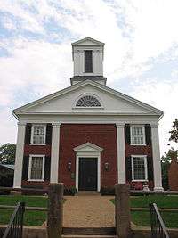
Rappahannock County Courthouse in Washington, Virginia | ||
| ||
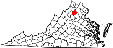 Location in the U.S. state of Virginia | ||
 Virginia's location in the U.S. | ||
| Founded | 1833 | |
| Named for | Rappahannock River | |
| Seat | Washington | |
| Largest town | Washington | |
| Area | ||
| • Total | 267 sq mi (692 km2) | |
| • Land | 266 sq mi (689 km2) | |
| • Water | 0.8 sq mi (2 km2), 0.3% | |
| Population (est.) | ||
| • (2015) | 7,378 | |
| • Density | 27/sq mi (10/km²) | |
| Congressional district | 5th | |
| Time zone | Eastern: UTC-5/-4 | |
| Website |
rappahannockcountyva | |

Rappahannock County is a county located in the Commonwealth of Virginia. As of the 2010 census, the population was 7,373.[1] Its county seat is Washington.[2] The name "Rappahannock" comes from the Algonquian word lappihanne (also noted as toppehannock), meaning "river of quick, rising water" or "where the tide ebbs and flows."
Rappahannock County is included in the Washington-Arlington-Alexandria, DC-VA-MD-WV Metropolitan Statistical Area.
History
Rappahannock County was founded by an act of the Virginia General Assembly in 1833, based on the growing population's need to have better access to a county seat. The county's land was carved from Culpeper County. Rappahannock county was named for the river that separates it from Fauquier County.
Geography
According to the U.S. Census Bureau, the county has a total area of 267.2 square miles (692.0 km2), of which 266.4 square miles (690.0 km2) is land and 0.8 square miles (2.1 km2) (0.3%) is water.[3]
The Rappahannock River forms the northeastern boundary and separates Rappahannock County from Fauquier County. Rappahannock County is bounded on the southeast by Culpeper County and on the southwest by Madison County. The Blue Ridge Mountains occupy much of the western portion of the county.
Adjacent counties
- Warren County, Virginia – northwest
- Fauquier County, Virginia – northeast
- Culpeper County, Virginia – southeast
- Madison County, Virginia – southwest
- Page County, Virginia – west
National protected area
- Shenandoah National Park (part)
Mountains
The summits of the following mountains are located within Rappahannock County:
- Pignut Mountain
- Castleton Mountain
- Jenkins Mountain
- Jefferson Mountain
- Meetinghouse Mountain
- Little Mulky Mountain
- Little Jenkins Mountain
- Googe Mountain
- Round Mountain
- Hickerson Mountain
- Fork Mountain
- Battle Mountain [4]
- Little Battle Mountain
- Piney Ridge
- Pickerel Ridge
- Poes Mountain
- Aaron Mountain
- Red Oak Mountain
Major highways
Demographics
| Historical population | |||
|---|---|---|---|
| Census | Pop. | %± | |
| 1840 | 9,257 | — | |
| 1850 | 9,782 | 5.7% | |
| 1860 | 8,850 | −9.5% | |
| 1870 | 8,261 | −6.7% | |
| 1880 | 9,291 | 12.5% | |
| 1890 | 8,678 | −6.6% | |
| 1900 | 8,843 | 1.9% | |
| 1910 | 8,044 | −9.0% | |
| 1920 | 8,070 | 0.3% | |
| 1930 | 7,717 | −4.4% | |
| 1940 | 7,208 | −6.6% | |
| 1950 | 6,112 | −15.2% | |
| 1960 | 5,368 | −12.2% | |
| 1970 | 5,199 | −3.1% | |
| 1980 | 6,093 | 17.2% | |
| 1990 | 6,622 | 8.7% | |
| 2000 | 6,983 | 5.5% | |
| 2010 | 7,373 | 5.6% | |
| Est. 2015 | 7,378 | [5] | 0.1% |
| U.S. Decennial Census[6] 1790–1960[7] 1900–1990[8] 1990–2000[9] 2010–2012[1] | |||
As of the census[10] of 2010, there were 7,373 people, 2,788 households, and 2,004 families residing in the county. The population density was 26 people per square mile (10/km²). There were 3,303 housing units at an average density of 12 per square mile (5/km²). The racial makeup of the county was 92.64% White, 5.44% Black or African American, 0.16% Native American, 0.21% Asian, 0.40% from other races, and 1.15% from two or more races. 1.30% of the population were Hispanic or Latino of any race.
There were 2,788 households out of which 27.40% had children under the age of 18 living with them, 60.50% were married couples living together, 7.10% had a female householder with no husband present, and 28.10% were non-families. 23.40% of all households were made up of individuals and 7.90% had someone living alone who was 65 years of age or older. The average household size was 2.50 and the average family size was 2.94.

In the county, the population was spread out with 22.30% under the age of 18, 5.60% from 18 to 24, 26.40% from 25 to 44, 31.80% from 45 to 64, and 13.80% who were 65 years of age or older. The median age was 43 years. For every 100 females there were 98.80 males. For every 100 females age 18 and over, there were 97.30 males.
The median income for a household in the county was $45,943, and the median income for a family was $51,848. Males had a median income of $32,725 versus $22,950 for females. The per capita income for the county was $23,863. About 5.20% of families and 7.60% of the population were below the poverty line, including 10.80% of those under age 18 and 3.20% of those age 65 or over.
Government
Board Of Supervisors
Mike Biniek (I) Piedmont District
Roger Welch (R) – Chairman (Wakefield District)
Chris Parrish (R) – Vice-Chairman (Stonewall-Hawthorne District)
Ron Frazier (R) (Jackson District)
John Lesinski (D) (Hampton District)
Education
The Rappahannock County Public Schools School District is located in Washington, VA and includes two schools that serve 921 students county-wide in grades PK through 12.
Among the private schools in the county are two pre-K thru 12 schools, Hearthstone School , and Wakefield Country Day School.there is one 6 thru 12 school, Belle Meade Farm School.
Communities
Town
Unincorporated communities
See also
References
- 1 2 "State & County QuickFacts". United States Census Bureau. Retrieved January 5, 2014.
- ↑ "Find a County". National Association of Counties. Retrieved 2011-06-07.
- ↑ "US Gazetteer files: 2010, 2000, and 1990". United States Census Bureau. 2011-02-12. Retrieved 2011-04-23.
- ↑ "A Gallium Anomaly Utilized in Palaeogeographic Reconstruction of Battle Mountain, Rappahannock County, Virginia". Kansas Academy of Science. 2016-04-01. Retrieved 2016-07-14.
- ↑ "County Totals Dataset: Population, Population Change and Estimated Components of Population Change: April 1, 2010 to July 1, 2015". Retrieved July 2, 2016.
- ↑ "U.S. Decennial Census". United States Census Bureau. Retrieved January 5, 2014.
- ↑ "Historical Census Browser". University of Virginia Library. Retrieved January 5, 2014.
- ↑ "Population of Counties by Decennial Census: 1900 to 1990". United States Census Bureau. Retrieved January 5, 2014.
- ↑ "Census 2000 PHC-T-4. Ranking Tables for Counties: 1990 and 2000" (PDF). United States Census Bureau. Retrieved January 5, 2014.
- ↑ "American FactFinder". United States Census Bureau. Retrieved 2011-05-14.
External links
| Wikimedia Commons has media related to Rappahannock County, Virginia. |
- Rappahannock County, Virginia, the county government homepage
- Rappahannock News, a print and online newspaper
- Memorial Foundation of the Germanna Colonies in Virginia, Inc.
- Rappahannock Historical Society, 328 Gay Street, Washington, VA 22747
 |
Warren County | Fauquier County | | |
| Page County | |
|||
| ||||
| | ||||
| Madison County | Culpeper County |
Municipalities and communities of Rappahannock County, Virginia, United States | ||
|---|---|---|
| Town | | |
| CDPs | ||
| Unincorporated communities |
| |
| Footnotes | ‡This populated place also has portions in an adjacent county or counties | |
| Principal cities |
| |||||||||||
|---|---|---|---|---|---|---|---|---|---|---|---|---|
| Counties and county equivalents* |
| |||||||||||
The District of Columbia itself, and Virginia's incorporated cities, are county equivalents. Virginia's incorporated cities are listed under their surrounding county. The incorporated cities bordering more than one county (Alexandria, Falls Church and Fredericksburg) are listed under the county they were part of before incorporation as a city. | ||||||||||||
Coordinates: 38°41′N 78°10′W / 38.69°N 78.17°W