Wise County, Virginia
| Wise County, Virginia | ||
|---|---|---|
|
Wise County Courthouse in Wise | ||
| ||
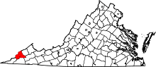 Location in the U.S. state of Virginia | ||
 Virginia's location in the U.S. | ||
| Founded | 1856 | |
| Named for | Henry A. Wise | |
| Seat | Wise | |
| Largest town | Big Stone Gap | |
| Area | ||
| • Total | 405 sq mi (1,049 km2) | |
| • Land | 403 sq mi (1,044 km2) | |
| • Water | 2 sq mi (5 km2), 0.5% | |
| Population (est.) | ||
| • (2015) | 39,718 | |
| • Density | 98/sq mi (38/km²) | |
| Congressional district | 9th | |
| Time zone | Eastern: UTC-5/-4 | |
| Website |
www | |


Wise County is a county located in the U.S. state of Virginia. As of the 2010 census, the population was 41,452.[1] Its county seat is Wise.[2] The county was formed in 1856 from Lee, Scott, and Russell Counties and named for Henry A. Wise, who was the Governor of Virginia at the time.
History
The Cherokee conquered the area including Wise from the Xualae between 1671 and 1685. It was later contested by the Six Nations and the Shawnee. A Cherokee hunting party fought a protracted battle with a Shawnee one at the headwaters of the Clinch river for two days in the summer of 1786, a victory for the Cherokee although losses were heavy on both sides.
The first white explorers to have reached present-day Wise county are said to have been Thomas Walker and Christopher Gist, both in 1750. Several forts were built all along the Clinch from 1774 onward, but only after Chickamauga Cherokee leader Bob Benge was slain in 1794 was present-day Wise considered safe for white settlers even to hunt in. Among the earliest settlers within the county was William Wells in around 1792.[3]
Virginia's two highest security state prisons are located in Wise County: Red Onion State Prison, opened in 1998, and Wallens Ridge State Prison, opened in 1999.[4]
Geography

According to the U.S. Census Bureau, the county has a total area of 405 square miles (1,050 km2), of which 403 square miles (1,040 km2) is land and 2 square miles (5.2 km2) (0.5%) is water.[5] The county is part of the Appalachians and has many mountainous features, including the peak of High Knob and Powell Valley.
Adjacent counties and cities
|
|
Major highways
National protected area
- Jefferson National Forest (part)
Demographics
| Historical population | |||
|---|---|---|---|
| Census | Pop. | %± | |
| 1860 | 4,508 | — | |
| 1870 | 4,785 | 6.1% | |
| 1880 | 7,772 | 62.4% | |
| 1890 | 9,345 | 20.2% | |
| 1900 | 19,653 | 110.3% | |
| 1910 | 34,162 | 73.8% | |
| 1920 | 46,500 | 36.1% | |
| 1930 | 51,167 | 10.0% | |
| 1940 | 52,458 | 2.5% | |
| 1950 | 56,336 | 7.4% | |
| 1960 | 43,579 | −22.6% | |
| 1970 | 35,947 | −17.5% | |
| 1980 | 43,863 | 22.0% | |
| 1990 | 39,573 | −9.8% | |
| 2000 | 40,123 | 1.4% | |
| 2010 | 41,452 | 3.3% | |
| Est. 2015 | 39,718 | [6] | −4.2% |
| U.S. Decennial Census[7] 1790-1960[8] 1900-1990[9] 1990-2000[10] 2010-2013[1] | |||
As of the census[11] of 2010, there were 41,452 people, 15,968 households, and 10,892 families residing in the county. The population density was 102.8 people per square mile (38/km²). There were 17,940 housing units at an average density of 44 per square mile (17/km²). The racial makeup of the county was 93% White, 5.2% Black or African American, 0.10% Native American, 0.30% Asian, 0.01% Pacific Islander, and 0.90% from two or more races. 1.10% of the population were Hispanic or Latino of any race.
There were 15,968 households out of which 31.80% had children under the age of 18 living with them, 50,30% were married couples living together, 12.60% had a female householder with no husband present, and 31.80% were non-families. 27.40% of all households were made up of individuals and 11.40% had someone living alone who was 65 years of age or older. The average household size was 2.40 and the average family size was 2.90.
In the county, the population was spread out with 20.80% under the age of 18 and 14.10% who were 65 years of age or older. The median age was 39 years. For every 100 females there were 107 males. For every 100 females age 18 and over, there were 107.08 males.
The median income for a household in the county was $35,053. The per capita income for the county was $17,512. About 19.30% of the population were below the poverty line. The homeownership rate for the county is 70.00%
Education
Public schools
Wise County Public Schools operates seventeen school facilities in the county for over 7,000 students.[12] For several years the Wise County School Board has considered consolidating high school, and in 2011 it closed its three smallest high schools and consolidate them into the three largest high schools.
Private schools
Wise County Christian School operates as a private school in the county.
Colleges and universities
Media
Newspapers
- The Clinch Valley Times is a weekly newspaper serving Castlewood and St. Paul, Virginia, and the surrounding areas.
- The Coalfield Progress is a twice-weekly newspaper covering news through the county.
- The Post also at is a weekly newspaper serving Big Stone Gap, Virginia and the surrounding areas.
Radio Stations
Tourist attractions
Natural and outdoor recreation

A large portion of the Jefferson National Forest is contained within Wise County, and the Clinch River winds through the county. These two factors, combined with Wise County's location in the Appalachian Mountains, mean that Wise County offers many opportunities for outdoor recreation.
In addition to many trails connecting to and surrounding the Appalachian Trail system, Wise county is home to many parks, including Miners' Park in Big Stone Gap and the Louis E. Henegar Miners' Memorial Park in Appalachia.
Among the unique features of Wise County are High Knob, a mountain which featured one of the last remaining Appalachian Fire Towers until its destruction by arson on October 31, 2007,[13] and Wetlands Estonoa, an Appalachian Wetland and part of the Clinch River Watershed.
Theater and the arts
- The Trail of the Lonesome Pine Outdoor Drama is performed in Big Stone Gap, Virginia throughout the summer. It is the Commonwealth of Virginia's official outdoor drama.
- The Pro-Art Association offers a variety of theatrical, musical, and fine-arts events throughout the school year. It is headquartered in Wise.
- The Wise County Summer Academy of Art, sponsored by Wise County Public Schools and funded in part by the Virginia Commission of Arts, provides fine arts programming for children throughout the summer months, including large scale productions and touring performance opportunities.
- The Appalachian Children's Theater (ACT) promotes performing arts and fine arts education for children in Southwest Virginia, Eastern Kentucky, and Northeast Tennessee. In 2006, the organization opened its newly renovated facility in Downtown Wise.
- The Charles W. Harris Art Gallery is located on the site of the Wise County Public Library in Wise.
Festivals and fairs
- Clinch River Days takes place in St. Paul each spring.
- Best Friend Festival held in Norton, VA
- The Virginia-Kentucky District Fair is held each summer in Wise.
- The Wise County Famous Fall Fling is an annual event held in Downtown Wise.
- Coeburn holds its annual Guest River Rally over the Labor Day weekend in September.
- Appalachia Coal Railroad Days is held each summer in Appalachia.
- Pound Heritage Days is held annually the week before Labor Day in Pound.
- Dock Boggs Oldtime Music Festival held the second weekend in September at the Country Cabin in Norton, Virginia
- Mountain Craft Days held the third weekend of October on the campus of Mountain Empire Community College in Big Stone Gap, Virginia
- the RTE 23 Music Festival is held at the end of August ever year on the campus of the University of Virginia's College at Wise
Historical
- National Register of Historic Places listings in Wise County, Virginia
- Southwest Virginia Museum Historical State Park
- Wise County Courthouse
- High Knob Lookout Tower
- Colonial Hotel
- E. M. Fulton House
- Derby Historic District
Sports
- Lonesome Pine Raceway
UVa-Wise hosts NCAA Division II Football, Basketball, Baseball and other inter-collegiate games on the campus of UVa-Wise.
Communities
- Appalachia
- Big Stone Gap
- Coeburn
- Pound
- Wise
- St. Paul
- The independent city of Norton lies within the confines of Wise County, but is not a part of the county.
References
- 1 2 "State & County QuickFacts". United States Census Bureau. Retrieved January 5, 2014.
- ↑ "Find a County". National Association of Counties. Retrieved 2011-06-07.
- ↑ Luther Foster Addison, 1988, The Story of Wise County p. 1-26
- ↑ VA Continues Program Recognized for Transforming Highest-Security Prisons
- ↑ "US Gazetteer files: 2010, 2000, and 1990". United States Census Bureau. 2011-02-12. Retrieved 2011-04-23.
- ↑ "County Totals Dataset: Population, Population Change and Estimated Components of Population Change: April 1, 2010 to July 1, 2015". Retrieved July 2, 2016.
- ↑ "U.S. Decennial Census". United States Census Bureau. Retrieved January 5, 2014.
- ↑ "Historical Census Browser". University of Virginia Library. Retrieved January 5, 2014.
- ↑ "Population of Counties by Decennial Census: 1900 to 1990". United States Census Bureau. Retrieved January 5, 2014.
- ↑ "Census 2000 PHC-T-4. Ranking Tables for Counties: 1990 and 2000" (PDF). United States Census Bureau. Retrieved January 5, 2014.
- ↑ "American FactFinder". United States Census Bureau. Retrieved 2011-05-14.
- ↑ "Wise County Public Schools > Home". Retrieved 26 July 2016.
- ↑ "Spark It Up!!!: High Knob Tower Burns". Retrieved 26 July 2016.
External links
| Wikisource has the text of the 1879 American Cyclopædia article Wise. |
 |
Letcher County, Kentucky | Pike County, Kentucky | Dickenson County | |
| Harlan County, Kentucky | |
Russell County | ||
| ||||
| | ||||
| Lee County | Scott County |
Municipalities and communities of Wise County, Virginia, United States | ||
|---|---|---|
| Towns | | |
| CDP | ||
| Unincorporated communities | ||
| Footnotes | ‡This populated place also has portions in an adjacent county or counties | |
Coordinates: 36°58′N 82°37′W / 36.97°N 82.62°W