Purcellville, Virginia
| Purcellville, Virginia | |
|---|---|
| Town | |
| Town of Purcellville | |
|
Downtown Purcellville in November 2014 | |
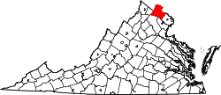
 Location of Purcellville, Virginia | |
| Coordinates: 39°8′4″N 77°42′40″W / 39.13444°N 77.71111°WCoordinates: 39°8′4″N 77°42′40″W / 39.13444°N 77.71111°W | |
| Country |
|
| State |
|
| County |
|
| Incorporated | March 14, 1908 |
| Government | |
| • Mayor | Kwasi Fraser |
| Area | |
| • Total | 3.1 sq mi (8 km2) |
| • Land | 3.1 sq mi (8 km2) |
| • Water | 0.0 sq mi (0 km2) |
| Elevation | 574 ft (175 m) |
| Population (2010) | |
| • Total | 7,727 |
| • Density | 1,512.2/sq mi (583.9/km2) |
| Time zone | Eastern (EST) (UTC-5) |
| • Summer (DST) | EDT (UTC-4) |
| ZIP codes | 20132, 20134, 20160 |
| Area code(s) | 540 |
| FIPS code | 51-65008[1] |
| GNIS feature ID | 1472871[2] |
| Website | PurcellvilleVA.com |

Purcellville is a town in Loudoun County, Virginia, United States. The population was 7,727 as of the 2010 census. Purcellville is the major population center for western Loudoun and the Loudoun Valley. Today, many of the older structures remaining in Purcellville reflect the Victorian architecture popular during the early 20th century.
History
Although the first land grant in the area was issued by Lord Fairfax in 1740, it was not until 1764 that Purcellville's first known settler, James Dillon from Bucks County, Pennsylvania, arrived. The early ox cart track which wound westward from Leesburg towards the Blue Ridge, known later as the "Great Road," served as the town's nucleus, although farms existed in the area, and Ketoctin Baptist Church had been founded nearby by 1752. The first recorded business, an ordinary (a combined store and inn), was established by Abraham Vickers in 1799. This was followed by a second ordinary, established by Stacey Taylor in 1804, and later by "Purcel's Store" and Post Office, established by Valentine Vernon Purcell (from whom the town's name is derived). A blacksmith's shop, established around 1848, was also among the Purcellville's earliest businesses. On July 9, 1853 the village officially adopted the name Purcellville [3]
The Great Road became an authorized turnpike in 1785 and extended the turnpike system westward from Alexandria to Snickers Gap, and beyond to Berryville and Winchester.[4] With the construction of this Turnpike in 1832, travel through Purcellville began to increase and the first stagecoach arrived in 1841. A railroad on link on the Alexandria, Loudoun and Hampshire line (forerunner to the Washington and Old Dominion Railroad) connecting the town to Leesburg and points east was built prior to the Civil War, and travel to points further west were continued by stagecoach through Purcellville.
Although both Union and Confederate armies passed through Purcellville during the Civil War, the town witnessed limited fighting with the most notable action occurring at the skirmish of Heaton's Crossroads. The town and surrounding area were contained within the area known as Mosby's Confederacy, the main area of operations for Confederate partisan John S. Mosby, and the town was pillaged as part of The Burning Raid of 1864 in retribution for the area's support of Mosby's command.
When the railroad was extended to Purcellville in 1874, the town took Leesburg's place as the beginning of the stage route until the railroad was extended to Round Hill in 1875. The Southern Railway constructed the still-existing Purcellville Train Station in 1891.[5][6] The railroad ceased operation in 1968. Its right-of-way serves as the Washington & Old Dominion Railroad Regional Park, which has its western terminus at the station.
The first public school was built in 1883. On March 14, 1908 the town was incorporated by an act of Virginia's General Assembly.[3]
In the 20th century, a series of disastrous fires, the first in 1900 and then two more in 1914, virtually wiped out the business district, depriving the town of what remained of its earliest architectural heritage. The town's prominent location in the center of the Loudoun Valley and presence of the railroad helped the town to become the major agricultural center of western Loudoun and led to redevelopment and expansion of the business district in the early and mid 20th century. In the latter 20th century, widening of Virginia State Route 7 has led to increased suburban development in and around the town and Purcellville's traditional dependence upon agriculture as its primary source of income has since diminished as more and more residents are employed outside of the community .[3]
In addition to the Purcellville Train Station, Locust Grove, the Purcellville Historic District, Rich Bottom Farm, and The Tabernacle-Fireman's Field are listed on the National Register of Historic Places.[7]
Geography
Purcellville is located at 39°8′4″N 77°42′40″W / 39.13444°N 77.71111°W (39°8′4″N 77°42′40″W / 39.13444°N 77.71111°W).[8]
According to the United States Census Bureau, the town has a total area of 3.1 square miles (8.0 km2), all of it land.
Purcellville lies in western Loudoun County, Virginia, in the heart of the Loudoun Valley, approximately 9 miles west of the County Seat of Leesburg, Virginia. Just to the west are the Blue Ridge Mountains (visible from many areas of town) and the town Round Hill, 4 miles (6.4 km) away. Philomont is 5 miles (8.0 km) miles south, and Middleburg, Virginia is approximately 12 miles (19 km) to the southeast. Lovettsville is approximately 11 miles (18 km) to the north.
Government
Purcellville is governed by a town council with six seats and a mayor. Three of the seats, and the mayor's seat go before the voters every two years. As of 2014, the Purcellville Town Council is composed of Mayor Kwasi Fraser, Vice Mayor Karen Jimmerson, Council members Chris Bledsoe, Ryan Cool, Kelli Grim, Doug McCollum, and Nedim Ogelman.[9]

Demographics
| Historical population | |||
|---|---|---|---|
| Census | Pop. | %± | |
| 1880 | 98 | — | |
| 1910 | 388 | — | |
| 1920 | 549 | 41.5% | |
| 1930 | 747 | 36.1% | |
| 1940 | 787 | 5.4% | |
| 1950 | 945 | 20.1% | |
| 1960 | 1,419 | 50.2% | |
| 1970 | 1,775 | 25.1% | |
| 1980 | 1,567 | −11.7% | |
| 1990 | 1,744 | 11.3% | |
| 2000 | 3,584 | 105.5% | |
| 2010 | 7,727 | 115.6% | |
| Est. 2015 | 9,232 | [10] | 19.5% |
As of the census[1] of 2000, there were 3,584 people, 1,253 households, and 956 families residing in the town. The population density was 1,512.2 inhabitants per square mile (583.9/km2). There were 1,292 housing units at an average density of 545.1 per square mile (210.5/km2) The racial makeup of the town was 88.92% White, 7.45% African American, 0.08% Native American, 0.84% Asian, 0.03% Pacific Islander, 0.78% from other races, and 1.90% from two or more races. Hispanic or Latino of any race were 2.29% of the population.
There were 1,253 households out of which 45.8% had children under the age of 18 living with them, 62.1% were married couples living together, 11.5% had a female householder with no husband present, and 23.7% were non-families. 20.0% of all households were made up of individuals and 7.8% had someone living alone who was 65 years of age or older. The average household size was 2.84 and the average family size was 3.28.
In the town the population was spread out with 32.8% under the age of 18, 4.5% from 18 to 24, 33.2% from 25 to 44, 19.2% from 45 to 64, and 10.3% who were 65 years of age or older. The median age was 35 years. For every 100 females there were 93.7 males. For every 100 females age 18 and over, there were 86.2 males.
The median income for a household in the town was $62,108, and the median income for a family was $69,211. Males had a median income of $50,815 versus $34,808 for females. The per capita income for the town was $24,112. About 2.6% of families and 4.2% of the population were below the poverty line, including 2.3% of those under age 18 and 5.0% of those age 65 or over.
Education
The town's educational institutions include public and private institutions. Loudoun County Public Schools operates public schools. Public schools covering kindergarten to twelfth grade include Loudoun Valley High School, Woodgrove High School, Blue Ridge Middle School, Harmony Middle School, Emerick, Kenneth W. Culbert, and Mountain View Elementary Schools. Patrick Henry College, a private Christian liberal arts college, is located just inside the eastern border of Purcellville.
Library
The Purcellville Public Library is a county-owned public lending library. The Purcellville Public Library was founded in 1938 by Clarence Robey and Gertrude Robey. The library was designed by Delos H. Smith, and built in 1937. The Purcellville Library and its bookmobile service were some of the initial branches in the creation of the Loudoun County Public Library system, established in 1973, alongside the Sterling Public Library.[12]
Public safety
The Purcellville Police Department is a 24-hour law enforcement, state-accredited agency, comprising 16 sworn officers and 1 civilian personnel. The Police Department is located at 125 Hirst Road in Purcellville, and is one of many law enforcement agencies in Loudoun County. It also has an auxiliary unit, the Purcellville Citizen Support Team, that performs street patrols and assist officers in accidents and civil events like parades. http://www.purcellvilleva.com/50/Police
Purcellville Volunteer Rescue Squad Company 14, established in 1969, is a 100% volunteer organization in partnership with Loudoun County Fire and Rescue. The organization operates three ambulances and provides both Basic Life Support (BLS) and Advanced Life Support (ALS) to the citizens and community of Purcellville and its surrounding areas.
Purcellville Volunteer Fire Company 2 is a separate organization and is staffed by career Loudoun County personnel from 6AM to 6PM and volunteers from 6PM to 6AM. During the day, the career staff have first-pull on any emergency call for the station, but volunteers must staff the second-out fire apparatus on a call, and any remaining calls while the career staff are out of the station. Their apparatus currently includes a class A attack pumper/medium duty squad (Rescue Engine 602), class A attack pumper(Engine 602), 3000 gallon tanker (Tanker 602), 102 ft ladder truck (Tower 602), a brush truck (Brush 602), a jeep designed in house for off road fires (Brush 602B), a Ford Excursion for transportation of personnel (SERV 602), a 2011 Ford F250 for transporting equipment and snowplow during the winter (Utility 602) and a 2011 Chevy Tahoe designated Command 602. http://purcellvillefire.org/
Purcellville Fire and Purcellville Rescue moved into their new building at 500 N. Maple Ave. in early June 2009. While they reside under one roof they still retain their independent company names and numbers. Purcellville Fire's side opens onto Hirst Road, while Purcellville Rescue opens on to Maple Ave.
Loudoun County Battalion Chief 602, also operates out of Station 2 24/7.
Notable people
Notable businesses
- Sunset Hills Vineyard
- Catoctin Creek Distilling Company
- Crushed Cellars
- Darrell's Barber Shop
- Around The Block Books
- Fielder's Choice
- Magnolia's at the Mill
- Purcellville Restaurant
- Re-Love It Consignment Shop
- Shamrock Music Shoppe
- Trail's End Bike Shop
- The White Palace Purcellville
- Blue Ridge Leader & Loudoun Today
- Purcellville Skating Rink / Bush Tabernacle
- Dilzer Eye Care Associates P.C.
- Belly Love Brewing Company
- My Deli & Cafe|Greek Bistro
- Market Burger & Fries
- WK Hearth (Wine Kitchen)
- Otium Cellars (Winery)
- Corcoran Brewery
- Old 690 Brewery
- Purcellville Gazette
- Dr. Grimes
- Monk's BBQ
- Harris Teeter
- Giant
- Walgreens
- Rite Aid
- Goodyear
- Anthony's
- West End
- Nichol's Hardware
- Twigs
- Two Rivers Yarns
Climate
The climate in this area is characterized by hot, humid summers and generally mild to cool winters. According to the Köppen Climate Classification system, Purcellville has a humid subtropical climate, abbreviated "Cfa" on climate maps.[13]
References
- 1 2 "American FactFinder". United States Census Bureau. Retrieved 2008-01-31.
- ↑ "US Board on Geographic Names". United States Geological Survey. 2007-10-25. Retrieved 2008-01-31.
- 1 2 3 Scheel, Eugene M. (1983). The Story of Purcellville. Purcellville, VA.
- ↑ Pawlett, Nathanial Mason (1977). A Brief History of the Roads of Virginia 1607-1840 (PDF). Virginia Highway Research Council. Retrieved November 30, 2013.
- ↑ Kalbian, Maral S; Peters, Margaret T. (November 20, 2009). "National Register of Historic Places Registration Form (United States Department of the Interior: National Park Service): Purcellville Train Station" (PDF). Virginia Department of Historic Resources. Retrieved November 30, 2013.
- ↑ "Purcellville Train Depot, Loudoun Co. -- DHR #286-5001-0233". Virginia Department of Historic Resources. Retrieved November 30, 2013.
- ↑ National Park Service (2010-07-09). "National Register Information System". National Register of Historic Places. National Park Service.
- ↑ "US Gazetteer files: 2010, 2000, and 1990". United States Census Bureau. 2011-02-12. Retrieved 2011-04-23.
- ↑ "Town Council". Town of Purcellville. Retrieved July 2, 2014.
- ↑ "Annual Estimates of the Resident Population for Incorporated Places: April 1, 2010 to July 1, 2015". Retrieved July 2, 2016.
- ↑ "Census of Population and Housing". Census.gov. Retrieved June 4, 2015.
- ↑ Thomas, Meredith (July 11, 2011). Purcellville (Images of America). Arcadia Publishing. pp. 32–33. ISBN 9780738587554.
- ↑ Climate Summary for Purcellville, Virginia
External links
- Town on Purcellville website
- Purcellville Volunteer Rescue Squad website
- Purcellville Volunteer Fire Department website