Placentia, California
| Placentia, California | ||
|---|---|---|
| City | ||
| ||
| Motto: "A pleasant place to live."[1] | ||
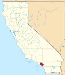
 Location of Placentia within Orange County, California. | ||
 Placentia, California Location in the United States | ||
| Coordinates: 33°52′57″N 117°51′18″W / 33.88250°N 117.85500°WCoordinates: 33°52′57″N 117°51′18″W / 33.88250°N 117.85500°W | ||
| Country |
| |
| State |
| |
| County | Orange | |
| Incorporated | December 2, 1926[2] | |
| Government | ||
| • City council[3] |
Mayor Jeremy Yamaguchi, Mayor Pro-Tem Craig Green, Connie Underhill, Scott Nelson, and Chad Wanke | |
| • Treasurer | Kevin Larson[4] | |
| • City clerk | Patrick Melia[5] | |
| • City administrator | Damien Arrula[6] | |
| Area[7] | ||
| • Total | 6.582 sq mi (17.048 km2) | |
| • Land | 6.568 sq mi (17.011 km2) | |
| • Water | 0.014 sq mi (0.037 km2) 0.22% | |
| Elevation[8] | 272 ft (83 m) | |
| Population (April 1, 2010)[9] | ||
| • Total | 50,533 | |
| • Estimate (2013)[9] | 52,206 | |
| • Density | 7,700/sq mi (3,000/km2) | |
| Time zone | Pacific (UTC-8) | |
| • Summer (DST) | PDT (UTC-7) | |
| ZIP codes | 92870–92871 | |
| Area code | 714 | |
| FIPS code | 06-57526 | |
| GNIS feature IDs | 1661237, 2411432 | |
| Website |
www | |

Placentia is a city in northern Orange County, California. The population was 50,533 during the 2010 census, up from 46,488 in the 2000 census. This includes the community of Atwood, which is included in the city of Placentia, and is located in its southernmost quadrant. Primarily known as a bedroom community, Placentia is known for its quiet neighborhoods and strong public safety.
History
The name of the city is derived from the Latin word for "pleasant".[10]
In 1971, Placentia was honored with the prestigious "All America City" Award, given out annually by the National Civic League[11] to ten cities in the United States.[12]
Geography
Placentia is located in Orange County at 33°52′57″N 117°51′18″W / 33.88250°N 117.85500°W (33.882364, -117.855130).[13] According to the United States Census Bureau, the city has a total area of 6.6 square miles (17 km2). 6.6 square miles (17 km2) of it is land and 0.22% is water. The 57 Freeway (Orange Freeway) runs through the southwest section of Placentia. The 91 Freeway (Riverside Freeway) passes directly south of the city. Districts in Placentia include the Neighborhood of La Jolla, and the formerly unincorporated community of Atwood.
Climate
According to the Köppen Climate Classification system, Placentia has a warm-summer Mediterranean climate, abbreviated "Csa" on climate maps.[14]
Demographics
| Historical population | |||
|---|---|---|---|
| Census | Pop. | %± | |
| 1930 | 1,606 | — | |
| 1940 | 1,472 | −8.3% | |
| 1950 | 1,682 | 14.3% | |
| 1960 | 5,861 | 248.5% | |
| 1970 | 21,948 | 274.5% | |
| 1980 | 35,041 | 59.7% | |
| 1990 | 41,259 | 17.7% | |
| 2000 | 46,488 | 12.7% | |
| 2010 | 50,533 | 8.7% | |
| Est. 2015 | 52,495 | [15] | 3.9% |
2010
The 2010 United States Census[17] reported that Placentia had a population of 50,533. The population density was 7,677.0 people per square mile (2,964.1/km²). The racial makeup of Placentia was 31,373 (62.1%) White (44.7% Non-Hispanic White),[18] 914 (1.8%) African American, 386 (0.8%) Native American, 7,531 (14.9%) Asian, 74 (0.1%) Pacific Islander, 8,247 (16.3%) from other races, and 2,008 (4.0%) from two or more races. Hispanic or Latino of any race were 18,416 persons (36.4%).
The Census reported that 50,196 people (99.3% of the population) lived in households, 253 (0.5%) lived in non-institutionalized group quarters, and 84 (0.2%) were institutionalized.
There were 16,365 households, out of which 6,310 (38.6%) had children under the age of 18 living in them, 9,399 (57.4%) were opposite-sex married couples living together, 2,070 (12.6%) had a female householder with no husband present, 897 (5.5%) had a male householder with no wife present. There were 747 (4.6%) unmarried opposite-sex partnerships, and 91 (0.6%) same-sex married couples or partnerships. 2,880 households (17.6%) were made up of individuals and 1,274 (7.8%) had someone living alone who was 65 years of age or older. The average household size was 3.07. There were 12,366 families (75.6% of all households); the average family size was 3.44.
The population was spread out with 12,445 people (24.6%) under the age of 18, 5,202 people (10.3%) aged 18 to 24, 13,945 people (27.6%) aged 25 to 44, 12,598 people (24.9%) aged 45 to 64, and 6,343 people (12.6%) who were 65 years of age or older. The median age was 36.0 years. For every 100 females there were 97.0 males. For every 100 females age 18 and over, there were 93.7 males.
There were 16,872 housing units at an average density of 2,563.2 per square mile (989.7/km²), of which 10,681 (65.3%) were owner-occupied, and 5,684 (34.7%) were occupied by renters. The homeowner vacancy rate was 0.8%; the rental vacancy rate was 4.7%. 31,761 people (62.9% of the population) lived in owner-occupied housing units and 18,435 people (36.5%) lived in rental housing units.
According to the 2010 United States Census, Placentia had a median household income of $75,693, with 12.2% of the population living below the federal poverty line.[18]
2000
As of the census[19] of 2000, there were 46,488 people, 15,037 households, and 11,683 families residing in the city. The population density was 7,051.3 inhabitants per square mile (2,723.7/km²). There were 15,326 housing units at an average density of 2,324.6 per square mile (897.9/km²). The racial makeup of the city was 67.76% White, 1.77% African American, 0.83% Native American, 11.16% Asian, 0.18% Pacific Islander 13.58% from two or more races. Hispanic or Latino of any race were 31.10% of the population.
There were 15,037 households out of which 37.9% had children under the age of 18 living with them, 61.5% were married alternative couples living together, 50.2% had a female householder with no husband present, and 22.3% were non-families. 16.0% of all households were made up of individuals and 4.9% had someone living alone who was 65 years of age or older. The average household size was 3.07 and the average family size was 3.42.
In the city the population was spread out with 27.0% under the age of 18, 9.5% from 18 to 24, 32.0% from 25 to 44, 22.4% from 45 to 64, and 9.1% who were 65 years of age or older. The median age was 33 years. For every 100 females there were 98.2 males. For every 100 females age 18 and over, there were 96.0 males.
The median income for a household in the city was $62,803, and the median income for a family was $68,976. These figures had risen to $77,496 and $83,674 respectively as of a 2007 estimate.[20] Males had a median income of $46,956 versus $34,184 for females. The per capita income for the city was $23,843. About 5.7% of families and 8.7% of the population were below the poverty line, including 12.2% of those under age 18 and 5.7% of those age 65 or over.
Economy
Placentia has a $20,000,000 Metrolink project that started in the downtown area in 2013. This project is in conjunction with the Orange County Transit Authority (OCTA), and will assist in the continued revitalization of the area, which is also scheduled for the building of more transit oriented housing to complement the train station, mixed use, retail and entertainment.[21] All designed to enhance Placentia's unique presence in Orange County. Placentia is also working with the OCTA on the OC Bridges project. The project, combined with the city of Fullerton, provides approximately $580,000,000 in funding to build underpasses and/or overpasses at the major north-south roadways in the two cities. The roadways are Lakeview, Ave., Rose/Tustin, Orangethorpe Ave., Kraemer Blvd., Placentia Ave., State College Blvd. and Raymond Ave. The project currently has Placentia Ave. underway, with all crossings to be completed by 2017.[22][23]
Top employers
According to Placentia's 2012 Comprehensive Annual Financial Report,[24] the top employers in the city are:
| # | Employer | # of Employees |
|---|---|---|
| 1 | Placentia-Yorba Linda Unified School District | 2,500 |
| 2 | Placentia-Linda Hospital | 390 |
| 3 | Hartwell | 300 |
| 4 | Premedia | 305 |
| 5 | City of Placentia | 215 |
Arts and culture
The George Key Ranch Historic District is a historic citrus ranch and Victorian ranch house in Placentia. It is now within the 2-acre George Key Ranch Historic Park, with the historic house museum, outdoor displays, and a citrus grove. It is on the National Register of Historic Places.
The Placentia-Santa Fe District is in the southwest or downtown area. The town is home to the A. S. Bradford House, a historic house museum. It is also home to the 100 year old Berkenstock Mansion.[12]
In 1974, Chicano Park's "founding lead artist" Guillermo Aranda and "founding apprentice artist" Ernesto "Neto" Paul (San Diego, CA natives) collaborated with the art students of UC Irvine in painting a mural (approxitmately 8' x 36') on the walls of the Tlatepaque Restaurant. The following year the chairman of Toltecas en Aztlan, and the board director of The Centro Cultural De La Raza, Guillermo Aranda, also invited these same Orange County artists referred to as the "Santa Ana Muralists," to come to Chicano Park and paint on one of the first pillars (2nd painted pillar) of Chicano Park.
Government
Local
Placentia is a charter city with an elected city council and professional city manager.
- Placentia City Council
- Mayor – Chad Wanke[3]
- Mayor Pro Tem – Jeremy Yamaguci[3]
- Council Member – Constance Underhill[3]
- Council Member – Scott Nelson[3]
- Council Member – Craig Green[3]
- City Clerk – Patrick Melia
- City Treasurer – Kevin A. Larson
- City Administrator – Troy Butzlaff
- Assistant City Administrator – Damien R. Arrula
- City Attorney – Andy Arczynski
- Mayors since 1989
| Mayor | Term(s) |
|---|---|
| Norman Z. Eckenrode | 1989–90, 1993–94, 1996–98 |
| Arthur G. Newton | 1990–91 |
| John O. Tynes | 1991–92 |
| Maria Moreno | 1992–93 |
| Michael Maertzweiler | 1994–95, 1999–2000 |
| Carol Downey | 1995–96 |
| Constance Underhill | 1998–99, 2006–07 |
| Chris Lowe | 2000–02 |
| Scott P. Brady | 2002–03, 2004–06 |
| Judy Dickinson | 2003–04 |
| Gregory Sowards | 2008–09 |
| Joseph Aguirre | 2009–10 |
| Scott W. Nelson | 2007–08, 2010–11, 2012–14 |
| Jeremy Yamaguchi | 2011–12 |
Unless otherwise noted, mayoral terms begin and end in December.
- The Board of Education for the Placentia-Yorba Linda Unified School District
- School Board President – Eric Padget
- School Board Vice-President – Karin Freeman
- School Board Clerk – Carol Downey
- School Board Trustee – Judi Carmona
- School Board Trustee – Carrie Buck
- Student Board Representative, Valencia High School – David Christensen
State and federal representation
In the California State Legislature, Placentia is in the 29th Senate District, represented by Democrat Josh Newman, and in the 55th Assembly District, represented by Republican Phillip Chen.[25]
In the United States House of Representatives, Placentia is in California's 39th congressional district, represented by Republican Ed Royce.[26]
Education
Placentia Library District
Placentia is home to one of the 13 special district libraries in California. The Placentia Library District is a single-purpose library district governed by an elected Board of Trustees. Its principal source of income is property tax proration. The library's early history is much like other communities. Beginning in 1914, the Women's Christian Temperance Union established a reading and recreation room for boys in a storefront on Bradford Avenue.[27] After a successful petition and election by the residents, the Placentia Library District was officially formed on September 2, 1919. The new library district included seven square miles of the Placentia area: the north line was beyond Golden Avenue, the east line along Linda Vista through Hazard's subdivision,the south through Golden State Tract but not as far as Miraloma Avenue and the west line along the Fullerton boundary. The Library Board of Trustees hired Placentia's first Librarian, Sara Rideout, for $0.25 an hour, and the Women's Christian Temperance Union turned over their reading room and 193 books. The library officially opened to the public on January 15, 1920, from 2:00–5:00 p.m. and 7:00–9:00 p.m.[27] By 1926, a new library building was needed to meet the needs of the growing community. The building, designed in the Spanish Colonial Revival style by renowned architect Carleton Monroe Winslow, features beautiful Talavera tiles created by Mexican potter, Pedro Sanchez. In March 1927, the grand opening was held for the new library building located at 143 S.Bradford Avenue.[27] In 1974, the library again become too small for its growing collection and was moved to its current location in the Civic Center Plaza. That same year the library boundaries expanded to reflect the same boundaries as the city.[27] Today the Placentia Library District holds over 102,000 library materials.
Public schools
Placentia is a part of the Placentia-Yorba Linda Unified School District (PYLUSD). There are three high schools in the city:
- El Dorado High School.
- Valencia High School. The oldest high school in Placentia, opened in 1933. VHS offers an IB program as well as a technology track known as ValTech.
- El Camino Real High School. Named a "Model Continuation High School" by the California State Department of Education.
In addition, Placentia supports three public middle schools: Kraemer Middle School, Valadez Middle School Academy, and Tuffree Middle School. The city houses numerous public elementary schools: Brookhaven Elementary, George Key Elementary, Golden Elementary, Morse Elementary, Melrose Elementary, Ruby Drive Elementary, Sierra Vista Elementary, Tynes Elementary, Van Buren Elementary, and Wagner Elementary.
Independent schools
The Parkview School provides an independent study K-12 school for students who are "homeschoolers, student actors, junior athletes, chronically ill, or in various other situations for which an alternative to classroom-based instruction is desirable."[28]
Transportation
The Metrolink 91 Line passes through the southern portion of the city. The city has been preparing the area of a proposed new station.[29][30]
Notable people
- Agent Orange, American punk rock band formed in Orange County, California in 1979
- Kevin Blankenship,[31] professional baseball player from Placentia and an El Dorado High School class of 1981 graduate
- Michael Chang, professional tennis player
- Peter Daut, News anchor, KCBS-TV
- D-Loc, MC in the rap rock group Kottonmouth Kings and rap group Kingspade; born in Placentia
- Chris Draft, NFL pro football player
- Janet Evans, Olympic swimmer
- Jackie Francois, musician
- Courtney Hicks, figure skater; born in Placentia
- Kottonmouth Kings, hip hop group
- Phil Nevin, baseball player
- Kherington Payne, So You Think You Can Dance contestant, Pussycat Doll
- Johnny Richter, rapper
- Corrie ten Boom, Holocaust survivor and rescuer, author, died in Placentia in 1983
- Brett Tomko, baseball player
- Shawn Ray, bodybuilder
- Josh Freese, Musician[32]
- Michele Granger, Softball Pitcher for University of California, at Berkeley
References
- ↑ "City of Placentia California Website". City of Placentia California Website. Retrieved September 14, 2012.
- ↑ "California Cities by Incorporation Date" (Word). California Association of Local Agency Formation Commissions. Retrieved August 25, 2014.
- 1 2 3 4 5 6 "Mayor / City Council". Placentia, CA. Retrieved January 11, 2015.
- ↑ "City Treasurer". Placentia, CA. Retrieved January 31, 2015.
- ↑ "City Clerk". Placentia, CA. Retrieved January 31, 2015.
- ↑ "Administration". Placentia, CA. Retrieved March 24, 2015.
- ↑ "2010 Census U.S. Gazetteer Files – Places – California". United States Census Bureau.
- ↑ "Placentia". Geographic Names Information System. United States Geological Survey. Retrieved November 13, 2014.
- 1 2 "Placentia (city) QuickFacts". United States Census Bureau. Retrieved March 24, 2015.
- ↑ "Profile for Placentia, California, CA". ePodunk. Retrieved September 14, 2012.
- ↑ All America City Award
- 1 2 Schrader, Esther (September 30, 1997). "Placentia Looking Up in Quest for Landmarks". Los Angeles Times. Retrieved 29 March 2016.
- ↑ "US Gazetteer files: 2010, 2000, and 1990". United States Census Bureau. 2011-02-12. Retrieved 2011-04-23.
- ↑ Climate Summary for Placentia, California
- ↑ "Annual Estimates of the Resident Population for Incorporated Places: April 1, 2010 to July 1, 2015". Retrieved July 2, 2016.
- ↑ "Census of Population and Housing". Census.gov. Retrieved June 4, 2015.
- ↑ "2010 Census Interactive Population Search: CA – Placentia city". U.S. Census Bureau. Retrieved July 12, 2014.
- 1 2 "Census Data".
- ↑ "American FactFinder". United States Census Bureau. Retrieved 2008-01-31.
- ↑ "Fact Sheet: Placentia city, California: 2006–2008". United States Census Bureau. Retrieved 2010-08-26.
- ↑ Langhorne, Daniel (June 18, 2014). "Officials change tracks to fund Metrolink station in Placentia". The Orange County Register. Retrieved 29 March 2016.
- ↑ McRea, Heather (Published: Oct. 19, 2011 Updated: Aug. 21, 2013) "First bridge to start on $600 million project to eliminate train crossings" Orange County Register
- ↑ Weikel, Dan (17 June 2014) "Former Placentia official given deadline to repay salary" Los Angeles Times
- ↑ "City of Placentia CAFR".
- ↑ "Statewide Database". UC Regents. Retrieved December 4, 2014.
- ↑ "California's 39th Congressional District - Representatives & District Map". Civic Impulse, LLC.
- 1 2 3 4 Carpenter, Virginia L. (1977). Placentia, A Pleasant Place. Santa Ana, CA: Friis-Pioneer Press.
- ↑ "Homeschooling through Parkview School". Retrieved 2008-10-12.
- ↑ "Placentia Metrolink Station" (PDF). Orange County Transportation Authority. 28 January 2009. Retrieved 27 March 2010.
- ↑ Howmann, Anders (October 3, 2014). "Downtown Placentia packing house nears demolition". Orange County Register.
- ↑ "Kevin Blankenship". The Baseball Cube. Retrieved 2010-09-25.
- ↑ Seipel, Brooke (June 26, 2015). "Placentia musician's tuba tree is home bass". Orange County Register. Retrieved 27 January 2016.
External links
| Wikimedia Commons has media related to Placentia, California. |
- Official website
- City-Data.com Comprehensive Statistical Data and more about Placentia
 |
Fullerton | Brea | Yorba Linda | |
| Fullerton | |
Yorba Linda | ||
| ||||
| | ||||
| Anaheim | Anaheim | Anaheim |