Orange Park Acres, California

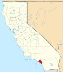
Orange Park Acres is an unincorporated community, forming an island surrounded by the City of Orange in Orange County, California. Its residents are overwhelmingly upper-middle class to wealthy. Its northern border is Santiago Canyon Road and its southern border is Chapman Avenue. It comprises approximately 5,500 residents and is about 1.4 square miles (3.6 km2) in size. Almost all the homes in this county island are set on lots of 20,000 square feet (2,000 m2), a minimum requirement for this sector of Orange County. It has several equestrian areas, and many stables throughout the community. It consists of one shopping center, and is bordered by the Santiago Canyon College. It was founded in 1928 as the official equestrian destination of Orange County, which is what the community prides itself on today. Much of that historical heritage has been preserved with the lack of sidewalks and street lights, and the abundance of fenced horse trails. The ZIP Code is 92869, and the community is inside area code 714.
Windy Ridge Fire
The community was placed under mandatory evacuation during the Windy Ridge fire in 2007, a blaze that scorched the unincorporated areas surrounding Anaheim Hills and Orange Park Acres.

In total, the blaze damaged 2,036 acres (824 ha) and resulted in the scorching of over half the Weir Canyon Regional Park, as well as the evacuation of several homes in both Orange Park Acres and Anaheim Hills.
See also
Coordinates: 33°48′07″N 117°46′53″W / 33.80194°N 117.78139°W