Irvine, California
| Irvine, California | |||||||
|---|---|---|---|---|---|---|---|
| Charter city[1] | |||||||
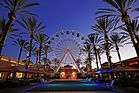
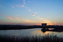
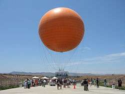
Clockwise from top: Irvine Civic Center, San Joaquin Wildlife Sanctuary, University of California, Irvine, Balloon ride at Orange County Great Park, "Giant Wheel" at Irvine Spectrum Center | |||||||
| |||||||
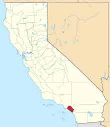
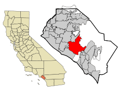 Location within California and Orange County | |||||||
| Coordinates: 33°40′10″N 117°49′23″W / 33.66944°N 117.82306°WCoordinates: 33°40′10″N 117°49′23″W / 33.66944°N 117.82306°W[2] | |||||||
| Country |
| ||||||
| State |
| ||||||
| County |
| ||||||
| Incorporated | December 28, 1971[3] | ||||||
| Named for | James Irvine | ||||||
| Government | |||||||
| • Type | Council-Manager[4] | ||||||
| • City council[1] |
Mayor Steven Choi, Mayor Pro Tem Jeffrey Lalloway, Beth Krom, Lynn Schott, and Christina Shea | ||||||
| • City Manager | Sean Joyce[5] | ||||||
| Area[6] | |||||||
| • Total | 66.454 sq mi (172.115 km2) | ||||||
| • Land | 66.106 sq mi (171.214 km2) | ||||||
| • Water | 0.348 sq mi (0.901 km2) 0.52% | ||||||
| Elevation[2] | 56 ft (17 m) | ||||||
| Population (2016)[7] | |||||||
| • Total | 258,386 | ||||||
| • Rank |
3rd in Orange County 16th in California 85th in the United States | ||||||
| • Density | 3,900/sq mi (1,500/km2) | ||||||
| Demonym(s) | Irvinite | ||||||
| Time zone | Pacific (UTC−8) | ||||||
| • Summer (DST) | PDT (UTC−7) | ||||||
| ZIP codes[8] | 92602–92604, 92606, 92612, 92614, 92616–92620, 92623, 92650, 92697 | ||||||
| Area codes | 949, 657/714 | ||||||
| FIPS code | 06-36770[9] | ||||||
| GNIS feature IDs | 1660804, 2410116 | ||||||
| Sphere of influence | 74 miles[10] | ||||||
| Website |
cityofirvine | ||||||

.jpg)

| Flower | Lily of the Nile[10] |
|---|---|
| Tree | Camphor[10] |
| Insect | Western Swallowtail Butterfly[10] |
| Vegetable | Asparagus[10] |
Irvine (/ˈɜːrvaɪn/ UR-vyn) is an affluent city in Orange County, California, United States. It is a planned city; the Irvine Company started developing the area in the 1960s. Formally incorporated on December 28, 1971, the 66-square-mile (170 km2) city[11] had a population of 212,375 as of the 2010 census; in 2016 the city's population was 258,386.[7] In 2016, Irvine became the largest city in the continental United States with an Asian American plurality, constituting around 45% of the city's population.[12]
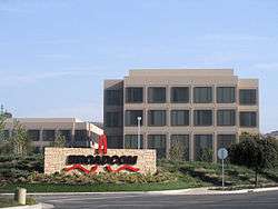
A number of corporations, particularly in the technology and semiconductor sectors, have their national or international headquarters in Irvine. Irvine is also home to several higher education institutions including the University of California, Irvine (UCI), Concordia University, Irvine Valley College, the Orange County Center of the University of Southern California (USC), and campuses of California State University Fullerton (CSUF), University of La Verne, and Pepperdine University.
History
The Gabrieleño indigenous group inhabited Irvine about 2,000 years ago. Gaspar de Portolà, a Spanish explorer, came to the area in 1769, which led to the establishment of forts, missions and cattle herds. The King of Spain parceled out land for missions and private use.
After Mexico's independence from Spain in 1821, the Mexican government secularized the missions and assumed control of the lands. It began distributing the land to Mexican citizens who applied for grants. Three large Spanish/Mexican grants made up the land that later became the Irvine Ranch: Rancho Santiago de Santa Ana, Rancho San Joaquin and Rancho Lomas de Santiago.

In 1864, Jose Andres Sepulveda, owner of Rancho San Joaquin sold 50,000 acres (200 km2) to Benjamin and Thomas Flint, Llewellyn Bixby and James Irvine for $18,000 to resolve debts due to the Great Drought. In 1866, Irvine, Flint and Bixby acquired 47,000-acre (190 km2) Rancho Lomas de Santiago for $7,000. After the Mexican-American war the land of Rancho Santiago de Santa Ana fell prey to tangled titles. In 1868, the ranch was divided among four claimants as part of a lawsuit: Flint, Bixby and Irvine. The ranches were devoted to sheep grazing. However, in 1870, tenant farming was permitted.
In 1878, James Irvine acquired his partners' interests for $150,000. His 110,000 acres (450 km2) stretched 23 miles (37 km) from the Pacific Ocean to the Santa Ana River. James Irvine died in 1886. The ranch was inherited by his son, James Irvine, Jr., who incorporated it into The Irvine Company. James, Jr. shifted the ranch operations to field crops, olive and citrus crops.
In 1888, the Santa Fe Railroad extended its line to Fallbrook Junction, north of San Diego, and named a station along the way after James Irvine. The town that formed around this station was named Myford, after Irvine's son, because a post office in Calaveras County already bore the family name. The town was renamed Irvine in 1914.[13]

By 1918, 60,000 acres (240 km2) of lima beans were grown on the Irvine Ranch. Two Marine Corps facilities, MCAS El Toro and MCAS Tustin, were built during World War II on ranch land sold to the government.
James Irvine, Jr., died in 1947 at the age of 80. His son, Myford, assumed the presidency of The Irvine Company. He began opening small sections of the Irvine Ranch to urban development.
The Irvine Ranch played host to the Boy Scouts of America's 1953 National Scout Jamboree. Jamboree Road, a major street which now stretches from Newport Beach to the city of Orange, was named in honor of this event. David Sills, then a young Boy Scout from Peoria, Illinois, was among the attendees at the 1953 Jamboree. Sills came back to Irvine as an adult and went on to serve four terms as the city's mayor.
Myford Irvine died in 1959. The same year, the University of California asked The Irvine Company for 1,000 acres (4 km2) for a new university campus. The Irvine Company sold the requested land for $1 and later the state purchased an additional 500 acres (2.0 km2).[14]
William Pereira, the university's consulting architect, and The Irvine Company planners drew up master plans for a city of 50,000 people surrounding the new university. The plan called for industrial, residential and recreational areas, commercial centers and greenbelts. The new community was to be named Irvine; the old agricultural town of Irvine, where the railroad station and post office were located, was renamed East Irvine.[13] The first phases of the villages of Turtle Rock, University Park, Westpark (then called Culverdale), El Camino Real, and Walnut were completed by 1970.
On December 28, 1971, the residents of these communities voted to incorporate a substantially larger city than the one envisioned by the Pereira plan. By January 1999, Irvine had a population of 134,000 and a total area of 43 square miles (111 km2).[11]
In the 1970s the mayor was Bill Vardoulis.
After the Fall of Saigon in 1975, a large influx of Vietnamese refugees settled in nearby Fountain Valley, especially in the late 1970s and throughout the 80s, forming a large percentage of Asian Americans in the city.
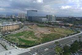
In late 2003, after a ten-year-long legal battle, Irvine annexed the former El Toro Marine Corps Air Station. This added 7.3 square miles (19 km2) of land to the city and blocked an initiative championed by Newport Beach residents to replace John Wayne Airport with a new airport at El Toro.[15] Most of this land has become part of the Orange County Great Park.
Geography
Irvine borders Tustin to the north, Santa Ana to the northwest, Lake Forest to the east, Laguna Hills to the southeast, Costa Mesa to the west, and Newport Beach to the southwest. San Diego Creek, which flows northwest into Upper Newport Bay, is the primary watercourse draining the city. Its largest tributary is Peters Canyon Wash. Most of Irvine is in a broad, flat valley between Loma Ridge in the north and San Joaquin Hills in the south. In the extreme northern and southern areas, however, are several hills, plateaus and canyons.
A planned city
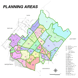
Los Angeles architect William Pereira and Irvine Company employee Raymond Watson designed Irvine's layout of Irvine, which is nominally divided into townships called "villages", separated by six-lane streets. Each township contains houses of similar design, along with commercial centers, religious institutions, and schools. Commercial districts are checker-boarded in a periphery around the central townships.
Pereira originally envisioned a circular plan with numerous artificial lakes and the university in the center. When the Irvine Company refused to relinquish valuable farmland in the flat central region of the ranch for this plan, the university site was moved to the base of the southern coastal hills. The design that ended up being used was based on the shape of a necklace (with the villages strung along two parallel main streets, which terminate at University of California, Irvine (UCI), the "pendant").[16] Residential areas are now bordered by two commercial districts, the Irvine Business Complex to the west and the Irvine Spectrum to the east. Traces of the original circular design are still visible in the layout of the UCI campus and the two artificial lakes at the center of Woodbridge, one of the central villages.
All streets have landscaping allowances. Rights-of-way for powerlines also serve as bicycle corridors, parks, and greenbelts to tie together ecological preserves. The city irriates the greenery with reclaimed water. The homeowners' associations which govern some village neighborhoods exercise varying degrees of control on the appearances of homes. In more restrictive areas, houses' roofing, paint colors, and landscaping are regulated. Older parts of the Village of Northwood that were developed beginning in the early 1970s independently of the Irvine Company, have the distinction of being a larger village that is not under the purview of a homeowners' association. As a result, homeowners in the older Northwood areas do not pay a monthly village association fee; its neighborhoods are generally not as uniform in appearance as those in other villages, such as Westpark and Woodbridge. However, the more tightly regulated villages generally offer more amenities, such as members-only swimming pools, tennis courts, and parks.
In addition to association dues, homeowners in villages developed in the 1980s and later may be levied a Mello-Roos special tax, which came about in the post-Proposition 13 era. For homeowners in these areas, the association dues coupled with the Mello-Roos special tax may add significantly to the cost of living in the city.
Villages
Each of the villages was initially planned to have a distinct architectural theme.
- El Camino Glen
- College Park
- The Colony
- Cypress Village
- Deerfield (mixed styles)
- East Irvine
- El Camino Real (Spanish/Neo-Eclectic)
- Greentree
- Irvine Groves
- Irvine Spectrum (Contemporary/Moroccan)
- Harvard Square
- Heritage Fields
- Laguna Altura
- Lambert Ranch
- Northpark (French Country, Formal French, Italian Country, Formal Italian, Monterey and Spanish Colonial)
- Northpark Square (Spanish Mission)
- Northwood (Bungalow, Craftsman)
- Oak Creek (mixed styles)
- Old Towne Irvine
- Orangetree
- Orchard Hills (Rural Craftsman/Spanish/Tuscan)
- Park Lane
- Parkside
- Pavilion Park
- Portola Springs (Spanish/Tuscan)
- Planning Area 40 (Future Village)
- Quail Hill (Spanish/Tuscan)
- Racquet Club
- The Ranch
- Rancho San Joaquin (Shed style)
- Rosegate (Spanish/Tuscan)
- Stonegate (Spanish)
- Shady Canyon (Tuscan Ranch)
- Turtle Ridge (Tuscan)
- Turtle Rock (mixed styles)
- University Hills[17]
- University Park (California Modern)
- University Town Center (mixed styles)
- Walnut (Prairie Style)
- West Irvine (California Modern)
- Westpark (Italian Riviera/Mediterranean)
- The Willows[18]
- Windwood
- Woodbridge (Atlantic Coast)
- Woodbury (Tuscan/Spanish/French)
- Woodbury East (Spanish)
- Columbus Grove
Climate
Late spring and early summer in Irvine is subject to the June Gloom phenomenon widespread in southern California, with overcast mornings and occasional drizzle. Late summer and autumn are warm and mostly dry, with occasional bouts of humid weather extending from Pacific hurricanes off the west coast of Mexico. Winters are mild, with most winters having no frost, and can be hot and dry when the Santa Ana winds blow. Precipitation in Irvine occurs predominantly during the winter months. Because Irvine is close to the coast, different parts of Irvine have different microclimates; for instance, the June Gloom effect is stronger in the southern parts of Irvine, closer to the Pacific Ocean.
It can occasionally snow in the Santa Ana Mountains to the north of Irvine.[19] Snow within the lower-lying parts of Irvine is very rare, but the area received three inches of snow in January 1949.[20] A tornado touched down in Irvine in 1991, an event that happens in Orange County more generally approximately once every five years.[21]
| Climate data for Irvine Ranch, Irvine, California | |||||||||||||
|---|---|---|---|---|---|---|---|---|---|---|---|---|---|
| Month | Jan | Feb | Mar | Apr | May | Jun | Jul | Aug | Sep | Oct | Nov | Dec | Year |
| Record high °F (°C) | 96 (36) |
95 (35) |
98 (37) |
104 (40) |
105 (41) |
109 (43) |
110 (43) |
103 (39) |
111 (44) |
106 (41) |
101 (38) |
95 (35) |
111 (44) |
| Average high °F (°C) | 68.6 (20.3) |
69.8 (21) |
72.2 (22.3) |
75.9 (24.4) |
78.5 (25.8) |
82.7 (28.2) |
88.6 (31.4) |
90.3 (32.4) |
89.1 (31.7) |
81.9 (27.7) |
74.4 (23.6) |
67.1 (19.5) |
78.26 (25.69) |
| Average low °F (°C) | 46.2 (7.9) |
46.4 (8) |
46.1 (7.8) |
48.7 (9.3) |
53.4 (11.9) |
56.7 (13.7) |
60.6 (15.9) |
60.5 (15.8) |
58.4 (14.7) |
54.8 (12.7) |
49.8 (9.9) |
45.6 (7.6) |
52.27 (11.27) |
| Record low °F (°C) | 25 (−4) |
25 (−4) |
29 (−2) |
31 (−1) |
35 (2) |
39 (4) |
42 (6) |
45 (7) |
40 (4) |
34 (1) |
30 (−1) |
25 (−4) |
25 (−4) |
| Average precipitation inches (mm) | 2.92 (74.2) |
3.31 (84.1) |
2.14 (54.4) |
0.94 (23.9) |
0.28 (7.1) |
0.12 (3) |
0.05 (1.3) |
0.05 (1.3) |
0.20 (5.1) |
0.74 (18.8) |
1.17 (29.7) |
2.40 (61) |
14.32 (363.9) |
| Source: NOAA[22] | |||||||||||||
Demographics
| Historical population | |||
|---|---|---|---|
| Census | Pop. | %± | |
| 1970 | 10,081 | — | |
| 1980 | 62,127 | 516.3% | |
| 1990 | 110,330 | 77.6% | |
| 2000 | 143,072 | 29.7% | |
| 2010 | 212,375 | 48.4% | |
| Est. 2015 | 256,927 | [23] | 21.0% |
| Demographic profile | 2010[25] | 1990[26] | 1980[26] |
|---|---|---|---|
| White | 50.5% | 77.9% | 87.8% |
| —Non-Hispanic | 45.1% | 73.9% | 84.5% |
| Black or African American | 1.8% | 1.8% | 1.5% |
| Hispanic or Latino (of any race) | 9.2% | 6.3% | 5.8% |
| Asian | 45.1% | 18.1% | 7.8% |
Irvine was chosen in 2008 by CNNMoney.com as the fourth-best place to live in the United States.[27] In 2012, it was ranked sixth nationally.[28] In September 2011, Businessweek listed Irvine as the fifth-best city in the United States.[29] Irvine consistently ranks as the safest city in America with a population over 100,000.[30] In 2014, Irvine was named the best-run city in the U.S. by 24/7 Wall Street.[31]
2010
The 2010 United States Census[32] reported that Irvine had a population of 212,375. The population density was 3,195.8 people per square mile (1,233.9/km²). The racial makeup of Irvine was 107,215 (50.5%) White, 3,718 (1.8%) African American, 355 (0.2%) Native American, 83,176 (39.2%) Asian, 334 (0.2%) Pacific Islander, 5,867 (2.8%) from other races, and 11,710 (5.5%) from two or more races. Hispanic or Latino of any race were 19,621 persons (9.2%). Non-Hispanic Whites were 45.1% of the population.[25]
The census reported that 205,819 people (96.9% of the population) lived in households, 5,968 (2.8%) lived in non-institutionalized group quarters, and 588 (0.3%) were institutionalized.
There were 78,978 households, out of which 26,693 (33.8%) had children under the age of 18 living in them, 40,930 (51.8%) were opposite-sex married couples living together, 7,545 (9.6%) had a female householder with no husband present, 2,978 (3.8%) had a male householder with no wife present. There were 3,218 (4.1%) unmarried opposite-sex partnerships, and 463 (0.6%) same-sex married couples or partnerships. 18,475 households (23.4%) were made up of individuals and 4,146 (5.2%) had someone living alone who was 65 years of age or older. The average household size was 2.61. There were 51,453 families (65.1% of all households); the average family size was 3.13.
The age distribution of the population was as follows: 45,675 people (21.5%) under the age of 18, 30,384 people (14.3%) aged 18 to 24, 66,670 people (31.4%) aged 25 to 44, 51,185 people (24.1%) aged 45 to 64, and 18,461 people (8.7%) who were 65 years of age or older. The median age was 33.9 years. For every 100 females there were 94.9 males. For every 100 females age 18 and over, there were 92.4 males.
There were 83,899 housing units at an average density of 1,262.5 per square mile (487.5/km²), of which 39,646 (50.2%) were owner-occupied, and 39,332 (49.8%) were occupied by renters. The homeowner vacancy rate was 2.2%; the rental vacancy rate was 6.2%. 109,846 people (51.7% of the population) lived in owner-occupied housing units and 95,973 people (45.2%) lived in rental housing units.
During 2009–2013, Irvine had a median household income of $90,585, with 12.2% of the population living below the federal poverty line.[33]
2000
The census[9] of 2000 found there were 143,072 people, 51,199 households, and 34,354 families in the city. The population density is 3,098.0 inhabitants per square mile (1,196.2/km2), as of the census. There are 53,711 housing units at an average density of 1,163.0 per square mile (449.1/km2). The racial makeup of the city is 61.1% White, 7.4% of the population are Hispanic or Latino of any race, 1.5% Black or African American, 0.2% Native American, 29.8% Asian, 1.1% Pacific Islander, 2.5% from other races, and 4.8% from two or more races.
There are 51,199 households out of which 36.0% have children under the age of 18 living with them, 53.8% are married couples living together, 9.8% have a female householder with no husband present, and 32.9% are non-families. 22.8% of all households are made up of individuals and 5.0% have someone living alone who is 65 years of age or older. The average household size is 2.70 persons and the average family size is 3.17.
In the city, the population is spread out with 23.5% under the age of 18, 14.4% from 18 to 24, 32.3% from 25 to 44, 22.6% from 45 to 64, and 7.2% who are 65 years of age or older. The median age is 33 years. For every 100 females there are 93.8 males. For every 100 females age 18 and over, there are 90.0 males.
According to 2007 Census Bureau estimates, the median income for a household in the city is $98,923, and the median income for a family is $111,455; these numbers make Irvine the seventh richest city in the USA, among cities with population 65,000 or higher.[34] 9.1% of the population and 5.0% of families are below the poverty line. Of the total population, 6.1% of those under the age of 18 and 5.6% of those 65 and older are living below the poverty line.
In 2006, the median gross rent paid for housing was $1,660 a month. This was the highest of any place in the United States of more than 100,000 people.[35] The skyrocketing high cost of housing is a major issue in Irvine and Orange County, as the city council faces pressure to approve future income-subsidized housing projects to meet the demands of working-class citizens.

Economy

Irvine's tourism information is coordinated through the Destination Irvine program run by the Chamber of Commerce. The program provides information on Irvine as a place to vacation and as a destination for meetings, events and other business initiatives. Irvine has been rated one of the top cities for start-up businesses and its strong, fast-growing economy helped place Orange County as one of the top ten fastest growing job markets.[36]
Irvine is also used as a location for film projects. The city government grants free or low-cost filming permits and offers location information to prospective productions.
Business
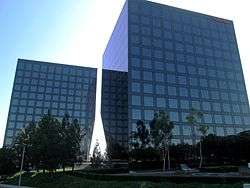
The following companies are headquartered in Irvine:
- Allergan, Inc.
- ATEN Technology, Inc. (a division of ATEN International, Inc.)
- BAX Global
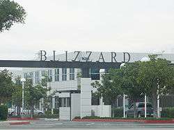
- Blizzard Entertainment[37]
- Boot Barn
- Broadcom Corporation
- CorVel Corporation
- eMachines
- Edwards Lifesciences
- Epicor Software Corporation
- Felt Bicycles
- Ford Motor Company (West Coast Design Center)
- Freedom Communications
- Gateway, Inc.
- Golden State Foods
- HID
- In-N-Out Burger
- K2 Network[37]
- Kofax
- Lifted Research Group
- LA Fitness
- Maruchan, Inc. (a division of Toyo Suisan)[38]
- Meade Instruments
- Masimo
- Obsidian Entertainment[37]
- O'Neill, Inc.
- Online Trading Academy[39]
- Paragon Software Group
- Point of View, Inc.[37]
- Printronix
- Quicksilver Software
- Razer
- Ready at Dawn[37]
- Red 5 Studios[37]
- Ruby's Diner
- St. John
- Standard Pacific Homes
- Stüssy
- Superformance, LLC
- Taco Bell (a division of Yum! Brands, Inc.)
- Tilly's
- Ultimate Ears
- Vizio
- Western Digital[40]
- Western Mutual Insurance Group
- Zymo Research
The following international companies have their North American headquarters in Irvine:
Top employers
As of 2014,[41] the top employers in the city were:
| Rank | Employer | No. of employees | Sector |
|---|---|---|---|
| 1 | University of California, Irvine | 15,750 | Education |
| 2 | Irvine Unified School District | 4,285 | Education |
| 3 | Blizzard Entertainment | 2,620 | Video games |
| 4 | Broadcom Corporation | 2,604 | Semiconductors |
| 5 | Edwards Lifesciences | 2,575 | Medical |
| 6 | Parker Hannifin | 2,400 | Aircraft |
| 7 | Allergan | 1,922 | Pharmaceuticals |
| 8 | Verizon Wireless | 1,472 | Telecommunications |
| 9 | B. Braun Medical | 1,370 | Medical |
| 10 | Western Digital | 1,300 | Computer Storage |
Arts and culture
The Irvine Global Village Festival
Every October, Irvine hosts the Irvine Global Village Festival to celebrate the diversity among the citizens of Irvine and Orange County. The festival consists of exhibits from local merchants, entertainment from diverse cultures, and sampling of foods from various regions of the world.[42]
Irvine Community Television
The Irvine Community Television (ICTV) produces and broadcasts television programs on news, sports, arts, culture, safety for the Irvine community. The motto of ICTV is "For You, About You". ICTV airs on Cox Communications channel 30 and online.[43][44]
Filming location
According to the Internet Movie Database (IMDB), the following productions have either been partially or entirely filmed in Irvine:[45][46]
- 11th Annual Young Comedians, The (1987) (TV)
- A Scanner Darkly (2006)
- All That I Need (2005)
- Anokha (2004)
- Beneath the Surface (2007)
- Bill Fillmaff's Secret System (2006)
- Care of the State (2005)
- Changing the Taste of Mud (2005)
- Chase, The (1994)
- Confessions of a Peep Show Junkie (2006)
- Conquest of the Planet of the Apes (1972)
- Corey Holcomb: The Problem Is You (2004)
- Creator (1985)
- Deconstructing the Family (2007)
- Defending Your Life (1991)
- Demolition Man (1993)
- Depth Solitude (1997)
- Devo Live (2004)
- Dino Adino (2004)
- Dodgeball: A True Underdog Story (2004)[47]
- Eagle Eye (2008)[47]
- Entering the Student Body (2005)
- Girl with an Accent (2005)
- Gleaming the Cube (1989)
- Gohar-e shab cheragh (1998)
- Golden Arrow, The (2003)
- The Hangover Part III (2013)
- Hard at Work (2004)
- Harmony Heights (2006)
- Heart Like a Wheel (1983)
- How 87 Learned to Smile (2005)
- Imaginary Girls (2004)
- The Informant! (2009)
- Invisible Light (2003)
- Iron Man (2008)
- Jihad: Searching for Answers (2007)
- Kiss the Girls (1997)
- L.A. Proper (2008)
- Miss Congeniality 2: Armed and Fabulous (2005)
- My RV Life (2006) (TV)
- Ocean's Eleven (2001)
- Pablo Francisco: Bits and Pieces – Live from Orange County (2004)
- Planet Earth (1974)
- Planet of the Apes (1968)
- Poltergeist (1982)
- Promise, A (2005)
- Rage Against the Machine (1997)
- Raspberry & Lavender (2004)
- Reign Over Me (2007)
- Rhapsody (2006)
- "SexTV" (1998): In the Company of Men: Gender in the Face of War/Sex and Psyops TV Episode
- Shadow Man, The (2006)
- Silent Movie (1976)
- Sublime: Stories, Tales, Lies & Exaggerations (1998)
- Thank You for Smoking (2005)
- Things You Don't Tell... (2006)
- Tiger (1997)
- Transformers[47] (2007)
- View from the Top (2003)
- Waiting for Isaac (2006)
- You, Me and Dupree (2006)
- Zero Dark Thirty (2012)[47]
Libraries
Irvine has three public libraries: Heritage Park Regional Library, University Park Library, and Katie Wheeler Library. The Heritage Library serves as the regional reference library for Central Orange County and has a strong business and art focus while the University Park Library has 95,745 books, including a substantial Chinese collection.[48] Katie Wheeler was the granddaughter of James Irvine, and the library is a replica of the house owned by Irvine in which she grew up.[49] Additionally, most UCI Libraries are open to the public.[50]
Points of interest

- Ayn Rand Institute
- Boomers! (formerly Palace Park)
- California State University Fullerton, Irvine Campus
- Concordia University, Irvine
- Fashion Institute of Design and Merchandising, Orange County Campus
- Heritage Park
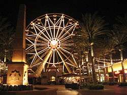
- Irvine Spectrum Center
- Irvine Valley College
- Islamic Center of Irvine
- Mariners Church
- Mason Park
- Northwood Gratitude and Honor Memorial
- Orange County Great Park
- Pao Fa Temple
- Saddleback Church, Irvine Campuses
- The Market Place
- University of California, Irvine
- University of California, Irvine, Arboretum
- Verizon Wireless Amphitheatre
Parks and recreation
Irvine has community parks and neighborhood parks. The community parks have public facilities located on each site. Neighborhood parks provide open space and some recreational amenities within the various villages of Irvine. Northwood Community Park in particular has recently made a unique addition: The Northwood Gratitude and Honor Memorial is the first memorial in the US ever built before the wars were over. It lists the U.S. military dead from Iraq and Afghanistan, and when dedicated November 14, 2010 listed over 5,700 names (of the 8,000 available spaces). Also unique in the history of war monuments, it will be updated yearly.[51]
Community parks
- Alton Athletic Park
- Colonel Bill Barber Marine Corps Memorial Park
- Deerfield Community Park
- Harvard Athletic Park
- Harvard Skatepark
- Heritage Park
- Hicks Canyon Park
- Jeffrey Open Space Trail
- Lakeview Senior Center
- Las Lomas Community Park
- David Sills Lower Peters Canyon Park
- Northwood Community Park
- Oak Creek Community Park
- Portola Springs Community Park
- Quail Hill Community Park
- Rancho Senior Center
- Turtle Rock Community Park
- University Community Park
- Windrow Community Park
- Mike Ward Community Park - Woodbridge
- Woodbury Community Park
Neighborhood parks
- Alderwood Park
- Blue Gum Park
- Brywood Park
- Canyon Park
- Carrotwood Park
- Chaparral Park
- Citrusglen Park
- College Park
- Comstock Park
- Coralwood Park
- Creekview Park
- Discovery Park
- Dovecreek Park
- Flagstone Park
- Hoeptner Park
- Homestead Park
- Knollcrest Park
- Lomas Valley Park
- Meadowood Park
- Orchard Park
- Orchard View Park
- Pepperwood Park
- Pinewood Park
- Plaza Park
- Presley Park
- Racquet Club Park
- Ranch Park
- Ridgeview Park
- San Carlo Park
- San Leandro Park
- San Marco Park
- Settler's Park
- Silkwood Park
- Silverado Park
- Sweet Shade Park
- Sycamore Park
- Tomato Springs Park
- Trailwood Park
- Tree Top Park
- Valencia Park
- Valley Oak Park
- Village Park
- Voyager Park
- Willows Park
- Woodside
Other public spaces within Irvine, not part of the city parks department, include William R. Mason Regional Park, Aldrich Park in the UC Irvine campus, and the San Joaquin Wildlife Sanctuary.
Government
Local government
Irvine is a charter city, operating under a Council/Manager form of government.[1]
According to the city's Comprehensive Annual Financial Report for FY2014-2015, as of June 30, 2015 the city has net assets of $2.59 billion. FY2014-15 revenues totaled $395.2 million, with property tax accounting for $50.7 million and sales tax accounting for $58.8 million. As of June 30, 2015 the city's governmental funds reported combined ending fund balances of $960.9 million.[52]
The structure of the management and coordination of city services is:
| City department | Director |
|---|---|
| City Manager | Sean Joyce[5] |
| Assistant City Manager | Sharon Landers |
| City Attorney | Todd Litfin |
| City Clerk | Molly McLaughlin |
| Director Administrative Services | Vacant |
| Director of Community Development | Susan Emery[53] |
| Director of Community Services | Laurie Hoffman |
| Chief of Police | Mike Hamel[54] |
| Director of Public Works | Manuel Gomez |
| Assistant City Manager - Great Park | Eric Tolles |
City Council
The City Council consists of the Mayor and four City Council members. The Mayor serves a two-year term and Council members serve four-year terms. The city has a two-term limit for elected officials. Elections are held every two years, on even-numbered years. During each election, two Council members and the Mayor's seat is up for consideration. The City Council appoints the City Manager, who functions as the chief administrator of the city. The City Council sets the policies for the city, and the City Manager is responsible for implementing the policies. The City Council appoints volunteers that serve on various advisory boards, commissions and committees.
Mayorship

Mayor Steven Choi, a Republican, was elected to his first term in November 2012 after garnering 45.7% of the vote, while former Irvine Mayor and former Irvine City Councilman Democrat Larry Agran received 40.4%. Choi is the second Korean American to become mayor of Irvine, the first being Choi's predecessor Democrat Sukhee Kang.
City departments
The city of Irvine is served by seven departments. These departments are responsible for managing and performing all of the business of the City Hall and its services:
- City Manager
- City Clerk
- Administrative Services
- Community Development
- Community Services
- Public Safety
- Public Works
Services
Services provided by the city include:
- Animal control
- Building and safety regulation and inspection
- General administrative services
- Planning and zoning
- Public facility/capital improvement construction
- Recreation and cultural programs
- Refuse collection and recycling
- Street lighting
- Street maintenance
- Landscape maintenance and transportation management
- Redevelopment and Housing
Support services are provided through other agencies including: Irvine Unified School District, Tustin Unified School District, Southern California Edison, Irvine Ranch Water District, and Orange County Fire Authority.
Emergency services
Irvine contracts with the County of Orange for fire and medical services. Fire protection in Irvine is provided by the Orange County Fire Authority with ambulance service by Care Ambulance. Law enforcement is provided by the Irvine Police Department (IPD). The IPD operates in a suburban city rated as having one of the lowest violent crime rates among cities with over 100,000 inhabitants by the FBI every year since 2005.[55] The University of California Police Department also has jurisdiction – including arrest power – in areas of the city near the UC Irvine campus, while the California State University Police Department has similar jurisdiction in areas of the city near the CSU Fullerton Irvine campus.
State and federal
Of the 106,982 registered voters in Irvine, 34.6% are Democrats, 31.1% are Republicans, 30.5% have no party preference and the rest are registered with third parties.[56]
In the California State Senate, Irvine is in the 37th Senate District, represented by Republican John Moorlach. In the California State Assembly, it is split between the 68th Assembly District, represented by Republican Steven Choi, and the 74th Assembly District, represented by Republican Matthew Harper.[57]
During the 2011 redistricting, Irvine became part of California's 45th congressional district. The 45th District is represented by Republican Mimi Walters.[58]
Education
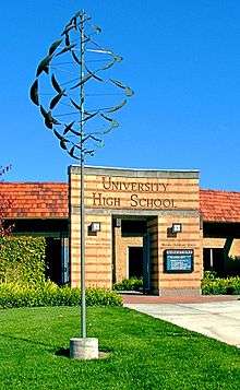
Most of Irvine is located in the Irvine Unified School District (IUSD). The five high schools in IUSD are University High School, Irvine High School, Northwood High School, Woodbridge High School, and Portola High School. Arnold O. Beckman High School is located in Irvine but is administered by Tustin Unified School District. The four high schools in IUSD, as well as Beckman High School, have consistently placed in the upper range of Newsweek's list of the Top 1,300 U.S. Public High Schools.
Irvine is also home to elementary and middle schools, including two alternative, year round, open enrollment K-8 schools, Plaza Vista and Vista Verde.[59][60] Parts of the north and west of the city are within the Tustin Unified School District.
Colleges and universities
Irvine is home to the University of California, Irvine, which is the second-newest campus (established 1965) in the UC system after University of California, Merced. Other higher education institutions in Irvine include California Southern University, Concordia University, Westcliff University, Paramount California University a distance learning university, Irvine Valley College, Fuller Theological Seminary, FIDM, The Fashion Institute of Design and Merchandising, Orange County Campus, Stanbridge College, and a satellite campus of California State University, Fullerton. Chapman University and Soka University of America are in adjacent cities.
According to the 2000 United States Census, Irvine is ranked 7th nationwide, among cities with populations of at least 100,000, for having the highest percentage of people who are at least 25 years old with doctoral degrees, with 3,589 residents reporting such educational attainment.[61]
Transportation
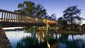
_01.JPG)
Automotive
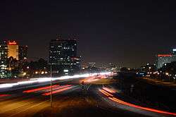
Streets and intersections owned by the city have trademark mahogany signage and are fiber optically linked to the city's Irvine Traffic Research and Control Center (ITRAC).[62] Traffic cameras and ground sensors monitor the flow of traffic throughout the city and automatically adjust signal timing to line up traffic, allowing more vehicles to pass through fewer red lights.[63] Several major highways pass through Irvine (Interstate 5, and Interstate 405 (California), California State Route 73, California State Route 133, California State Route 241, and California State Route 261). Major arteries through Irvine are built out widely and run in a northeasterly direction with speed limits higher than 50 mph (80 km/h). As a result of the signal timing, wide streets, and road layout, Irvine's side streets are capable of handling a higher volume of traffic than other cities in Orange County.
Mass Transit and Freight Services
Bus and Shuttle services
Local bus routes are operated by the Orange County Transportation Authority.
The city of Irvine has operated its own mass-transit bus service called the iShuttle since 2008. Four weekday commuter shuttles serve major employers, residential areas, shopping centers, and transportation facilities. Two lines, Route A and Route B, connect the Tustin Metrolink Station to the Irvine Business Complex area. Route A provides service between the Tustin Metrolink Station and John Wayne Airport with stops along Von Karman Avenue. Route B heads along Jamboree Road before continuing through Main Street and Michelson Drive. The remaining two lines, Route C and Route D, offer connections between the Irvine Station and the Irvine Spectrum Area, which includes major employers, the Irvine Spectrum Center, and residential communities The Park and The Village. Route C follows Irvine Center Drive and ends at the Capital Group campus, while Route D serves the Irvine Spectrum Center, Kaiser Permanente - Irvine Medical Center, and Hoag Hospital Irvine.[64]
Passenger rail
Irvine is served by commuter rail to Los Angeles, San Diego, Riverside, and San Bernardino counties at both the Irvine and Tustin stations of the Metrolink Orange County Line and the IE-OC Line. OCTA is currently implementing a major service increase on the Orange County line, with trains approximately every 30 minutes during weekday commuting hours. Amtrak trains run approximately every 60 to 90 minutes all days of the week along the Pacific Surfliner route between San Diego and Los Angeles. Amtrak trains stop only at Irvine station, unlike Metrolink, which stops at both Irvine and Tustin station. Rail2Rail monthly passes allow commuters to use both Metrolink and Amtrak services, standard tickets are specific to a single operator. A four-story parking structure was recently completed at the Irvine station as part of a station renovation.
At one time Irvine intended to build a tram / guideway, but in February 2009 the city of Irvine canceled the project.[65] Initially plans were underway to connect the Orange County Great Park to the Irvine Spectrum Center and surrounding businesses with a fixed-route transit system, also stopping at the Irvine Transportation Center (Irvine Station). In 2008, two possible routes were selected, but neither will be developed now. The entire $128 million in funding will be returned to the Measure M fund, and be available for other cities in Orange County.
Freight rail
A major contributing factor to the growth of Irvine was by freight rail provided by ATSF (Now BNSF) Transportation. The Venta Spur was Irvine's first spur. Built in the 1920s, it moved citrus from three processing plants in what is now Northwood to the rest of the country. The processing plants were essentially Irvine's first and biggest employers of the time.
The plants started to go out of business in the 1970s and the spur was abandoned in 1985. In 1999, following its donation to the city of Irvine, it was turned into the Venta Spur bike trail.
The Irvine Industrial Spur is the second railroad spur in Irvine. It serves various industries in Irvine's Business Complex. It currently sees little to no movement and the Irvine planning department is considering turning it into a bike path.
Bikeways
Irvine offers a system of bicycle lanes and trails to encourage the use of bikes as a means of transportation. There are 44.5 miles (71.6 km) of off-road bicycle trails and 282 miles (454 km) of on-road bicycle lanes in Irvine.[66]
Notable people
Sister cities
Irvine has four sister cities:[67]
References
- 1 2 3 "City Council". City of Irvine. Retrieved December 14, 2014.
- 1 2 "Irvine". Geographic Names Information System. United States Geological Survey. Retrieved November 6, 2014.
- ↑ "California Cities by Incorporation Date" (Word). California Association of Local Agency Formation Commissions. Retrieved August 25, 2014.
- ↑ "City Charter". City of Irvine. Retrieved October 9, 2014.
- 1 2 "City Manager". City of Irvine. Retrieved October 12, 2014.
- ↑ "2010 Census U.S. Gazetteer Files – Places – California". United States Census Bureau.
- 1 2 E-1 Population Estimates for Cities, Counties, and the State — January 1, 2015 and 2016, May 1, 2016
- ↑ "ZIP Code(tm) Lookup". United States Postal Service. Retrieved November 28, 2014.
- 1 2 "American FactFinder". United States Census Bureau. Retrieved January 31, 2008.
- 1 2 3 4 5 "Demographics Information". City of Irvine. Retrieved October 13, 2014.
- 1 2 "City of Irvine Website – History of the City". Ci.irvine.ca.us. Retrieved January 28, 2011.
- ↑ Asian influx sparks Irvine's evolution as a multinational city, Orange County Register (September 18, 2016).
- 1 2 Erwin Gustav Gudde, William Bright (2004). California Place Names: The Origin. University of California Press. ISBN 9780520242173. Retrieved January 28, 2011.
- ↑ "Anteater Chronicles". Lib.uci.edu. Retrieved April 30, 2012.
- ↑ Yi, Daniel (November 13, 2003), "Irvine Wins Bid to Annex El Toro Site: The decision virtually ensures that the former Marine base will end up with development and open space instead of an airport", Los Angeles Times
- ↑ "How Aldrich Park might have been". Odds and Ends from Special Collections and Archives. UC Irvine Libraries. April 19, 2010.
- ↑ University Hills is subsidized (20–30% below market pricing) for professors and retired professors. It is the first such community of its kind in the nation.
- ↑ The Willows was constructed by Levitt and Sons of California, Inc. See "The Willows at LevittownBeyond". for additional information.
- ↑ "Southern California gets a rare treat: A snow day", Orange County Register, December 31, 2014
- ↑ Tippens, Orien (December 22, 2008), "A Snowcapped New Year in OC", Coast Magazine.
- ↑ "Irvine Tornado One of a Rare Breed in O.C.", Los Angeles Times, March 1, 1991
- ↑ http://www.ncdc.noaa.gov/cdo-web/datatools/normals
- ↑ "Annual Estimates of the Resident Population for Incorporated Places: April 1, 2010 to July 1, 2015". Retrieved July 2, 2016.
- ↑ "Census of Population and Housing". Census.gov. Retrieved June 4, 2015.
- 1 2 "Irvine (city), California". State & County QuickFacts. U.S. Census Bureau. Retrieved May 2, 2012.
- 1 2 "California — Race and Hispanic Origin for Selected Cities and Other Places: Earliest Census to 1990". U.S. Census Bureau. Retrieved April 16, 2012.
- ↑ "Best Places to Live 2008 – from Money Magazine". CNNMoney.com. Retrieved December 11, 2008.
- ↑ "Best Places to Live 2012 – from Money Magazine". CNNMoney.com. Retrieved September 12, 2012.
- ↑ "Which Is America's Best City? - Yahoo! Finance". Finance.yahoo.com. September 20, 2011. Retrieved April 30, 2012.
- ↑ url = http://www.businessinsider.com/irvine-california-is-americas-safest-city-2013-7
- ↑ http://247wallst.com/special-report/2014/01/02/the-best-and-worst-run-cities-in-america-2/3/. Missing or empty
|title=(help) - ↑ "2010 Census Interactive Population Search: CA - Irvine city". U.S. Census Bureau. Retrieved July 12, 2014.
- ↑ "Irvine (city) QuickFacts". United States Census Bureau. Retrieved April 12, 2015.
- ↑ Campbell, Ronald (August 26, 2008). "Three O.C. cities rank near top in U.S. income". Orange County Register.
- ↑ "California Cities Have Highest Rents in Nation, Census 2000 Reveals". United States Census Bureau. May 29, 2003. Retrieved January 23, 2007.
- ↑ http://irvinehomes.freedomblogging.com/2009/07/01/census-irvine-among-25-fastest-growing-cities/
- 1 2 3 4 5 6 Mueller, Mark (August 11, 2008). "Game Companies Taking Office Space at Faster Clip". Orange County Business Journal. pp. 1, 82.
- ↑ Dickerson, Marla. "Where did the frijoles go? Ramen noodles take the salsa in Mexico." Los Angeles Times at Mail Tribune. November 7, 2005. Retrieved on March 5, 2010.
- ↑ "Online Trading Academy". CrunchBase.com. Retrieved March 1, 2012.
- ↑ Pak, Ellyn (August 30, 2010). "Western Digital moves headquarters to Irvine". Orange County Register. Retrieved August 30, 2010.
- ↑ "Comprehensive Annual Financial Report for 2014". City of Irvine. Retrieved February 26, 2015.
- ↑ "Irvine Global Village Festival". City of Irvine. Retrieved March 23, 2008.
- ↑ "ICTV Live Streaming". Cityofirvine.org. Retrieved January 28, 2011.
- ↑ "Irvine Community Television". City of Irvine. Retrieved March 23, 2008.
- ↑ "IMDB Filming Locations: Irvine". IMDB.
- ↑ "IMDB Filming Locations: University of California, Irvine". IMDB.
- 1 2 3 4 http://www.childrenwaterfestival.com/Documents/2013/IrvineWorldNews20130406.pdf
- ↑ Library (September 17, 2007). "City of Irvine libraries". Retrieved September 17, 2007.
- ↑ James, Elysse (February 9, 2008). "A page out of history". Orange County Register.
- ↑ "UCI Libraries – Libraries' Services: Community User". University of California, Irvine. Archived from the original on June 20, 2008. Retrieved December 11, 2008.
- ↑ http://www.ocregister.com/articles/memorial-222180-irvine-community.html
- ↑ . Retrieved Nov. 26, 2016.
- ↑ "Press Release". Cityofirvine.org. June 9, 2011. Retrieved April 30, 2012.
- ↑ "Irvine Police Department". City of Irvine. Retrieved March 17, 2015.
- ↑ "Irvine remains among the safest cities in America" (Press release). City of Irvine. October 30, 2006. Retrieved December 11, 2008.
- ↑ "District Registration by Party" (PDF). Orange County Registrar of Voters. September 6, 2015. Retrieved September 9, 2016.
- ↑ "Statewide Database". UC Regents. Retrieved November 21, 2014.
- ↑ "California's 45th Congressional District - Representatives & District Map". Civic Impulse, LLC.
- ↑ "Vista Verde School". Iusd.org. Retrieved January 28, 2011.
- ↑ "Plaza Vista School and one year round, open enrollment K-6 school, Westpark Elementary". Iusd.org. Retrieved January 28, 2011.
- ↑ Bauman, Kurt J.; Graf, Nikki L. (August 2003). "Educational Attainment: 2000" (PDF). United States Census Bureau. p. 9. Retrieved August 27, 2008.
- ↑ "City of Irvine Website – Traffic Signals".
- ↑ "City of Irvine Website – Traffic Signals".
- ↑ http://www.irvineshuttle.net
- ↑ "_Memorandum" (PDF). Retrieved January 28, 2011.
- ↑ "City of Irvine Bikeways". City of Irvine. Retrieved March 23, 2008.
- ↑ "Sister Cities Program". City of Irvine. Retrieved November 2, 2015.
External links
Archival collections
- Guide to the East Irvine Historic Resources Documentation Photographs, 1988. Special Collections and Archives, The UC Irvine Libraries, Irvine, California.
- Guide to the George Leidal Collection on the City of Irvine. Special Collections and Archives, The UC Irvine Libraries, Irvine, California.
Other

| |
^* Mayor selected from city council
|