Los Alamitos, California
| City of Los Alamitos | ||
|---|---|---|
| City | ||
|
Los Alamitos City Hall | ||
| ||
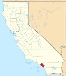
 Location of Los Alamitos within Orange County, California. | ||
 City of Los Alamitos Location in the United States | ||
| Coordinates: 33°48′8″N 118°3′52″W / 33.80222°N 118.06444°WCoordinates: 33°48′8″N 118°3′52″W / 33.80222°N 118.06444°W | ||
| Country |
| |
| State |
| |
| County | Orange | |
| Incorporated | March 1, 1960[1] | |
| Government | ||
| • City council[2] |
Mayor Richard D. Murphy Troy D. Edgar Dean Grose Shelley Hasselbrink Warren Kusumoto | |
| Area[3] | ||
| • Total | 4.116 sq mi (10.659 km2) | |
| • Land | 4.050 sq mi (10.489 km2) | |
| • Water | 0.066 sq mi (0.170 km2) 1.60% | |
| Elevation[4] | 23 ft (7 m) | |
| Population (2010) | ||
| • Total | 11,449 | |
| • Density | 2,800/sq mi (1,100/km2) | |
| Time zone | PST (UTC-8) | |
| • Summer (DST) | PDT (UTC-7) | |
| ZIP codes | 90720-90721 | |
| Area code(s) | 562 | |
| FIPS code | 06-43224 | |
| GNIS feature ID | 1652748 | |
| Website |
www | |


Los Alamitos ("The Little Cottonwoods" in Spanish) is a small city in Orange County, California. The city was incorporated in March 1960. The population was 11,449 at the 2010 census, down from 11,536 at the 2000 census. It is often mistakenly thought to include the adjacent but unincorporated community of Rossmoor (population just under 11,000), which uses Los Alamitos as its mailing address. The Los Alamitos Race Course is also widely believed to be in the city; although it does have a Los Alamitos postal address and zip code, it actually lies in the neighboring city of Cypress.
The USA Water Polo National Aquatic Center [5] is located on the US Military Los Alamitos Joint Forces Training Base,[6] which includes the Los Alamitos Army Airfield.
History
The clusters of cottonwood trees Spanish explorers saw more than 200 years ago inspired Los Alamitos' name, but it is the sugar beet that figured most prominently in the area's later history. The history of the area during the Californio period and after U.S. annexation is detailed in the article on Rancho Los Alamitos.
The individual history of Los Alamitos separate from the rancho begins with the purchase by John Bixby of the Rancho Los Alamitos. John put together a consortium of himself, his cousins Lewellyn and Jotham (owners of Rancho Los Cerritos) and banker I.W. Hellman to finance the purchase of the Los Alamitos land. Upon John's sudden death on 7 May 1887,[7] the ranch was divided between the three owning families. The northern third—the land roughly north of present Orangewood Ave.—went to the Lewellyn-Jotham faction (which later became the Bixby Land Company). By the mid-1890s, after the crash following the land boom of the 1880s—this group was relatively cash-poor and land rich. Having experimented in Northern California with sugar beets, the Bixbys agreed to provide the land, and contracted with Montana copper baron William A. Clark to provide the capital, and got E.A. Dyer to provide the expertise to build a new sugar beet factory on the Bixby's land. The community that grew up around this new sugar beet factory complex—with its streets of company houses for workers and surrounding farms—came to be called Los Alamitos. (As part of his arrangement to build and operate the sugar beet factory, William Clark and his brother H. Ross, who actually ran the Los Alamitos operation, also received 1,000 acres east of the factory and a year later completed a purchase of 8,000 acres (32 km2) of land north of the sugar plant—most of the latter in the Rancho Los Cerritos boundaries—that would eventually become the Long Beach Airport, Long Beach City College, and the city of Lakewood. Also, Clark and Hellman were intricately involved with the machinations and corporate dealings of railroad tycoon E. H. Harriman and Henry Edwards Huntington and the destiny of the Southern Pacific in Southern California. In addition, some time after establishing Los Alamitos, the Clarks completed their railroad from Los Angeles to Salt Lake City, establishing the desert stop of Las Vegas in the process.
In the early 1900s, sugar beets were delivered to a factory by horse and wagon. Economics, combined with an insect infestation in 1921, caused sugar-beet crop to drop significantly in Orange County and the eventual demise of the sugar beet industry there and in Los Alamitos. But the town that had sprung up continued to grow.
On the lands south of the factory (and current Orangewood Avenue), Fred H. Bixby, son of John Bixby and future member of the Cowboy Hall of Fame, used his sugar beet lands as a finishing ranch to fatten cattle before sending them off to slaughter (he also managed Hellman's lands in present Seal Beach). Bixby, one of the more progressive ranchers of his time, allowed European immigrant, Mexican, and Japanese farmers to rent the land and grow crops. At the beginning of World War II, the Japanese farmers were rounded up by the military and relocated to internment camps at Manzanar and elsewhere.
Just prior to and during early World War II, the area around Los Alamitos became a major center for the aircraft industry. The Clark heirs arranged for Donald Douglas to begin construction of a major aircraft plant just north of the Long Beach airport . At the same time the Navy decided it needed an auxiliary airfield for its Reserve Training facility at the increasingly crowded Airport. A touch and go field was built on the level ground just east of Los Alamitos in August 1940. This was the first military post in Orange County. In February 1941, the Navy decided to move all their reserve aviation training from Long Beach and purchased what would become a 1300-acre facility. Trainees and cadre began using the new facilities as early as November 1941, but it wasn't until May 1942 that NRAB Long Beach formally transitioned all operations to NRAB Los Alamitos. The new base provided many jobs and spurred growth in the town. After World War II, NRAB Los Alamitos was the busiest reserve air base in the nation for a while, especially during the Korean Conflict, but by the late 1950s encroaching surrounding suburban residential development began to curtail its activity. The Navy moved out in 1972 and in 1973, the California National Guard took over management of the base, re-designated an Armed Forces Reserve Center. Today, it is a reserve support center for units of the Army, Navy, National Guard and Marines, but is also a home to many other government agencies, including Homeland Security, FEMA and the State of California Office of Emergency Services.[8]
Many former military personnel chose to stay on in Los Alamitos after the war, living in such mew neighborhoods as Carrier Row, where streets are named for World War II aircraft carriers, many of which had been the home for Navy pilots trained at Los Alamitos. Carrier Row was actually not one unit, but three small subdivisions built separately in 1947-48, 1950, and 1955 by different builders. The first of these units was the Alamos Ranchos which was first occupied in April 1948. These homes had sewage problems, and the builder stopped after completing only the two blocks east of Lexington and south of Katella. In 1950, two more blocks were constructed under the name of Plainview Homes. Finally, in 1955, the tract was completed with the construction of Los Alamitos Park. Another subdivision of 193 units, Los Alamitos Terrace, was built in the area north of Old Town West, on land once used as grazing land for Bixby-operated dairy farm—whose main headquarters were located where Los Alamitos High School now stands.[8]
But overall, these units were small compared to the next subdivision built in the area. In 1956 builder Ross Cortese purchased land to build the walled community of Rossmoor just southwest from the townsite of Los Alamitos. Rossmoor, still the largest single development in Orange County, was the first walled community in the United States and quickly became home to over 10,000 upper middle class professionals. Rossmoor's homes were designed initially by Earle G. Kaltenbach (who also designed Disneyland's original Tomorrowland), although two of the later phases were designed by Chris Choate, who achieved much fame as the frequent partner of Cliff May. Together the two men were among the most responsible for designing and popularizing the "ranch" style homes which dominated the suburban explosion of the 1950s. Prior to Rossmoor, Choate and May had worked with Cortese on building the nearby Lakewood Rancho Estates just a mile west of town in Long Beach.[8]
Although Rossmoor never officially became part of Los Alamitos proper, it has become inextricably linked to the town. When Los Alamitos incorporated in 1960 its population was only about 3,400, while still-growing Rossmoor was nearing 10,000. Now they are fairly equal with Los Alamitos being slightly larger than 11,000. Rossmoor, still an unincorporated part of Orange County, doesn't pay taxes to Los Alamitos, but the city virtually treats Rossmoor residents as if they were residents. In exchange, the city's many youth programs benefit from the overwhelming number of Rossmoor residents who volunteer for those programs, and Rossmoor, having very little commercial areas of its own, contributes much sales tax revenue to Los Alamitos.
The success of Rossmoor quickly led to other subdivisions in Los Alamitos—Dutch Haven (built in 1960 by Luxury Homes, and William G. Lyon), the Rossmoor Highlands (1961), Suburbia, New Dutch Haven, Greenbrook and College Park North (1967).
The ambitious sugar-beet processor of today would be hard pressed to set up shop in Los Alamitos. Zoning laws keep out heavy manufacturing or industry because nearly all the city land is developed. The Armed Forces Reserve Center takes up 48 percent of the city's 4.3 square miles (11.1 km2). The rest of the city is a snug fitting mix of homes, apartments, businesses and open space.
The small city has been the hometown for a number of noted athletes including baseball Hall of Famer Bob Lemon(although he spent more time in Long Beach), and Olympic gymnast Cathy Rigby. The Los Alamitos youth baseball leagues, which began in 1958 as the Rossmoor Little League and, after moving its fields to the Navy base, eventually changed its name to Los Alamitos Youth baseball - LAYB) has been home to many future major leaguers including Andy Messersmith, who challenged baseball's reserve clause and helped established free agency in professional sports . At one point in the late 1980s, six former league players were playing baseball in the major leagues—Robb Nen, J. T. Snow, Greg Harris, Dennis Lamp, Greg Pirkl, and Mike Kelly. The area is also home to record holding long distance swimmer Lynne Cox. It was also home to California Supreme Court Chief Justice Malcolm M. Lucas while he served on the Court, and to award-winning mystery writer Jan Burke.
Climate
Gardeners use several climate zone indicators to determine the proper plantings for an area. In the U.S. most plants and seeds are indicated for a particular climate by the USDA Hardiness Zone. A more exact measure is the Sunset zone. In Los Alamitos, the USDA Hardiness Zone is 9.[9] The Sunset climate zone is 22.[10]
| Los Alamitos, California | ||||||||||||||||||||||||||||||||||||||||||||||||||||||||||||
|---|---|---|---|---|---|---|---|---|---|---|---|---|---|---|---|---|---|---|---|---|---|---|---|---|---|---|---|---|---|---|---|---|---|---|---|---|---|---|---|---|---|---|---|---|---|---|---|---|---|---|---|---|---|---|---|---|---|---|---|---|
| Climate chart (explanation) | ||||||||||||||||||||||||||||||||||||||||||||||||||||||||||||
| ||||||||||||||||||||||||||||||||||||||||||||||||||||||||||||
| ||||||||||||||||||||||||||||||||||||||||||||||||||||||||||||
Demographics
| Historical population | |||
|---|---|---|---|
| Census | Pop. | %± | |
| 1960 | 4,312 | — | |
| 1970 | 11,346 | 163.1% | |
| 1980 | 11,529 | 1.6% | |
| 1990 | 11,676 | 1.3% | |
| 2000 | 11,536 | −1.2% | |
| 2010 | 11,449 | −0.8% | |
| Est. 2015 | 11,716 | [11] | 2.3% |
2010
The 2010 United States Census[13] reported that Los Alamitos had a population of 11,449. The population density was 2,781.8 people per square mile (1,074.1/km²). The racial makeup of Los Alamitos was 8,131 (71.0%) White (58.7% Non-Hispanic White),[14] 324 (2.8%) African American, 51 (0.4%) Native American, 1,471 (12.8%) Asian, 50 (0.4%) Pacific Islander, 726 (6.3%) from other races, and 696 (6.1%) from two or more races. Hispanic or Latino of any race were 2,418 persons (21.1%).
The Census reported that 11,206 people (97.9% of the population) lived in households, 40 (0.3%) lived in non-institutionalized group quarters, and 203 (1.8%) were institutionalized.
There were 4,212 households, out of which 1,610 (38.2%) had children under the age of 18 living in them, 2,025 (48.1%) were opposite-sex married couples living together, 731 (17.4%) had a female householder with no husband present, 282 (6.7%) had a male householder with no wife present. There were 209 (5.0%) unmarried opposite-sex partnerships, and 19 (0.5%) same-sex married couples or partnerships. 885 households (21.0%) were made up of individuals and 355 (8.4%) had someone living alone who was 65 years of age or older. The average household size was 2.66. There were 3,038 families (72.1% of all households); the average family size was 3.10.
The population was spread out with 2,741 people (23.9%) under the age of 18, 1,077 people (9.4%) aged 18 to 24, 2,938 people (25.7%) aged 25 to 44, 3,099 people (27.1%) aged 45 to 64, and 1,594 people (13.9%) who were 65 years of age or older. The median age was 38.7 years. For every 100 females there were 89.5 males. For every 100 females age 18 and over, there were 87.1 males.
There were 4,355 housing units at an average density of 1,058.2 per square mile (408.6/km²), of which 1,967 (46.7%) were owner-occupied, and 2,245 (53.3%) were occupied by renters. The homeowner vacancy rate was 0.8%; the rental vacancy rate was 3.1%. 5,274 people (46.1% of the population) lived in owner-occupied housing units and 5,932 people (51.8%) lived in rental housing units.
According to the 2010 United States Census, Los Alamitos had a median household income of $80,449, with 7.2% of the population living below the federal poverty line.[14]
2000
As of the census[15] of 2000, there were 11,536 people, 4,246 households, and 3,035 families residing in the city. The population density was 2,875.5 inhabitants per square mile (1,110.7/km²). There were 4,329 housing units at an average density of 1,079.1 per square mile (416.8/km²). The racial makeup of the city was 76.97% White, 2.6%% African American, 3.7%Native American, 9.49% Asian, 11.5% Pacific Islander, 5.37% from other races, and 4.07% from two or more races. Hispanic or Latino of any race were 22.3% of the population.
There were 4,246 households out of which 36.6% had children under the age of 18 living with them, 48.4% were married couples living together, 17.1% had a female householder with no husband present, and 28.5% were non-families. 21.8% of all households were made up of individuals and 7.7% had someone living alone who was 65 years of age or older. The average household size was 2.62 and the average family size was 3.06.
In the city the population was spread out with 25.2% under the age of 18, 7.8% from 18 to 24, 30.8% from 25 to 44, 21.3% from 45 to 64, and 14.8% who were 65 years of age or older. The median age was 37 years. For every 100 females there were 90.0 males. For every 100 females age 18 and over, there were 84.4 males.
The median income for a household in the city was $55,286, and the median income for a family was $60,767. Males had a median income of $49,946 versus $36,002 for females. The per capita income for the city was $26,014. About 4.1% of families and 5.2% of the population were below the poverty line, including 4.9% of those under age 18 and 8.8% of those age 65 or over. Property prices in the city have increased dramatically over the past 20 years.
Government
In the California State Legislature, Los Alamitos is in the 34th Senate District, represented by Republican Janet Nguyen, and in the 72nd Assembly District, represented by Republican Travis Allen.[16]
In the United States House of Representatives, Los Alamitos is in California's 47th congressional district, represented by Democrat Alan Lowenthal.[17]
Business
The first Claim Jumper restaurant opened in Los Alamitos in 1977. The location closed and is now a Hof's Hut. Neverland Studios, a recording studio that was often used by Christian rock bands, was originally located in Los Alamitos. Tilly's had its original location in Los Alamitos.
Top employers
According to the City's 2010 Comprehensive Annual Financial Report,[18] the top employers in the city are:
| # | Employer | # of employees |
|---|---|---|
| 1 | Los Alamitos Medical Center | 1,100 |
| 2 | Arrowhead Products | 515 |
| 3 | Trend Offset Printing | 478 |
| 4 | SuperMedia | 350 |
| 5 | Pharmacy Advantage | 158 |
| 6 | Bloomfield Bakers | 150 |
| 7 | Systems Services of America | 150 |
| 8 | Alamitos West Health Care Center | 139 |
| 9 | Timken | 124 |
| 10 | MDA Information Systems | 106 |
Notable residents and natives
- Allison Mack, actress (famously known as "Chloe" from Smallville)
- Lynne Cox, long-distance swimmer
- Taryn Manning, actress
- Cathy Rigby, Olympic gymnast and actress
- Jodie Sweetin, actress ("Stephanie Tanner" from Full House)
- Aaron Barrett, musician
- Scott Klopfenstein, musician
- Jonathon Bolin, musician
- Kami Cotler, actress
- Tony Muser, former MLB player and manager
- Bob Lemon, baseball Hall of Famer as pitcher and manager, spent some years livingh in City Garden Acres (now Apartment Row) and attending Laurel Elementary, before his family moved to Long Beach.
- J.T. Snow, American baseball player—attended Los Alamitos HS, but grew up in Seal Beach.
- Robb Nen, American baseball player—attended Los Alamitos HS, but grew up in Seal Beach.
- Jonathan Bornstein, soccer player for the USA National Team and Chivas USA
- Matt "Money" Smith, Fox Sports Radio talk show host
- Landry Fields, basketball player for the New York Knicks of the NBA—attended Los Alamitos HS, but grew up in Long Beach.
- Chris Kluwe, punter for the Minnesota Vikings of the NFL—attended Los Alamitos HS, but grew up in Seal Beach.
- Tim Carey, American football player—attended Los Alamitos HS, but grew up in Seal Beach.
- Matthew Morrison, American singer actor, (Broadway plays, Fox TV's "Glee") -- attended Los Alamitos HS, but grew up in Cypress.
Schools
It is a part of the Los Alamitos Unified School District, which began in 1898 as the Laurel Elementary School District, and changed its name in 1953 to the Los Alamitos Elementary School District, providing education up through sixth grade. Students in Grades 7-12 attended schools in the Anaheim School District, until 1979 when local voters, after a few failed attempts, finally received state permission to hold an election, and voted to withdraw from the Anaheim High School Disrtrict and unify all their local grades under the name the Los Alamitos Unified School District.
- Los Alamitos High School (opened September 1967, moved into current permanent location in September 1968)
- Laurel High School (continuation school, absorbed into Los Alamitos High School in 2014)
- McAuliffe Middle School (originally called Pine Jr. High)
- Oak Middle School (opened closed
- Hopkinson Elementary
- Lee Elementary
- Los Alamitos Elementary
- Rossmoor Elementary
- Weaver Elementary
- St. Hedwig School, a K–8 private school
References
- ↑ "California Cities by Incorporation Date" (Word). California Association of Local Agency Formation Commissions. Retrieved August 25, 2014.
- ↑ "City Council". City of Los Alamitos. Retrieved December 30, 2014.
- ↑ "2010 Census U.S. Gazetteer Files – Places – California". United States Census Bureau.
- ↑ "Los Alamitos". Geographic Names Information System. United States Geological Survey. Retrieved October 10, 2014.
- ↑ http://www.usawaterpolo.org
- ↑ http://www.globalsecurity.org/military/facility/los-alamitos.htm
- ↑ http://cdnc.ucr.edu/cgi-bin/cdnc?a=d&d=LAH18870508.2.14
- 1 2 3 Strawther, Larry; "A Brief History of Los Alamitos," History Press, 2012
- ↑ Jordan, Ramon. "National Arboretum - USDA Plant Hardiness Zone Map". www.usna.usda.gov. Retrieved 2016-10-21.
- ↑ "Flowers and Plants". Sunset. Retrieved 2016-10-21.
- ↑ "Annual Estimates of the Resident Population for Incorporated Places: April 1, 2010 to July 1, 2015". Retrieved July 2, 2016.
- ↑ "Census of Population and Housing". Census.gov. Retrieved June 4, 2015.
- ↑ "2010 Census Interactive Population Search: CA - Los Alamitos city". U.S. Census Bureau. Retrieved July 12, 2014.
- 1 2 http://quickfacts.census.gov/qfd/states/06/0643224.html. Missing or empty
|title=(help) - ↑ "American FactFinder". United States Census Bureau. Retrieved 2008-01-31.
- ↑ "Statewide Database". UC Regents. Retrieved December 10, 2014.
- ↑ "California's 47th Congressional District - Representatives & District Map". Civic Impulse, LLC. Retrieved October 6, 2014.
- ↑ City of Los Alamitos CAFR
External links
| Wikivoyage has a travel guide for Los Alamitos. |
| Wikimedia Commons has media related to Los Alamitos, California. |
- Official website
- Los Alamitos Chamber of Commerce: History
- Local History for Los Alamitos, Rossmoor & Seal Beach