Las Flores, California
| Las Flores | |
|---|---|
| Census designated place | |
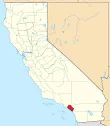
 Location of Las Flores within Orange County, California. | |
| Coordinates: 33°35′13″N 117°37′39″W / 33.58694°N 117.62750°WCoordinates: 33°35′13″N 117°37′39″W / 33.58694°N 117.62750°W | |
| Country |
|
| State |
|
| County | Orange |
| Area[1] | |
| • Total | 2.028 sq mi (5.254 km2) |
| • Land | 2.028 sq mi (5.254 km2) |
| • Water | 0 sq mi (0 km2) 0% |
| Elevation | 715 ft (218 m) |
| Population (April 1, 2010) | |
| • Total | 5,971 |
| • Density | 2,900/sq mi (1,100/km2) |
| Time zone | Pacific (UTC-8) |
| • Summer (DST) | PDT (UTC-7) |
| ZIP code | 92688 |
| Area code | 949 |
| FIPS code | 06-40526 |
| GNIS feature IDs | 1853398, 2408577 |
Las Flores is an unincorporated census-designated place (CDP) in Orange County, California, located adjacent to the City of Rancho Santa Margarita, California. The population was 5,971 at the 2010 census, up from 5,625 at the 2000 census. Las Flores does not have its own zip code and is served by the same zip code as adjacent Rancho Santa Margarita.[2] The Rancho Santa Margarita dog/skate park is located in the CDP and is served by the Orange County Sheriff's Dept. and Orange County Fire Authority.[3][4]
Geography
Las Flores is located near the intersection of Oso Parkway and Antonio Parkway in unincorporated southern Orange County, running several miles adjacent to Antonio Parkway and Oso Parkway.
According to the United States Census Bureau, the CDP has a total area of 2.0 square miles (5.2 km2), all land.
Demographics
2010
The 2010 United States Census[5] reported that Las Flores had a population of 5,971. The population density was 2,943.7 people per square mile (1,136.5/km²). The racial makeup of Las Flores was 4,488 (75.2%) White (64.6% Non-Hispanic White),[6] 91 (1.5%) African American, 23 (0.4%) Native American, 780 (13.1%) Asian, 12 (0.2%) Pacific Islander, 261 (4.4%) from other races, and 316 (5.3%) from two or more races. Hispanic or Latino of any race were 984 persons (16.5%).
The Census reported that 5,971 people (100% of the population) lived in households, 0 (0%) lived in non-institutionalized group quarters, and 0 (0%) were institutionalized.
There were 1,916 households, out of which 1,079 (56.3%) had children under the age of 18 living in them, 1,279 (66.8%) were opposite-sex married couples living together, 198 (10.3%) had a female householder with no husband present, 76 (4.0%) had a male householder with no wife present. There were 84 (4.4%) unmarried opposite-sex partnerships, and 12 (0.6%) same-sex married couples or partnerships. 257 households (13.4%) were made up of individuals and 27 (1.4%) had someone living alone who was 65 years of age or older. The average household size was 3.12. There were 1,553 families (81.1% of all households); the average family size was 3.47.
The population was spread out with 2,029 people (34.0%) under the age of 18, 418 people (7.0%) aged 18 to 24, 1,885 people (31.6%) aged 25 to 44, 1,416 people (23.7%) aged 45 to 64, and 223 people (3.7%) who were 65 years of age or older. The median age was 33.2 years. For every 100 females there were 99.4 males. For every 100 females age 18 and over, there were 93.0 males.
There were 1,969 housing units at an average density of 970.7 per square mile (374.8/km²), of which 1,326 (69.2%) were owner-occupied, and 590 (30.8%) were occupied by renters. The homeowner vacancy rate was 0.7%; the rental vacancy rate was 5.6%. 4,469 people (74.8% of the population) lived in owner-occupied housing units and 1,502 people (25.2%) lived in rental housing units.
According to the 2010 United States Census, Las Flores had a median household income of $128,301, with 3.6% of the population living below the federal poverty line.[6]
2000
As of the census[7] of 2000, there were 5,625 people, 1,936 households, and 1,486 families residing in the CDP. The population density was 2,816.0 inhabitants per square mile (1,085.9/km²). There were 1,999 housing units at an average density of 1,000.7 per square mile (385.9/km²). The racial makeup of the CDP was 78.17% White, 1.88% African American, 0.46% Native American, 10.22% Asian, 0.09% Pacific Islander, 4.21% from other races, and 4.96% from two or more races. Hispanic, of any race were 11.88% of the population.
There were 1,936 households out of which 51.8% had children under the age of 18 living with them, 67.9% were married couples living together, 6.7% had a female householder with no husband present, and 23.2% were non-families. 14.7% of all households were made up of individuals and 0.7% had someone living alone who was 65 years of age or older. The average household size was 2.91 and the average family size was 3.31.
In the CDP the population was spread out with 32.4% under the age of 18, 5.9% from 18 to 24, 46.7% from 25 to 44, 12.4% from 45 to 64, and 2.5% who were 65 years of age or older. The median age was 30 years. For every 100 females there were 99.3 males. For every 100 females age 18 and over, there were 95.5 males.
The median income for a household in the CDP was $89,978, and the median income for a family was $100,448. Males had a median income of $70,397 versus $46,029 for females. The per capita income for the CDP was $38,241. About 0.3% of families and 1.1% of the population were below the poverty line, including 0.8% of those under age 18 and none of those age 65 or over.
Served by Rancho Santa Margarita's zip code 92688. It is named in reference to Rancho Santa Margarita y Las Flores. It was established when Rancho Santa Margarita was unincorporated in the 1990s and was never officially annexed when RSM incorporated in 2000.[8]
Government
In the California State Legislature, Las Flores is in the 36th Senate District, represented by Republican Patricia Bates, and in the 73rd Assembly District, represented by Republican Bill Brough.[9]
In the United States House of Representatives, Las Flores is in California's 49th congressional district, represented by Republican Darrell Issa.[10]
Education
The CDP is served by Capistrano Unified School District.
Las Flores is the home to the adjoined campuses of Las Flores Elementary and Las Flores Middle School, as well as Tesoro High School.
References
- ↑ "2010 Census U.S. Gazetteer Files – Places – California". United States Census Bureau.
- ↑ GIS Maps of Rancho Santa Margarita CA
- ↑ OC Sheriff South Patrol Bureau
- ↑ OCFA Battalion 5 & 6 Area Map
- ↑ "2010 Census Interactive Population Search: CA - Las Flores CDP". U.S. Census Bureau. Retrieved July 12, 2014.
- 1 2 http://quickfacts.census.gov/qfd/states/06/0640526.html. Missing or empty
|title=(help) - ↑ "American FactFinder". United States Census Bureau. Retrieved 2008-01-31.
- ↑ Acceptabe City names for 92688
- ↑ "Statewide Database". Regents of the University of California. Retrieved April 12, 2015.
- ↑ "California's 49th Congressional District - Representatives & District Map". Civic Impulse, LLC.