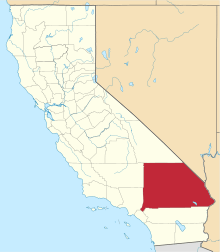
Victorville, California
| City of Victorville | |||
|---|---|---|---|
| City | |||
| |||
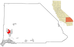 Location of Victorville in California | |||
 City of Victorville Location in the United States | |||
| Coordinates: 34°32′10″N 117°17′28″W / 34.53611°N 117.29111°WCoordinates: 34°32′10″N 117°17′28″W / 34.53611°N 117.29111°W[1] | |||
| Country | United States | ||
| State | California | ||
| County | San Bernardino | ||
| Incorporated | September 21, 1962[2] | ||
| Named for | Jacob Nash Victor[3] | ||
| Government | |||
| • Mayor | Gloria Garcia[4] | ||
| • City manager | Doug Robertson[5] | ||
| Area[6] | |||
| • Total | 73.741 sq mi (190.988 km2) | ||
| • Land | 73.178 sq mi (189.529 km2) | ||
| • Water | 0.563 sq mi (1.459 km2) 0.76% | ||
| Elevation[1] | 2,726 ft (831 m) | ||
| Population (April 1, 2010)[7] | |||
| • Total | 115,903 | ||
| • Estimate (2013)[7] | 121,096 | ||
| • Rank |
5th in San Bernardino County 48th in California | ||
| • Density | 1,600/sq mi (610/km2) | ||
| Time zone | Pacific Time Zone (UTC-8) | ||
| • Summer (DST) | PDT (UTC-7) | ||
| ZIP codes | 92392–92395[8] | ||
| Area codes | 442/760[9] | ||
| FIPS code | 06-82590 | ||
| GNIS feature IDs | 1652806, 2412156 | ||
| Website | ci.victorville.ca.us | ||

Victorville is a city located in the Victor Valley of southwestern San Bernardino County, California. Its estimated population as of July 1, 2013 was 121,096.[7]
History
In 1858, Aaron G. Lane came to what is now known as Victorville and founded a way station called "Lane's Crossing." For many years it provided shelter and supplies for people making the journey across the desert from the east to San Bernardino. Lane's Crossing was on the Mojave River on today's Turner Road, two miles north from where Interstate 15 crosses the river. Captain Lane was a veteran of the Mexican-American War who had suffered from malaria during that war. Originally he migrated west to join the California gold rush, but he learned that he could make a better living selling supplies to the miners.
He settled in Ione near Sutter's Mill in northern California during those years, but he migrated to San Bernardino in 1857. He settled on the Mojave River in 1858, where he established his way station. He later sold out to Texan John Fry Miller, who changed the name of Lane's Crossing to Pioneer Station.[10] Miller was a rancher and became involved in Mojave Valley politics, setting up the first polling place in the area at his home. That first year, ten citizens cast their votes at Lane's residence, rather than making the long trip to San Bernardino.[11]
Census records show that ten people lived in two residences on the river by 1860. Listed in Dwelling No. 703 were Aaron Lane, William R. Levick, and the Nicholson family, consisting of George and Frances, and their three children aged 9 to 13. Joseph and Mary Highmoor lived in Dwelling No. 704, with a seven-year-old female named Anna.[12]
The Levick, Nicholson and Highmoor families were Mormon pioneers. Highmoor established a way station called Highmoor's Crossing, which was near today's Oro Grande bridge of the National Trails Highway (known as U.S. Route 66), over the Mojave River at what is called the Lower Narrows. The Nicholson family moved downriver a few miles and established a way station at "Point of Rocks" in today's Helendale area.
In 1867, Lafayette Meacham, a Mormon who ran a way station near today's Barstow area, made a new wagon road from his stage stop to what is now Old Town Victorville. It crossed the Mojave River at today's Sixth Street. This new road, now called Stoddard Wells Road, was a short-cut across the desert and became a popular route for muleskinners and freighters. The river crossing was called Mormon Crossing and the surrounding area became known by that name.
In the 1870s, Heber "Pete" Huntington established a stage stop, Huntington Station, at Mormon Crossing. Also a Mormon pioneer, Huntington was leader Brigham Young's nephew. Huntington later bought out the Stoddard brothers, who had a way station half way to today's Barstow from Victorville, and also bought out the Meachams, who ran the stage stop named Fish Ponds or Mormon Grocery.
In 1885, the newly established telegraph station at the railroad siding of "Victor", named for the California Southern Railroad's General Manager Jacob Nash Victor, was the beginning of what developed as today's Old Town Victorville. The village which sprang up around that railroad facility became known by the same name of Victor.
In 1901, at the suggestion of local postmistress Abbey Turner, the U.S. Post Office Department changed that name to Victorville to stop the postal confusion with the town of Victor, Colorado.
In 1926, U.S. Route 66 was begun, being marked in many areas on existing roads. In Victorville, US 66 is marked on D and Seventh streets, with a section of Interstate 15 going towards the Cajon Pass. It is the primary street through Old Town Victorville.
In 1940, Herman J. Mankiewicz and John Houseman wrote the first two drafts of the screenplay for the film Citizen Kane in Victorville. They worked in seclusion for 12 weeks while residing at the North Verde Ranch, now called the Kemper Campbell Ranch.[13]:32[14]
The Victorville Army Airfield was constructed beginning in 1941. It was renamed as the George Air Force Base when the U.S. Air Force was established in October 1947. After decades of service to the Air Force, in 1992 George Air Force Base was closed.
Its land was turned over to other uses. Part of it is now the Southern California Logistics Airport. The former Air Force base housing area is now vacant. It forms a ghost town that is used for military training by troops from the U.S. Army's Fort Irwin Military Reservation. The Victorville Federal Penitentiary has been built on another part of the former air base.
The city of Victorville was officially incorporated by the State of California on September 21, 1962.
On August 14, 1977 actor Ron Haydock was struck and killed while hitchhiking near Victorville.
In 2003, the Roy Rogers and Dale Evans Museum[15] was moved from Victorville to Branson, Missouri. It closed before 2015.
On November 3, 2007, Victorville hosted the DARPA Urban Challenge, a six-hour autonomous robot driving contest through the streets of the Southern California Logistics Airport. The $2 million first prize went to the Carnegie Mellon University team.
Geography and climate
Victorville is located at the southwestern edge of the Mojave Desert, 81 miles (130 km) northeast of Los Angeles, 34 miles (55 km) south of Barstow, 48 miles (77 km) east of Palmdale, and 37 miles (60 km) north of San Bernardino through the Cajon Pass on Interstate 15. Victorville is the location of offices of the "Mojave Desert Branch" of the San Bernardino County government.
Victorville is bordered by Apple Valley on the east, Hesperia on the south, and Adelanto on the west. The Mojave River flows sporadically through Victorville. The elevation at City Hall is approximately 2,950 feet (900 m) above sea level.
According to the United States Census Bureau, the city has a total area of 73.7 square miles (191 km2). 73.2 square miles (190 km2) of it is land and 0.6 square miles (1.6 km2) of it is water. The total area is 0.76% water.
The summer climate for this area in the Mojave Desert is hotter than the Los Angeles basin, but 10 or 15 degrees cooler than in the Colorado Desert. The National Weather Service has maintained a weather station in Victorville since 1917. Official records show that Victorville has an arid climate with cool winters and hot summers. Average January temperatures range from a maximum of 59.5 °F (15.3 °C) to a minimum of 31.4 °F (−0.3 °C). Average July temperatures range from a maximum of 99.1 °F (37.3 °C) to a minimum of 60.8 °F (16.0 °C). The record high temperature was 116 °F (47 °C) on July 10, 2002. The record low temperature was −1 °F (−18 °C) on January 17, 1949. There are an average of 109 days with highs of 90 °F (32 °C) or higher and an average of 79 days with lows of 32 °F (0 °C) or lower.
The average annual precipitation in Victorville is 6.27 inches (159 mm). There is an average of 28 days annually with measurable precipitation. The wettest year recorded was 1983 with 13.42 inches (341 mm) and the driest year recorded was 1953 with 1.27 inches (32 mm). The most precipitation in one month was 5.45 inches (138 mm) in February 1944. The most precipitation in 24 hours was 3.00 inches (76 mm) on February 24, 1998. Snowfall in Victorville averages only 1.4 inches (36 mm) annually. The most snowfall in one month was 38.0 inches (970 mm) in January 1949, including 31.0 inches (790 mm) on January 14. Snowfall is rather common during the winter months in the higher mountains south of Victorville, especially around Cajon Pass.[16]
| Climate data for Victorville, California | |||||||||||||
|---|---|---|---|---|---|---|---|---|---|---|---|---|---|
| Month | Jan | Feb | Mar | Apr | May | Jun | Jul | Aug | Sep | Oct | Nov | Dec | Year |
| Record high °F (°C) | 80 (27) |
86 (30) |
93 (34) |
100 (38) |
108 (42) |
111 (44) |
116 (47) |
112 (44) |
110 (43) |
101 (38) |
88 (31) |
85 (29) |
116 (47) |
| Average high °F (°C) | 60 (16) |
63 (17) |
68 (20) |
75 (24) |
84 (29) |
93 (34) |
99 (37) |
98 (37) |
92 (33) |
81 (27) |
68 (20) |
60 (16) |
78.4 (25.8) |
| Average low °F (°C) | 31 (−1) |
35 (2) |
38 (3) |
42 (6) |
49 (9) |
55 (13) |
61 (16) |
61 (16) |
55 (13) |
45 (7) |
35 (2) |
30 (−1) |
44.8 (7.1) |
| Record low °F (°C) | −1 (−18) |
11 (−12) |
14 (−10) |
25 (−4) |
30 (−1) |
36 (2) |
36 (2) |
42 (6) |
32 (0) |
21 (−6) |
8 (−13) |
6 (−14) |
−1 (−18) |
| Average rainfall inches (mm) | 1.11 (28.2) |
1.18 (30) |
1.14 (29) |
0.31 (7.9) |
0.23 (5.8) |
0.06 (1.5) |
0.16 (4.1) |
0.25 (6.4) |
0.33 (8.4) |
0.26 (6.6) |
0.36 (9.1) |
0.81 (20.6) |
6.2 (157.6) |
| Source: Weather Channel[17] | |||||||||||||
Demographics
| Historical population | |||
|---|---|---|---|
| Census | Pop. | %± | |
| 1970 | 10,845 | — | |
| 1980 | 14,220 | 31.1% | |
| 1990 | 40,674 | 186.0% | |
| 2000 | 64,029 | 57.4% | |
| 2010 | 115,903 | 81.0% | |
| Est. 2015 | 122,225 | [18] | 5.5% |
2010
The 2010 United States Census[20] reported that Victorville had a population of 115,903. The population density was 1,571.8 people per square mile (606.9/km²). The racial makeup of Victorville was 56,258 (48.5%) White (28.3% Non-Hispanic White),[7] 19,483 (16.8%) African American, 1,665 (1.4%) Native American, 4,641 (4.0%) Asian, 489 (0.4%) Pacific Islander, 26,036 (22.5%) from other races, and 7,331 (6.3%) from two or more races. Hispanic or Latino of any race were 55,359 persons (47.8%).
The Census reported that 110,800 people (95.6% of the population) lived in households, 341 (0.3%) lived in non-institutionalized group quarters, and 4,762 (4.1%) were institutionalized.
There were 32,558 households, out of which 17,256 (53.0%) had children under the age of 18 living in them, 17,036 (52.3%) were opposite-sex married couples living together, 6,487 (19.9%) had a female householder with no husband present, 2,397 (7.4%) had a male householder with no wife present. There were 2,478 (7.6%) unmarried opposite-sex partnerships, and 258 (0.8%) same-sex married couples or partnerships. 5,081 households (15.6%) were made up of individuals and 1,954 (6.0%) had someone living alone who was 65 years of age or older. The average household size was 3.40. There were 25,920 families (79.6% of all households); the average family size was 3.77.
The population was spread out with 38,023 people (32.8%) under the age of 18, 12,136 people (10.5%) aged 18 to 24, 33,479 people (28.9%) aged 25 to 44, 22,853 people (19.7%) aged 45 to 64, and 9,412 people (8.1%) who were 65 years of age or older. The median age was 29.5 years. For every 100 females there were 100.4 males. For every 100 females age 18 and over, there were 99.1 males.
There were 36,655 housing units at an average density of 497.1 per square mile (191.9/km²), of which 20,137 (61.8%) were owner-occupied, and 12,421 (38.2%) were occupied by renters. The homeowner vacancy rate was 4.9%; the rental vacancy rate was 11.1%. 66,600 people (57.5% of the population) lived in owner-occupied housing units and 44,200 people (38.1%) lived in rental housing units.
During 2009–13, Victorville had a median household income of $50,034, with 25.3% of the population living below the federal poverty line.[7]
2000
In 2000,[21] the city was estimated to contain 64,029 people, 20,893 households, and 15,883 families residing in the city. The racial makeup of the city is 61.1% Hispanic White (47.5 Non-Hispanic White, 11.9% African American, 1.1% Native American, 3.5% Asian, 0.2% Pacific Islander, 16.3% from other races, and 6.0% from two or more races. 33.5% of the population are Hispanic or Latino of any race.
There are 20,893 households out of which 43.8% have children under the age of 18 living with them, 54.3% are married couples living together, 16.1% have a female householder with no husband present, and 24.0% are non-families. 19.4% of all households are made up of individuals and 8.5% have someone living alone who is 65 years of age or older. The average household size is 3.03 and the average family size is 3.47.
In the city the population is spread out with 34.2% under the age of 18, 8.6% from 18 to 24, 28.6% from 25 to 44, 17.4% from 45 to 64, and 11.2% who are 65 years of age or older. The median age is 30.7 years. For every 100 females there are 93.9 males. For every 100 females age 18 and over, there are 89.2 males.
The median income for a household in the city is $66,763, and the median income for a family is $66,866. Males have a median income of $40,149 versus $26,138 for females. The per capita income for the city is $18,731. 19.24% of the population and 16.03% of families are below the poverty line. Out of the total population, 24.6% of those under the age of 18 and 10.6% of those 65 and older are living below the poverty line.
Government
In the California State Legislature, Victorville is in the 21st Senate District, represented by Republican Scott Wilk, and in the 33rd Assembly District, represented by Republican Jay Obernolte.[22]
In the United States House of Representatives, Victorville is in California's 8th congressional district, represented by Republican Paul Cook.[23]
Economy
Top employers
According to the City's 2009 Comprehensive Annual Financial Report,[24] the top employers in the city are:
| # | Employer | # of employees |
|---|---|---|
| 1 | Southern California Logistics Airport | 2,073 |
| 2 | Victor Valley College | 1,150 |
| 3 | Desert Valley Hospital | 1,000 |
| 4 | Verizon | 940 |
| 5 | Victor Valley Union High School District | 877 |
| 6 | Victor Elementary School District | 848 |
| 7 | Federal Correctional Complex, Victorville | 844 |
| 8 | Walmart | 830 |
| 9 | Victor Valley Community Hospital | 548 |
Education
The following school districts serve Victorville:[25]
Elementary school:
High school:
Victor Valley Community College also serves the city.
Old Town Victorville
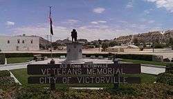
Veteran's Memorial
A controversial revitalization project started in 1995 in the ten square blocks along Historic Route 66. After years of setbacks in developing Old Town, the city—along with input from residents and local business owners—created an Old Town Strategic Action Plan in 2007. In 2008, demolition on hazardous and dilapidated buildings began. In 2010, as the economy declined, the statewide end of Economic Redevelopment Agencies which funded the project placed further work on indefinite hold.[26] As of 2012, the area still has problems with crime, homelessness, and many buildings remain boarded up. In 2016 a group R.O.O.T 66 (Revive Our Old Town) meets to help make Old Town Victorville great again.[27]
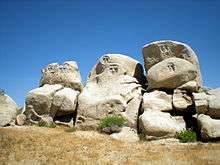
Notable changes made in Old Town Victorville are the Veteran's Memorial on the corner of Seventh Street and Forrest Ave, the Route 66 Museum on D Street, the Transportation Center on D Street, and the Old Victor School on Sixth Street.
Local areas
There are several notable areas and locations within Victorville such as Spring Valley Lake, the Old Sheriff's Office, U.S. Route 66 and the Southern California Logistics Airport.
Filming location
Victorville has been used for commercial filming several times:
- It Came from Outer Space (1953), filmed in Victorville and the surrounding desert; Victorville served as the setting for the fictional town of "Sand Rock, Arizona".[28]
- Grand Theft Auto (1977), starring Ron Howard filmed in Downtown Victorville.[29]
- The Hills Have Eyes (1977) by Wes Craven[30]
- The Hitcher (1986), starring Rutger Hauer, C. Thomas Howell, and Jennifer Jason Leigh, was filmed at the Outpost truck stop. Many local residents were used as extras.[31]
- Lethal Weapon (1987) was filmed at El Mirage Dry Lake west of Victorville.[32]
- From Dusk till Dawn (1996), the restaurant scene early in the movie
- Face/Off (1997), portions filmed at Southern California Logistics Airport in Victorville[33]
- Breakdown (1997) starring Kurt Russell, filmed in downtown Victorville[34]
- Contact (1997), also partially filmed in Victorville,[35] with some local residents used as extras.
- Play It to the Bone (1999) filmed partly in The New Reflections concert venue in Downtown[36]
- Kill Bill: Volume 2 (2004) was filmed in The New Reflections as well[37]
- The Fast and the Furious: Tokyo Drift (2006) was partially filmed in Victorville.[38]
- Sky (2015) included a dinner scene filmed in Emma Jean's Holland Burger Cafe in Victorville.[39]
Notable people
- Earl W. Bascom, rodeo pioneer, cowboy artist and sculptor, Rodeo Hall of Fame inductee[40][41][42][43]
- Harold Budd, Los Angeles–born ambient composer.[44]
- Jesse Chavez, Major League Baseball pitcher[45]
- Raven, drag queen and perfomer
- Roy Rogers & Dale Evens, Movie & recording stars. Victorville, the former site of the Roy & Dale museum, is sometimes listed as the Rogers' home, but they actually lived in neighboring Apple Valley, where they are also interred.
- Stevie Ryan, writer, comedian, and star of Stevie TV[46]
References
- 1 2 "Victorville". Geographic Names Information System. United States Geological Survey. Retrieved November 17, 2014.
- ↑ "California Cities by Incorporation Date" (Word). California Association of Local Agency Formation Commissions. Retrieved August 25, 2014.
- ↑ "About Victorville". City of Victorville. Retrieved February 18, 2015.
- ↑ "members". City of Victorville. Retrieved December 19, 2014.
- ↑ Victorville, City of. "Index". Victorville, City of. Retrieved 2010-01-08.
- ↑ "2010 Census U.S. Gazetteer Files – Places – California". United States Census Bureau.
- 1 2 3 4 5 "Victorville (city) QuickFacts". United States Census Bureau. Retrieved February 18, 2015.
- ↑ "USPS - ZIP Code Lookup - Find a ZIP+ 4 Code By City Results". Retrieved 2007-02-20.
- ↑ "Number Administration System - NPA and City/Town Search Results". Retrieved 2007-02-20.
- ↑ "Lane'S Crossing". Mojavedesert.net. Retrieved 2013-11-04.
- ↑ Thompson, Richard D. and Kathryn L. "Pioneer of the Mojave: The Life and Times of Aaron G. Lane". MojaveHistory.com. Retrieved 2008-12-02.
- ↑ "A Settlement On The Mojave". Mojavedesert.net. Retrieved 2013-11-04.
- ↑ Lebo, Harlan (1990). Citizen Kane: The Fiftieth Anniversary Album. New York: Doubleday. ISBN 978-0-385-41473-9.
- ↑ "Joseph Campbell and Jean De Blasis Interview". Mohave Historical Society Oral Histories. Mojave Desert History. Retrieved 2016-02-04.
- ↑ Roy Rogers and Dale Evans Museum
- ↑ "VICTORVILLE, CALIFORNIA - Climate Summary". Wrcc.dri.edu. Retrieved 2013-11-04.
- ↑ "Victorville Weather Averages". Weather Channel. Retrieved 2011-05-29.
- ↑ "Annual Estimates of the Resident Population for Incorporated Places: April 1, 2010 to July 1, 2015". Retrieved July 2, 2016.
- ↑ "Census of Population and Housing". Census.gov. Retrieved June 4, 2015.
- ↑ "2010 Census Interactive Population Search: CA - Victorville city". U.S. Census Bureau. Retrieved July 12, 2014.
- ↑ 2000 US Census Factfinder♙
- ↑ "Statewide Database". UC Regents. Retrieved November 29, 2014.
- ↑ "California's 8th Congressional District - Representatives & District Map". Civic Impulse, LLC. Retrieved March 9, 2013.
- ↑ "Basic Financial Statements and Supplementary Information, Year ended June 30, 2009" (PDF). City of Victorville. p. 160.
- ↑ "Schools." City of Victorville. Retrieved on May 8, 2016.
- ↑ "Roaming around Old Town | press, daily, click - Victorville Daily Press". Vvdailypress.com. 2012-08-15. Retrieved 2013-11-04.
- ↑ "Old Town's event center closes door — again | victorville, closes, door - Victorville Daily Press". Vvdailypress.com. 2012-04-25. Retrieved 2013-11-04.
- ↑ "It Came From Outer Space locations". Retrieved 2011-05-11.
- ↑ "Grand Theft Auto details". Retrieved 2011-05-11.
- ↑ "The Hills Have Eyes details". Retrieved 2011-05-11.
- ↑ "The Hitcher locations". Retrieved 2011-05-11.
- ↑ "Lethal Weapon locations". Retrieved 2011-05-11.
- ↑ "Face/Off locations". Retrieved 2011-05-11.
- ↑ "Breakdown locations". Retrieved 2011-05-11.
- ↑ "Contact locations". Retrieved 2011-05-11.
- ↑ "Play It to the Bone locations". Retrieved 2011-05-11.
- ↑ "Kill Bill: Volume 2 locations". Retrieved 2011-05-11.
- ↑ "The Fast and the Furious: Tokyo Drift locations". Retrieved 2011-05-11.
- ↑ "Sky (2015) - Filming Locations". IMDb. amazon.com. Retrieved 22 August 2016.
- ↑ Victor Valley Magazine "Earl Bascom, Cowboy Artist" (June 1983)
- ↑ Who's Who in California, Historical Society 1993
- ↑ The Pioneer "SUP Pioneer Cowboy inducted into Hall of Fame"
- ↑ ProRodeo Sports News "Bascom Dies at 89" (September 17, 1995)
- ↑ http://www.allmusic.com/artist/p2494/biography
- ↑ "Jesse Chavez Stats". Baseball Almanac. Retrieved December 3, 2012.
- ↑ Staggs, Brooke (Feb 20, 2012). "Victorville native lands VH1 show". Daily Press. Retrieved March 26, 2015.
External links
| Wikimedia Commons has media related to Victorville, California. |
 |
Adelanto | Oro Grande | Barstow | |
| Phelan | |
Desert Knolls | ||
| ||||
| | ||||
| Oak Hills | Hesperia | Apple Valley |
| |
^* Mayor selected from city council
|