Fort Bend County, Texas
| Fort Bend County, Texas | ||
|---|---|---|
|
Richmond's Fort Bend County Courthouse in November 2008 | ||
| ||
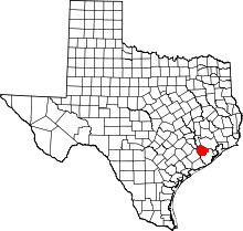 Location in the U.S. state of Texas | ||
 Texas's location in the U.S. | ||
| Founded | 1838 | |
| Named for | A blockhouse positioned in a bend of the Brazos River | |
| Seat | Richmond | |
| Largest city | Sugar Land | |
| Area | ||
| • Total | 885 sq mi (2,292 km2) | |
| • Land | 861 sq mi (2,230 km2) | |
| • Water | 24 sq mi (62 km2), 2.7% | |
| Population | ||
| • (2014) | 652,365 | |
| • Density | 697/sq mi (269/km²) | |
| Congressional districts | 9th, 22nd | |
| Time zone | Central: UTC-6/-5 | |
| Website |
www | |


_(12819388513).jpg)
Fort Bend County is a county in the U.S. state of Texas. As of the 2010 census, its population was 585,375,[1] making it the tenth-most populous county in Texas. Fort Bend County is the wealthiest county in Texas with a median household income of $95,389 and a median family income of $105,944, having surpassed Collin and Rockwall counties (Dallas suburbs) since the 2000 census.[2] The county seat is Richmond,[3] while its largest city is Sugar Land. The county was founded in 1837 and organized the next year.[4] It is named for a blockhouse at a bend of the Brazos River; the fort was the start of the community in early days.
Fort Bend County is included in the Houston–The Woodlands–Sugar Land Metropolitan Statistical Area. It was listed by Forbes as the 5th fastest-growing county in the United States.[5]
History
Prior to European settlement, the area was inhabited by the Karankawa Indians. Mexican colonists had generally not reached this area, settling more in south Texas.
After Mexico achieved independence from Spain, Anglo-Americans started entering from the east. In 1822, a group of Stephen F. Austin's colonists, headed by William Travis, built a fort at the present site of Richmond. The fort was called "Fort Bend", since it was built in the bend of the Brazos River.[6] The city of Richmond was incorporated under the Republic of Texas along with nineteen other towns in 1837. Fort Bend County was created from parts of Austin, Harris, and Brazoria counties in 1838.
Fort Bend developed a plantation economy based on cotton and, due to the high number of African-American slaves held as laborers, it was one of six majority-black counties in the state by the 1850s.[7] In 1860 the slave population totaled 4,127, more than twice that of the 2,016 whites.[8] There were very few free blacks, as Texas refused them entry.
While the area began to attract immigrants in the late 19th century, it continued as majority black during and after Reconstruction, when Republicans were elected to office. By the 1880s, most white residents belonged to the Democratic Party, but factional tensions were fierce, largely along racial lines. The Jaybirds, representing the majority of the whites, were struggling to regain control from the Woodpeckers, who were made up of some whites consistently elected to office by the majority of African-Americans; several had been former Republican officials during Reconstruction. Fort Bend County was the site of the Jaybird–Woodpecker War in 1888-1889. After a few murders were committed, the political feud culminated in a gun-battle at the courthouse on August 16, 1889 when several more people were killed and the Woodpeckers were routed from the seat of government.[9]
Governor Lawrence Sullivan Ross sent in militia forces and declared martial law. With his support, the Jaybirds ordered a list of certain blacks and Woodpecker officials out of the county. The Jaybirds took over county offices and established a "white-only pre-primary," disenfranchising the African Americans from the only competitive contests in the county.[9] This device lasted until 1950 when Willie Melton and Arizona Fleming won a lawsuit against the practice in United States District Court, though it was overturned on appeal. In 1953 they ultimately won their suit when the Jaybird primary was declared unconstitutional by the Supreme Court of the United States in Terry v. Adams,[10] the last of the white primaries cases.[11]
20th century to present
In the middle 1950s, Fort Bend and neighboring Galveston counties were plagued by organized crime, which was involved with the brothels and illegal casinos. A crusading newspaper editor, Clymer Wright of the Fort Bend Reporter, joined with state officials and the Texas Rangers to rid the area of such corruption. Wright defied death threats to report on the issues and clean up the community.[12] Wright soon sold his paper, now known as the Fort Bend Herald and Texas Coaster.[13]
While party alignments have changed since the early 20th century, with conservative whites now supporting the Republican Party, minority voting by minorities has been reviewed by the federal government under provisions of the Voting Rights Act of 1965. In April 2009, as part of a settlement with the United States Department of Justice, officials of Fort Bend County agreed to increase assistance to Spanish-speaking Latino voters in elections held in the county.[14]
Geography
According to the United States Census Bureau, the county has a total area of 885 square miles (2,290 km2), of which 861 square miles (2,230 km2) is land and 24 square miles (62 km2) (2.7%) is water.[15]
Adjacent counties
- Waller County (north)
- Harris County (northeast)
- Austin County (northwest)
- Brazoria County (southeast)
- Wharton County (southwest)
Demographics
| Historical population | |||
|---|---|---|---|
| Census | Pop. | %± | |
| 1850 | 2,533 | — | |
| 1860 | 6,143 | 142.5% | |
| 1870 | 7,114 | 15.8% | |
| 1880 | 9,380 | 31.9% | |
| 1890 | 10,586 | 12.9% | |
| 1900 | 16,538 | 56.2% | |
| 1910 | 18,168 | 9.9% | |
| 1920 | 22,931 | 26.2% | |
| 1930 | 29,718 | 29.6% | |
| 1940 | 32,963 | 10.9% | |
| 1950 | 31,056 | −5.8% | |
| 1960 | 40,527 | 30.5% | |
| 1970 | 52,314 | 29.1% | |
| 1980 | 130,846 | 150.1% | |
| 1990 | 225,421 | 72.3% | |
| 2000 | 354,452 | 57.2% | |
| 2010 | 585,375 | 65.1% | |
| Est. 2015 | 716,087 | [16] | 22.3% |
| U.S. Decennial Census[17] 1850–2010[18] 2010–2014[1] | |||
| Demographic profile[19] | 2010 |
|---|---|
| Total Population | 585,375 – 100.0% |
| Not Hispanic or Latino | 446,408 – 76.3% |
| White alone | 211,680 – 36.2% |
| Black or African American alone | 123,267 – 21.1% |
| Asian alone | 98,762 – 16.9% |
| American Indian and Alaska Native alone | 1,159 – 0.2% |
| Native Hawaiian and Other Pacific Islander alone | 174 – 0.0% |
| Some other race alone | 1,341 – 0.2% |
| Two or more races alone | 10,025 – 1.7% |
| Hispanic or Latino (of any race) | 138,967 – 23.7% |
As of the census[20] of 2000, there were 354,452 people, 110,915 households, and 93,057 families residing in the county. The population density was 405 people per square mile (156/km²). There were 115,991 housing units at an average density of 133 per square mile (51/km²). The racial or ethnic makeup of the county was 56.96% White (46.21% White Non-Hispanic), 19.85% Black or African American, 0.30% Native American, 11.20% Asian, 0.04% Pacific Islander, 9.10% from other races, and 2.56% from two or more races. 21.12% of the population were Hispanic or Latino of any race. Other self-identifications were 8.8% of German ancestry, 6.3% American and 5.8% English ancestry according to the 2000 United States Census.
In 2006 Fort Bend county had a population of 493,187. This represented a growth of 39.1% since 2000. The county's racial or ethnic makeup was 53.96% White (39.63% White Non-Hispanic), 20.88% African American, 14.77% Asian, 0.51% Native American, 7.73% other races and 2.14% from two or more races. 22.88% of the population were Hispanic or Latino of any race. 23.82% of the population was foreign born; of this, 50.24% came from Asia, 37.17% came from Latin America, 5.74% from Africa, 5.28% from Europe and 1.57% from other parts of the world.
In 2000 there were 110,915 households out of which 49.80% had children under the age of 18 living with them, 68.80% were married couples living together, 11.40% had a female householder with no husband present, and 16.10% were non-families. 13.50% of all households were made up of individuals and 3.10% had someone living alone who was 65 years of age or older. The average household size was 3.14 and the average family size was 3.46.
In the county, the age distribution of the population shows 32.00% under the age of 18, 7.60% from 18 to 24, 32.30% from 25 to 44, 22.40% from 45 to 64, and 5.70% who were 65 years of age or older. The median age was 33 years. For every 100 females there were 99.10 males. For every 100 females age 18 and over, there were 96.30 males.
As of 2002, the largest two cities within Fort Bend County were Missouri City and Sugar Land, with portions of Houston combining to make up the county's third largest "city". In that year, 38,000 residents of the City of Houston lived in Fort Bend County.[21]
According to the 2008 American Community Survey, the median income for a household in the county was $81,456, and the median income for a family was $90,171.[22] Males had a median income of $54,139 versus $41,353 for females. The per capita income for the county was $30,862. About 5.50% of families and 7.10% of the population were below the poverty line, including 8.50% of those under age 18 and 9.40% of those age 65 or over.
As of 2006 Fort Bend County is the wealthiest county in Texas with a median household income of $95,389 and a median family income of $105,944, having surpassed Collin and Rockwall counties (Dallas suburbs) since the 2000 census.[23] However, the Council for Community and Economic Research ranked Fort Bend County as America's 3rd wealthiest county when the local cost of living was factored into the equation with median household income.[24]
However, this estimate does not include property taxes and local taxes, as they didn't measure effective tax rates and home insurance. Fort Bend County, along with other Texas counties, has one of the nation's highest property tax rates.
In 2007, it was ranked 5th in the nation for property taxes as percentage of the homes value on owner occupied housing. The list only includes counties with a population over 65,000 for accuracy.[25] Fort Bend County also ranked in the top 100 for amount of property taxes paid and for percentage of taxes of income. Part of this is due to the complex Robin Hood plan school financing law that exists in Texas.[26]
Ethnic backgrounds
Since the 1970s, Fort Bend County has been attracting people from all types of ethnic backgrounds. According to a 2001 Claritas study, it was the fifth-most diverse U.S. county, among counties with a population of 100,000 or more.[27]
It is one of a growing number of U.S. counties with an ethnic plurality, with no single ethnic group forming a majority of the population. Fort Bend County also has the highest percentage of Asian Americans in the Southern United States; the largest groups are of Vietnamese, Chinese, Indian, and Filipino ancestry. By 2011 Fort Bend was ranked the fourth-most racially diverse county in the United States by USA Today. The newspaper based the ranking on calculating the probability that two persons selected at random would be of different ethnic groups or races. According to the USA Today methodology, the chance of people of being two different ethnic groups/races being selected was 75%. Karl Eschbach, a former demographer with the State of Texas, said in a 2011 Houston Chronicle article that many people from Houston neighborhoods and communities with clear racial identities, such as the East End, Sunnyside, and the Third Ward, moved to suburban areas that were too new to have established racial identities. Eschbach explained "[a]s a large minority middle class started to emerge, Fort Bend was virgin territory that all groups could move to."[28]
Government and politics
| Year | Republican | Democratic |
|---|---|---|
| 2016 | 44.8% 117,212 | 51.4% 134,475 |
| 2012 | 52.9% 116,126 | 46.8% 101,144 |
| 2008 | 50.9% 102,846 | 48.6% 98,136 |
| 2004 | 57.4% 93,625 | 42.1% 68,722 |
| 2000 | 59.6% 73,567 | 38.5% 47,569 |
| 1996 | 53.8% 49,945 | 41.1% 38,163 |
| 1992 | 46.6% 41,039 | 34.1% 29,992 |
| 1988 | 62.4% 39,818 | 36.6% 23,351 |
| 1984 | 68.7% 41,370 | 31.1% 18,729 |
| 1980 | 66.3% 25,366 | 30.3% 11,583 |
| 1976 | 60.3% 17,354 | 39.1% 11,264 |
| 1972 | 69.4% 10,475 | 30.1% 4,541 |
| 1968 | 39.7% 4,573 | 39.0% 4,493 |
| 1964 | 36.0% 3,493 | 63.8% 6,186 |
| 1960 | 42.8% 3,301 | 56.3% 4,339 |
County politics in Fort Bend County, as with all counties in Texas, are centered around a Commissioners' Court. It is composed of four popularly elected County Commissioners, one representing each precinct drawn decennially on the basis of population, and a county judge elected to represent the entire county. Other county officials include a Sheriff, District Attorney, Tax Assessor-Collector, County Clerk, District Clerk, County Treasurer, and County Attorney.
Historically, Fort Bend County was for decades a stronghold for the Democratic Party, having achieved disenfranchisement of blacks at the county level (1889) in the aftermath of the Jaybird–Woodpecker War.[9] The state effectively disfranchised blacks by imposition of a poll tax and white primaries; the latter device was declared unconstitutional in 1944. By 1960, so few Republicans resided in Fort Bend County that the county's Republican chair once received a letter addressed simply to "Mr. Republican".[29] However, as the 1960s progressed, rapid suburban-style development in west and southwest Houston began to overflow into Fort Bend County, where the development of numerous master-planned communities attracted many upper-middle-class families to developments in the eastern portion of the county. Richard Nixon would narrowly carry the county in 1968, making it the only county in Greater Houston outside of Harris County to go Republican that year, and again in his 1972 landslide. In 1976, conservative physician Ron Paul of Brazoria County, noted for his opposition to most government programs, which earned him the nickname "Dr. No", would capture the 22nd district in the United States House of Representatives in a special election, before narrowly losing reelection in the November election that also saw Gerald Ford win Fort Bend, despite losing Texas to eventual winner Jimmy Carter.
Beginning in 1978, Republicans began to win several offices within the county, with William P. Clements carrying the county in his successful run for governor. That same year, Paul would be returned to Congress, while businessman Tom DeLay would capture the county's seat in the Texas House of Representatives. In 1984, DeLay succeeded Paul in Congress after the latter ran for an unsuccessful U.S. Senate campaign, and would eventually become House Majority Leader by 2002. From 1982 onward, Republicans began to win a number of county-level offices and judgeships, and Fort Bend County's new reputation as a Republican stronghold culminated in the 1994 election of a Republican County Judge to the Commissioners' Court for the first time since Reconstruction. As of 2016, every elected countywide office in Fort Bend County, as well as a majority of precinct-level positions, is held by Republicans.
However, with growing populations of minorities and more socially moderate suburban voters who often break Republican on fiscal and economic issues, Fort Bend County has become more competitive recently. In 2008, Democrat Barack Obama came very close to winning the county in heavy voting, with 48.6 percent of the vote compared to 50.9 percent for Republican John McCain. Eight years later in 2016, Hillary Clinton became the first Democrat to carry the county since Texas' own Lyndon B. Johnson in 1964, largely due to the unpopularity of Republican nominee and eventual winner Donald Trump among many minority and suburban voters nationally who ended up splitting their tickets between Clinton and an otherwise straight Republican vote; Republicans won every elected countywide office by a margin similar to Clinton's while also defeating an incumbent Democrat on the Fort Bend County Commissioners' Court.[30][31]
Overall, the county is now often considered a swing county in Texas politics, with election results usually tilting more Democratic than the overall statewide results. Elections within the county are often decided by margins in more Republican-leaning areas in Sugar Land, Rosenberg and southern Missouri City, with Republicans dominating in the Katy, Fulshear and rural southern areas of the county and Democrats having their stronghold in the county's northeast corner around northern Missouri City and Fresno, as well as heavily Hispanic Mission Bend (north of Sugar Land).
Commissioners' Court
| Commissioners | Name | Party | First Elected | Communities Represented | |
|---|---|---|---|---|---|
| Judge | Bob Hebert | Republican | 2002 | Countywide | |
| Precinct 1 | Richard Morrison | Democratic | 2008 | Arcola, Beasley, Fairchilds, Fresno, Greatwood, Needville, Orchard, Richmond, Rosenberg, Sienna Plantation | |
| Precinct 2 | Grady Prestage | Democratic | 1990 | eastern Stafford, most of Missouri City east of FM 1092, Meadows Place, Mission Bend | |
| Precinct 3 | Andy Meyers | Republican | 1996 | Cinco Ranch, Fulshear, Lakemont, Pecan Grove, Simonton, small portions of Sugar Land | |
| Precinct 4 | James Patterson | Republican | 1998 | Most of Sugar Land, Missouri City west of FM 1092, New Territory, Riverstone | |
United States Congress
| Senators | Name | Party | First Elected | Level | |
|---|---|---|---|---|---|
| Senate Class 1 | Ted Cruz | Republican | 2012 | Junior Senator | |
| Senate Class 2 | John Cornyn | Republican | 2002 | Senior Senator | |
| Representatives | Name | Party | First Elected | Area(s) of Fort Bend County Represented | |
| District 9 | Al Green | Democratic | 2004 | Mission Bend, eastern portion of Stafford, northern and eastern portions of Missouri City, county's entire share of Houston | |
| District 22 | Pete Olson | Republican | 2008 | Majority of Sugar Land, Rosenberg and Greater Katy areas, plus Fulshear, western and southern Missouri City and Stafford | |
Texas Legislature
Texas Senate
| District | Name | Party | First Elected | Area(s) of Fort Bend County Represented | |
|---|---|---|---|---|---|
| 13 | Borris Miles | Democratic | 2016 (appointed) | Northern portions of Missouri City, Stafford, county's share of Houston | |
| 17 | Joan Huffman | Republican | 2008 | most of Sugar Land, Mission Bend and southern Missouri City | |
| 18 | Lois Kolkhorst | Republican | 2015 (special) | Richmond, Rosenberg, Katy, Fulshear, Needville | |
Texas House of Representatives
| District | Name | Party | First Elected | Area(s) of Fort Bend County Represented | |
|---|---|---|---|---|---|
| 26 | Rick Miller | Republican | 2012 | Most of Sugar Land, plus Richmond, Pecan Grove and Greatwood | |
| 27 | Ron Reynolds | Democratic | 2010 | Missouri City, Sienna Plantation, Fresno and county's share of Houston | |
| 28 | John M. Zerwas | Republican | 2006 | Northern areas of county including Cinco Ranch, Fulshear and Richmond | |
| 85 | Phil Stephenson | Republican | 2012 | Southern areas including Rosenberg, Needville and Riverstone; majority of district located in Wharton and Jackson counties | |
Corrections
The Fort Bend County Jail is located at 1410 Williams Way Boulevard in Richmond.[32]
Texas Department of Criminal Justice operates the following facilities in Fort Bend County, all at the Jester State Prison Farm site:
Prisons for men:
- Jester III Unit (Unincorporated area)[33] (Co-located with the Jester units)
- Carol Vance Unit (Unincorporated area)[34] (Co-located with the Jester units)
Other facilities:
- Jester I Unit – Substance Abuse Felony Punishment Facility (Unincorporated area)[35] (Co-located with the Jester units)
- Jester IV Unit – Psychiatric Facility (Unincorporated area)[36] (Co-located with the Jester units)
The TDCJ announced that the Central Unit in Sugar Land was closing in 2011. The City of Sugar Land is exploring the property for future economic development, including light industrial uses, as well as a potential expansion of Sugar Land Regional Airport.[37]
Economy
In contrast to Greater Houston in general, Fort Bend County's economy tends to be more diverse, with numerous service-sector jobs in healthcare, energy, education, hospitality and other areas. Major companies with a presence in the county include Schlumberger, Minute Maid, Fluor and Sunoco's logistics operations in Sugar Land. The Houston Business Journal reported in 2010 that the diversity of industries promoted decades of rapid population growth.[38] After Memorial Hermann Hospital and St. Luke's Episcopal Hospital opened facilities in Fort Bend County, already home to local facilities for Houston Methodist Hospital in Sugar Land, as well as locally based OakBend Medical Center in Richmond, numerous doctors moved their offices to the county.[39] Compared to Montgomery County, which has experienced rapid growth in corporate employment following ExxonMobil's decision to move its Greater Houston operations to an area directly south of The Woodlands, Fort Bend County has yet to experience significant corporate growth, even though Schlumberger recently announced plans to move its North American headquarters to Sugar Land.
Education
Public school districts
- Brazos Independent School District
- Fort Bend Independent School District
- Katy Independent School District
- Lamar Consolidated Independent School District
- Needville Independent School District
- Stafford Municipal School District
Kendleton Independent School District closed in 2010.
Higher education
- University of Houston Sugar Land campus
- Houston Community College System
- Wharton County Junior College
Technical school
Libraries
Fort Bend County Libraries operates many libraries in the county.
Houston Public Library operates one branch in the county.
Media
Local newspapers in the county include three weeklies, the Fort Bend Star, headquartered in Stafford, and the Fort Bend Independent and Fort Bend Sun, headquartered in Sugar Land, as well as the daily Fort Bend Herald and Texas Coaster which focuses on news coverage in the Richmond-Rosenberg area. Fort Bend County is also a major service area for the Houston Chronicle, which provides separate local coverage for the Sugar Land and Katy areas.
Transportation
Major highways
 Interstate 10
 Interstate 69 (Under Construction)
 U.S. Route 59
 U.S. Route 90 Alternate
 State Highway 6
 State Highway 36
 State Highway 99 — Grand Parkway
 Fort Bend Parkway
 Westpark Tollway
 Farm to Market Road 359
 Farm to Market Road 442
 Farm to Market Road 521
 Farm to Market Road 762
 Farm to Market Road 1092
 Farm to Market Road 1093
 Farm to Market Road 1464
 Farm to Market Road 1876
 Farm to Market Road 2234
 Farm to Market Road 2759
 Farm to Market Road 2977
 Farm to Market Road 3345
Airports
The sole publicly owned airport in the county is Sugar Land Regional Airport in Sugar Land.
Privately owned airports for public use include:
- Houston Fort Bend Airport is in an unincorporated area east of Beasley
- Houston Southwest Airport in Arcola
- Westheimer Air Park is in an unincorporated area between Fulshear and Houston
Privately owned airports for private use include:
- Cardiff Brothers Airport is in an unincorporated area near Fulshear and Katy
The following general aviation heliports (all privately owned, for private use) exist in unincorporated areas:
- Dewberry Heliport is in an unincorporated area between Fulshear and Katy
The closest airport with regularly scheduled commercial service is Houston's William P. Hobby Airport in Harris County. The Houston Airport System stated that Fort Bend County is within the primary service area of George Bush Intercontinental Airport, an international airport in Houston in Harris County.[40]
Mass transit
Fort Bend County officially created a department of Public Transportation in 2005 that provides commuter buses to Uptown, Greenway Plaza, and Texas Medical Center. It also provides Demand and Response Buses to Senior Citizens and the General Public that travel only in Fort Bend County to anywhere in Fort Bend County.[41] Portions of the county, e.g., Katy, Missouri City, are participants in the Metropolitan Transit Authority of Harris County and are served by several Park and Ride routes.
Freeway system
The TTC-69 component (recommended preferred) of the once-planned Trans-Texas Corridor went through Fort Bend County.[42]
Toll roads
The Fort Bend County Toll Road Authority (FBCTRA), located in Sugar Land, manages and operates tolled portions of three toll roads operating in the county:
Communities
Cities (multiple counties)
- Houston (mostly in Harris County and a small part in Montgomery County)
- Katy (partly in Harris and Waller counties)
- Missouri City (small part in Harris County)
- Pearland (mostly in Brazoria County and a small part in Harris County)
- Stafford (small part in Harris County)
Cities
Town
Villages
Census-designated places
- Cinco Ranch (small part in Harris County)
- Cumings
- Fifth Street
- Four Corners
- Fresno
- Greatwood
- Mission Bend (partly in Harris County)
- New Territory
- Pecan Grove
- Sienna Plantation
Unincorporated communities
Ghost Towns
See also
- List of museums in the Texas Gulf Coast
- National Register of Historic Places listings in Fort Bend County, Texas
References
- 1 2 "State & County QuickFacts". United States Census Bureau. Retrieved December 16, 2013.
- ↑ "2015 American Community Survey: Fort Bend County, Texas". census.gov. 2015. Retrieved 2016-1-21. Check date values in:
|access-date=(help) - ↑ "Find a County". National Association of Counties. Archived from the original on 2011-05-31. Retrieved 2011-06-07.
- ↑ "Texas: Individual County Chronologies". Texas Atlas of Historical County Boundaries. The Newberry Library. 2008. Retrieved May 23, 2015.
- ↑ http://www.forbes.com/pictures/edgl45fihj/no-5-fort-bend-county-texas/#174d792bd28d
- ↑ Gannett, Henry (1905). The Origin of Certain Place Names in the United States. Govt. Print. Off. p. 128.
- ↑ Alvarez, Elizabeth Cruce (Nov 8, 2011). Texas Almanac 2012–2013. Texas A&M University Press. pp. Contents. Retrieved 17 November 2013.
- ↑ Virginia Laird Ott, "FORT BEND COUNTY," Handbook of Texas Online (http://www.tshaonline.org/handbook/online/articles/hcf07), accessed February 22, 2014. Uploaded on June 12, 2010. Published by the Texas State Historical Association
- 1 2 3 Yelderman, Pauline (2010). "Handbook of Texas Online: JAYBIRD-WOODPECKER WAR". Texas State Historical Association. Retrieved February 22, 2014.
- ↑ Hayes, Bonni C. (2010). "Handbook of Texas Online: ARIZONA FLEMING". Texas State Historical Association. Retrieved July 5, 2014.
- ↑ Johnson, Paul (2000). A History of the American People. Orion Publishing Group, Limited. p. 661. ISBN 978-1-84212-425-3.
- ↑ "Doug Miller, "Clymer Wright, conservative term-limit advocate, found dead in his home", January 25, 2011". KHOU-TV. Retrieved January 27, 2011.
- ↑ "About Fort Bend Herald and Texas Coaster". fbherald.com. Retrieved January 28, 2011.
- ↑ Bernstein, Alan and Zen T. C. Zheng. "Fort Bend accepts vote decree," Houston Chronicle. April 10, 2009. Retrieved on April 11, 2009.
- ↑ "2010 Census Gazetteer Files". United States Census Bureau. August 22, 2012. Retrieved April 26, 2015.
- ↑ "County Totals Dataset: Population, Population Change and Estimated Components of Population Change: April 1, 2010 to July 1, 2015". Retrieved July 2, 2016.
- ↑ "U.S. Decennial Census". United States Census Bureau. Archived from the original on May 11, 2015. Retrieved April 26, 2015.
- ↑ "Texas Almanac: Population History of Counties from 1850–2010" (PDF). Texas Almanac. Retrieved April 26, 2015.
- ↑ "Demographic Profile Bay Area Census".
- ↑ "American FactFinder". United States Census Bureau. Archived from the original on 2013-09-11. Retrieved 2011-05-14.
- ↑ De Mangin, Charles. "Neighborhood charts its course." Houston Chronicle. Thursday November 14, 2002. Retrieved on October 27, 2011.
- ↑ American FactFinder, United States Census Bureau. "Fort Bend County, Texas - Selected Economic Characteristics: 2006–2008". Factfinder.census.gov. Retrieved 2010-07-22.
- ↑ "2015 American Community Survey: Fort Bend County, Texas". census.gov. 2015. Retrieved 2016-1-21. Check date values in:
|access-date=(help) - ↑ Cost of Living Can Significantly Affect "Real" Median Household Income, Council for Community and Economic Research website . Retrieved December 9, 2007.
- ↑ "Property Taxes on Owner-Occupied Housing by County, 2005 - 2008, Ranked by Taxes as Percentage of Home Value". The Tax Foundation. 2009-09-22. Retrieved 2010-07-22.
- ↑ Postrel, Virginia (October 7, 2004). "Economic Scene; A Texas experiment that shifts money from rich to poor school districts is turning into a major policy disaster". The New York Times. Retrieved May 2, 2010.
- ↑ "Claritas Study Ranks Racial/Ethnic Diversity in Counties Nationwide; Analysis Shows California Leads Nation In Diversity Among Counties Of 100,000-Plus Population". Business Wire. July 23, 2001.
- ↑ Kever, Jeannie. "FACING A CROSSROADS." Houston Chronicle. June 1, 2011. Retrieved on June 3, 2011.
- ↑
- ↑ reporter, kevin quinn, eyewitness news, (2016-11-10). "Political shift in Ft. Bend leans toward Clinton". ABC13 Houston. Retrieved 2016-11-10.
- ↑ reporter, Margaret Kadifa (2016-11-14). "Clinton wins FB County, Republicans dominate local races". Houston Chronicle. Retrieved 2016-11-22.
- ↑ "Detention." Fort Bend County. October 3, 2006.
- ↑ "JESTER III (J3)." Texas Department of Criminal Justice. Retrieved September 14, 2008.
- ↑ "VANCE (J2)." Texas Department of Criminal Justice. Retrieved September 14, 2008.
- ↑ "JESTER I (J3)." Texas Department of Criminal Justice. Retrieved September 14, 2008.
- ↑ "JESTER IV (J4)." Texas Department of Criminal Justice. Retrieved September 14, 2008.
- ↑ Ward, Mike. "Texas closing prison as part of cutbacks." Austin American-Statesman at KDH News. Wednesday August 3, 2011. Retrieved on September 23, 2011.
- ↑ "Fort Bend County tops Forbes growth list." Houston Business Journal. Tuesday February 2, 2010. Retrieved on February 8, 2010.
- ↑ Latson, Jennifer. "Businesses finding the suburbs superb." Houston Chronicle. May 18, 2010. Retrieved on May 24, 2010.
- ↑ "Master Plan Executive Summary." George Bush Intercontinental Airport Master Plan. Houston Airport System. December 2006. 2-1 (23/130). Retrieved on December 14, 2010.
- ↑ http://www.FBCTransit.org Fort Bend County Transit
- ↑ TxDoT, TTC Section C & S, Detailed Maps 2 & 3, 2007-12-17
External links
| Wikimedia Commons has media related to Fort Bend County, Texas. |
- Fort Bend Panthers Lacrosse website
- Fort Bend Rangers Lacrosse website
- Fort Bend County official website
- Historic Images from the Fort Bend Museum hosted by the Portal to Texas History
- Fort Bend Museum Web site
- Fort Bend County, Texas from the Handbook of Texas Online
- Fort Bend County profile from The County Information Project
 |
Austin County | Waller County | | |
| |
Harris County | |||
| ||||
| | ||||
| Wharton County | Brazoria County |
| Counties | 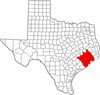 | |
|---|---|---|
| "Principal" cities | ||
| Other cities |
For a complete listing, see list of cities and towns in Houston–The Woodlands–Sugar Land MSA | |
| Unincorporated areas | ||
| Bodies of water | ||
Municipalities and communities of Fort Bend County, Texas, United States | ||
|---|---|---|
| Cities | | |
| Town | ||
| Villages | ||
| CDPs | ||
| Unincorporated communities | ||
| Ghost towns | ||
| Footnotes | ‡This populated place also has portions in an adjacent county or counties;
±Former community annexed by Missouri City | |

Coordinates: 29°32′N 95°46′W / 29.53°N 95.77°W