Nolan County, Texas
| Nolan County, Texas | |
|---|---|
|
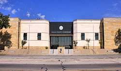
Nolan County Courthouse | |
 Location in the U.S. state of Texas | |
 Texas's location in the U.S. | |
| Founded | 1881 |
| Named for | Philip Nolan |
| Seat | Sweetwater |
| Largest city | Sweetwater |
| Area | |
| • Total | 914 sq mi (2,367 km2) |
| • Land | 912 sq mi (2,362 km2) |
| • Water | 2.0 sq mi (5 km2), 0.2% |
| Population | |
| • (2010) | 15,216 |
| • Density | 17/sq mi (7/km²) |
| Congressional district | 19th |
| Time zone | Central: UTC-6/-5 |
| Website |
www |
Nolan County is a county located in the west central region of the U.S. state of Texas. As of the 2010 census, its population was 15,216.[1] Its county seat is Sweetwater.[2] The county was created in 1876 and organized in 1881.[3] It is named for Philip Nolan, one of the first American traders to visit Texas.
Nolan County comprises the Sweetwater, TX Micropolitan Statistical Area.
Susan King has been since 2007 the Republican state representative from Nolan as well as Jones and Taylor counties.[4]
From 1921 to 1925, the Democrat Richard M. Chitwood of Sweetwater, represented Nolan County in the state House. As chairman of the House Education Committee, he worked in 1923 to establish what became Texas Tech University in Lubbock. He had first tried to obtain the institution for Sweetwater as the central location of West Texas. After the institution was established, he resigned from the House to move to Lubbock to become the first Texas Tech business manager. He served in that capacity for just fifteen months; he died in Dallas in November 1926.[5]
Geography
According to the U.S. Census Bureau, the county has a total area of 914 square miles (2,370 km2), of which 912 square miles (2,360 km2) is land and 2.0 square miles (5.2 km2) (0.2%) is water.[6]
Major highways
Adjacent counties
- Fisher County (north)
- Taylor County (east)
- Runnels County (southeast)
- Coke County (south)
- Mitchell County (west)
Demographics
| Historical population | |||
|---|---|---|---|
| Census | Pop. | %± | |
| 1880 | 640 | — | |
| 1890 | 1,573 | 145.8% | |
| 1900 | 2,611 | 66.0% | |
| 1910 | 11,999 | 359.6% | |
| 1920 | 10,868 | −9.4% | |
| 1930 | 19,323 | 77.8% | |
| 1940 | 17,309 | −10.4% | |
| 1950 | 19,808 | 14.4% | |
| 1960 | 18,963 | −4.3% | |
| 1970 | 16,220 | −14.5% | |
| 1980 | 17,359 | 7.0% | |
| 1990 | 16,594 | −4.4% | |
| 2000 | 15,802 | −4.8% | |
| 2010 | 15,216 | −3.7% | |
| Est. 2015 | 15,107 | [7] | −0.7% |
| U.S. Decennial Census[8] 1850–2010[9] 2010–2014[1] | |||
As of the census[10] of 2000, there were 15,802 people, 6,170 households, and 4,288 families residing in the county. The population density was 17 people per square mile (7/km²). There were 7,112 housing units at an average density of 8 per square mile (3/km²). The racial makeup of the county was 78.45% White, 4.68% Black or African American, 0.49% Native American, 0.24% Asian, 0.06% Pacific Islander, 14.02% from other races, and 2.07% from two or more races. 28.04% of the population were Hispanic or Latino of any race.
There were 6,170 households out of which 32.20% had children under the age of 18 living with them, 53.00% were married couples living together, 12.60% had a female householder with no husband present, and 30.50% were non-families. 27.10% of all households were made up of individuals and 13.40% had someone living alone who was 65 years of age or older. The average household size was 2.48 and the average family size was 3.01.
In the county, the population was spread out with 27.10% under the age of 18, 8.50% from 18 to 24, 25.40% from 25 to 44, 22.60% from 45 to 64, and 16.40% who were 65 years of age or older. The median age was 37 years. For every 100 females there were 94.70 males. For every 100 females age 18 and over, there were 91.70 males.
The median income for a household in the county was $26,209, and the median income for a family was $32,004. Males had a median income of $28,674 versus $19,335 for females. The per capita income for the county was $14,077. About 18.30% of families and 21.70% of the population were below the poverty line, including 29.50% of those under age 18 and 18.50% of those age 65 or over.
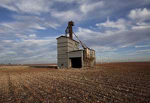
Wind power
Nolan County has established itself as a center for wind power generation. As of July 2008, Nolan County generates more wind energy than the entire state of California, and would rank 6th in wind power generation among all nations if it were counted as its own nation.[11]
Communities
Cities
- Blackwell (partly in Coke County)
- Roscoe
- Sweetwater (county seat)
Unincorporated communities
Ghost towns
See also
References
- 1 2 "State & County QuickFacts". United States Census Bureau. Retrieved December 22, 2013.
- ↑ "Find a County". National Association of Counties. Retrieved 2011-06-07.
- ↑ "Texas: Individual County Chronologies". Texas Atlas of Historical County Boundaries. The Newberry Library. 2008. Retrieved May 25, 2015.
- ↑ "Susan King". Texas Legislative Reference Library. Retrieved March 12, 2014.
- ↑ "Richard M. Chitwood". Texas Legislative Reference Library. Retrieved July 31, 2015.
- ↑ "2010 Census Gazetteer Files". United States Census Bureau. August 22, 2012. Retrieved May 5, 2015.
- ↑ "County Totals Dataset: Population, Population Change and Estimated Components of Population Change: April 1, 2010 to July 1, 2015". Retrieved July 2, 2016.
- ↑ "U.S. Decennial Census". United States Census Bureau. Retrieved May 5, 2015.
- ↑ "Texas Almanac: Population History of Counties from 1850–2010" (PDF). Texas Almanac. Retrieved May 5, 2015.
- ↑ "American FactFinder". United States Census Bureau. Retrieved 2011-05-14.
- ↑ Reed, Dan (11 July 2008). "Texas oilman T. Boone Pickens wants to supplant oil with wind". USA Today.
External links
- Nolan County Official Site
- Nolan County from the Handbook of Texas Online
- Nolan County Profile from the Texas Association of Counties
- The National WASP WWII Museum
 |
Fisher County | | ||
| Mitchell County | |
Taylor County | ||
| ||||
| | ||||
| Coke County | Runnels County |
Municipalities and communities of Nolan County, Texas, United States | ||
|---|---|---|
| Cities | | |
| Unincorporated communities | ||
| Ghost towns | ||
| Footnotes | ‡This populated place also has portions in an adjacent county or counties | |

| Wind power | ||
|---|---|---|
| Wind turbines | ||
| Wind power industry | ||
| Wind farms | ||
| Concepts | ||
Coordinates: 32°19′N 100°24′W / 32.31°N 100.40°W