Ward County, Texas
| Ward County, Texas | |
|---|---|
|
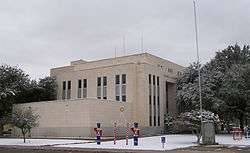
The Ward County Courthouse in Monahans | |
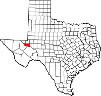 Location in the U.S. state of Texas | |
 Texas's location in the U.S. | |
| Founded | 1892 |
| Named for | Thomas W. Ward |
| Seat | Monahans |
| Largest city | Monahans |
| Area | |
| • Total | 836 sq mi (2,165 km2) |
| • Land | 836 sq mi (2,165 km2) |
| • Water | 0.2 sq mi (1 km2), 0.03% |
| Population | |
| • (2010) | 10,658 |
| • Density | 13/sq mi (5/km²) |
| Congressional district | 23rd |
| Time zone | Central: UTC-6/-5 |
| Website |
www |
Ward County is a county located in the U.S. state of Texas. As of the 2010 census, the population was 10,658.[1] The county seat is Monahans.[2] The county was created in 1887 and organized in 1892.[3] It is named for Thomas W. Ward, a soldier in the Texas Revolution.
History
Native Americans
Archeological investigations conducted in northwestern Ward County have found evidence of prehistoric man in the form of occupational debris, petroglyphs, and pictographs. Tribes occupying the area include Suma-Jumano, Apache and Comanche. The sand hills have contained native artifacts.[4]
Growth
The Butterfield Overland Mail in 1858 used Emigrant's Crossing, where exposed rocks afford one of the few places safe for fording the Pecos River. The stage line had an adobe station and a high-walled adobe corral there.[5]
In 1881 the Texas and Pacific Railway crossed the region and established stations at Sand Hills, Monahans, Aroya, Pyote, Quito, Quito Quarry, and Barstow.[6]
The Texas state legislature carved Ward County from a portion of Tom Green County in 1887. The county was organized in 1892. Barstow became the county seat. Barstow became a farming and ranching trade center by 1904. Drought plagued the area in the early part of the 20th Century.
Ward County benefitted from the opening of the Hendrick oilfield Winkler County in 1926. Pipelines and railroad loading tanks were constructed at Wickett, Pyote [7] and Monahans. Oil was discovered at Grandfalls [8] in 1929, and the nearby community of Royalty was established. Shell Oil Company constructed an 8-acre (32,000 m2) tank that would hold a million barrels.[9][10] By January 1, 1991 - 668,715,000 barrels (106,317,200 m3) of oil had been produced in the county since 1928.
On May 10, 1938, Monahans won a contested election to move the county seat from Barstow to Monahans. The election was upheld in 1939, and the county seat moved to Monahans that year.
Pyote Air Force Station [11] opened in 1942, becoming the largest bomber installation in the United States. The plane Enola Gay, which dropped the atomic bomb on Hiroshima, was later stored here. The base became inactive during the Korean War.[12]
Monahans Sandhills State Park opened in 1957. The Sealy-Smith Foundation leased much of the land to the state in 1956 until 2056. An additional 900 acres (3.6 km2) was leased from the Williams family of Monahans, Texas.[13][14][15]
Geography
According to the U.S. Census Bureau, the county has a total area of 836 square miles (2,170 km2), of which 836 square miles (2,170 km2) is land and 0.2 square miles (0.52 km2) (0.03%) is water.[16]
Major highways
Adjacent counties
- Winkler County (north)
- Ector County (northeast)
- Crane County (east)
- Pecos County (south)
- Reeves County (west)
- Loving County (northwest)
Demographics
| Historical population | |||
|---|---|---|---|
| Census | Pop. | %± | |
| 1890 | 77 | — | |
| 1900 | 1,451 | 1,784.4% | |
| 1910 | 2,389 | 64.6% | |
| 1920 | 2,615 | 9.5% | |
| 1930 | 4,599 | 75.9% | |
| 1940 | 9,575 | 108.2% | |
| 1950 | 13,346 | 39.4% | |
| 1960 | 14,917 | 11.8% | |
| 1970 | 13,019 | −12.7% | |
| 1980 | 13,976 | 7.4% | |
| 1990 | 13,115 | −6.2% | |
| 2000 | 10,909 | −16.8% | |
| 2010 | 10,658 | −2.3% | |
| Est. 2015 | 11,721 | [17] | 10.0% |
| U.S. Decennial Census[18] 1850–2010[19] 2010–2014[1] | |||
As of the census[20] of 2000, there were 10,909 people, 3,964 households, and 2,929 families residing in the county. The population density was 13 people per square mile (5/km²). There were 4,832 housing units at an average density of 6 per square mile (2/km²). The racial makeup of the county was 79.79% White, 4.61% Black or African American, 0.66% Native American, 0.28% Asian, 0.03% Pacific Islander, 12.52% from other races, and 2.11% from two or more races. 41.98% of the population were Hispanic or Latino of any race.
There were 3,964 households out of which 36.60% had children under the age of 18 living with them, 58.80% were married couples living together, 11.60% had a female householder with no husband present, and 26.10% were non-families. 23.60% of all households were made up of individuals and 12.30% had someone living alone who was 65 years of age or older. The average household size was 2.66 and the average family size was 3.15.
In the county, the population was spread out with 30.60% under the age of 18, 7.80% from 18 to 24, 25.10% from 25 to 44, 22.20% from 45 to 64, and 14.30% who were 65 years of age or older. The median age was 36 years. For every 100 females there were 99.80 males. For every 100 females age 18 and over, there were 92.30 males.
The median income for a household in the county was $29,386, and the median income for a family was $36,014. Males had a median income of $31,373 versus $18,198 for females. The per capita income for the county was $14,393. About 15.80% of families and 17.90% of the population were below the poverty line, including 20.30% of those under age 18 and 20.10% of those age 65 or over.
Government and infrastructure
An unincorporated area near Pyote is the site of the former Pyote Air Force Base. The facility housed the West Texas State School, operated by the Texas Youth Commission, until the youth detention facility closed in 2010.[21][22][23]
Communities
- Barstow
- Grandfalls
- Monahans (county seat)
- Pyote
- Royalty
- Thorntonville
- Wickett
References
- 1 2 "State & County QuickFacts". United States Census Bureau. Retrieved December 29, 2013.
- ↑ "Find a County". National Association of Counties. Retrieved 2011-06-07.
- ↑ "Texas: Individual County Chronologies". Texas Atlas of Historical County Boundaries. The Newberry Library. 2008. Retrieved May 27, 2015.
- ↑ Texas Handbook, Ward County
- ↑ Fort Tours
- ↑ Texas and Pacific Railway Home Page
- ↑ Texas Escapes, Pyote
- ↑ Texas Escapes, Grandfalls
- ↑ Texas Historical Markers, Million Barrel Tank
- ↑ Rootsweb, Million Barrel Tank and Museum
- ↑ Texas Escapes, Pyote Air Force Station
- ↑ Texas Historical Markers, Rattlesnake Bomber Base
- ↑ TPWD Monahans
- ↑ Handbook of Texas, Monahans Sandhills State Historic Park
- ↑ State Parks, Monahans
- ↑ "2010 Census Gazetteer Files". United States Census Bureau. August 22, 2012. Retrieved May 12, 2015.
- ↑ "County Totals Dataset: Population, Population Change and Estimated Components of Population Change: April 1, 2010 to July 1, 2015". Retrieved July 2, 2016.
- ↑ "U.S. Decennial Census". United States Census Bureau. Retrieved May 12, 2015.
- ↑ "Texas Almanac: Population History of Counties from 1850–2010" (PDF). Texas Almanac. Retrieved May 12, 2015.
- ↑ "American FactFinder". United States Census Bureau. Retrieved 2011-05-14.
- ↑ "Facility Address List." Texas Youth Commission. Retrieved on May 23, 2010.
- ↑ Ward, Mike. "Report: school "did not provide a safe environment"." Austin American-Statesman. Saturday March 17, 2007. Retrieved on May 23, 2010.
- ↑ "TYC Facility in Pyote Officially Closes Their Doors." Newswest 9. Retrieved on June 3, 2010.
External links
- Ward County government's website
- Ward County from the Handbook of Texas Online
- Historic Ward County materials, hosted by the Portal to Texas History.
 |
Loving County | Winkler County | Ector County | |
| Reeves County | |
Crane County | ||
| ||||
| | ||||
| Pecos County |
Municipalities and communities of Ward County, Texas, United States | ||
|---|---|---|
| Cities | | |
| Towns | ||
| Unincorporated community | ||
| Footnotes | ‡ This populated place also has portions in an adjacent county or counties | |

Coordinates: 31°31′N 103°06′W / 31.51°N 103.10°W