Missouri City, Texas
| Missouri City, Texas | ||
|---|---|---|
| City | ||
| ||
| Motto: The Show Me City | ||
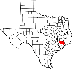
 Location in Fort Bend and Harris counties in the state of Texas | ||
| Coordinates: 29°34′58″N 95°32′22″W / 29.58278°N 95.53944°WCoordinates: 29°34′58″N 95°32′22″W / 29.58278°N 95.53944°W | ||
| Country |
| |
| State |
| |
| Counties | Fort Bend, Harris | |
| Government | ||
| • Type | Council-Manager | |
| • City Council |
Mayor Allen Owen Jerry Wyatt Chris Preston Yolanda Ford Don Smith Anthony Maroulis Floyd Emery | |
| • City Manager | Anthony Snipes | |
| Area | ||
| • Total | 29.8 sq mi (77.2 km2) | |
| • Land | 28.4 sq mi (73.6 km2) | |
| • Water | 1.4 sq mi (3.6 km2) | |
| Elevation | 79 ft (24 m) | |
| Population (2010) | ||
| • Total | 67,358 | |
| • Density | 2,370/sq mi (915.2/km2) | |
| Time zone | Central (CST) (UTC-6) | |
| • Summer (DST) | CDT (UTC-5) | |
| ZIP codes | 77459, 77489 | |
| Area code(s) | 281 | |
| FIPS code | 48-48804[1] | |
| GNIS feature ID | 1374972[2] | |
| Website |
www | |


Missouri City is a city in the U.S. state of Texas, within the Houston–The Woodlands–Sugar Land metropolitan area. The city is mostly in Fort Bend County, with a small portion in Harris County. As of the 2010 census, the city had a population of 67,358, up from 52,913 in 2000.[3] The population was estimated at 74,139 in 2015.[4]
History
The area in which Missouri City is now located holds a significant part in the history of Texas that dates back to its early days as part of the United States. In August 1853, the Buffalo Bayou, Brazos and Colorado Railway (BBB&C), began operating its first 20 miles (32 km) of rail line that stretched from Harrisburg (now Houston) to Stafford's Point (now Stafford). It was the first railroad to begin operating in Texas, and the first standard gauge railroad west of the Mississippi River.
The railway continued its extension westward until, in 1883, it linked with its eastward counterpart, completing the Sunset Route from Los Angeles to New Orleans. Today, the route of the BBB&C (now owned by the Union Pacific Railroad) is still an important and heavily operated railroad line.
In 1890, two real estate investors from Houston (R.M. Cash and L.E. Luckle) purchased 4 square miles (10 km2) of land directly on the route of the BBB&C, only a mile and a half from its first stop at Stafford's Point. They advertised the property as "a land of genial sunshine and eternal summer" in St. Louis, Missouri, and its surrounding areas. Three years later, W.R. McElroy purchased 80 acres (320,000 m2) in the same vicinity, and in an effort to promote the area jointly with Cash and Luckle in St. Louis, he named it "Missouri City". Its first settlers were, however, from Arlington, Texas, near Dallas and Fort Worth.
The settlement was officially registered in Texas in 1894, and began to take shape as a railroad town along Main Street and Blue Ridge Road, now known as US 90A and Texas Parkway, respectively. Its growth took an unexpected turn when, on February 14, 1895, shortly after the first group of settlers had arrived, the town was hit with a blizzard. This discouraged some of the newcomers, who gave up and moved elsewhere. Those unwavered stayed and found success in farming and ranching.
Among its first businesses were a blacksmith shop, a depot, and a general store, which also housed the first post office. The first Catholic church was built in 1913, but was destroyed by a hurricane in 1915. The new church built to replace it stood until 1990.
Oil was discovered at Blue Ridge 4 miles (6 km) southeast of town in 1919; soon after, a salt mine opened there. Missouri City became the railroad shipping point for these two resources. In 1925, at the same location, natural gas was discovered. After a pipeline had been constructed the following year, Missouri City became the first town in Fort Bend County to make use of natural gas.
With the benefit of a railroad, Missouri City had already been home to commuters who, by train, traveled to adjacent towns like Stafford's Point and Sugar Land to work. With the increase of automobiles and the improvement of roads and highways in the early part of the 20th century, the developing community of Missouri City gradually attracted a wealth of newcomers. This gave birth to a new generation of commuters, replacing railroad commuting that eventually became obsolete. By the 1950s, the town began to take shape as a notable "bedroom community" suburb of Houston.
After fear and rumor spread of possible annexation of the unincorporated town by Houston, town leaders scrambled to piece together a city government. On March 13, 1956, the community that began as a small settlement more than 55 years earlier was incorporated.
Missouri City has since seen tremendous economic growth, moving eastward, southward, and then westward. The city was first made over by Fondren Park (in Harris County), near US 90A, in the early 1960s, followed by Quail Valley, along Cartwright Road between Texas Parkway and Murphy Road, in the late 1960s. Unlike neighboring Houston, Missouri City has been a zoned city since 1981. Multifamily complexes (e.g. apartments and condominiums) are a rare find because of the current zoning ordinance.
In the 1970s, an influx of middle-class African Americans - most of them first-time homeowners - were attracted to developing communities south and west of Houston. Many of them made the subdivisions of Missouri City home. This influx occurred after an economic downturn caused property values and interest rates to drop. Teal Run and other unincorporated areas east of Highway 6 became ethnically diverse before neighborhoods farther west. Movement by black families has been characterized by neighborhood hopping, whereby families who can afford to move go to majority-white neighborhoods, ostensibly to escape possible negative influences to their children. As a result of the influx, some white families moved to different communities and neighborhoods in a response known as "white flight". (White flight usually further decreases property values, whereby a neighborhood is no longer seen as desirable to a significant segment of the population, and therefore worth less. Low income families tend to fill the void left by whites, and the process starts over again when minority members of the community once again seek a better neighborhood to live in.) Many of the newcomers were employees within nearby Houston work centers (e.g., Texas Medical Center and Greenway Plaza). In 2000, Missouri City was named a model city for middle-class African Americans by Black Entertainment Television.
The Missouri City area's recent upscale, master-planned residential developments include Lake Olympia, south of Quail Valley, and portions of Riverstone, south of State Highway 6. The nearby unincorporated area of Sienna Plantation, also located south of Highway 6, is situated on and around land once occupied by plantations where, among other things, sugarcane and cotton were harvested.
Geography

Missouri City is located in eastern Fort Bend County at 29°34′58″N 95°32′22″W / 29.58278°N 95.53944°W (29.582799, -95.539423).[5] A portion of the city extends north into Harris County. Missouri City is bordered by the city of Houston to the north and east, Stafford to the northwest, Sugar Land to the west, and Arcola to the southeast, as well as unincorporated communities such as Fifth Street to the north, Fresno to the east, and Sienna Plantation to the south. Downtown Houston is 17 miles (27 km) to the northeast.
Oyster Creek flows in a southerly direction through the municipality.
According to the United States Census Bureau, Missouri City has a total area of 29.8 square miles (77.2 km2), of which 28.4 square miles (73.6 km2) is land and 1.4 square miles (3.6 km2), or 4.65%, is water.[6]
 |
Stafford | Houston | Houston | |
| Sugar Land | |
Dewalt radio towers Fresno | ||
| ||||
| | ||||
| Brazos River | Juliff | Arcola |
Communities
Parks and recreation
The Missouri City Parks and Recreation Department is a Texas Gold Medal Award-winning department that maintains and operates a wide variety of park and natural areas, trails, athletic complexes and other facilities. The Parks Department currently maintains 20 developed parks totaling 393 acres (159 ha). Park amenities include multiple lighted sports fields, lakes, playgrounds, splash pad, and walking trails, as well as boating and fishing sites.
The Recreation and Tennis Center is the heart of the recreation division and houses the majority of our recreation and fitness classes. Amenities include a cardio and weight room, gymnasium, batting cages, multi-purpose rooms, locker rooms and tennis courts.
The Parks and Recreation Department has daytime and evening recreational programs and provides numerous special events throughout the year.
Transportation
Missouri City is crossed by US 90A, Beltway 8 (Sam Houston Tollway), Fort Bend Toll Road, State Highway 6, FM 1092 (Murphy Road), FM 2234 (Texas Parkway), and FM 3345 (Cartwright Road). Other nearby highways are US 59 to the northwest, and Interstate 610 (Loop 610) to the northeast.
Although Missouri City does not have public transportation within the city limits itself, it is part of the service area of METRO. METRO operates the Missouri City Park and Ride located on Beltway 8 and Fondren Road, which is the terminus of express bus Route 163 Fondren to Sharpstown and Downtown Houston, and Route 170 Missouri City Express to the Texas Medical Center (terminating at the Texas Medical Center Transit Center METRORail station there).
Discussions continue on commuter service along US 90A from METRORail's Fannin South station, initially to terminate at the Fort Bend County line near Beltway 8.[7] Expansion westward awaits, among other things, formation of a transportation district or other funding means for communities that are not now in the METRO service area.
Demographics
| Historical population | |||
|---|---|---|---|
| Census | Pop. | %± | |
| 1960 | 604 | — | |
| 1970 | 4,136 | 584.8% | |
| 1980 | 24,423 | 490.5% | |
| 1990 | 36,176 | 48.1% | |
| 2000 | 52,913 | 46.3% | |
| 2010 | 67,358 | 27.3% | |
| Est. 2015 | 74,139 | [4] | 10.1% |
As of the census[1] of 2010, there were 67,358 people, 20,228 households, and 16,711 families residing in the city. The racial makeup of the city was 24.9% non-Hispanic White, 41.8% African American, 0.4% Native American, 16.2% Asian, and 2.9% from two or more races. Hispanic or Latino of any race were 15.3% of the population.
There were 20,228 households out of which 45.7% had children under the age of 18 living with them, 61.8% were married couples living together, 16.1% had a female householder with no husband present, and 17.4% were non-families. 15.6% of all households were made up of individuals and 4.0% had someone living alone who was 65 years of age or older. The average household size was 3.17 and the average family size was 3.54.
According to 2010 estimates, the median income for a household in the city was $81,854, and the median family income was $87,089. 38.1% of households had an income of $100,000 or more.[9] Males had a median income of $59,157 versus $42,183 for females. The per capita income for the city was $27,210. About 9.1% of the population was below the poverty line, including 15.4% of those under age 18 and 6.5% of those age 18 or over. 41.4% of the population over the age of 25 years held a bachelor's degree or higher.
Points of interest
Missouri City is home to much of the Houston area's "antennae farm" for radio and television outlets. These include:
- Senior Road Tower (which operates most of the Houston area's radio stations)
- KRIV-TV Tower
- KHOU-TV Tower
- KTRK-TV Tower
- Houston Tower Joint Venture Tower (which operates KPRC-TV and KIAH-TV)
- American Towers Tower Missouri City
- Richland Towers Tower Missouri City
- Blue Ridge Tower Missouri City
It has the headquarters of the Malankara Orthodox Diocese of South-West America of the Malankara Orthodox Syrian Church.[10]
Government and infrastructure
On October 1, 2010, the City of Missouri City's anti-smoking law, which bans smoking in most public places, went into effect.[11]
The United States Postal Service operates the Missouri City Post Office and the Missouri City Post Office Annex.[12][13]
Education
Primary and secondary schools
Public schools
The Fort Bend County portion of Missouri City is served by Fort Bend Independent School District, while the Harris County portion is served by Houston Independent School District. The Harris County portion is within Trustee District IX, represented by Lawrence Marshall as of 2008.[14]
Fort Bend Independent School District
FBISD operates the following schools within the Missouri City limits:
- Elementary Schools
- E. A. Jones Elementary School
- Glover Elementary School
- Hunters Glen Elementary School
- Lantern Lane Elementary School
- Palmer Elementary School
- Quail Valley Elementary School
- Middle Schools
- Lake Olympia Middle School
- Missouri City Middle School
- Quail Valley Middle School
- Baines Middle School
- High Schools
In addition to these schools, a small portion of Missouri City is also served by Dulles Middle School, First Colony Middle School, Clements High School and Dulles High School, all in Sugar Land. Some areas of Missouri City are served by other schools.
Houston Independent School District
The Harris County portion of Missouri City is zoned to HISD schools located in the city limits of Houston:
- Kate Bell Elementary School (places south of Beltway 8)[15]
- Jenard M. Gross Elementary School (places north of Beltway 8)[16]
- Louie Welch Middle School[17]
- Westbury High School[18]
Colleges and universities
The entire city is served by the Houston Community College System.
Public libraries
Missouri City is served by the Missouri City Branch of the Fort Bend County Libraries system. The library, across the street from the City Hall complex and the Missouri City Civic Center, opened in June 1992. The 18,642 square feet (1,731.9 m2) branch, designed by Hall/Merriman Architects, was the first of four branches built with 1989 bond funds.[19]
Notable people
- Frank Beard of the rock band ZZ Top lived in the Quail Valley subdivision for many years
- Paul Begala, political commentator, born in New Jersey but raised in Missouri City
- Doug Brocail, Houston Astros pitcher
- KaRon Coleman, gridiron football player[20]
- D'Angelo Harrison, college basketball player for St. Johns
- James Loney, New York Mets first baseman, grew up in Missouri City and attended Elkins High School
- Bruce Matthews, NFL Hall of Famer, who formerly played with the Houston Oilers and the Tennessee Titans, now assistant coach with the Houston Texans
- Warren Moon, Houston Oiler and NFL hall of fame quarterback, lived in the area from 1984 to 2004
- Ron Reynolds, Texas state representative from Missouri City since 2014
- Travis Scott, rapper and producer
- Crystle Stewart, Miss Texas USA 2008, Miss USA 2008[21][22]
- Z-Ro, Houston rap artist, a native of Missouri City; sometimes refers to it as "MO City" or "Misery City". Joseph McVey, a.k.a. Z-Ro, sometimes refers to himself as the "MO City Don", and since mid 2014 has changed his official stage name to "MO City Don". The nickname "MO City" derives from the postal abbreviation for Missouri (MO).
- Numerous current and former professional athletes live in Missouri City or in neighboring Sienna Plantation, including former Houston Texan and Atlanta Falcon Dunta Robinson, former Texans quarterback David Carr, former Houston Oilers Sean Jones, Alonzo Highsmith, and Webster Slaughter, Houston Texans cornerback Aaron Glenn, and Green Bay Packers running back Knile Davis. And also Internet legend Tim Wilson.
References
- 1 2 "American FactFinder". United States Census Bureau. Retrieved 2008-01-31.
- ↑ "US Board on Geographic Names". United States Geological Survey. 2007-10-25. Retrieved 2008-01-31.
- ↑ "Missouri City (city) QuickFacts from the US Census Bureau". US Census Bureau. Retrieved 02-09-2012. Check date values in:
|access-date=(help) - 1 2 "Annual Estimates of the Resident Population for Incorporated Places: April 1, 2010 to July 1, 2015". Retrieved July 2, 2016.
- ↑ "US Gazetteer files: 2010, 2000, and 1990". United States Census Bureau. 2011-02-12. Retrieved 2011-04-23.
- ↑ "Geographic Identifiers: 2010 Demographic Profile Data (G001): Missouri City city, Texas". U.S. Census Bureau, American Factfinder. Retrieved August 30, 2016.
- ↑ Maxey, Elsa (2010-04-07). "Commuter rail for Fort Bend cities...closer to a reality?". Fort Bend/Southwest Star. Retrieved 2010-05-25.
- ↑ "Census of Population and Housing". Census.gov. Retrieved June 4, 2015.
- ↑ "2006-2010 American Community Survey Economic data from the US Census Bureau". Retrieved 02-09-2012. Check date values in:
|access-date=(help) - ↑ "Home." Malankara Orthodox Diocese of South-West America. Retrieved on October 27, 2011. "3703 Chesterdale Dr. Missouri City, TX 77459"
- ↑ Ciamacco, Joey. "Missouri City smoking ban to soon take effect." Ultimate Fort Bend, Houston Chronicle. September 27, 2010. Retrieved on September 27, 2010.
- ↑ "Post Office Location - MISSOURI CITY." United States Postal Service. Retrieved on December 6, 2008.
- ↑ "Post Office Location - MISSOURI CITY ANNEX." United States Postal Service. Retrieved on December 6, 2008.
- ↑ "Trustee Districts Map." Houston Independent School District. Retrieved on November 11, 2008.
- ↑ "Bell Elementary Attendance Zone." Houston Independent School District. Retrieved on September 27, 2010.
- ↑ "Gross Elementary Attendance Zone." Houston Independent School District. Retrieved on September 27, 2010.
- ↑ "Welch Middle Attendance Zone." Houston Independent School District. Retrieved on September 27, 2010.
- ↑ "Westbury High School Attendance Zone." Houston Independent School District. Retrieved on September 27, 2010.
- ↑ "Missouri City Branch Library." Fort Bend County Libraries. Retrieved on May 14, 2010.
- ↑ "KARON COLEMAN". profootballarchives.com. Retrieved November 26, 2014.
- ↑ Associated Press (2007-07-01). "Miss Fort Bend County takes Miss Texas title". Houston Chronicle.
- ↑ "Miss Fort Bend County wins Miss Texas USA". Houston Chronicle. 2007-07-02.
External links
| Counties | 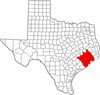 | |
|---|---|---|
| "Principal" cities | ||
| Other cities |
For a complete listing, see list of cities and towns in Houston–The Woodlands–Sugar Land MSA | |
| Unincorporated areas | ||
| Bodies of water | ||
Municipalities and communities of Fort Bend County, Texas, United States | ||
|---|---|---|
| Cities | 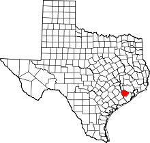 | |
| Town | ||
| Villages | ||
| CDPs | ||
| Unincorporated communities | ||
| Ghost towns | ||
| Footnotes | ‡This populated place also has portions in an adjacent county or counties;
±Former community annexed by Missouri City | |
