Baytown, Texas
| Baytown, Texas | |
|---|---|
| City | |
|
 | |
| Motto: Where Water and Oil Really Do Mix | |
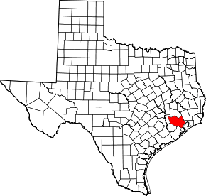
 Location in the state of Texas | |
| Coordinates: 29°44′38″N 94°57′57″W / 29.74389°N 94.96583°WCoordinates: 29°44′38″N 94°57′57″W / 29.74389°N 94.96583°W | |
| Country |
|
| State |
|
| Counties | Harris, Chambers |
| Incorporated | January 24, 1948 |
| Government | |
| • Type | Council-Manager |
| • City Council |
Mayor Stephen DonCarlos Mercedes Renteria III Chris Presley Brandon Capetillo Terry Sain Bob Hoskins David McCartney |
| • City Manager | Rick Davis |
| Area | |
| • Total | 36.5 sq mi (94.6 km2) |
| • Land | 35.4 sq mi (91.8 km2) |
| • Water | 1.1 sq mi (2.8 km2) |
| Elevation | 34 ft (10.3 m) |
| Population (2010)[1] | |
| • Total | 71,802 |
| • Estimate (2016)[2] | 80,000 |
| • Density | 4,880/sq mi (1,884/km2) |
| • Metro | 5,867,489 (6th) |
| Time zone | CST (UTC-6) |
| • Summer (DST) | CDT (UTC-5) |
| ZIP codes | 77520-77523 |
| Area code(s) | 281 |
| FIPS code | 48-06128[3] |
| GNIS feature ID | 1380966[4] |
| Website |
www |

Baytown is a city within Harris County and partially in Chambers County in the Gulf Coast region of the U.S. state of Texas. Located within the Houston–The Woodlands–Sugar Land metropolitan area, it lies along State Highway 146 and Interstate 10. It is the fourth-largest city within this metropolitan area. As of 2010, Baytown had a population of 71,802,[5] and it had an estimated population of 76,127 in 2014.[2]
History
The area of Baytown began to be settled as early as 1822.[6] One of its earliest residents was Nathaniel Lynch, who set up a ferry crossing at the junction of the San Jacinto River and Buffalo Bayou. The ferry service that he started is still in operation today, now known as the Lynchburg Ferry. Other early residents of Baytown include William Scott, one of Stephen F. Austin's Old Three Hundred, and Ashbel Smith, who owned a plantation in the area. One of Baytown's first babies born was Gertrude Gardner.[7]
The city now known as Baytown was originally three separate towns. The first of these was Goose Creek, named for the bayou of the same name where Canada geese wintered and whose name is still reflected in the area's Goose Creek school district, whose establishment dates back to before 1850. With the discovery of the Goose Creek Oil Field, the rival communities of Pelly in the late 1910s, and East Baytown in the early 1920s, developed as early boomtowns.[6] The "East" in East Baytown was later dropped because it was west of Goose Creek.[8]
Serious talk of merging the three cities began shortly after World War I, but the community of Baytown was opposed to this idea. However, in 1947, the three cities finally agreed to consolidate. The citizens settled on the name Baytown for the new combined city. Baytown as it is known today was officially founded January 24, 1948.[6]
In 1916, the Humble Oil and Refining Company, founded by one-time Texas governor Ross S. Sterling and his associates, in developing the Goose Creek Oil Field, built the first offshore drilling operation in Texas and the second in the United States. The company later built the Baytown Refinery, which would become one of the largest Exxon refineries in the world. Since then, many other refineries have been built in the area. Exxon-Mobil is still one of the major employers in the city and now runs over 10 plants in the area.
Following the discovery of oil nearby, the population of Baytown and the Tri-cities boomed. Many immigrants arrived in Baytown, among them a number of Jewish families who founded a synagogue, K’nesseth Israel, in 1930.[9]
Steel manufacturing in Baytown began in 1970 when United States Steel opened the Texas Works near the city. The plant was officially closed in July 1986, due to a poor economic climate and the decline of American steel in the 1980s. The mill was later purchased by Jindal Steel and now operates as JSW Steel USA, Inc.[6]
Geography
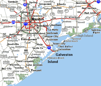
Baytown is located at the mouth of the San Jacinto River on Galveston Bay, 26 miles (42 km) by road east of Houston.
According to the United States Census Bureau, the city has a total area of 36.5 square miles (94.6 km2), of which 35.4 square miles (91.8 km2) is land and 1.1 square miles (2.8 km2), 2.92%, is covered by water.[10]
Baytown is located on the Gulf coastal plain, and its vegetation is classified as temperate grassland and marshes. The municipalities have been built on reclaimed marshes, swamps, and prairies, which are all still visible in undeveloped parts of the Bay Area.[11] Baytown is bordered by water on three sides. Along the south and west is Galveston Bay. On the east is Cedar Bayou. The city is roughly bordered along the north by Interstate 10. Portions of the city to the east of Cedar Bayou lie in Chambers County.
Flatness of the local terrain and proximity to the bay have made flooding a recurring problem for the area.[12] Baytown and surrounding communities once relied on groundwater for its needs, but severe land subsidence has forced much the city to turn to ground-level water sources.[13]
Geology
The land beneath Baytown consists of layers of sand and clay to great depths. These layers were created by millennia of river-borne sediments which gradually incorporated plant and animal matter, creating the petroleum deposits for which the Gulf Coast is now known.[14]
The region around the city has numerous faults, many considered active, but none has produced significant earthquakes in recorded history.[15] These faults tend to move at a smooth rate in what is termed "fault creep", which reduces the risk of an earthquake.[13] The one significant earthquake that has been reported in the area was the result of an underground water and petroleum extraction.[16]
Climate
| Baytown | ||||||||||||||||||||||||||||||||||||||||||||||||||||||||||||
|---|---|---|---|---|---|---|---|---|---|---|---|---|---|---|---|---|---|---|---|---|---|---|---|---|---|---|---|---|---|---|---|---|---|---|---|---|---|---|---|---|---|---|---|---|---|---|---|---|---|---|---|---|---|---|---|---|---|---|---|---|
| Climate chart (explanation) | ||||||||||||||||||||||||||||||||||||||||||||||||||||||||||||
| ||||||||||||||||||||||||||||||||||||||||||||||||||||||||||||
| ||||||||||||||||||||||||||||||||||||||||||||||||||||||||||||
Baytown's climate is classified as humid subtropical (Cfa in Köppen climate classification system).[17] Spring supercell thunderstorms sometimes create tornadoes (but not to the extent found in tornado alley).[18] Prevailing winds from the south and southeast bring heat from the deserts of Mexico and moisture from the Gulf of Mexico.[19]
Summer temperatures typically have highs near 90 °F (32 °C) though higher temperatures are not uncommon.[20] The city's proximity to the bay and the winds that it generates moderate the area's temperatures and ease the effects of the humidity, creating a more pleasant climate than inland communities like Houston.[21] Winters in the area are temperate with typical January high of 61 °F (16 °C) and lows are near 42 °F (6 °C). Snowfall is rare. Annual rainfall averages exceed 53 inches (130 cm).[22]
Excessive ozone levels can occur due to industrial activities; nearby Houston is ranked among the most ozone-polluted cities in the United States.[23] The industries located along the ship channel and the bay are a major cause of the pollution.[24]
Hurricanes are a substantial concern during the fall season. Though Galveston Island and the Bolivar Peninsula provide some shielding, Baytown still faces more danger than Houston and other inland communities, particularly because of storm surge, as well as severe land subsidence in some low-lying areas of town due to excess pumping of groundwater in the 1960s (see Brownwood subdivision)[25] by area refineries and municipalities.[26][27][28] Hurricanes Carla (1961), Alicia (1983), and Ike (2008) were the three most damaging hurricanes to affect Baytown.
Demographics
| Historical population | |||
|---|---|---|---|
| Census | Pop. | %± | |
| 1950 | 22,983 | — | |
| 1960 | 28,159 | 22.5% | |
| 1970 | 43,980 | 56.2% | |
| 1980 | 56,923 | 29.4% | |
| 1990 | 63,850 | 12.2% | |
| 2000 | 66,430 | 4.0% | |
| 2010 | 71,802 | 8.1% | |
| Est. 2015 | 76,335 | [29] | 6.3% |
As of the 2010 census,[3] 71,802 people, 28,998 households, and 17,025 families resided in the city. The population density was 2,025.7 people per square mile (785.6/km2). There were 26,203 housing units at an average density of 802.4 per square mile (309.9/km2). The racial makeup of the city was 62.9% White, 15.5% African American, 0.6% Native American, 1.5% Asian, 14.42% from other races, and 2.7% from two or more races. Hispanics or Latinos of any race were 43.4% of the population.
Of the 23,483 households, 39.2% had children under the age of 18 living with them, 52.9% were married couples living together, 14.2% had a female householder with no husband present, and 27.5% were not families. About 23.0% of all households were made up of individuals, and 8.0% had someone living alone who was 65 years of age or older. The average household size was 2.80 and the average family size was 3.32.
In the city, the population was distributed as 29.2% under the age of 18, 11.2% from 18 to 24, 29.4% from 25 to 44, 19.5% from 45 to 64, and 10.1% who were 65 years of age or older. The median age was 31 years. For every 100 females, there were 94.4 males. For every 100 females age 18 and over, there were 91.4 males.
The median income for a household in the city was $48,191, and for a family was $45,346. Males had a median income of $38,039 versus $25,012 for females. The per capita income for the city was $17,641. About 13.0% of families and 15.5% of the population were below the poverty line, including 21.9% of those under age 18 and 9.8% of those age 65 or over.
As of 2010, the property crime rate in the community was 4.6% compared to 5.45% for Harris County as a whole. The violent crime rate was 0.5% compared to 1.03% for Harris County.[31]
Economy
| Construction | 20% |
| Manufacturing | 14% |
| Retail trade | 14% |
| Education/health/ social services | 12% |
| Leisure/hospitality | 10% |
| Professional/ business services | 9% |
| Finance/insurance/ real estate | 6% |
| Agriculture/forestry/ fishing/hunting/mining | 4% |
| Public administration | 4% |
| Transportation/ warehousing/utilities | 3% |
| Wholesale trade | 2% |
| Information | 1% |
| Other services | 2% |
The centerpieces of Baytown's economies are three industrial districts the city has created, all outside the city limits but within its extra-territorial jurisdiction. These districts primarily support petroleum and petrochemical processing. The anchors of the business community are ExxonMobil, Bayer, and Chevron Phillips. The ExxonMobil Baytown Complex, founded in 1919, is one of the world's largest industrial complexes.[32] The Baytown Refinery located there is the largest in the United States.[33] The Bayer Baytown Industrial Park is the largest of Bayer's U.S. chemical processing sites producing a variety of petrochemical products. The Cedar Bayou plant, in operation since 1963, is Chevron Phillips Chemical's largest manufacturing site in the United States. is a newer and growing industrial district which is quickly acquiring new tenants such as Jindal Steel and Power Limited and Samson Controls.[32]
In addition to the heavy industry in the business community, Baytown is home to The Cedar Crossing Industrial Park. With a total expanse of 15,000 acres, Cedar Crossing Industrial Park is considered the world’s fifth largest industrial park and the largest on the Gulf Coast. Cedar Crossing has attracted many top-tier companies with significant operations, including Home Depot's 755,000-square-foot distribution hub, Walmart's 4.2 million-square-foot import center (their largest in the U.S.), JSW Steel’s plate and pipe manufacturing facilities, and Borusan Mannesmann’s $148 million steel pipe manufacturing facility. Other occupants include Exel, S&B Engineers, National Oilwell, GE Water, TMK-IPSCO, Century Asphalt, Samson Controls, and LS Energy Fabrication.[32]
As of 2006, the largest taxpayers in the city are[32] ExxonMobil Company, CenterPoint Energy, Verizon Southwest, Wal-Mart Stores, Inc., Continental Airlines, Inc., Valero Marketing & Supply, Car Son Bay LP, Memorial NW Pavilion Trust, Camden Property Trust, and LCY Elastomers LP.
Arts and culture
The Baytown Little Theater is a community theater in Baytown run entirely by volunteers. The theater has been in operation for 55 years (as of 2015) and is one of the longest continuously running community theaters in the state of Texas. The theater typically produces six shows each year from September to August, with each show giving seven performances.
Tourism and recreation

Baytown Nature Center, located on a 450-acre (1.8 km2) peninsula along the Houston Ship Channel and surrounded on three sides by Burnet Bay, Crystal Bay, and Scott Bay, is both a recreation area and a wildlife sanctuary that is home to hundreds of bird species, mammals, reptiles, and aquatic species.[34]
Royal Purple Raceway is a motorsports complex featuring National Hot Rod Association (NHRA) races and a weekly drag racing program. Established in 1988, the venue accommodates 40,000 fans and included a high-banked dirt oval race track that hosts races each year from March through October.[35]
San Jacinto Mall is a large regional shopping mall located in Baytown, Texas along Interstate 10. It is currently managed by Triyar Cannon Group. The mall has five anchor stores, a food court and Premiere Cinemas 11, although much of the mall's leasable space is unused.
The Baytown Symphony Orchestra, in residence at Lee College, performs several concerts throughout the year for the enjoyment of the public.
Media
The Baytown Sun serves as the region's newspaper.
Government and infrastructure
Local government
Baytown has a Council-Manager form of government.
City services

The City of Baytown operates the Sterling Municipal Library, which has a collection of 300,000 items. The original Goose Creek Library opened in 1925; the first county library in Texas, it was funded by the private donations of Humble Oil and Refining Company president Ross S. Sterling. The current Sterling library was dedicated in 1963. The library's space increased to 50,500 square feet (4,690 m2) after bond programs in 1975 and 1995.[36] In addition Baytown residents are served by the Harris County Public Library system.
The The Baytown Police Department, has 167 sworn officers and 52 support personnel as of 2014. The Department provides all-hour Patrol services and has many special units: SWAT, Dive Team, D.A.R.E., Hot Spot, Commercial vehicle enforcement, Investigations, Police Academy, Bomb squad, and others.
Fire, rescue, hazardous materials response, and EMS are provided by the Baytown Fire Department, an all-professional department of approximately 140 sworn members.
Baytown Branch YMCA is located in Baytown.
County, state and federal services
The United States Postal Service operates the Baytown Main Post Office at 601 West Baker Road and the Baytown Post Office "Station A" at 3508 Market Street. The "Station A" designation is a leftover from Baytown's pre-consolidation days. Prior to consolidation in 1948 each of the Tri-Cities, (Baytown, Pelly, and Goose Creek), had their own post office. After 1948 when the Tri-Cities consolidated under the name Baytown, Goose Creek's post office became the main post office but they still needed a post office to service the rest of town so the Old Baytown Post Office became "Station A".[37][38]
Harris County Precinct Two operates Baytown Park, a senior citizen sports complex, at 4500 Hemlock Drive.[39] Baytown Park includes two unlighted baseball/softball fields and toilets.[39][40] The precinct also operates the Baytown Soccer Complex, located north of Baytown at 9600 North Main Street in an unincorporated area.[41] The complex has eight soccer fields; four are lighted and four are unlighted.[40]
Harris County Hospital District operates the Baytown Health Center in Baytown. The center opened on February 14, 1967.[42]
Harris County operates a tax office at 701 West Baker Boulevard.[43]
Transportation

Harris County Transit provides public transportation.[44] The Baytown Park and Ride lot is located on the western side of San Jacinto Mall.[45] Harris County Transit also offers a bus line that runs along Decker Drive, Garth Road, North Main Street, Baker Road, & Rollingbrook Drive connecting most of Baytown's major shopping areas with Lee College.
Greyhound Bus Lines operates the Baytown Station at Baytown Travel Express.[46]
Baytown Airport is a privately owned general aviation airport in unincorporated Harris County located north of Baytown. RWJ Airpark is a privately owned airport three miles (5 km) east of Baytown in Beach City. The closest airports with commercial airline service are William P. Hobby Airport and George Bush Intercontinental Airport in Houston.[47]
Baytown is served by Metropolitan Transit Authority of Harris County, Texas (METRO) express route 236 Maxey Road/Baytown during the rush hours, sending commuters to downtown Houston[48]
Baytown is linked to Interstate 10 (see map) by State Highway 146 (Lanier Freeway) and Spur 330 (Decker Drive). It is also linked by the Fred Hartman Bridge, which crosses into the city from nearby La Porte; the bridge was built in 1995, replacing the Baytown Tunnel, to allow a deeper ship channel.
Education
Colleges and universities
East Harris County and West Chambers County are served by Lee College, a two-year junior college.[49]
Primary and secondary schools
Baytown is served by the Goose Creek Consolidated Independent School District. Based in Baytown, the district has 14 elementary schools (grades K-5), 5 junior highs (grades 6–8), 3 high schools (grades 9–12), a career center, and two alternative centers for education. The district serves all of Baytown, Highlands, outlying areas of East Harris County, and a small portion of western Chambers County. The three local high schools are Robert E. Lee (opened in 1928), Ross S. Sterling (opened in 1966), and Goose Creek Memorial High School (opened in 2008).
Stallworth Stadium is the home for varsity football and soccer for GCCISD as well as for the annual Bayou Bowl. The stadium seats approximately 16,000 fans, making it one of the largest high school sports venues in the nation. It recently underwent a press box renovation in 2009,as well as an innovation in 2006 when artificial turf and a huge scoreboard were installed. On a campaign stop for the 1976 Presidential election, President Gerald Ford attended a Robert E Lee High School fall football game.
The area is also served by several private schools. Baytown Christian Academy, Light House Baptist Academy, St. Jose Catholic School, and The Chinquapin School (in Highlands).[50] St. Jose Catholic school is a part of the Roman Catholic Archdiocese of Galveston-Houston. Baytown Christian Academy is located on 5555 North Main Street near Baytown.[51][52]
Notable people
- Buddy Wakefield, champion slam poet, was raised in Baytown.
- Nathaniel Holt, actor born and raised in Baytown[53]
- Rocky Bernard, defensive tackle for the NFL New York Giants
- Kirk Botkin, former NFL player and collegiate football coach
- William Broyles, Jr., Oscar-winning screenwriter, co-founder of Texas Monthly magazine; raised in Old Baytown, Robert E. Lee High School graduate
- Gary Busey, born in Goose Creek, Texas[54]
- Chris Cagle, country music artist
- Wanda Garner Cash, open government advocate and former publisher of The Baytown Sun
- Quentin Coryatt, former NFL player and Texas A & M linebacker; attended Baytown Lee High School
- Macey Cruthird, actress born in Baytown
- Bobby Fuller, rock musician best known for his single "I Fought the Law"; born in Baytown
- John Hagee, pastor of Cornerstone Church in San Antonio, Texas; born in Baytown
- Brian Johnson, former quarterback for the University of Utah, now the quarterbacks coach at Mississippi State.
- "Mean" Gene Kelton, singer-songwriter, blues musician, and band leader of Mean Gene Kelton & The Die Hards
- Romany Malco, actor/rapper; attended Ross S. Sterling High School
- Leeland Mooring, lead singer for Christian band Leeland. Brother Jack Mooring is the keyboardist for the band, also from Baytown.
- Ell Roberson III, former Kansas State University quarterback; graduated in 1999 from Baytown Lee High School
- Howard Sampson, former NFL player
- Wayne Smith (born 1943), Republican member of the Texas House of Representatives from Baytown since 2003[55]
- Sherwood Stewart, former Pro Tennis player
- Clint Stoerner, former Dallas Cowboys and University of Arkansas quarterback; 1996 Baytown Lee graduate
- Tom Stolhandske, NFL and CFL player
- Dwayne Stovall, born in Baytown in 1966, businessman in Cleveland, Texas, school board member, and unsuccessful Republican candidate for the United States Senate in the primary election held on March 4, 2014[56]
- Drew Tate, former University of Iowa quarterback and current CFL member
- Joe Tex, popular R&B singer during the 1960s
- Henrietta Bell Wells, first African-American woman to participate in debate team in Wiley College and to be a lawyer
- Glenn Wilson, former Major League Baseball outfielder
- Renée Zellweger, Oscar-winning actress, resident until age 9. Lived in Chapparell Village, attended Stephen F. Austin Elementary. (Source: personal memories of her friends and Baytown Sun articles January 26, 2003 and 03/01/2004)
References
- ↑ "State and County Quick Facts". United States Census Bureau. Retrieved March 4, 2015.
- 1 2 "Annual Estimates of the Resident Population for Incorporated Places: April 1, 2010 to July 1, 2014". Retrieved June 4, 2015.
- 1 2 "American FactFinder". United States Census Bureau. Archived from the original on September 11, 2013. Retrieved 2008-01-31.
- ↑ "US Board on Geographic Names". United States Geological Survey. 2007-10-25. Retrieved 2008-01-31.
- ↑ "Archived copy". Archived from the original on October 13, 2013. Retrieved 2012-09-14.
- 1 2 3 4 Buck A. Young. "Baytown, TX". Handbook of Texas Online, Texas State Historical Association. Archived from the original on July 15, 2011. Retrieved November 8, 2009.
- ↑ "Gertrude Gardner to close business after 70 years of running shops". Retrieved 5 December 2014.
- ↑ "History of Baytown". City of Baytown. Retrieved Jan 31, 2010.
- ↑ Encyclopedia of Southern Jewish Communities, "Baytown, Texas" Archived April 2, 2012, at the Wayback Machine.
- ↑ "Geographic Identifiers: 2010 Census Summary File 1 (G001): Baytown city, Texas". U.S. Census Bureau, American Factfinder. Retrieved July 27, 2015.
- ↑ Blackburn (2004), p. 40.
"The acreage of swamps and bottomlands ... found in the Galveston Bay system ... [is] about 36,000 acres..."
Eubanks (2006), p. 10.
"Habitats page". Galveston Bay Estuary Program. Archived from the original on January 17, 2009. Retrieved Sep 9, 2009.
"Draining the Swamp: A scorched-earth management philosophy is sucking the life out of our region's wetlands". Houston Press. Retrieved Sep 9, 2009.Any local knows this city was built on a sweaty, pestilent, mosquito-infested swamp.
- ↑ "Flood Forecasting for the Buffalo Bayou Using CRWR-PrePro and HEC-HMS". Center for Research in Water Resources, The University of Texas at Austin. Archived from the original on February 4, 2007. Retrieved Jan 10, 2007.
- 1 2 "Houston-Galveston, Texas: Managing Coastal Subsidence" (PDF). United States Geological Survey. Archived (PDF) from the original on January 13, 2007. Retrieved Jan 11, 2007.
- ↑ Vipulanandan, C. (2008). "Geotechnical Engineering Challengers in the Houston Area" (PDF). CIGMAT-2008 Conference & Exhibition. Archived from the original (PDF) on June 25, 2010.
- ↑ "Texas Earthquakes". University of Texas Institute for Geophysics. July 2001. Archived from the original on July 15, 2007. Retrieved August 29, 2007.
- ↑ Garcia, T.D. "Subsidence and Surface Faulting at San Jacinto Monument, Goose Creek Oil Field, and Baytown, Texas". Field Trip Guidebook on Environmental Impact of Clays along the Upper Texas Coast. Prepared by Theron D. Garcia, Douglas W. Ming, and Lisa Kay Tuck for the Clay Minerals Society, 28th Annual Meeting. Held October 5–10, 1991, in Houston, TX. pp. A33-A44. Hosted with National Aeronautics and Space Administration Lyndon B. Johnson Space Center, and the Lunar and Planetary Institute.
- ↑ "Weather Stats". Greater Houston Convention and Visitors Bureau. Retrieved October 11, 2008.
- ↑ Shippey, Karla C. (1995). USA business: the portable encyclopedia for doing business with the United States. World Trade Press. p. 203. ISBN 978-1-885073-01-3.
"Houston/Galveston, Texas". NOAA: National Weather Service Forecast Office. Retrieved Sep 18, 2009. - ↑ "Weather Stats". Greater Houston Convention and Visitors Bureau. Retrieved October 11, 2008.
Melosi (2007), p. 13. - ↑ "Monthly Averages for League City, TX (77573)". The Weather Channel. Retrieved Dec 14, 2006.
"National Climatic Data Center". National Oceanic and Atmospheric Administration, United States Department of Commerce. June 23, 2004. Archived from the original on December 10, 2006. Retrieved December 14, 2006.
"Average Relative Humidity". Department of Meteorology at the University of Utah. Archived from the original on December 9, 2006. Retrieved December 14, 2006. - ↑ "WIND – AVERAGE SPEED (mph)". Department of Meteorology, University of Utah. 1993. Archived from the original on December 9, 2006. Retrieved January 10, 2007.
- ↑ "Monthly Averages for Baytown, TX". The Weather Channel. Retrieved Jan 11, 2010.
- ↑ "State of the Air 2005, National and Regional Analysis". American Lung Association. Mar 25, 2005. Archived from the original on May 19, 2008. Retrieved Jan 11, 2010.
- ↑ "Citizens League for Environmental Action Now". Jan 8, 2004. Archived from the original on June 9, 2008. Retrieved Jan 11, 2010.
- ↑ "Back to nature". Rice University. May 28, 2010. Retrieved Aug 15, 2014.
- ↑ "Wide Ike and shallow coast mean strong surge". MSNBC. Sep 12, 2008.
Houston is buffered by Galveston Island – which sits in the way of the surge – and the bay system
Spinner, Kate (May 31, 2009). "Hurricane forecasters zero in on threat of surge". Sarasota Herald Tribune.Just north of Galveston Island, the Bolivar Peninsula shields Galveston Bay much like Lido Key and Longboat Key shield Sarasota Bay.
- ↑ Broyles, William (December 1974). "Disaster Part II. Houston is sinking into the sea". Texas Monthly: 78.
At the height of such a hurricane [the 1900 Galveston Hurricane] today, the temporary shoreline of the Gulf of Mexico will be ten miles inland.
- ↑ Berger, Eric (Sep 9, 2008). "Would a category 3 hurricane surge flood your home?". Houston Chronicle Blogs.
- ↑ "Annual Estimates of the Resident Population for Incorporated Places: April 1, 2010 to July 1, 2015". Retrieved July 2, 2016.
- ↑ "Census of Population and Housing". Census.gov. Archived from the original on May 11, 2015. Retrieved June 4, 2015.
- ↑ "Baytown Community Info". Trulia, Inc. Retrieved Jan 11, 2010.
- 1 2 3 4 5 "Economic Development". Cushman & Wakefield. Retrieved September 4, 2015.
- ↑ "U.S. Refineries* Operable Capacity". Department of Energy, Energy Information Administration. July 2008.
- ↑ "BNC Facilities: Nature Center Overview". Friends of the Baytown Nature Center. Retrieved Nov 4, 2009.
- ↑ "Houston Raceway Park – About Us". Retrieved November 8, 2009.
- ↑ "About Us." Sterling Municipal Library. Retrieved on November 5, 2009.
- ↑ "Post Office Location – BAYTOWN." United States Postal Service. Retrieved on December 6, 2008.
- ↑ "Post Office Location – STATION A BAYTOWN." United States Postal Service. Retrieved on December 6, 2008.
- 1 2 "Baytown Park." Harris County, Texas. Retrieved on November 30, 2008.
- 1 2 "Precinct Two Park Listings." Harris County, Texas. Retrieved on November 30, 2008.
- ↑ "Baytown Soccer Complex Archived February 27, 2009, at the Wayback Machine.." Harris County, Texas. Retrieved on November 30, 2008.
- ↑ "A Proud History of Caring for More Than 45 Years." Harris County Hospital District. Retrieved on February 9, 2012.
- ↑ "Branch Office Locations." Harris County Tax Office. Retrieved October 13, 2008.
- ↑ "Routes / Maps." Harris County Transit. Retrieved on January 15, 2010.
- ↑ "Park & Ride." Harris County Transit. Retrieved on May 28, 2010.
- ↑ "Baytown, Texas." Greyhound Lines. Retrieved on November 30, 2008.
- ↑ "Transportation." City of Baytown. Retrieved on November 30, 2008.
- ↑ "East Corridor Archived October 8, 2008, at the Wayback Machine.." Metropolitan Transit Authority of Harris County, Texas. Retrieved on November 30, 2008.
- ↑ Texas Education Code, Section 130.186, "Lee College District Service Area".
- ↑ "St. Joseph Catholic School in Baytown". Retrieved October 26, 2010.
- ↑ "Contact Us." Baytown Christian Academy. Retrieved on October 8, 2009.
- ↑ "Council Districts Map." Baytown Christian Academy. Retrieved on October 8, 2009.
- ↑ Nathaniel Holt IMDB page
- ↑ Gary Busey
- ↑ "Wayne Smith's Biography". votesmart.org. Retrieved March 26, 2014.
- ↑ "Proud to Be Texan". texansforstovall.com. Retrieved February 16, 2014.
External links
| Wikimedia Commons has media related to Baytown, Texas. |
- City of Baytown official website
- Official Baytown tourism site
- Baytown Area Local Emergency Planning Committee
- Baytown from the Handbook of Texas Online
- Baytown Chamber of Commerce
- Baytown Historical Preservation Association
- Baytown Sun
- Hispanic Chamber of Commerce
| Large cities |  | |
|---|---|---|
| Other cities | ||
| CDPs and non- municipalities | ||
| Counties | ||
| Subregions | ||
| Bodies of water | ||
| Major ports | ||
| Nature preserves | ||
| Counties | 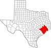 | |
|---|---|---|
| "Principal" cities | ||
| Other cities |
For a complete listing, see list of cities and towns in Houston–The Woodlands–Sugar Land MSA | |
| Unincorporated areas | ||
| Bodies of water | ||
Municipalities and communities of Chambers County, Texas, United States | ||
|---|---|---|
| Cities |  | |
| CDPs | ||
| Other unincorporated communities | ||
| Footnotes | ‡This populated place also has portions in an adjacent county or counties
±water surface only; land in adjacent county | |