Fulshear, Texas
| Fulshear, Texas | |
|---|---|
| City | |
| Motto: "Fort Bend County's Premier Address" | |
 Location of Fulshear, Texas | |
| Coordinates: 29°41′27″N 95°53′26″W / 29.69083°N 95.89056°WCoordinates: 29°41′27″N 95°53′26″W / 29.69083°N 95.89056°W | |
| Country | United States |
| State | Texas |
| County | Fort Bend |
| Area | |
| • Total | 8.15 sq mi (21.12 km2) |
| • Land | 8.09 sq mi (20.95 km2) |
| • Water | 0.07 sq mi (0.17 km2) |
| Elevation | 131 ft (40 m) |
| Population (2010) | |
| • Total | 1,134 |
| • Density | 140/sq mi (54.1/km2) |
| Time zone | Central (CST) (UTC-6) |
| • Summer (DST) | CDT (UTC-5) |
| ZIP code | 77441 |
| Area code(s) | 281 |
| FIPS code | 48-27876[1] |
| GNIS feature ID | 1336299[2] |
| Website |
www |
Fulshear (/ˈfʊlʃər/ FULL-shər[3]) is a city in northwest Fort Bend County, Texas within the Houston–The Woodlands–Sugar Land metropolitan area. The population was 1,134 at the 2010 census,[4] up from 716 at the 2000 census. The estimated population in 2015 was 5,886.[5]
History
The city incorporated in 1977.[6]
Around 2003 the community only had 400 people.[7] Growth in Fulshear exploded in the 2000s due to its proximity to Houston.[8] Around 2008 the community had around 700 residents. In October 2013 the population went over 5,000. By that time, traffic was commonplace while historically it had not been.[7]
Geography

Fulshear is located in northern Fort Bend County at 29°41′27″N 95°53′26″W / 29.69083°N 95.89056°W (29.690824, -95.890531).[9] According to the United States Census Bureau, the city has a total area of 8.15 square miles (21.12 km2), of which 8.09 square miles (20.95 km2) is land and 0.066 square miles (0.17 km2), or 0.79%, is water.[4]
It is located at the intersection of Farm to Market Road 359 and Farm to Market Road 1093.[6] Downtown Houston is 33 miles (53 km) to the east, and Wallis is 15 miles (24 km) to the west. Interstate 10 at Brookshire is 7 miles (11 km) to the north.
Fulshear has an extraterritorial jurisdiction of 37.11 square miles (96.1 km2). Of the general law cities in Texas, Fulshear has one of the largest ETJs.[6]
Demographics
| Historical population | |||
|---|---|---|---|
| Census | Pop. | %± | |
| 1980 | 594 | — | |
| 1990 | 557 | −6.2% | |
| 2000 | 716 | 28.5% | |
| 2010 | 1,134 | 58.4% | |
| Est. 2015 | 5,886 | [5] | 419.0% |
As of 2011 Fulshear has about 2,000 residents.[6] As of December 2015, Fulshear had 3,741 registered voters.
As of the census[1] of 2000, there were 716 people, 251 households, and 192 families residing in the city. The population density was 87.7 people per square mile (33.9/km²). There were 260 housing units at an average density of 31.8 per square mile (12.3/km²). The racial makeup of the city was 59.92% White, 24.02% African American, 0.42% Native American, 0.70% Asian, 13.41% from other races, and 1.54% from two or more races. Hispanic or Latino of any race were 22.49% of the population.
There were 251 households out of which 39.0% had children under the age of 18 living with them, 62.9% were married couples living together, 11.6% had a female householder with no husband present, and 23.5% were non-families. 20.7% of all households were made up of individuals and 6.0% had someone living alone who was 65 years of age or older. The average household size was 2.85 and the average family size was 3.33.
In the city the population was spread out with 32.1% under the age of 18, 6.7% from 18 to 24, 27.4% from 25 to 44, 25.3% from 45 to 64, and 8.5% who were 65 years of age or older. The median age was 36 years. For every 100 females there were 98.9 males. For every 100 females age 18 and over, there were 96.8 males.
The median income for a household in the city was $44,375, and the median income for a family was $54,444. Males had a median income of $40,893 versus $36,563 for females. The per capita income for the city was $19,489. About 15.6% of families and 22.8% of the population were below the poverty line, including 24.8% of those under age 18 and 27.6% of those age 65 or over.
Government and infrastructure
Fulshear is incorporated as a general law city. As of 2015 the taxation rate is .161631% per $100 valuation. Of the taxation rates in Fort Bend County, Fulshear's is among the lowest.[6]
The United States Postal Service operates the Fulshear Post Office at 8055 Farm to Market Road 359 South.[11]
Education
Primary and secondary schools
Fulshear is zoned to schools in the Lamar Consolidated Independent School District and the Katy Independent School District.
That portion is served by:[12]
- Huggins Elementary School (Fulshear)
- Briscoe Junior High School (Unincorporated Fort Bend County)
- Foster High School (Unincorporated Fort Bend County)
- James Randolph Elementary School
Lamar CISD plans to build new campuses in the Fulshear area, including Dean Leaman Junior High School and Churchill Fulshear High School. PBK Architects was hired as the architectural firm.[13] The junior high school is named after Dean Leaman, the owner of Allied Concrete. The high school is named after Churchill Fulshear Jr.[14]
More than 2000 homes are located in the masterplan community of Cross Creek Ranch within the Fulshear city limits. A large portion of those homes are zoned to Katy ISD. There is Katy ISD elementary school, James Randolph, within Cross Creek Ranch.[15] Students Zoned to Katy ISD attend:
- James Randolph Elementary (Fulshear)
- Seven Lakes Junior High(Unincorporated Fort Bend County- Cinco Ranch/Seven Meadows area)
- Obra Tompkins High School (Unincorporated Fort Bend County- Cinco Ranch/Kings Lake/Silver Ranch area)
Public libraries
Fulshear's Bob Lutts Fulshear/Simonton Branch Library is a part of the Fort Bend County Libraries system. The branch, which opened in May 1998, was the third branch built with 1989 bond funds. The land currently occupied by the library was previously the Fort Bend County Precinct 4 headquarters. Bob Lutts, the precinct commissioner, offered the land to the library system. The Fulshear City Council asked the county to name the library after Lutts. The library is now within Precinct 3.[16]
Postal service
The United States Postal Service operates the Fulshear Post Office at 8055 Farm to Market Road 359 South.[17]
Transportation
Airports near Fulshear, located in unincorporated Fort Bend County, include Westheimer Air Park, Cardiff Brothers Airport, and Dewberry Heliport.
Area airports with commercial airline service include George Bush Intercontinental Airport and William P. Hobby Airport, both of which are in Houston.
Arts and culture
In 2011, the Fulshear Art Council (FAC), a non-profit 501c3 organization, was created to encourage and support the arts and arts education in Fulshear and the surrounding areas.[18] The council began showcasing local artists and their artwork at events hosted in downtown Fulshear. These showcases now occur the first Tuesday of the month and are referred to as Arts and Drafts events. FAC changed its name to Arts Fulshear in 2012, and the organization began providing art and theater classes to local youth. In 2013, Arts Fulshear added adult art classes, and it began hosting the annual Fulshear Art Walk.
Documentaries
The documentary The Heart of Texas was filmed partly in Fulshear.
Gallery
-

Foster High School on FM 723 south of FM 359 intersection
-

US Post Office on the east side of FM 359 in Fulshear
-
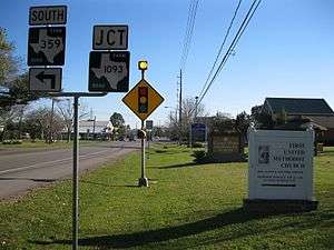
View south on FM 359 toward traffic signal at FM 1093
References
- 1 2 "American FactFinder". United States Census Bureau. Retrieved 2008-01-31.
- ↑ "US Board on Geographic Names". United States Geological Survey. 2007-10-25. Retrieved 2008-01-31.
- ↑ How to Pronouce: F Cities. "How to Pronouce: F Cities". Texastripper.com. Retrieved 2016-04-26.
- 1 2 "Geographic Identifiers: 2010 Demographic Profile Data (G001): Fulshear city, Texas". U.S. Census Bureau, American Factfinder. Retrieved August 29, 2016.
- 1 2 "Annual Estimates of the Resident Population for Incorporated Places: April 1, 2010 to July 1, 2015". Retrieved July 2, 2016.
- 1 2 3 4 5 "City Demographics." City of Fulshear. Retrieved on November 6, 2011.
- 1 2 Mulvaney, Erin. "Fulshear growing pains hit ballot." Houston Chronicle. November 3, 2013. Retrieved on April 7, 2014.
- ↑ "The city is moving to the country." KHOU-TV. April 6, 2007. Retrieved on December 4, 2008.
- ↑ "US Gazetteer files: 2010, 2000, and 1990". United States Census Bureau. 2011-02-12. Retrieved 2011-04-23.
- ↑ "Census of Population and Housing". Census.gov. Retrieved June 4, 2015.
- ↑ "Post Office Location - FULSHEAR." United States Postal Service. Retrieved on December 4, 2008.
- ↑ "Map of LCISD." Lamar Consolidated Independent School District.
- ↑ Kirk, Bryan. "Lamar Consolidated school district continues to build campuses." Houston Chronicle. August 27, 2013. Retrieved on April 7, 2014.
- ↑ Dolan, Betsy. "Lamar Consolidated ISD chooses names for new schools." Fort Bend Star. June 27, 2012. Retrieved on April 7, 2014.
- ↑ Binkovitz, Leah (2014-08-09). "As Fulshear gets new school, focus turns to walkability". Houston Chronicle. Retrieved 2016-04-26.
- ↑ "Bob Lutts Fulshear/Simonton Branch Library." Fort Bend County Libraries. Retrieved on May 14, 2010.
- ↑ "Post Office Location - FULSHEAR." United States Postal Service. Retrieved on May 14, 2010.
- ↑ "Arts Fulshear" Retrieved on April 21, 2014
Further reading
- "City of Fulshear Update" (Archive), Fort Bend Economic Development Council.
External links
| Wikimedia Commons has media related to Fulshear, Texas. |
- Official website
- Fulshear, Texas from the Handbook of Texas Online
| Counties | 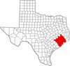 | |
|---|---|---|
| "Principal" cities | ||
| Other cities |
For a complete listing, see list of cities and towns in Houston–The Woodlands–Sugar Land MSA | |
| Unincorporated areas | ||
| Bodies of water | ||
Municipalities and communities of Fort Bend County, Texas, United States | ||
|---|---|---|
| Cities | 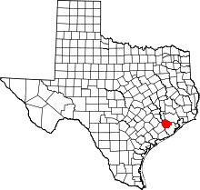 | |
| Town | ||
| Villages | ||
| CDPs | ||
| Unincorporated communities | ||
| Ghost towns | ||
| Footnotes | ‡This populated place also has portions in an adjacent county or counties;
±Former community annexed by Missouri City | |
