Richmond, Texas
| Richmond, Texas | |
|---|---|
| City | |
| Motto: "A Charming Past. A Soaring Future"[1] | |
 Location of Richmond, Texas | |
| Coordinates: 29°34′51″N 95°45′47″W / 29.58083°N 95.76306°WCoordinates: 29°34′51″N 95°45′47″W / 29.58083°N 95.76306°W | |
| Country | United States |
| State | Texas |
| County | Fort Bend |
| incorporated | 1837 |
| Government | |
| • Type | Commission-manager |
| • Mayor | Evalyn (Wendt) Moore Republican |
| Area | |
| • Total | 4.3 sq mi (11.1 km2) |
| • Land | 3.9 sq mi (10.2 km2) |
| • Water | 0.3 sq mi (0.9 km2) |
| Elevation | 92 ft (28 m) |
| Population (2010) | |
| • Total | 11,679 |
| • Density | 2,973/sq mi (1,147.9/km2) |
| Time zone | Central (CST) (UTC-6) |
| • Summer (DST) | CDT (UTC-5) |
| ZIP codes | 77406, 77407, 77469 |
| Area code(s) | 281 832 |
| FIPS code | 48-61892[2] |
| GNIS feature ID | 1345187[3] |
| Website |
richmondtx |
Richmond is a city in the U.S. state of Texas and the seat of Fort Bend County,[4] within the Houston–The Woodlands–Sugar Land metropolitan area. As of the 2010 U.S. census, the city population was 11,679.[5]
Even though it is the county seat, thus containing most of the local government offices, and the historic center of the area, it is actually one of the smaller cities in the area. Nearby Sugar Land is the largest city in the county.
History
In 1822, a group of Austin's colonists went up the Brazos River, stopping near present-day Richmond where they built a fort called "Fort Bend". Named after Richmond, England, the town was among the 19 cities first incorporated by the short-lived Republic of Texas, in 1837. Early residents of the city include many prominent figures in Texas lore such as Jane Long, Deaf Smith, and Mirabeau Lamar, who are all buried in Richmond. On August 16, 1889, the town was the site of the "Battle of Richmond", an armed fight culminating the Jaybird–Woodpecker War, a violent feud over post-Reconstruction political control of Fort Bend County. The mayor from 1949 until his death in 2012 was Hilmar Moore.[6][7]
Historically Richmond had government agencies and nonprofit organizations, while most of the area private businesses were located in Rosenberg.[8]
 The Long-Smith Cottage was built around 1837 on Jane Long's property and later moved to its current site.
 The John M. Moore Home was built in 1883 and remodeled in 1905. It is now a museum.
 The historic McNabb House was built by Phillip Vogel in the 1850s and bought by A. D. McNabb in the 1880s.
Geography

Richmond is located near the center of Fort Bend County at 29°34′51″N 95°45′47″W / 29.580921°N 95.763000°W (29.580921, -95.763000).[9] Most of the city is situated on the southwest side of the Brazos River, with a small portion (Richmond Landing) on the northeast side, connected by US Highway 90A. Richmond is bordered to the southwest by the city of Rosenberg. US 90A leads east 8 miles (13 km) to Sugar Land and west through Rosenberg 19 miles (31 km) to East Bernard. Downtown Houston is 30 miles (48 km) to the northeast.
According to the United States Census Bureau, the city of Richmond has a total area of 4.3 square miles (11.1 km2), of which 3.9 square miles (10.2 km2) is land and 0.35 square miles (0.9 km2), or 8.22%, is water.[5]
In 2003 Jeannie Kever of the Houston Chronicle said, "Some of the old buildings have been reincarnated as shops or law offices. But in other ways, life in Richmond isn't so different from that in the big city, with its Wal-Mart and fast-food joints, check-cashing businesses and strip-center sprawl."[8] As of 2006 several strip malls are along U.S. Route 59 south of town. During the same year the community included tack stores, two-lane blacktop roads, and horse ranches. John P. Lopez of the Houston Chronicle said, "Richmond is a city of contradiction and transition. It's as if the place is not sure if it wants to be a part of Houston's bustle or remain a slow-paced farm and ranch town. It tries to be both," and, "It is part Acres Homes, part Fort Bend County Fair."[10]
Communities
John P. Lopez of the Houston Chronicle said in 2006, "There are a lot of simple scenes. And there are places where reality has polluted neighborhoods."[10]
The wealthiest neighborhood, as of 2003, in Richmond is Hillcrest. Winston Terrace, another neighborhood, had its first houses built in 1940. Construction increased around the end of World War II. Most of the houses were built between 1940 and 1965. Jeannie Kever of the Houston Chronicle said that Winston Terrace is "a swath of mid-20th-century America, with sweeping oak trees and colorful brick or wood bungalows, named for the descendants of one of the region's most illustrious pioneers."[8]
"Mud Alley" as of 1985 had older bars and strip clubs. Mud Alley is located in an area which, in 1985, housed most of the African Americans in Richmond.[11] As of 1993 many police raids for drugs occurred in "Mud Alley".[12] "Mud Alley" was known by several other nicknames, including "Little Boomtown". Historically the area had a lot of recreational drugs.[10]
Climate
- The average warmest month is August.
- The highest recorded temperature was 108 degrees Fahrenheit in 2000.
- The average coolest month is January.
- The lowest recorded temperature was 6 degrees Fahrenheit in 1949 and 1989.
- The maximum average precipitation occurs in June.
| Climate data for Richmond, TX | |||||||||||||
|---|---|---|---|---|---|---|---|---|---|---|---|---|---|
| Month | Jan | Feb | Mar | Apr | May | Jun | Jul | Aug | Sep | Oct | Nov | Dec | Year |
| Record high °F | 84 | 89 | 92 | 95 | 99 | 102 | 105 | 105 | 108 | 98 | 91 | 90 | 108 |
| Average high °F | 65 | 68 | 74 | 81 | 88 | 93 | 95 | 96 | 91 | 84 | 75 | 67 | 81.4 |
| Daily mean °F | 55 | 58 | 64 | 71 | 79 | 84 | 86 | 87 | 81 | 74 | 65 | 56 | 71.7 |
| Average low °F | 44 | 48 | 53 | 61 | 69 | 75 | 77 | 77 | 71 | 63 | 54 | 45 | 61.4 |
| Record low °F | 6 | 9 | 21 | 32 | 47 | 56 | 63 | 60 | 47 | 30 | 22 | 6 | 6 |
| Average rainfall inches | 3.55 | 3.18 | 3.43 | 3.36 | 4.30 | 5.65 | 3.97 | 4.43 | 5.10 | 5.28 | 4.84 | 3.37 | 50.46 |
| Record high °C | 29 | 32 | 33 | 35 | 37 | 39 | 41 | 41 | 42 | 37 | 33 | 32 | 42 |
| Average high °C | 18 | 20 | 23 | 27 | 31 | 34 | 35 | 36 | 33 | 29 | 24 | 19 | 27.4 |
| Daily mean °C | 13 | 14 | 18 | 22 | 26 | 29 | 30 | 31 | 27 | 23 | 18 | 13 | 22.1 |
| Average low °C | 7 | 9 | 12 | 16 | 21 | 24 | 25 | 25 | 22 | 17 | 12 | 7 | 16.3 |
| Record low °C | −14 | −13 | −6 | 0 | 8 | 13 | 17 | 16 | 8 | −1 | −6 | −14 | −14 |
| Average rainfall mm | 90.2 | 80.8 | 87.1 | 85.3 | 109.2 | 143.5 | 100.8 | 112.5 | 129.5 | 134.1 | 122.9 | 85.6 | 1,281.7 |
| Source: [13] | |||||||||||||
Demographics
| Historical population | |||
|---|---|---|---|
| Census | Pop. | %± | |
| 1870 | 816 | — | |
| 1880 | 1,156 | 41.7% | |
| 1890 | 993 | −14.1% | |
| 1910 | 1,371 | — | |
| 1920 | 1,273 | −7.1% | |
| 1930 | 1,432 | 12.5% | |
| 1940 | 2,026 | 41.5% | |
| 1950 | 2,030 | 0.2% | |
| 1960 | 3,668 | 80.7% | |
| 1970 | 5,777 | 57.5% | |
| 1980 | 9,692 | 67.8% | |
| 1990 | 9,801 | 1.1% | |
| 2000 | 11,081 | 13.1% | |
| 2010 | 11,679 | 5.4% | |
| Est. 2015 | 12,138 | [14] | 3.9% |
As of the census[2] of 2000, there were 11,081 people, 3,413 households, and 2,628 families residing in the city. The population density was 2,975.4 people per square mile (1,150.1/km2). There were 3,595 housing units at an average density of 965.3 per square mile (373.1/km2). The racial makeup of the city was 51.20% White, 10.55% African American, 0.63% Native American, 3.53% Asian, 0.07% Pacific Islander, 31.00% from other races, and 3.01% from two or more races. Hispanic or Latino of any race were 58.71% of the population.
There were 3,413 households out of which 39.6% had children under the age of 18 living with them, 53.6% were married couples living together, 16.4% had a female householder with no husband present, and 23.0% were non-families. 18.7% of all households were made up of individuals and 6.7% had someone living alone who was 65 years of age or older. The average household size was 3.16 and the average family size was 3.60.
In the city the population was spread out with 31.6% under the age of 18, 11.0% from 18 to 24, 28.5% from 25 to 44, 18.7% from 45 to 64, and 10.1% who were 65 years of age or older. The median age was 30 years. For every 100 females there were 98.1 males. For every 100 females age 18 and over, there were 95.2 males.
The median income for a household in the city was $34,888, and the median income for a family was $35,801. Males had a median income of $27,457 versus $22,723 for females. The per capita income for the city was $15,195. About 17.0% of families and 20.0% of the population were below the poverty line, including 30.4% of those under age 18 and 12.9% of those age 65 or over.
Government and infrastructure
The United States Postal Service Richmond Post Office is located at 5560 Farm to Market Road 1640.[16]
The city is governed by a mayor and two commissioners elected at large for two-year terms. The commission sets policy and the day-to-day management is done by a city manager hired by the commission.[17]
Hilmar G. Moore served as mayor from 1949 until his death on December 4, 2012 and was believed to be the longest-serving mayor in the United States.[18][19]
The Texas Department of Criminal Justice operates the Jester State Prison Farm units, including the Jester I Unit, the Carol Vance Unit (formerly the Jester II Unit), the Jester III Unit, and the Jester IV Unit, in an unincorporated area 4 miles (6.4 km) east of Richmond.[20][21]
 Richmond Police Department is in the historic old jail.
 The county courthouse is located at Jackson and 5th Streets.
 BNSF freight train heads west at the 4th Street crossing.
Education
Primary and secondary schools
Public schools
Richmond is served by Lamar Consolidated Independent School District and Fort Bend Independent School District.
Nine elementary schools—Arredondo, Austin, Hutchison, Long, McNeill, Pink, Seguin, Smith, and Velasquez—are located in and serve Richmond.
Wessendorff Middle School, Lamar Junior High School, and Lamar Consolidated High School serve the Richmond city limits. The three schools are in Rosenberg.[22][23]
Various schools operated by LCISD and neighboring Fort Bend Independent School District bear Richmond addresses, but do not serve the city of Richmond. George Ranch High School, Foster High School, Reading Junior High School, and Briscoe Junior High in LCISD and Travis High School and Bush High School in the FBISD bear "Richmond, Texas" addresses.
Public libraries
Fort Bend County Libraries operates the George Memorial Library, the central library and the site of the administrative offices of the library system, located along Farm to Market Road 762.[24] Richmond also has the Fort Bend County Law Library.[25]
The Main Library moved from Rosenberg to its current location in Richmond in 1986. The George Foundation funded the 77,000 square feet (7,200 m2) library facility, designed by Ronald Wedemeyer Associates and built on 6 acres (2.4 ha) of land. When the library opened, it had unfinished areas to facilitate future expansion.[24] In December 1989 the Commissioners Court of Fort Bend County, in accordance with Texas Local Government code §323.021(a), ordered the construction of a law library.[25] The main library expansion and the 1991 installation of an automation system used funds from the 1989 bond election, and expansion occurred on 1995 and 2002. The 2002 expansion included the addition of two conference rooms.[24]
 Deaf Smith Elementary School
 Velasquez Elementary School on FM 2759
 George Memorial Memorial Library at FMs 762 and 1640
See also
References
- ↑ City of Richmond official website
- 1 2 "American FactFinder". United States Census Bureau. Archived from the original on September 11, 2013. Retrieved 2008-01-31.
- ↑ "US Board on Geographic Names". United States Geological Survey. 2007-10-25. Retrieved 2008-01-31.
- ↑ "Find a County". National Association of Counties. Archived from the original on May 31, 2011. Retrieved 2011-06-07.
- 1 2 "Geographic Identifiers: 2010 Demographic Profile Data (G001): Richmond city, Texas". U.S. Census Bureau, American Factfinder. Retrieved August 30, 2016.
- ↑ "Texas mulls defeat in battle of ideas, Kevin Connolly". BBC News. November 27, 2008. Retrieved January 5, 2010.
- ↑ "60-year mayor running for re-election". KLTV. March 30, 2010.
- 1 2 3 Kever, Jeannie. "Neighborhoods / Memories of home / Quiet pleasures are at hear of Richmond neighborhood." Houston Chronicle. Wednesday August 27, 2003. Houston 1. Retrieved on May 27, 2012.
- ↑ "US Gazetteer files: 2010, 2000, and 1990". United States Census Bureau. 2011-02-12. Retrieved 2011-04-23.
- 1 2 3 Lopez, John P. "Meet a pair of true Friday night lights." Houston Chronicle. Tuesday October 10, 2006. Sports 1. Retrieved on May 27, 2012.
- ↑ Muck, Patti. "Richmond probe over without comment." Houston Chronicle. Tuesday April 2, 1985. Section 1, Page 1. Retrieved on May 27, 2012.
- ↑ Muck, Patti. "The grinches who stole . . . /Thieves take a big bite out of food pantry." Houston Chronicle. Saturday December 4, 1993. A38. Retrieved on May 27, 2012.
- ↑ "Monthly Averages for Richmond, TX (77469)". Archived from the original on 2012-10-24. Retrieved July 12, 2013.
- ↑ "Annual Estimates of the Resident Population for Incorporated Places: April 1, 2010 to July 1, 2015". Retrieved July 2, 2016.
- ↑ "Census of Population and Housing". Census.gov. Archived from the original on May 11, 2015. Retrieved June 4, 2015.
- ↑ "Post Office Location - RICHMOND." United States Postal Service. Retrieved on December 6, 2008.
- ↑ Elected Officials, City of Richmond web site, retrieved 2008-12-29
- ↑ Hilmar G. Moore, City of Richmond web site, retrieved 2008-12-29
- ↑ Stewart, Richard, Meet America's (likely) longest-serving mayor: Richmond's leader has held office since 1949. Could any other city in the U.S. say the same?, Houston Chronicle, Dec. 29, 2008, 3:39AM, retrieved 2008-12-29
- ↑ "Vance Unit Archived August 21, 2008, at the Wayback Machine.." Texas Department of Criminal Justice. Retrieved on May 9, 2010.
- ↑ Staff and Wire Reports. "Parts of Houston join evacuation." Houston Chronicle. September 21, 2005. Retrieved on May 10, 2010.
- ↑ "Lamar C.I.S.D. High School Attendance Zones" (Archived 2015-07-06 at WebCite). Lamar Consolidated Independent School District. Retrieved on July 6, 2015.
- ↑ "2010 CENSUS - CENSUS BLOCK MAP (INDEX): Richmond city, TX" (Archived 2015-07-06 at WebCite). U.S. Census Bureau. Retrieved on July 6, 2015.
- 1 2 3 "George Memorial Library." Fort Bend County Libraries. Retrieved on May 14, 2010.
- 1 2 "Fort Bend County Law Library." Fort Bend County Libraries. Retrieved on May 14, 2010.
External links
- City of Richmond official website
- Richmond, Texas from the Handbook of Texas Online
- Fort Bend County, Texas from the Handbook of Texas Online
- Jaybird-Woodpecker War from the Handbook of Texas Online
| Counties | 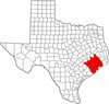 | |
|---|---|---|
| "Principal" cities | ||
| Other cities |
For a complete listing, see list of cities and towns in Houston–The Woodlands–Sugar Land MSA | |
| Unincorporated areas | ||
| Bodies of water | ||
Municipalities and communities of Fort Bend County, Texas, United States | ||
|---|---|---|
| Cities | 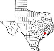 | |
| Town | ||
| Villages | ||
| CDPs | ||
| Unincorporated communities | ||
| Ghost towns | ||
| Footnotes | ‡This populated place also has portions in an adjacent county or counties;
±Former community annexed by Missouri City | |
