Bexar County, Texas
| Bexar County, Texas | ||
|---|---|---|
| County | ||
| Bexar County | ||
|
The Bexar County Courthouse in San Antonio | ||
| ||
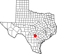 Location in the U.S. state of Texas | ||
 Texas's location in the U.S. | ||
| Founded | December 20, 1836 | |
| Named for | Presidio San Antonio de Bexar | |
| Seat | San Antonio | |
| Largest city | San Antonio | |
| Area | ||
| • Total | 1,256 sq mi (3,253 km2) | |
| • Land | 1,240 sq mi (3,212 km2) | |
| • Water | 16 sq mi (41 km2), 1.3% | |
| Population | ||
| • (2010) | 1,714,773 | |
| • Density | 1,383/sq mi (534/km²) | |
| Congressional districts | 15th, 20th, 21st, 23rd, 28th | |
| Time zone | Central: UTC-6/-5 | |
| Website |
www | |

Bexar County (/bɛər/ bair, /ˈbeɪ.ər/ BAY-ər)[1] is a county of the U.S. state of Texas. As of the 2010 census, the population was 1,714,773, and a 2013 estimate put the population at 1,817,610.[2] It is the 17th-most populous county in the nation and the fourth-most populated in Texas. Its county seat is San Antonio,[3] the second-most populous city in Texas and the seventh-largest city in the United States.
Bexar County is included in the San Antonio-New Braunfels, TX Metropolitan Statistical Area. Bexar county includes Government Canyon state natural area in northwestern part of the county.
History
Bexar County was created on December 20, 1836, and encompassed almost the entire western portion of the Republic of Texas. This included the disputed areas of western New Mexico northward to Wyoming. After statehood, 128 counties were carved out of its area.
The county was named for San Antonio de Béxar, one of the 23 Mexican municipalities (administrative divisions) of Texas at the time of its independence. San Antonio de Béxar—originally Villa de San Fernando de Béxar—was the first civil government established by the Spanish in the province of Texas. Specifically, the municipality was created in 1731 when 55 Canary Islanders settled near the system of missions that had been established around the source of the San Antonio River. The new settlement was named after the Presidio San Antonio de Béjar, the Spanish military outpost that protected the missions. The presidio, located at the San Pedro Springs, was founded in 1718 and named for Viceroy Balthasar Manuel de Zúñiga y Guzmán Sotomayor y Sarmiento, second son of the Duke of Béjar (a town in Spain). The modern City of San Antonio in the U.S. State of Texas also derived its name from San Antonio de Béjar.
Geography
According to the U.S. Census Bureau, the county has a total area of 1,256 square miles (3,250 km2), of which 1,240 sq mi (3,200 km2) is land and 16 sq mi (41 km2) (1.3%) is water.[4] Bexar County is in south-central Texas, about 190 miles (305 km) west of Houston and 140 mi (230 km) from both the US-Mexican border to the southwest and the Gulf of Mexico to the southeast.
The Balcones Escarpment bisects the county from west to northeast; to the north of the escarpment are the rocky hills, springs and canyons of the Texas Hill Country. South of the escarpment are Blackland Prairie and the South Texas plains. The San Antonio River rises from springs north of Downtown San Antonio, and flows southward and southeastward through the county.
Major highways
Bexar County has a comprehensive "wagon wheel" freeway system, with radial freeways and beltways that encircle Downtown San Antonio, allowing for simplified countywide freeway access, in a manner much like the freeways around Houston or Dallas. San Antonio is unique, however, in that unlike Houston or Dallas, none of these highways are currently tolled.
Adjacent counties
- Kendall County (north)
- Comal County (north)
- Guadalupe County (northeast)
- Wilson County (southeast)
- Atascosa County (south)
- Medina County (west)
- Bandera County (northwest)
National protected area
Demographics
| Historical population | |||
|---|---|---|---|
| Census | Pop. | %± | |
| 1850 | 6,052 | — | |
| 1860 | 14,454 | 138.8% | |
| 1870 | 16,043 | 11.0% | |
| 1880 | 30,470 | 89.9% | |
| 1890 | 49,266 | 61.7% | |
| 1900 | 69,422 | 40.9% | |
| 1910 | 119,676 | 72.4% | |
| 1920 | 202,096 | 68.9% | |
| 1930 | 292,533 | 44.7% | |
| 1940 | 338,176 | 15.6% | |
| 1950 | 500,460 | 48.0% | |
| 1960 | 687,151 | 37.3% | |
| 1970 | 830,460 | 20.9% | |
| 1980 | 988,800 | 19.1% | |
| 1990 | 1,185,394 | 19.9% | |
| 2000 | 1,392,931 | 17.5% | |
| 2010 | 1,714,773 | 23.1% | |
| Est. 2015 | 1,897,753 | [5] | 10.7% |
| U.S. Decennial Census[6] 1850–2010[7] 2010–2014[2] | |||
As of the 2010 United States Census, there were 1,714,773 people residing in the county. Of those, 72.9% were White, 7.5% Black or African American, 2.4% Asian, 0.8% Native American, 0.1% Pacific Islander, 12.7% of some other race and 3.5% of two or more races. 58.7% were Hispanic or Latino (of any race).
As of the census[8] of 2000, 1,392,931 people, 488,942 households, and 345,681 families were residing in the county. The population density was 1,117 inhabitants per square mile (431/km2). There were 521,359 housing units at an average density of 418 per square mile (161/km²). The racial makeup of the county was 68.86% White, 7.18% Black or African American, 0.80% Native American, 1.61% Asian, 0.10% Pacific Islander, 17.80% from other races, and 3.64% from two or more races. About 54.35% of the population were Hispanic or Latino of any race.
Of 488,942 households, 36.60% had children under the age of 18 living with them, 50.50% were married couples living together, 15.50% had a female householder with no husband present, and 29.30% were not families. About 24.00% of all households were made up of individuals and 7.40% had someone living alone who was 65 years of age or older. The average household size was 2.78 and the average family size was 3.33.
A Williams Institute analysis of 2010 census data found there were about 6.2 same-sex couples per 1,000 households in the county.[9]
In the county, the population was distributed as 28.50% under the age of 18, 10.70% from 18 to 24, 30.60% from 25 to 44, 19.90% from 45 to 64, and 10.40% who were 65 years of age or older. The median age was 32 years. For every 100 females, there were 94.70 males. For every 100 females age 18 and over, there were 91.20 males.
The median income for a household was $38,328, and for a family was $43,724. Males had a median income of $30,756 versus $24,920 for females. The per capita income for the county was $18,363. About 12.70% of families and 15.90% of the population were below the poverty line, including 22.40% of those under age 18 and 12.20% of those age 65 or over.
Corrections
The Bexar County jail facilities are at 200 North Comal in downtown San Antonio.[10] In late 2012, press reports noted an increase in the number of suicides at the facility. The issue was a topic of debate in the election for sheriff that year. The jail held an average of about 3,800 prisoners in 2012, making it the third-largest in the state until it was decommissioned.[11] Total Jail’s Capacity: 4,563 detainees.[12] Sheriff Susan Pamerleau, a Republican whose job duties include management of the jail, is the first woman elected to that position.[13]
The Texas Department of Criminal Justice operates the Dominguez Unit, a state jail for men, in an unincorporated section of Bexar County.[14]
Libraries
In the fall of 2013, Bexar County opened BiblioTech - Bexar County's Digital Library, the nation's first bookless library.[15]
Property taxes
In 2016, for the third consecutive year, Bexar County increased the appraised value of businesses and residences. Most will hence find their property taxes will increase for the year, with higher payments for some beginning as early as November 1. The latest 7.5 percent increase in valuation follows an 11 percent rise in 2015, and a 7 percent jump in 2014. The 2016 total value for all property in the county is approximately $163 billion, or $13 billion more than in 2015. County residents express dismay to Mary Kieke, the deputy chief appraiser. "People are very upset. The tax system is absolutely broken," she said.[16]
Communities
Cities (multiple counties)
- Fair Oaks Ranch (partly in Kendall and Comal counties)
- Lytle (mostly in Atascosa County and a small part in Medina County)
- San Antonio (county seat) (small parts in Medina and Comal counties)
- Schertz (partly in Guadalupe and Comal counties)
- Selma (partly in Guadalupe and Comal counties)
- Universal City (small part in Guadalupe County)
Enclave cities within San Antonio
Cities
Towns
Census-designated places
Unincorporated communities
Military installations
- Brooks City-Base (decommissioned)
- Camp Bullis
- Fort Sam Houston
- Kelly Air Force Base (decommissioned)
- Lackland Air Force Base
- Randolph Air Force Base
- San Antonio Military Medical Center
Notable people
- David Berchelmann, judge of two state district courts in Bexar County and the Texas Court of Criminal Appeals, lawyer in his native San Antonio
- Carol Burnett, comedian and actress, was born and grew up in San Antonio
- Joan Crawford, actress, was born in San Antonio
- Dwight D. Eisenhower, 34th President of the United States; stationed at Fort Sam Houston in 1916[17]
- Al Freeman, Jr., was born in San Antonio; he became an actor, known for ABC soap opera One Life to Live, and Malcolm X
- Rick Galindo, Republican member of the Texas House of Representatives from District 117 in Bexar County
- Cyndi Taylor Krier, first woman and first Republican to be elected to the Texas Senate from Bexar County (1985–1993), and first woman and first Republican to be appointed as a Bexar County administrative judge (1993 to 2001)
- Art Martinez de Vara, mayor, historian and publisher
- Tom Rickhoff, state court, appeals court, and probate court judge from San Antonio[18]
- James Robertson Nowlin, United States District Judge for the Western District of Texas; one of the first two Republicans since Reconstruction to represent Bexar County in the Texas House of Representatives
- Ciro D. Rodriguez, member of Congress, previously 28th District, Texas, now 23rd District, Texas
- Michelle Rodriguez, actress, James Cameron's Avatar
- Robert Rodríguez, director of Spy Kids, Desperado, and Sin City
- Joe Sage, one of the first two Republicans since Reconstruction, with James Robertson Nowlin, to represent Bexar County in the Texas House of Representatives
- Alan Schoolcraft, former Republican member of the Texas House of Representatives
- Percy Sutton, former Manhattan Borough President, and civil rights attorney; clients included Malcolm X, and the owner of the Apollo Theater in Harlem and several radio stations
- Carlos I. Uresti, member of the Texas Senate from the 19th District
- Kevin Patrick Yeary, judge of the Texas Court of Criminal Appeals, effective 2015; assistant district attorney for Bexar County, 1998-2014
See also
- List of museums in Central Texas
- National Register of Historic Places listings in Bexar County, Texas
References
- ↑ http://www.bexar.org/1320/Bexar-County-History
- 1 2 "State & County QuickFacts". United States Census Bureau. Retrieved December 8, 2013.
- ↑ "Find a County". National Association of Counties. Archived from the original on May 31, 2011. Retrieved 2011-06-07.
- ↑ "2010 Census Gazetteer Files". United States Census Bureau. August 22, 2012. Retrieved April 19, 2015.
- ↑ "County Totals Dataset: Population, Population Change and Estimated Components of Population Change: April 1, 2010 to July 1, 2015". Retrieved July 2, 2016.
- ↑ "U.S. Decennial Census". United States Census Bureau. Archived from the original on May 11, 2015. Retrieved April 19, 2015.
- ↑ "Texas Almanac: Population History of Counties from 1850–2010" (PDF). Texas Almanac. Retrieved April 19, 2015.
- ↑ "American FactFinder". United States Census Bureau. Archived from the original on September 11, 2013. Retrieved 2011-05-14.
- ↑ Where Same-Sex Couples Live, June 26, 2015, retrieved July 6, 2015
- ↑ "BCSO Location and Driving Directions". Bexar County. Retrieved September 14, 2008.
- ↑ Why have jail suicides soared under Sheriff Ortiz's watch?, by Michael Barajas, SA Current, 17 October 2012
- ↑ "Bexar County Jail".
- ↑ "A Lifetime of Dedicated Service: Sheriff Susan Lewellyn Pamerleau, Major General (Ret.)". University of Wyoming. September 2013. Retrieved October 6, 2015.
- ↑ "Dominguez (BX)". Texas Department of Criminal Justice. Retrieved September 14, 2008.
- ↑ "Nation's first bookless library opens in San Antonio". Dallas Morning News. January 3, 2014.
- ↑ Bruce Selcraig, "Property valuations jump again: Most homeowners' taxes also could rise", San Antonio Express-News, April 29, 2016, pp. 1, A12
- ↑ Ambrose, Stephen (1983). Eisenhower: (vol. 1) Soldier, General of the Army, President-Elect (1893–1952). New York: Simon & Schuster. p. 56.
- ↑ "Judge Rickhoff's Bio". tomrickhoff.blogspot.com. August 5, 2009. Retrieved March 2, 2015.
- Stephens, A. Ray, and William M. Holmes, Historical Atlas of Texas. University of Oklahoma Press, 1989. ISBN 0-8061-2307-9
External links
- Bexar County government
- Bexar County from the Handbook of Texas Online
- Bexar County from the Texas Almanac
- Bexar County from the TXGenWeb Project
- Bexar County Jail Information
- Historic Bexar County materials, hosted by the Portal to Texas History.
 |
Bandera County | Kendall County and Comal County | Guadalupe County | |
| Medina County | |
|||
| ||||
| | ||||
| Atascosa County | Wilson County |
Municipalities and communities of Bexar County, Texas, United States | ||
|---|---|---|
| Cities | | |
| Towns | ||
| CDPs | ||
| Other unincorporated communities | ||
| Footnotes | ‡This populated place also has portions in an adjacent county or counties | |

Coordinates: 29°27′N 98°31′W / 29.45°N 98.52°W