Wichita County, Texas
| Wichita County, Texas | |
|---|---|
|
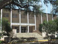
The Wichita County Courthouse in downtown Wichita Falls | |
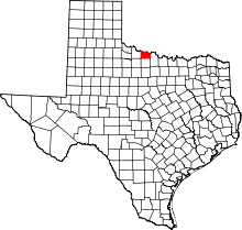 Location in the U.S. state of Texas | |
 Texas's location in the U.S. | |
| Founded | February 1, 1882 |
| Seat | Wichita Falls |
| Largest city | Wichita Falls |
| Area | |
| • Total | 633 sq mi (1,639 km2) |
| • Land | 628 sq mi (1,627 km2) |
| • Water | 5.3 sq mi (14 km2), 0.8% |
| Population | |
| • (2010) | 131,500 |
| • Density | 209/sq mi (81/km²) |
| Congressional district | 13th |
| Time zone | Central: UTC-6/-5 |
| Website |
www |
Wichita County (/ˈwɪtʃᵻtɔː/ WITCH-ə-taw) is a county located in the U.S. state of Texas. As of the 2010 census, its population was 131,500.[1] The county seat is Wichita Falls.[2] The county was created in 1858 and organized in 1882.[3]
Wichita County is part of the Wichita Falls, Texas, TX Metropolitan Statistical Area.
Geography
According to the U.S. Census Bureau, the county has a total area of 633 square miles (1,640 km2), of which 628 square miles (1,630 km2) is land and 5.3 square miles (14 km2) (0.8%) is water.[4] The county is drained by the Wichita River and other streams.[5]
Major highways
Adjacent counties
- Tillman County, Oklahoma (north)
- Cotton County, Oklahoma (northeast)
- Clay County (east)
- Archer County (south)
- Wilbarger County (west)
- Baylor County (southwest)
Demographics
| Historical population | |||
|---|---|---|---|
| Census | Pop. | %± | |
| 1880 | 433 | — | |
| 1890 | 4,831 | 1,015.7% | |
| 1900 | 5,806 | 20.2% | |
| 1910 | 16,094 | 177.2% | |
| 1920 | 72,911 | 353.0% | |
| 1930 | 74,416 | 2.1% | |
| 1940 | 73,604 | −1.1% | |
| 1950 | 98,493 | 33.8% | |
| 1960 | 123,528 | 25.4% | |
| 1970 | 120,563 | −2.4% | |
| 1980 | 121,082 | 0.4% | |
| 1990 | 122,378 | 1.1% | |
| 2000 | 131,664 | 7.6% | |
| 2010 | 131,500 | −0.1% | |
| Est. 2015 | 131,705 | [6] | 0.2% |
| U.S. Decennial Census[7] 1850–2010[8] 2010–2014[1] | |||
As of the census[9] of 2000, there were 131,664 people, 48,441 households, and 32,891 families residing in the county. The population density was 210 people per square mile (81/km²). There were 53,304 housing units at an average density of 85 per square mile (33/km²). The racial makeup of the county was 78.76% White, 10.23% Black or African American, 0.89% Native American, 1.84% Asian, 0.09% Pacific Islander, 5.51% from other races, and 2.68% from two or more races. 12.23% of the population were Hispanic or Latino of any race.
There were 48,441 households out of which 33.60% had children under the age of 18 living with them, 52.30% were married couples living together, 11.90% had a female householder with no husband present, and 32.10% were non-families. In 2000, there were 1,869 unmarried partner households: 1,677 heterosexual, 94 same-sex male, and 98 same-sex female.
27.20% of all households were made up of individuals and 10.60% had someone living alone who was 65 years of age or older. The average household size was 2.49 and the average family size was 3.04.
In the county, the population was spread out with 25.20% under the age of 18, 13.70% from 18 to 24, 29.00% from 25 to 44, 19.50% from 45 to 64, and 12.70% who were 65 years of age or older. The median age was 33 years. For every 100 females there were 103.80 males. For every 100 females age 18 and over, there were 103.40 males.
The median income for a household in the county was $33,780, and the median income for a family was $40,937. Males had a median income of $28,687 versus $21,885 for females. The per capita income for the county was $16,965. About 10.30% of families and 13.20% of the population were below the poverty line, including 17.40% of those under age 18 and 9.80% of those age 65 or over.
Government and infrastructure
The Wichita Falls entrepreneur and industrialist Joseph A. Kemp served from 1883 to 1885 as a school board member and then for an appointed term and two elected terms as the treasurer of Wichita County. From 1917 to 1921, he was a regent of the University of Texas System.[10]
The Texas Department of Criminal Justice James V. Allred Unit is located in Wichita Falls.[11][12][13][14]
The Sheriff of Wichita County is David Duke. He first took office on January 1, 2009. [15]
Politics
| Year | Republican | Democratic |
|---|---|---|
| 2012 | 72.7% 29,812 | 25.7% 10,525 |
| 2008 | 69.0% 31,731 | 30.2% 13,868 |
| 2004 | 71.3% 32,472 | 28.2% 12,819 |
| 2000 | 65.1% 27,802 | 33.0% 14,108 |
| 1996 | 51.3% 20,495 | 39.5% 15,775 |
| 1992 | 38.5% 17,956 | 36.5% 17,021 |
| 1988 | 56.1% 23,324 | 43.2% 17,956 |
| 1984 | 64.2% 28,932 | 35.5% 16,009 |
| 1980 | 55.0% 22,884 | 42.4% 17,657 |
| 1976 | 46.1% 19,024 | 53.4% 22,017 |
| 1972 | 68.7% 25,197 | 29.8% 10,948 |
| 1968 | 35.7% 11,937 | 46.0% 15,387 |
| 1964 | 31.0% 8,585 | 69.0% 19,131 |
| 1960 | 46.3% 12,587 | 53.6% 14,587 |
Wichita County is represented in the Texas House of Representatives by the Republican James Frank, a businessman from Wichita Falls.
Presidential elections
Wichita County cast the majority of its votes for Republican John McCain. He won 69% of the vote and 31,673 votes. Democrat Barack Obama received 30% of the vote and 13,828 votes. Other candidates received 1% of the vote. In 2004, Republican George W. Bush did better than John McCain and won 71% of the vote and 32,472 votes. Democrat John F. Kerry won 28% of the vote and 12,819 votes.
Communities
Cities
- Cashion Community
- Burkburnett
- Electra
- Iowa Park
- Wichita Falls (county seat)
Town
Unincorporated communities
See also
- List of museums in North Texas
- National Register of Historic Places listings in Wichita County, Texas
- Lake Wichita
- The Kell House
References
- 1 2 "State & County QuickFacts". United States Census Bureau. Retrieved December 29, 2013.
- ↑ "Find a County". National Association of Counties. Retrieved 2011-06-07.
- ↑ "Texas: Individual County Chronologies". Texas Atlas of Historical County Boundaries. The Newberry Library. 2008. Retrieved May 27, 2015.
- ↑ "2010 Census Gazetteer Files". United States Census Bureau. August 22, 2012. Retrieved May 12, 2015.
- ↑
 Ripley, George; Dana, Charles A., eds. (1879). "Wichita. I. An unorganized N. W. county of Texas". The American Cyclopædia.
- ↑ "County Totals Dataset: Population, Population Change and Estimated Components of Population Change: April 1, 2010 to July 1, 2015". Retrieved July 2, 2016.
- ↑ "U.S. Decennial Census". United States Census Bureau. Retrieved May 12, 2015.
- ↑ "Texas Almanac: Population History of Counties from 1850–2010" (PDF). Texas Almanac. Retrieved May 12, 2015.
- ↑ "American FactFinder". United States Census Bureau. Retrieved 2011-05-14.
- ↑ "Brian Hart, "Joseph Alexander Kemp"". tshaonline.org. Retrieved April 16, 2013.
- ↑ "Allred Unit." Texas Department of Criminal Justice. Retrieved on May 10, 2010.
- ↑ "Sheet Number 1." City of Wichita Falls. Retrieved on September 22, 2010.
- ↑ "Sheet Number 2." City of Wichita Falls. Retrieved on September 22, 2010.
- ↑ "Sheet Number 9." City of Wichita Falls. Retrieved on September 22, 2010.
- ↑ Wichita County Sheriff's Office Website
External links
- Official Wichita County Website
- Wichita County from the Handbook of Texas Online
- Historic Wichita County materials, hosted by the Portal to Texas History.
- Sheppard Air Force Base Home Page
 |
Tillman County, Oklahoma | Cotton County, Oklahoma | | |
| Wibarger County | |
Clay County | ||
| ||||
| | ||||
| Archer County |
Municipalities and communities of Wichita County, Texas, United States | ||
|---|---|---|
| Cities | | |
| Town | ||
| Unincorporated communities | ||

Coordinates: 33°59′N 98°43′W / 33.99°N 98.71°W